ArtsAutosBooksBusinessEducationEntertainmentFamilyFashionFoodGamesGenderHealthHolidaysHomeHubPagesPersonal FinancePetsPoliticsReligionSportsTechnologyTravel

97 Mile Pacific Crest Trail Trek of 02

Updated on February 29, 2008

Jondolar's Backpacking Adventure #2

July 30, 2002

This year Bill and Jondolar had decided and agreed to knock off a 97 mile chunck of the Pacific Crest Trail, from White Pass north to Snoqualmie Pass, in Washington state. As you will see by the pictures below, this is argueably one of the most beautiful sections of the trail. I know I enjoyed it; mostly because the weather for the week of the trip was perfect; until the last day.

Our first day took us to Fish Lake, where the mosquitos were incredibly thick and extremely pesky. We woke the next morning to a blanket of fog which made for some interesting shots for Bill. After several hours of packing in the fog, it lifted just before we reached our second day's campsite next to Anderson Lake. Having reached our day's destination relatively early in the afternoon, we had the daylight available to explore the surroundings of Anderson Lake and the meadows in its vacinity. During this time of year it is peak growth season, and everything is lush and vividly gorgeous.

July 31, 2002

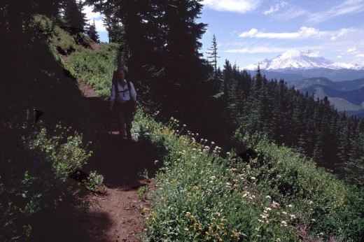
Our third day on the trail consisted mostly of covering the mileage for the day while enjoying the incredible beauty of the Cascades around us and the occasional glimpses of the looming massiveness of Mt. Rainier off to the west. We arrived at our day's destination, Dewey Lake, to camp for the night.

August 1, 2002

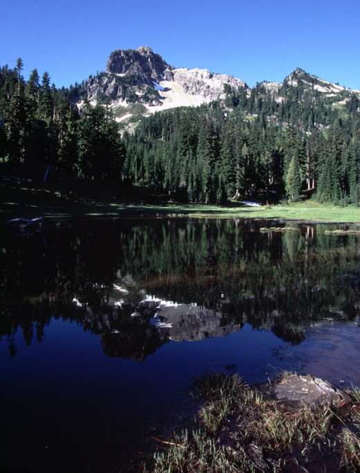
After sunrise the next morning we were treated to a fabulous view the peak standing sentinel in the background while reflecting on the glass smooth surface of Dewey Lake. Having made plans to meet Jondolar's wife and daughter at Chinook Pass to pick up a new supply of food where one of Washington's main routes over the mountains cuts through, Bill and Jondolar ascended in elevation over the ridge and down the other side to the pass. At mid-day the pickup was made and we moved on north toward Sheep Lake. With another rise in elevation facing us, we camped next to Sheep Lake for the night.

August 2, 2002

Our next day's trek first went up at least a 1,000 feet gain in elevation to Sourdough Gap, then along a high ridge for several miles as we went past, just to the east of, Crystal Mountain ski resort. After covering a good 12 miles, and with the sun getting low on the horizon to the west, we were forced to bivouac just off the trail on a side ridge for the night. Fortunately we'd planned ahead and made sure we had sufficient water for the night's meal. After using most of his water for dinner, Jondolar chose to explore a tributary trail off the main PCT to see if he could locate a source of water at lower elevation. He was successful, but it was only a very slow trickle; taking about ten minutes to fill one one bottle.

August 3, 2002

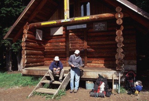
Continuing on the next morning over Scout Pass and along Norse Peak to the north, Bill and Jondolar put another 15 miles behind them while going through some wonderful old growth forest. The camp site for the night was on the spot where a cabin once had been erected at Arch Rock.

August 4, 2002

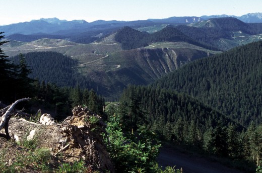
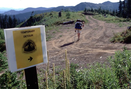
Just a few miles to the north was Government Meadows, with a log cabin infested with rodents and insects, with the Naches Trail just north of it. This jeep trail used by four-wheeler clubs today, is one of the main routes used in the 1800s by settlers migrating west to the Puget Sound region in their covered wagons from out of the Columbia Basin and Yakima area. Beyond this, we entered an area of heavy clear-cut logging, both past and current operations. This forced us to take a temporary detour trail around an active logging operation which routed us up and over some poorly chosen terrain. After about 13 miles we found a trailside campsite near a creek with sufficient water flow for our replenishing needs.

One of the more memorable events to occur during this trek was the meeting of a red-haired man who was passing our campsite that afternoon. He was tall, lanky and dirty, with only a lightweight pack of essentials and very little to no food with him. After a brief conversation while we were relaxing and taking some pictures, we learned that he'd begun his trek on the Pacific Crest Trail last April at the Mexican border and was on his way to the Canadian border. He was covering as much as 35 miles per day and was living off the land or others along the trail. He took off again when our conversation ended; saying he had to put in another five miles before sitting down for the night and covering himself with a leg tarp to sleep.

After the man had been gone for about 30 minutes, Bill realized he'd left his telephoto lens on a rock down the creek a bit and went after it. He returned with a desperate look on his face. "My lens is gone, it's not there!" After a thorough second look with my help, we could only surmise that this man had discovered his lens on the rock, and took it with him to later cash in at a pawn shop to buy supplies with.

August 5, 2002

Onward to the north over Blowout Mountain took us on our longest day of the whole week; a 19 mile trek through some more second growth forest and over a logging road to our next campground in a heavily wooded area a few miles beyond the road. Occasional glimpses of Interstate 90 and the large man-made lake to the east of Snoqulamie Pass.

August 6, 2002

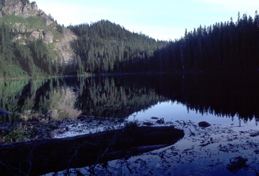
Continuing on, we encountered our first day of overcast weather. As the miles wore on and the sun crossed the sky, rain began to fall lightly. The closer we got to Mirror Lake, the thicker the trail vegetation became. This created a big problem for us. The moisture of the light rain gathering on the vegetation and our brushing through this vegetation caused a large amount of water to eventually soak our pant legs and drain into our socks; making them sound and feel as though we were wearing sponges on our feet. This made the days hike much less desireable. As the days could cover blocked the sun, darkness decended on us sooner. So, we decided it wise to cut our mileage for the day a bit short and camp at Mirror Lake instead of further down the trail toward the pass and the end of our trip. It rained all night and our tent was soaked.

August 7, 2008

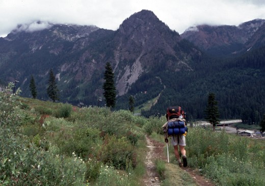
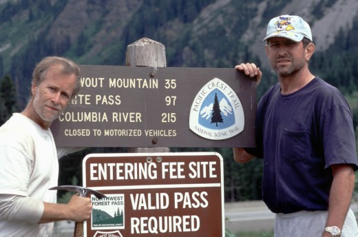
Under very cool and wet conditions, we finished off the last 8 miles the next day and were pleased to see occasional cloud breaks as we neared civilization once again at the business loop just off of the interstate highway. A total of 97 miles in seven days.

While waiting there for our ride from Tacoma to arrive, we met some other backpackers who shared stories about their experience both on the PCT, as well as the Appalachian Trail on the eastern side of the country. We shared our unfortunate experience of losing the camera lens and our supicion that it was picked up by the red-haired "speedster". They recalled having come across the man on his hurried way north, but had no idea whether or not he had a lens with him. Our ride arrived and we climbed in the car to once again experience the adjustment from continuously moving under our own power, to not moving, yet still traveling at incredible speed.

It was nice to be back in civilization once again.

7 Days From White Pass to Snoqualmie Pass
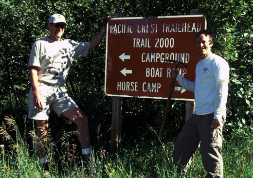
Start of trip - day one at the trailhead of White Pass.
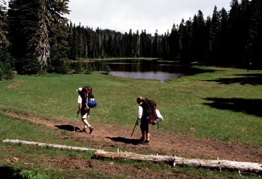
Hiking past Sand Lake.
Sand Lake just north of White Pass.
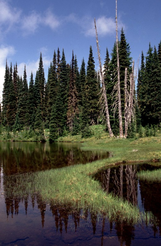
Pond near Sand Lake.
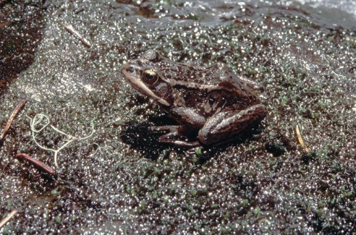
Froggy sun bathing.
Froggy sun bathing.
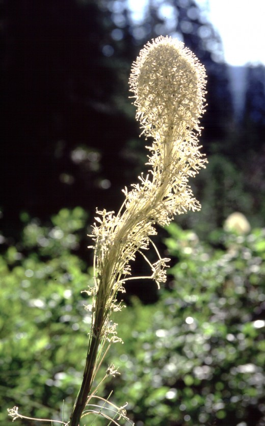
Bear Grass bloom.
Bear Grass bloom.
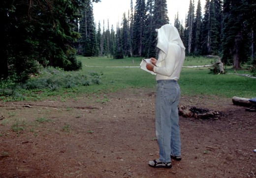
Jondolar deals with the mosquitos as best he can.
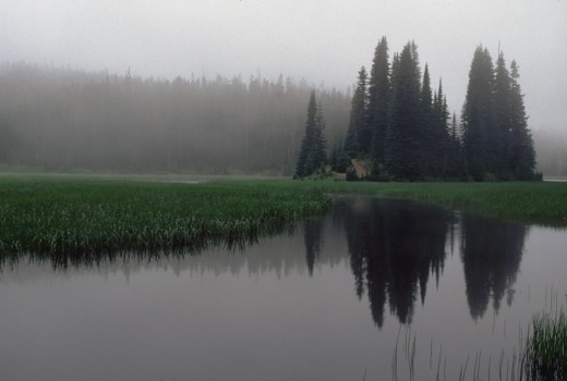
Fish Lake the next morning in the fog.
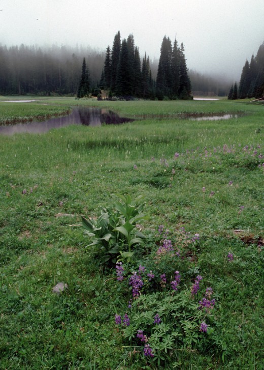
Meadow vegitation at Fish Lake area.
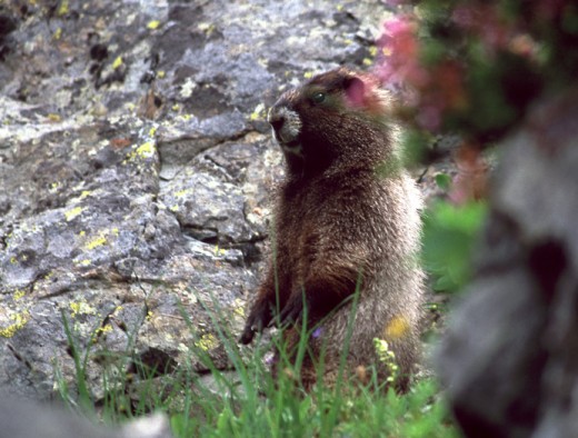
A marmot sits up to check us out along the trail.
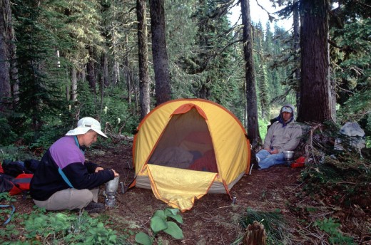
Camp site at Anderson Lake.
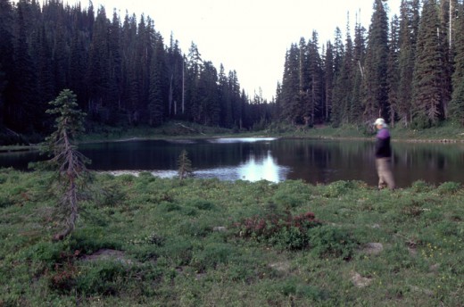
Anderson Lake.
Anderson Lake.
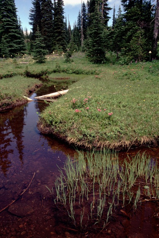
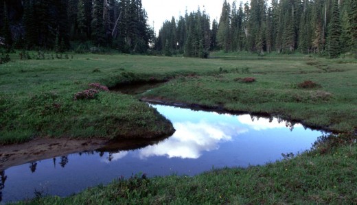
Stream in meadow flowing out of Anderson Lake.
Peak near Dewey Lake just south of Chinook Pass.
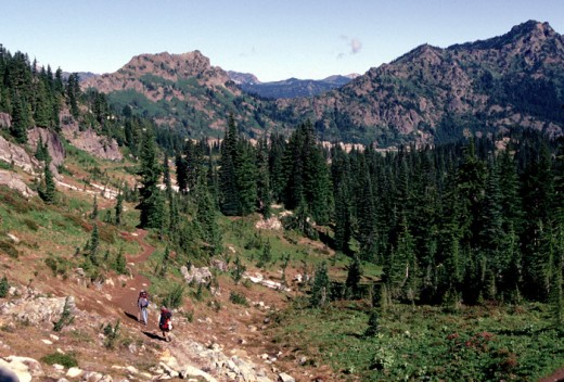
Nearing Chinook Pass for food pick up.
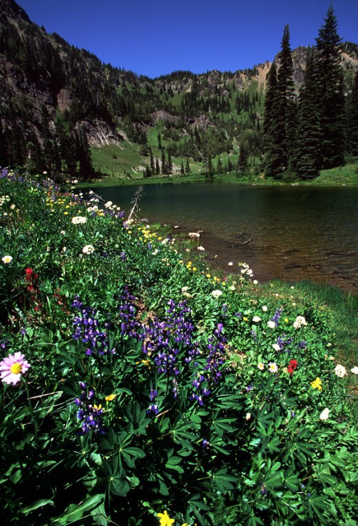
Lupine along Sheep Lake just north of Chinook Pass.
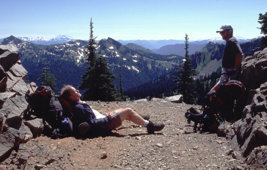
Resting at Sourdough Gap after long hard climb from Sheep Lake.
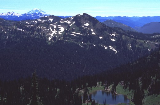
Sheep Lake below, from Sourdough Gap, with Mt. Adams to the south in the distance.
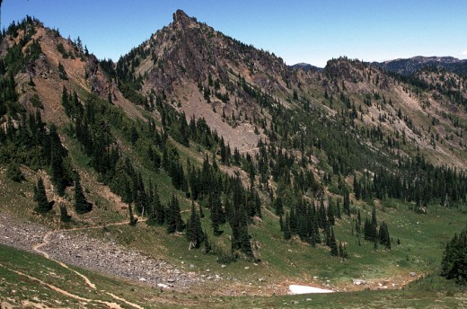
Looking north from Sourdough Gap toward Bear Gap.
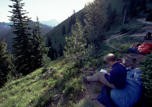
Bill writes in his trail journal at our bivouac at Bear Gap.
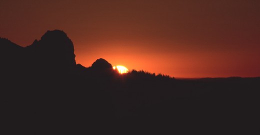
Sunrise in the east from Bear Gap the next morning.
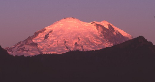
Mt. Rainier basks in the morning sunrise glow. A great view of the side Jondolar climbed in '86.
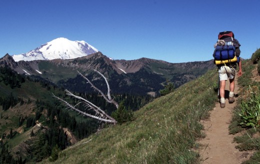
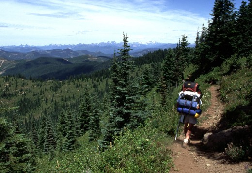
Jondolar heading north on the trail with Mt. Rainier as scenery.
Looking north from Scout Pass.
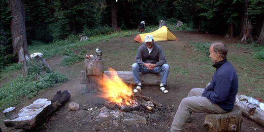
Enjoying the camp fire at what used to be Arch Rock Shelter site.
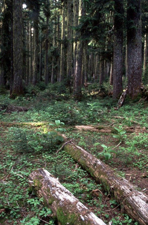
Forrest scene just south of Government Meadow.
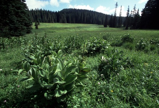
Government Meadow looking east.
Cabin at Government Meadow near Naches Trail.
View of logged out area just north of Government Meadow.
Jondolar expresses his opinion about the detour trail around the logging area.
Looking north from Blowout Mountain toward Snoqualmie Pass.
Looking south to Mt. Rainier from Blowout Mountain.
Mirror Lake, just south of Snoqualmie Pass.
Approaching Snoqualmie Pass below on last day.
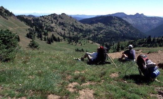
Posing at trailhead sign for completion of trek.
working

This website uses cookies

As a user in the EEA, your approval is needed on a few things. To provide a better website experience, hubpages.com uses cookies (and other similar technologies) and may collect, process, and share personal data. Please choose which areas of our service you consent to our doing so.

For more information on managing or withdrawing consents and how we handle data, visit our Privacy Policy at: https://corp.maven.io/privacy-policy

Show Details
Necessary
HubPages Device IDThis is used to identify particular browsers or devices when the access the service, and is used for security reasons.
LoginThis is necessary to sign in to the HubPages Service.
Google RecaptchaThis is used to prevent bots and spam. (Privacy Policy)
AkismetThis is used to detect comment spam. (Privacy Policy)
HubPages Google AnalyticsThis is used to provide data on traffic to our website, all personally identifyable data is anonymized. (Privacy Policy)
HubPages Traffic PixelThis is used to collect data on traffic to articles and other pages on our site. Unless you are signed in to a HubPages account, all personally identifiable information is anonymized.
Amazon Web ServicesThis is a cloud services platform that we used to host our service. (Privacy Policy)
CloudflareThis is a cloud CDN service that we use to efficiently deliver files required for our service to operate such as javascript, cascading style sheets, images, and videos. (Privacy Policy)
Google Hosted LibrariesJavascript software libraries such as jQuery are loaded at endpoints on the googleapis.com or gstatic.com domains, for performance and efficiency reasons. (Privacy Policy)
Features
Google Custom SearchThis is feature allows you to search the site. (Privacy Policy)
Google MapsSome articles have Google Maps embedded in them. (Privacy Policy)
Google ChartsThis is used to display charts and graphs on articles and the author center. (Privacy Policy)
Google AdSense Host APIThis service allows you to sign up for or associate a Google AdSense account with HubPages, so that you can earn money from ads on your articles. No data is shared unless you engage with this feature. (Privacy Policy)
Google YouTubeSome articles have YouTube videos embedded in them. (Privacy Policy)
VimeoSome articles have Vimeo videos embedded in them. (Privacy Policy)
PaypalThis is used for a registered author who enrolls in the HubPages Earnings program and requests to be paid via PayPal. No data is shared with Paypal unless you engage with this feature. (Privacy Policy)
Facebook LoginYou can use this to streamline signing up for, or signing in to your Hubpages account. No data is shared with Facebook unless you engage with this feature. (Privacy Policy)
MavenThis supports the Maven widget and search functionality. (Privacy Policy)
Marketing
Google AdSenseThis is an ad network. (Privacy Policy)
Google DoubleClickGoogle provides ad serving technology and runs an ad network. (Privacy Policy)
Index ExchangeThis is an ad network. (Privacy Policy)
SovrnThis is an ad network. (Privacy Policy)
Facebook AdsThis is an ad network. (Privacy Policy)
Amazon Unified Ad MarketplaceThis is an ad network. (Privacy Policy)
AppNexusThis is an ad network. (Privacy Policy)
OpenxThis is an ad network. (Privacy Policy)
Rubicon ProjectThis is an ad network. (Privacy Policy)
TripleLiftThis is an ad network. (Privacy Policy)
Say MediaWe partner with Say Media to deliver ad campaigns on our sites. (Privacy Policy)
Remarketing PixelsWe may use remarketing pixels from advertising networks such as Google AdWords, Bing Ads, and Facebook in order to advertise the HubPages Service to people that have visited our sites.
Conversion Tracking PixelsWe may use conversion tracking pixels from advertising networks such as Google AdWords, Bing Ads, and Facebook in order to identify when an advertisement has successfully resulted in the desired action, such as signing up for the HubPages Service or publishing an article on the HubPages Service.
Statistics
Author Google AnalyticsThis is used to provide traffic data and reports to the authors of articles on the HubPages Service. (Privacy Policy)
ComscoreComScore is a media measurement and analytics company providing marketing data and analytics to enterprises, media and advertising agencies, and publishers. Non-consent will result in ComScore only processing obfuscated personal data. (Privacy Policy)
Amazon Tracking PixelSome articles display amazon products as part of the Amazon Affiliate program, this pixel provides traffic statistics for those products (Privacy Policy)
ClickscoThis is a data management platform studying reader behavior (Privacy Policy)