Travel North - 43: High Spy With My Little Eye - Strike out for the Northern Lake District
Rosthwaite in the northern Lake District, off the beaten tourist track but on Alfred Wainwright's Coast-to-coast Walk
Assess the Lie of the Land
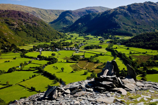
There is a long, sometimes steep climb by way of Tongue Gill and the disused Rigg Head* slate quarries to achieve some boggy ground at Rigg Head and Dale Head Tarn*.
These upland areas are exposed and walking is recommended in more clement weather, possibly where the ground higher up around the tarn might have dried a bit. The weather in the Lake District is changeable, and that's an understatement. Get a weather forecast beforehand and do not try it in wintry conditions. There are steep and rocky sections, and ice or snow will endanger you or your friends. Dale Head is 753 metres high, not to be underestimated. Countless potential climbers or walkers come to grief in this region, don't add to the rescuers' work-load if you can possibly avoid it.
Warning: Take plenty of liquid refreshment, and try some Kendal Mint cake. It might sound silly, the idea of taking 'cake' with you, but it's not really cake as such, it's concentrated sugar to keep you going. You may need it if you don't take it. There is plain and there is chocolate-coated mint cake, and it might taste funny to you (pretty sweet!) but it's a life-saver. This walk is a challenge, even at only about five and a half miles, so don't over-tax yourself. You could suffer a sprain being over-confident, and if the weather closes in on you up there it could be awkward for those with you. .
Walk wear: Hill-walking gear, good stout walking boots (not trainers), weather-proofs, good waterproof leg-wear, possibly oilskin leggings for in case the weather turns rough (not jeans, they'll take in water/damp and you'll end up with something you wouldn't want in the way of 'plumbing' problems). Something to put on your head aside from a hood on your weatherproof to keep your head warm. You can't think properly if you've got a bunged-up nose or constant sniffles.
Take: a back-pack with food, water, energy juice/drink, chocolate (for energy) or Kendal Mint Cake, map (inside a plastic map case, folded so you can read your route without having to pull it our and watch your map fly away in a brisk wind), compass.
Got that? Then it's time to get going!.
-------------------------------------------------------------
*A rigg is a ridge (Norse origin) and a tarn is a mountain top lake with no outlet to drain away the water (word has Brythonic origins, along with 'col', a saddle between two higher points)
Places to watch out for
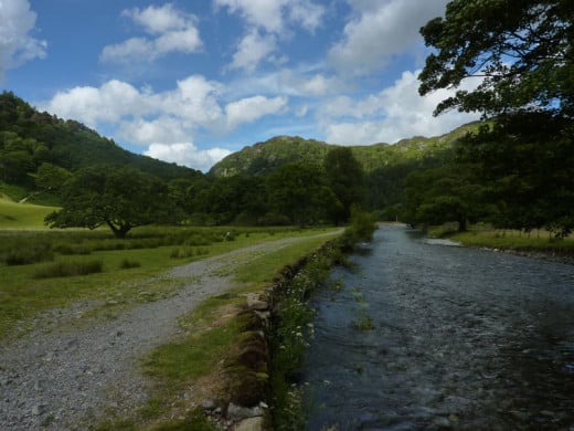
Sited mid-dale to the south of where Stonethwaite Beck meets the Derwent, Rosthwaite amounts to a single street on the B5289 and a back lane that comes off the road to the west side, bends round and meets the road again at the top end of the village. A dead end lies opposite the lane on the east side of the beck. The road heads north to Keswick over the beck where it bends to the north-west. Farms and cottages cluster around the marginally higher ground of The How, the low rise around which the community has been established since the Norsemen settled the region around the 10th Century AD. The name of the village stems from 'Ros', a cluster of rocks - boulders brought down in the winter by the swollen mountain waterways - and 'thwait', a clearing in the woods.
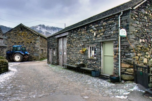
The walk leaves the village by a track that skirts Yew Tree Farm, a typical Lakeland farm built - what you see now - in the vernacular style, with a popular cafe that abuts on a stony lane. The lane crosses crosses the Derwent by the stepping stones and ford, the principal route to Grange. Together with the old packhorse track that winds over the fells (high moors) to Watendlath these were the only links to Rosthwaite before a road was cut through Borrowdale's 'jaws' in 1842. Stop and take in the great mountain-scape before you pass on to the harder part of your walk uphill to Dale Head.
You can see up to the summit on a good day, the sizeable cairn next to the tarn visible, just two of the unforgettable features of Lakeland. There is the view north along the 'U'-shaped Newlands dale to look forward to, Skiddaw standing proud some way off. A short stroll to the west from your vantage point up on Dale Head gives a good view of the dale that Buttermere occupies before the return down into Borrowdale.
Central Lake District, Cumbria
The only things you have to remember to take on your walk are: 1. Get some good waterproofs (coat and over-trousers if you wear jeans), 2. some good boots, 3. a good map (Ordnance Survey is the best) and guide. Look to your right here and you've achieved the third part. Do some armchair hiking and find your way around the dales, fells and lakes. Optionals are a camera and/or binoculars in case you aim to watch out for rare flora and fauna, of which there are numerous varieties to be seen in these upland areas.

Way ahead... From the car park beside the village hall
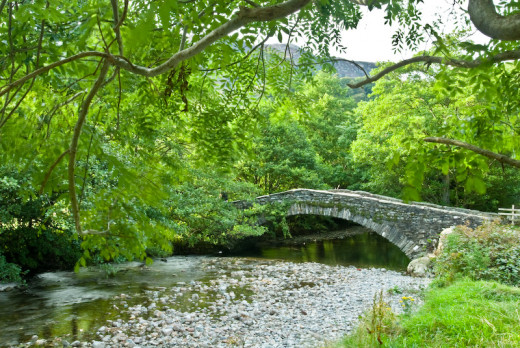
Starting with your back to the car park next to the village hall, go right to Yew Tree Farm. Pass through the cobbled yard, past the 'Flock-in' cafe and on along a walled track to the River Derwent. You come across a humped stone bridge after following this track as it leads along the riverbank. This is New Bridge, where the walk leads sharp left and on to a small footbridge across Tongue Gill, a smaller tributary of the Derwent.
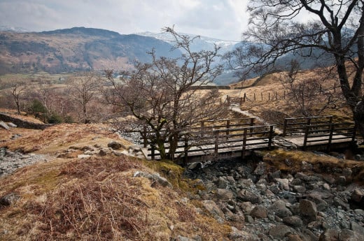
Over the footbridge take a right turn and pass through a small gate. From here you follow the gill upstream. There is another gate, beyond which you follow the gill at it bends to the right and cross another small bridge that takes you over Scaleclose Gill and on to a stile that straddles a fence. With Tongue Gill on your right cross the stile and walk leftward on the broad green path over the centre of a field and then meanders steeply up a bracken-covered hillside, keeping Tongue Gill to the right. Now follow a little to your left where there is a wall to your left. Pass the ladder stile over the wall and take the small ford to follow the grassy footpath again beyond, up the hillside. There is a wall on your left along here, where you progress to a gate inset in the wall ahead at the head of the field. Tongue Gill should still be there on your right.
------------------------------------------------------------------
There's some arduous climbing in store...
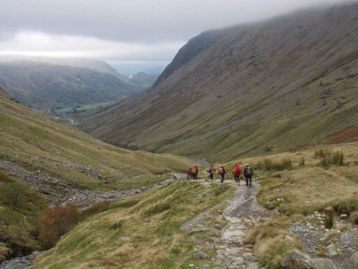

Pass through the gate...
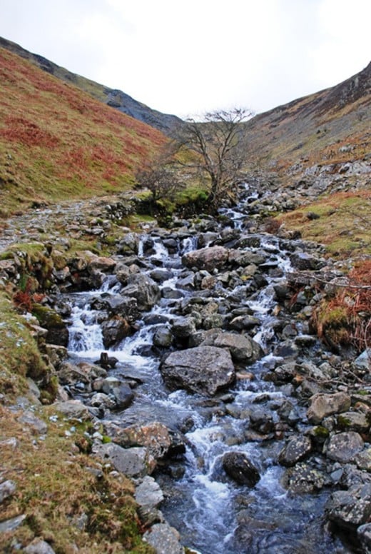
and take the path ahead to climb steeply alongside the gill - still on your right there, got that? - up through the Tongue Gill gully for around 650 yards/500 metres. Next is a stile over a fence at the foot of the now disused slate quarry at Rigg Head. Keep up the pace a little while longer past spoil heaps and along an inclined stone path with the gill burbling along beside you - to your left still - for a little over a hundred yards or a hundred metres.
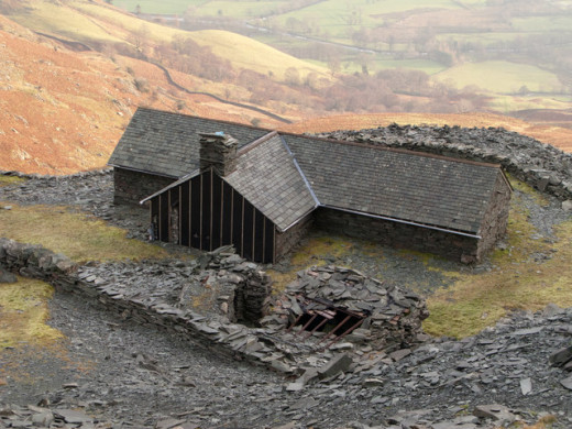
Heading a little left now, uphill still past quarry workings that have stood still in time, along a slate-laid path between quarry levels. Ruined buildings here and there bear witness to industry abandoned a long time ago (not out of puff, are you?) And yes, you're at the top of the old workings!
At the top of these old workings take a breather and your bearings. Look around. Behind is the climbers' hut. It pays to remember these things in case the weather closes in.
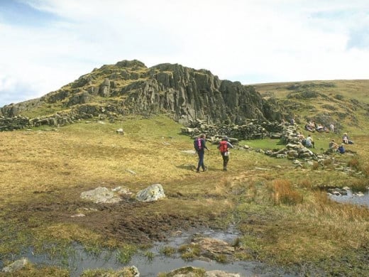
The path veers to the right and climbs steadily up over the grassy hillside where a fence awaits at the head of the gully that Tongue Gill tumbles through. Where the path nears the fence there is a fork. follow the leftward one and you come to a stile across a fence. You are now at Rigg Head, a wide and soggy, level area where the ground falls away on either side. The large part of Dale Head is still before you, the rock wall of High Spy on your right.
High amongst the peaks...
Hill Walking
Is this the kind of walk you like?
Cross the stile and keep to the left...
south-westward, bearing 244 degrees if it's turned misty and you can't see your target ahead. The path is normally fairly easy to follow, that skirts the lower and probably spongy ground on the way to Dale Head. Go along for around 400 yards or 350 metres to get to a gill. Cross this and and take the path along to the right to Dalehead Tarn. Just by here is a stone-built sheepfold set against the rocky outcrop. If the weather's fine and the scenery clear you could set up for an impromptu picnic before heading back for Rosthwaite..
If you've come for the views the rewards are self-evident
Getting there
Walk distance 9 km (5.6 miles) with a height difference between dale bottom and Dale Head of around 65O feet; the route can be walked in five hours overall, but in good daylight and decent weather you could take your time to enjoy the views and make observations and/or take pictures.
Finding your way: Ordnance Survey (OS) Explorer sheet OL4;
Walk base: Pay & Display car park on the north side of Rosthwaite village;
Refreshments and accommodation:
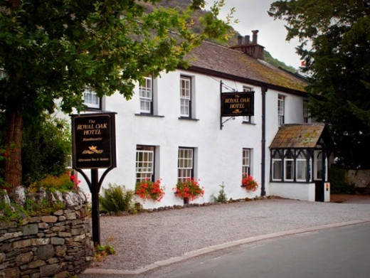
Royal Oak Inn, ph 017687 77214, www.booking.com/Rosthwaite-Hotels;
Yew Tree Farm Flock-in cafe and B&B 017687 77208, www.borrowdaleherdwick.co.uk
Weather permitting, pass the sheepfold by the tarn...
The ground here is sometimes boggy along the path around the tarn. Follow the clearly delineated path that for much of the way is stone-strewn. Clamber up onto the north-eastern shoulder of Dale Head, where the path bends leftward up the shoulder to a large stone cairn at the Head's summit.
Go on, have a wander, look around and take in the broad views across three dales and two lakes - most are called meres up here - .Buttermere on the west side, Derwent Water to the north beyond Grange. Thirlmere to the east is largely hidden by a bulwark of land that leads up to High Seat (608 m). Below you to the south is Honister Pass with Seatoller to the south-east. Further to the east are Great Dodd (856 m) and - to the south of that - Stybarrow Dodd (840 m). To the south-east is the great bulk of Helvellyn at 950 metres. South of Buttermere to the west is High Stile (806 m). Southward from where you stand, right to left, are Pillar (892 m), Kirk Fell (802 m), Great Gable (899 m), Scafell Pike further away at 978 metres with Sca Fell to its south-westerly flank at 964 metres are England's highest peaks. A lot closer and in line with Great Gable and Kirk Fell is Glamara at 780 metres. South-westward is High White Stones at 762 metres. Beat that for scenery, if you can.
This is Alfred Wainwright country. The renowned walker, writer and illustrator of his books - now collector's items - combed the Lakeland peaks and tracks with his eagle eyes. You can almost feel him behind you - don't turn around.
Back from the summit cairn on Dale Head...
Take the path back from the top of Dale Head, down along the south-eastern shoulder and the steep stone path to the tarn. Pass the sheepfold - oh well, take another look - and pass along the gill that's fed by the tarn to reach another gill. Go straight on over the soggy ground again north-eastward back to the fence stile and descend Tongue Gill. Take care downhill, it's not the same as climbing and it can be a lot faster if you don't watch your step!
Back through the quarry area, with the climbers' hut on your right below you, follow the gully with Tongue Gill.on your left. After reaching the Derwent (we've got four rivers by that name between the Midlands and the North) turn left and follow the riverside track to New Bridge, cross to the walled track back into Rosthwaite.
If you have booked rooms at Yew Tree Farm you don't have far to go. The Royal Oak is at the other end of the village by the B5289, where it bends from near Stonethwaite Beck towards the Derwent.
Alfred Wainwright, 1907-1991
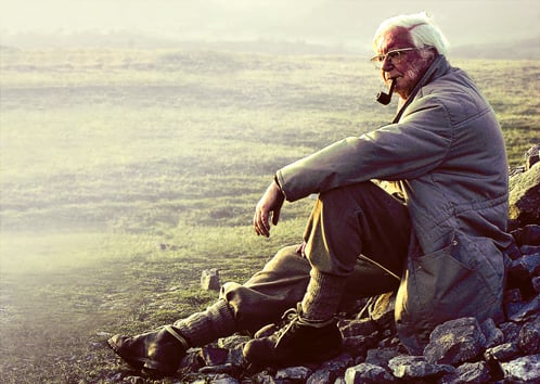
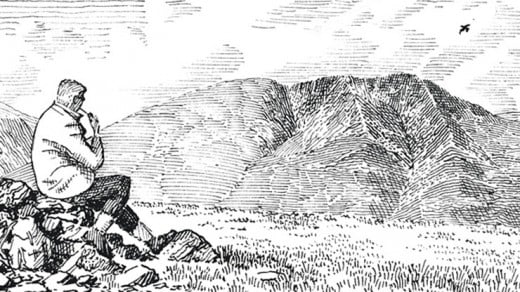
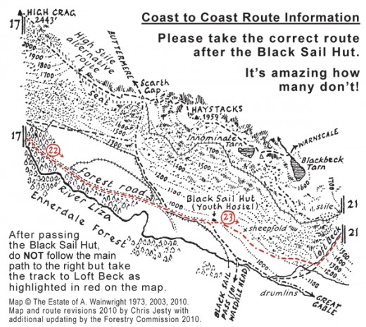
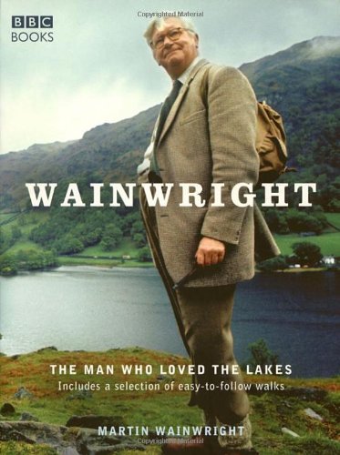
A shy, retiring man, Alfred Wainwright was a local government officer from nearby Lancashire who liked to get away from it all. In his free time he'd take a sketchbook and notebook on a long walk, note down his route as he went, the going and - in his estimation - how difficult the walk was. Here and there a drawing might be called for, to show a route or a natural feature such as the 'cow and calf' on one of his routes. Then he'd take the bus home and write out his pages. The books that resulted were originally sold in cafes and shops around the Lakes. Now you can get hold of them online. How's that for progress?
------------------------------------------------
© 2013 Alan R Lancaster

