Natural Disaster Phenomena
The planet has undergone many changes, many of which were caused by natural disasters. Although these disasters where on a megalithic scale and are very uncommon their predecessors however are frequent and can still be devastating. This paper analyses the causational phenomena involved in several types of natural disasters. Furthermore the relationship between these disasters and their geographical, social and economic influence is explored with highlights on our ability to predict and or prevent these disasters, their effect on geography, natural resources and technological infrastructure on a global scale.
Our planet has been buffeted by many natural disasters in the past ranging from cataclysmic earth quakes and volcanic eruptions to megalithic storms and floods. Each event leaves the planet and it populous changed on a geographical, sociological and economic level. What is it that causes these destructive forces? What are their effects on resources, economics and our technological infrastructure? Are there ways in which we can monitor and or prevent these disasters? What are the limitations of these methods and their availability on a global scale? These are some of the questions that will be addressed further in this paper with hopes that through research they may be answered.
Of the many destructive forces in nature, volcanic eruptions have the most potential for immense disaster in its area. Although less frequent than other natural phenomena the force with which they occur can be so devastating as to cause an extinction level event. Super Volcanoes are one of the most devastating forces on the planet arising from the release of miles of magma built up into a pool under the earth’s crust. In our history we have had several that have left their signature for us to find hundreds of thousands of years later. One such even it believed to have taken place around 74,000 years ago in what is now Indonesia which may have eliminated most of the human populous on the planet. (Ski, T 2012) Today the potential lies a little closer to home in Yellow Stone National Park in the form of magma pool around 6.2 miles below the crust. This is the cause of the many geysers present in the area resulting from hot gasses and stem being built up as from the enormous heat being generated. (Handwerk, B 2011) Yet as fantastic these events are they are rare. On a smaller scale however there are different eruption levels in around 10 volcanoes on any given day across the globe (SDSU, 2012). What is it that causes these eruptions ranging from just gas to tons of molten rock and ash?
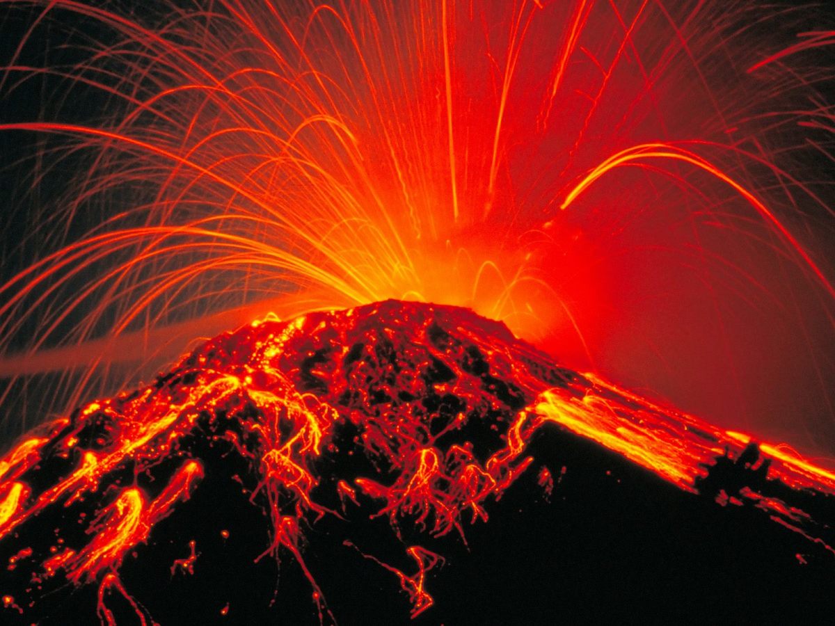
There are four basic types of volcanoes including cinder cones, Lava Domes, Shield Volcanoes and Composite Volcanoes. Cinder Cones are the eruptive type of volcano. Much like Super Volcanoes cinder cones erupt along the same methods sending tons of ash into the atmosphere to settle as cone around the blast site. As magma flows around the base it cools and in turn supports the higher parts of the cone. Some of this material called Tephra is a result of gas filled pieces of molten rock cooling as it travels through the air to become volcanic rock. Although the magma pools under cinder cones are not as expansive as super volcanoes they still hold the potential to be extremely destructive to their surrounding areas. One volcano in the village of Paricutin Mexico witnessed the rise of a cinder cone around 1,200 feet over the course of 9 years. This volcano succeeded in destroying the town San Juan as a result of around 100 miles of ash being deposited in conjunction with many lava flows (USGS, 2012)
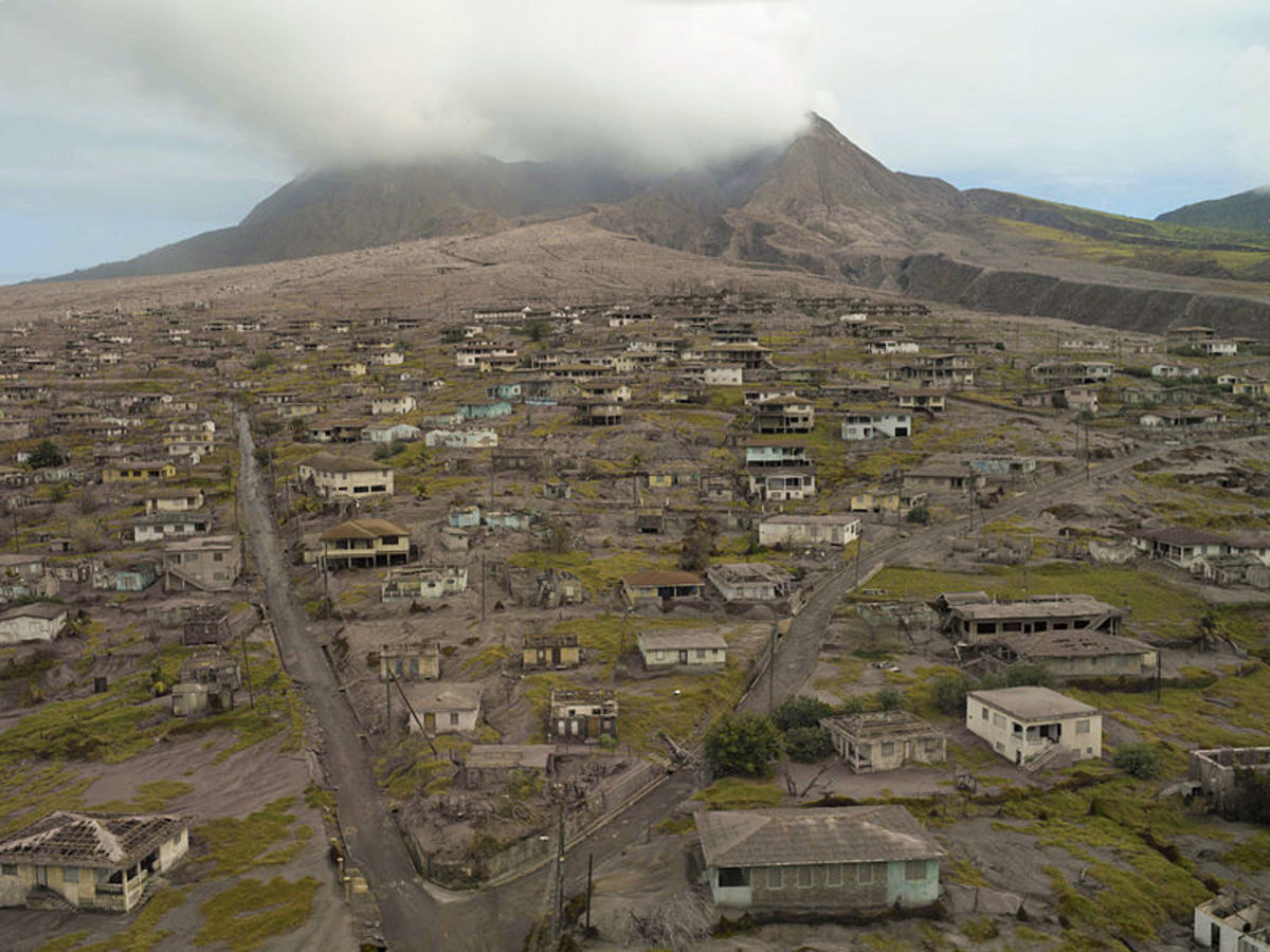
Another very destructive type of volcano goes by the title Lava Domes. Lava Domes are simply pockets of Lava that is to “vicious” to flow resulting the lava collecting over and around it rim slowly growing as pressure builds within. The reason for this viscosity is the level of Silica present in the magma. The less Silica present the easier and “thinner” the flow of lava will be ( USGS 2012) The eruption accompanying the formation of these domes can be devastating. In 1902 Mont Pelé the eruption destroyed the city of St. Pierre about 4 miles away with hot gases, volcanic dust and ash killing around 30,000 people. (USGS 2012)
Composite Volcanoes are the end result of a dormant volcano. Eventually as the magma plug cools erosion begins to take place in the surrounding landscape. After many years the magma plug will have lost its covering leaving the plug exposed to eventually also be worn down into a small lava capped mesa. This process can take thousands of years to occur after volcanic activity has halted. Although these do not present any eminent danger they may have spent years actively altering the surrounding landscape through eruption and disbursement of volcanic material.
Lastly there what is call a Shield Volcano. Shield Volcanoes tend to be the most massively expansive due to their content of basaltic lava. This type of lava is very liquid and flows very easily from fissures or cracks in the volcano to cool and form thin sheets that layer themselves. This process results in large volcanic formations. In some cases, such as oceanic shield volcanoes, they eventually form islands such as Mauna Loa in Hawaii. This formation begins at a depth of more than 15,000 feet and extends 13,677 feet above sea level. That would suggest that from sea floor to its top this volcanic structure spans around 4.5 miles in height. (USGA 2012) Although massive in their size these volcanoes seem to be more predictable and avoidable as there are less sudden eruptions of destructive magnitude.
So what can be done to detect and or prevent these disasters? In the United States the U.S Geological Survey monitors volcanic activity. Through the monitoring of gas, hydraulic activity, satellite imaging and land change scientists are better able to monitor volcanic activity and in some cases predict a possible eruption. When monitoring gas levels of a volcano the levels of carbon dioxide and sulfur dioxide are monitored closely because an increase in their release either from tubes, vents or the cone can indicate building pressure that can result in an eruption. Hydraulic monitoring is important as it measures the level of sediment in the water flows surrounding the volcanic area. An increase such as the one created by Mount St. Helen in the eruption of 1980. After the eruption sediment levels where 500 times higher than normal and after 20 years are still 100 times higher than normal. (USGS 2012) The increase in sediment in the surrounding water ways can result in a lesser capacity of water flow to the surrounding area and severe damage to the area vegetation as the sediment, usually consisting of ash and tephra, inhibit the absorption of water into the soil. The use of satellite imaging and GPS are also very helpful in determining potential eruptions. The idea behind the GPS system is that by placing GPS transmitters in a volcanic area the satellite will be able to detect changes in the land formation such as an increase from sea level. The way they do this is simply by analyzing the signal and its duration between being sent and received to determine if there is a change from previous signal durations. The one major flaw in this is that the signal lengths can vary depending on the position of the satellites and need constant recalibration to be accurate. (USGS 2012)
Another method of eruption detection is the use of Seismology. Seismometers measure the vibrations in the ground comparing past dormant and active data to determine the possibility of future eruptions. Generally these instruments are placed within 20 meters of the volcano and will tell scientist is there is earthquake activity. As earthquakes can lead to eruption or at minimum show volcanic unrest this is an effective way of determining possible future eruptions. As science soars into new technologies and scientists become more experienced in this field the accuracy and speed with which this activity is discoverable has continued to increase. (USGS 2012) These methods will surly see reengineering in the future as we become more technologically advanced and gain more insight and experience into this disastrous natural phenomena.
Closely associated with volcanoes, earthquakes present another potential disaster on our planet. Our planet is covered by several layers including the crust, mantle, outer core and inner core. Beneath its crust lies the Earth’s mantle, a hot mass of rock extending to the earths outer core. In certain areas on the crust the mantle seeps through to the surface as magma then lava. Because of the mantles nature of movement the top crust is never really allowed to solidify into a non-moving mass. As a result of this the “plates” of the Earth’s crust occasional push against each other. The resulting vibration from the earthquake is caused by the built up energy being stored as the jagged edges of the plates press and then release from each other. The resulting vibration is called seismic waves. This is what shakes the ground and anything on it so violently. One such incident occurred on September 1st, 1923 in the cities of Tokyo and Yokohama. A fault line being pulled apart in the Sagami Bay resulted in the collapse buildings, wild fires and eventually the death of around 200,000 of its citizens.(NHM, 2012)
So how do scientists forecast or even find the source of these earthquakes as they are so far underground? With the use of Seismometers, which is basically a weight attacked to a string suspended over a base. When the base shakes from an earthquake it transfers the vibration to the string which is then read as data showing the variation in magnitude. Scientists have discovered that an earthquake gives of 2 types of vibrations called P-waves and S-waves. As P-waves travel much faster than S-waves there is a differentiation in arrival time depending on the distance from the source. In other words the farther you are away from the epicenter the greater time distance between the 2 types of vibrations and their arrival at a given point. This differentiation allows for scientists to determine how far a seismometer is from the epicenter. However it does not tell the location of it. To do this the use of many seismometers are used to triangulate its position. By comparing the data of multiple seismometers and there relative distance from the epicenter scientists are able to determine the location. (USGS, 2012) Unfortunately as of now there are no proven ways to predict the occurrence and site of an earthquake.
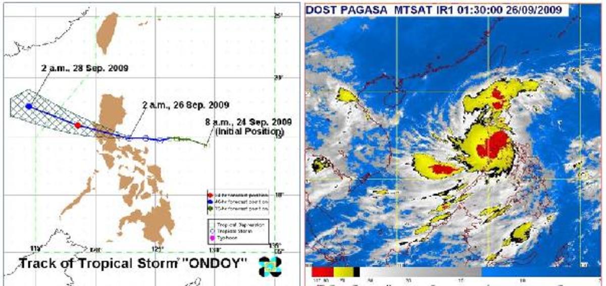
These are two very powerful land based natural forces that are capable of mass destruction all over the globe. Yet we are subject to other sources of disaster from the breezes we usually take for granted as pleasing. Of these phenomena hurricanes pose a major threat as they are capable of massive amounts of coastal destruction from torrential rain fall to floods and winds in excess of 74 miles per hour. Hurricane unlike land mass phenomena is highly dependent on an ever shifting environment for its creation and sustenance. A hurricane is basically a grouping of thunderstorms. However, to gain the ferocity of a hurricane the storm needs help from not only the ocean but from the atmosphere as well. From the ocean the storm requires oceanic water in excess of 26.5 degrees Celsius. Secondly high relative humidity is required in the “lower and middle” troposphere to reduce evaporation of clouds and increase the storage of latent heat, this heat is what “drives” the storm system. Then the inclusion of wind velocity plays its role as it defines the disbursement of heat and moisture responsible for the hurricanes growth. This factor is called wind shear. With a low wind shear the hurricane is able to expel the heat and moisture from it top thus promoting its own growth. However, a high wind shear will cause the disbursement of heat and moisture to be disbursed to a wider area. (UIUC, 2010) The power unleashed in these storms can be catastrophic to the affected area. Take for example the hurricane of Galveston that occurred in 1900. This hurricane was responsible for the deaths of around “6,000-12,000” people and the subsequent destruction of the entire coastal area. (NOAA, 2012)
Our methods of early detection of these weather phenomena have greatly increased with the use of radar and satellites. Through advances in technology scientists have been able to create more accurate measurement instruments able to be used from space. One such instrument that seems crucial to our ability to predict the occurrence of a hurricane is the QuikSCAT. This instrument is able register near surface wind speed using a “specialized microwave radar” (NASA, 2012) By doing so scientists are able to observe the process by which a storm descends to the surface, kicks up water vapor and starts the process of becoming a hurricane, thus allowing for early detection and preparation.
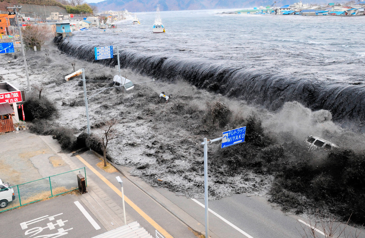
As troublesome and disastrous these phenomena can be in of by themselves the true damage comes in the form of degraded ecosystems, reduced resource availability, damaged infrastructure and economic strain. All of these disastrous events cause landform change that effects vegetation, resource access and viability and even present wildlife. Take for example an erupting volcano. By the time the eruption has subsided and becomes inactive the surrounding land will have been covered in ash and volcanic deposits choking of water absorption and sun light crucial to plant life. The water flows surrounding the volcano become infused with this sediment and have a reduced capacity to transport water that is needed to feed the outlying areas wildlife and vegetation. Earthquakes can cause much of the same damage depending on their point of origin and magnitude. Specifically oceanic seismic activity can cause tsunami waves of such force as to flood and/or destroy coastal cities. This can result in damage to the ecosystem and displacement of marine life used as a food resource.
In conjunction with the destruction of the surrounding land mass and life forms dependent on it these disasters can have a massive financial impact on populations in their area also. The earthquake in 1923 Japan cost a total of “$70 billion in today’s currency” (NHM 2012). In our own country hurricane Katrina placed 80% of New Orleans underwater, disrupted oil production by “1.4 million barrels per day” with 1.7 million people losing power creating around $100 million in total damages (NOAA, 2012). Volcano eruption can also have a devastatingly heavy toll economically. The island of Kilauea in Hawaii experienced around $2.6 million in damages a portion of which encompasses 10,670.4 lbs. of sugar valued at $1.24 million (1955 dollars) and 3,000 acres of land. (oregonstate.edu, 2012)
One aspect of these disasters that can often be overlooked is the social impact. Yes there are many negative effects of these disasters such as homelessness, loss of income, post-traumatic stress and depression (DVA 2012), yet there is also a positive side as a result of all the turmoil and struggle. These disasters have the power to invoke compassion and generosity in others. They bind communities that were otherwise individualized. They even have the power to unite nations in their efforts to help those in need and to rebuild. Although this charity to third world countries is welcome it does not however influence their lack of technological availability to predict and minimize damage from these disasters. They may have access to satellite imaging and other means of detection yet these are only beneficial to the people who are warned. A small coastal village of a few dozen to a hundred people that do not have contact with the outside world may suffer heavy casualties as a result of being uninformed and unprepared.
It is clear that these disasters have many drastic effects on the environment, economy, social structure and the areas infrastructure. The methods of detection and preparedness have increase in their efficiency over the years yet we are still a long way from consistent detection prior to the natural event, all we can really consistently do is be prepared and aware of safety steps related to each disaster and their implementation. As scientists delve deeper into the physics of these phenomena perhaps in the future we will discover the root causes of them and not only be able to predict their occurrence but remove the danger of collateral damage and possibly even harness the awesome amount of energy being released.
References
DVA
NATIONAL CENTER for PTSD, United States Department of Veteran Affairs, 2012. Retrieved on May28th 2012 from http://www.ptsd.va.gov/public/pages/effects-natural-disasters.asp
Handwerk, B
Yellowstone Has Bulged as Magma Pocket Swells, Daily News, nationalgoegraphic.com, National Geographic Magazine, Jan 29th, 2012. Retrieved on May 27th 2012 from http://news.nationalgeographic.com/news/2011/01/110119-yellowstone-park-supervolcano-eruption-magma-science/
NASA
QuikSCAT, Hurricanes: The greatest Storms on Earth, Earth Observatory, National Aeronautics and Space Administration, nasa.gov, 2012. Retrieved on May 28th 2012 from http://www.google.com/#hl=en&sugexp=edvst&gs_nf=1&cp=4&gs_id=f&xhr=t&q=NASA&pf=p&output=search&sclient=psy-ab&oq=NASA&aq=0&aqi=g4&aql=f&gs_l=&pbx=1&bav=on.2,or.r_gc.r_pw.r_qf.,cf.osb&fp=cd42049d4e82fac7&biw=234&bih=522
NHM
Past event, Catastrophic Earthquake, Natural Disasters, Nation History Museum, 2012. Retrieved on May 27th 2012 from http://www.nhm.ac.uk/nature-online/earth/volcanoes-earthquakes/global-catastrophes/html-version/earthquake/index.html
NOAA
HURRICANE KATRINA, National Oceanic & Atmospheric Administration (NOAA), U.S. Department of Commerce, NOAA Public Affairs, 2007. Retrieved on May 28th 2012 from http://www.katrina.noaa.gov/
NOAA
Impacts, Hurricane Katrina, National Climatic Data Center, National Oceanic and Atmospheric Administration, 2012. Retrieve May 28th 2012 from http://www.ncdc.noaa.gov/special-reports/katrina.html
oregonstate.edu
Losses from the 1955 Lava Flows from Kilauea, Hawaii, , The Cost of Volcanic Eruptions, oregonstate.edu, Oregon State University, 2012. Retrieved on May 28th 2012 from http://volcano.oregonstate.edu/education/facts/CostVolc.html
SDSU
Historical Eruptions, How Volcanoes Work, Geology, sdsu.edu, San Diego State University, 2012. Retrieved on May 26th 2012 from http://www.geology.sdsu.edu/how_volcanoes_work/
Ski, T
Super Volcanoes Could Be a Catastrophic For Civilizations, Environment, St. Augustine News, Staugnews.com, May 31st 2012. Retrieved on May 27th 2012 from http://staugnews.com/2012/05/31/super-volcanoes-could-be-a-catastrophic-for-civilizations.html
UIUC
Hurricanes, Meteorology, Online Guides, WW2010 University of Illinois, 2010. Retrieved on May 27th 2012 from http://ww2010.atmos.uiuc.edu/ (Gh)/guides/mtr/hurr/grow/home.rxml
USGS
Cinder Cones, Principle Types of Volcanoes, U.S Geological Survey, 2012. Retrieved on May 27th 2012 from http://pubs.usgs.gov/gip/volc/types.html
USGS
Lava Domes, Principle Types of Volcanoes, U.S Geological Survey, 2012. Retrieved on May 27th 2012 from http://pubs.usgs.gov/gip/volc/types.html
USGS
Molten rock, Volcanic Lava Domes, Lava Domes, Volcanic Domes, Composite Domes, usgs.gov, U.S Geological Survey, 2012. Originally sourced from Myers, et.al. 1997, What are Volcano Hazards?: USGS Fact Sheet 002-97. Retrieved on May 27th 2012 from http://vulcan.wr.usgs.gov/Glossary/Domes/description_lava_dome.html
USGS
Shield Volcanoes, Principle Types of Volcanoes, U.S Geological Survey, 2012. Retrieved on May 27th 2012 from http://pubs.usgs.gov/gip/volc/types.html
USGS
Hydrologic Monitoring of Volcanoes, Volcanoes Hazard Alerts, usgs.com, U.S Geological Survey, 2012. Retrieved on May 27th 2012 from http://volcanoes.usgs.gov/activity/methods/hydrologic/index.php
USGS
Using GPS for Monitoring Volcano Deformation, Monitoring Volcano Ground Deformation with GPS, Volcanoes Hazard Alerts, usgs.com, U.S Geological Survey, 2012. Retrieved on May 27th 2012 from http://volcanoes.usgs.gov/activity/methods/deformation/gps/index.php
USGS
Moving Magma and Volcanic Fluids Trigger Earthquakes, Monitoring Volcano Seismicity, Volcanoes Hazard Alerts, usgs.com, U.S Geological Survey, 2012. Retrieved on May 27th 2012 from http://volcanoes.usgs.gov/activity/methods/seismic/index.php
USGS
The Science of Earthquakes, Earthquake Hazard Program, U.S. Geological Survey, 2012. Retrieved on May 28th 2012 from http://earthquake.usgs.gov/learn/kids/eqscience.php

