An Appalachian Trail Thru-Hike: - Part 28 Finding a Groove in Southern New England
" I sat down on a rock face and slid down on my butt in a very undignified manner ..."
Steep Wet Hiking
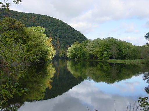
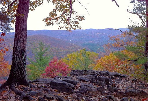
It rained the night we stayed at Chase Mountain Shelter, just a few miles outside of Kent, CT. The next morning the woods were wet. When we started out hiking on our first full day in Connecticut, we found that the trail followed the Housatonic River. It alternated between a level path that wended along the River, and steep climbs and descents up and down the mountains that overlooked the river. We were surprised at how steep and rugged the trail was. There were a few places where the trail led down some bare rock faces where we had to grab onto small trees growing beside the trail and exposed roots that snaked across some of the boulders that we were scrambling over. The wetness from the previous night's rain combined with the steep path made for some slippery footing. In a few cases I sat down on a rock face and slid down on my butt in a very undignified manner, slowing my slide by hanging onto vegetation on either side of the rock. I commented to Dave that I hadn't expected the terrain in Connecticut to be so challenging. He agreed. We noted that the trail was similar to trails that we had hiked in the Adirondacks when we were growing up. Gone were the graded trails and switchbacks we had become used to in the southern states and gone were the long ridges of the mid-Atlantic states. The character of the trail had changed. We had first noticed it on sections of the trail in New York, but now it had become more pronounced. We could see that the mountains that we were encountering were much more broken up. There was more up and down and the trail construction tended to favor straight climbs over obstacles rather than a meandering, gradual approach.The mountains were not yet very tall, but they were getting taller with every mile we went north. We knew from experience that much taller peaks were still a few weeks away, and the hiking would only get tougher from here on out.
If you want to read this series from the beginning, click the link below:
- An Appalachian Trail Thru-hike: Part 1 - Deciding to...
Two teenagers hike the Appalachian Trail from end to end in 1982. This episode describes how they decided to hike the trail and their preparation for the trip.
Cornwall
After hiking 13.5 miles during the morning we came to the small town of Cornwall. In Cornwall there was a store where AT hikers could stop in and be treated to a free soda. Dave and I stopped and made sure to get ours. Of course we also got a whole lot of other snacks as well, which we paid for. I'm sure we were not the only AT hikers to spend money at that place. The free soda that the proprietor gave out was well worth the cash he got back from a hungry hikers that were attracted to the store by the free soda offer.
We decided to stay the night in Cornwall. We found a place called the Country Motel for $24 a night. Just after checking in we discovered that another hiker named Clayton, a guy we had met earlier in the trip, was also staying there. Clayton was hiking half of the trail that summer. He had started earlier in June, somewhere around the halfway point in southern Pennsylvania. He planned to do the southern half of the AT some time in the future.
The next morning I called home before we started hiking again. During that call I arranged with my parents a meeting with them in a week or so. The closest spot along the trail to where my parents lived was in Williamstown Massachusetts, which was about an hour drive due east. We estimated that we would get to Williamstown around the fourth of July. To be safe, we gave ourselves an extra day to get there. We planned to meet them for a picnic in Williamstown around noon on July 5th.
The next day we enjoyed some easy trail for a while for a while as we hiked through a beautiful forest full of pine and birch trees. After 7.5 miles of hiking it began to rain. We didn’t hike much further. We ended up staying at Mohawk Shelter, and once again Clayton was there. Mohawk Shelter was one of the few shelters we stayed at on the entire trip that did not have a wooden floor. We had to lay our sleeping bags out on packed dirt.
Clayton was a friendly guy who carried a green Lowe internal frame pack. We thought of him as a kindred spirit of sorts. Dave and I had started out our trip with a tendency to carry a lot of canned foods. Over the course of the trip we had gotten away from carrying so many due to both the weight and the expense, but we still liked to get occasional cans of fruit such as peaches or pears to supplement our mostly starchy dinners. Clayton carried lots of cans also. He liked to carry cans of tuna and Kipper snacks, which were like sardines. In fact, another guy we had hiked with a time or two who also knew Clayton tried to give Clayton the trail name of "Kipper". Clayton never used it though, so it didn’t stick. That evening at Mohawk Shelter, Clayton made us each a tuna sandwich and it really hit the spot. It was so good that I made special mention it of it in my journal.
"It had a wonderful view of the valley below. We could see a little village with a white church steeple – the quintessential New England scene."
A New Kind of Hay Bale
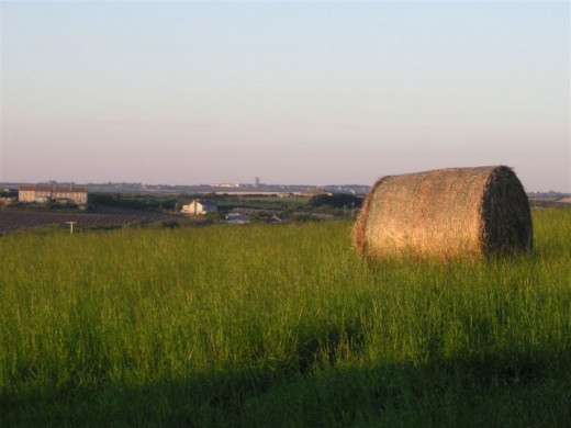
The next day, the last day of June, was beautiful. The sun was out all day and there was a cool breeze. We took advantage of some road walking to make good time. After a few days of fairly light mileage, we broke out with a 25 mile day. We were even able to fit in a supply stop at Salisbury, Connecticut which we thought was a nice town. The best hiking of the day took place after our supply stop. We hiked through some picturesque fields and we came across something I had never seen before. Dave and I had both seen our share of hay bales in some of the farm fields around the little town where we grew up. The hay bales we were familiar with were the 3 foot long by 2 foot wide by 2 foot high variety that could be lifted and heaved onto the bed of a truck. On this day in Connecticut however, we came out of the woods into a beautiful pasture on a mountainside. It had a wonderful view of the valley below. We could see a little village with a white church steeple – the quintessential New England scene. What caught our attention the most, though, were the enormous hay bales that were in the field. It was the first time we had ever seen huge circular hay "wheels" that were 6 or 7 feet in diameter. There were several dotting the large pasture like some kind of art exhibit of organic sculptures. Dave and I walked up to one of the giant hay "wheels" and pushed at it to see if we could move it at all. We couldn't. We ended up climbing up to the top of one by digging the toes of our boots and squeezing our hands into crevices in the tightly packed hay. We perched ourselves on top, drank from our water bottles, and enjoyed the view.
After a while we got down and moved on. We climbed Barrick Mountain and Lion’s Head. From Lion’s Head we got a fantastic view of the sunset. Not far past there, we reached our final destination of the day – Brassy Brook Lean-to. It had been a good day.
White Paint
The next day was another beautiful day. We hiked another 20 miles and we climbed a number of steep mountains. In the morning we crossed from Connecticut into Massachusetts. Not long after that we came across a volunteer trail crew from the local ATC chapter. They were keeping the trail cleared and repainting the rectangular white blazes that marked the trail. We had been following those white trail blazes all the way from Georgia and this was the first time we had run across a crew that was maintaining and marking the trail. I remember looking at the glistening new paint on one of the trees. For some reason I took the handle end of my hiking stick and dabbed into the wet paint of one of the blazes so I could get a spot of trail marker paint onto the end of my stick. It was a small spot and it wasn’t detectable on the blaze. I'm not sure why I did it. The stick was already personalized with my name carved into the side, and before I had left on the trip I had actually used a wood burning set to inscribe the words "Appalachian Trail Georgia to Maine 1982". Maybe I had the sudden urge to further align my stick with the trail by getting white AT blaze paint on it. Shortly after that, Dave and I climbed Mount Everett, the first mountain we climbed in Massachusetts. Everett was a fun mountain to climb with a nice view.
"He had eaten crab legs before and told me they were really good, especially dipped in butter."
Ripped Off
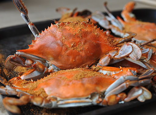
The weather was great and we made good time for the entire day. After Mount Everett the trail followed a 7 mile section of road walking where we came across a restaurant about midday. The restaurant was called the Pine Tree Restaurant. Never one’s to pass up an opportunity for a meal, Dave and I stopped. The Pine Tree was a nicer place than those we usually frequented. There were tablecloths and the menu was a little pricey. We discussed whether or not we should eat there because of the expense. Finally we decided that we would eat there, but get something inexpensive. As it turned out, the lunch special looked pretty good. It was “Crab and Seafood Salad Sandwich”. The price seemed good for a crab and a sandwich. Dave was very excited about the crab. He had eaten crab legs before and told me they were really good, especially dipped in butter. We each ordered the special and sat back to wait. It didn’t occur to us, as we sat there waiting for our food, that a steamed crab and a seafood salad sandwich was not a very likely lunch special combination. We just waited in anticipation for our delicacies to arrive.
A few minutes later the waitress came back with our plates. She set them in front of us and we each looked down at a seafood salad sandwich made with toasted white bread. There were no fries or chips to go with it, only a piece of lettuce as a garnish. The waitress was about to leave when Dave spoke up.
"Excuse me,” he said.
She stopped and looked at him.
“Uh, where's the crab?" he asked
“The crab?” she asked.
“Yeah, we thought there was supposed to be a crab with the sandwich.”
"The crab is in the sandwich," she said.
"Huh?" We both asked.
"It's in there," she repeated, "The sandwich is made of crab and seafood salad." With that she turned on her heel and swiftly walked away.
We looked at each other, dumbfounded.
"I thought they meant it was a crab, and a seafood salad sandwich!" I said.
"So did I!" Dave agreed.
“Isn’t crab considered to be seafood?” I wondered aloud.
“Sure,” said Dave.
“So why would they call it crab and seafood salad sandwich instead of just seafood salad sandwich?”
I could tell by Dave’s expression that he was wondering the same exact thing. There was nothing to do but to eat our sandwiches. They were gone in about six bites each. They were tasty, but not too filling. After they were devoured, Dave and I just sat there drinking our ice water.
"What a ripoff!" Dave grumbled.
“Yeah, a total ripoff,” I agreed.
Soon after that the waitress came with the checks. We paid twice what we normally paid for lunch, and we got about half of the food that we normally received. Luckily the hiking for the rest of the day was great. That, combined with the wonderful weather we had been having, and the nice views on all the peaks we climbed, soon made us forget how we had been fooled at the Pine Tree Restaurant. At the end of the day we stayed the night in our tent somewhere on East Mountain.
A Good Rhythm
The stint of great weather continued on the next day. Dave and I found ourselves getting into one of our best hiking rhythms of the trip. The weather was great, the trail scenic and pleasant, and the long evenings gave us ample opportunity for tacking on extra miles at the end of the day. We had a motivation to keep to a schedule due to our meeting with my parents that we had set up for 5 July. We hiked 27.5 miles from East Mountain to October Mountain Leanto, with a stop in the town of Lee to get some snacks. The next day was similar. This time we hiked 25 miles and passed through the town of Dalton. The trail cut straight through Dalton on a section of road, but our hiking focus was so strong at that time, that we didn't even stop for any snacks. By the end of the day we had finished our 4th 20+ mile day in a row. It was our most productive 4 consecutive days of the trip. In those 4 days we hiked just under 100 miles.
"Get these guys some sodas!" Remo ordered, "Put it on my tab!"
A Warm Welcome
Even though we bypassed a snacking opportunity in Dalton, at the end of the day we made up for it when we came to the little town of Cheshire. It was early evening when we came to a road intersection where we turned and hiked into town looking for a general store. We found a place and went in looking for refreshments. The proprietor greeted us and quickly found out we were hiking the trail. As soon as he found that out he became excited and insisted that we come into the storeroom in the back to meet some of his friends. We went back and found a group of guys sitting amongst boxes of grocery items. They were having a small party. The center of attention was a guy who was sitting in the middle of the room cracking jokes and giving instructions to everyone else. His name was Remo. The store proprietor told him that we were AT hikers and he gave us a warm welcome.
"Get these guys some sodas!" Remo ordered, "Put it on my tab!"
Remo already had his own can of soda – a Coca-Cola. He took a couple big swigs out of it, then cracked open a mini bottle of Jack Daniels, like the bottles that are handed out to passengers who order drinks on airlines. He poured the contents of the mini bottle into his can of Coke. The other guys in the room were doing the same either with mini bottles of Jack Daniels or Bacardi rum. They were a very happy group. The storeroom had a festive mood. The men asked us all sorts of questions about our trip while they sipped their drinks and we polished off our sodas.
After about 15 min. another guy showed up. Remo addressed him as Stan.
"You're the last one here Stan so you're going to have to give these guys a ride back to the trail! They’re hiking the Appalachian Trail and came here for a break and now they need you to bring them back!"
Stan didn't bat an eye. "These guys need a ride somewhere?" he asked, "Sure, I can take ‘em," he said without waiting for an answer. "Where are you guys headin’," he asked.
"Just back to the trail," we told him.
"Sure, no problem," he said. "Come on, I'll take you there right now," he offered.
We stood up and the group all wished us well. We said our thanks and followed Stan out the door.
Stan had a small hatchback. Dave and I squeezed our packs into the back, then squeezed ourselves into the seats of his little car. On our drive back to the trail Stan gave us a brief narration about the town and how great it was to live there. He dropped us off back at the trailhead and helped us lift our packs out of the back. Then he left with a waive. We turned back to the woods once again, our spirits bolstered by friendliness and moral support of people that lived near the trail and understood what we were doing.
"Right then I felt great. I was in the best shape of my life, I viewed the world as being populated with goodhearted people, and I believed that every tough challenge I surmounted would be rewarded with something spectacular."
Jones’ Nose
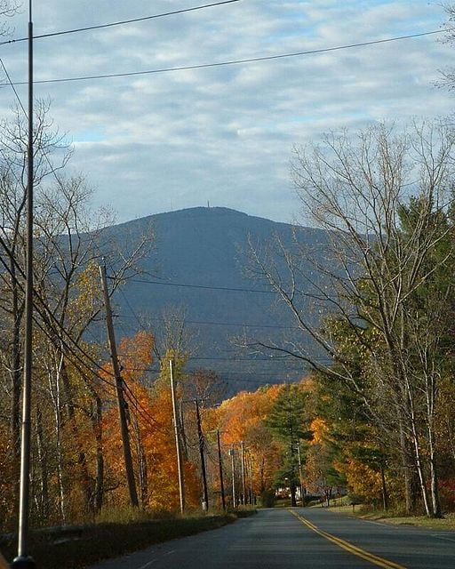
It was evening now and before us was the approach to the highest point in Massachusetts – Mt. Greylock. Before we could get there we had to climb the slope known as Jones’ Nose and beyond that, SaddleBall Mountain. Jones Nose had the reputation of being a straight steep climb. We didn't have to hike for a long time before we found out. It turned out to be a promontory at the top of a wide open field. We could see the trail cutting straight though the field and up the steep slope with no switchbacks. We followed the trail’s course with our eyes until it disappeared over the top of the slope. Why Jones’ Nose was covered by an open field was a mystery to me. It reminded me of the balds in North Carolina and Tennessee.
Dave and I had been on the trail for a long time – we were in great shape and we were fresh off a rest with our bellies full of snacks. We charged the slope and hustled up it straining against the gravity pulling down on our pack straps like horses hauling a wagon up a hill. We were determined to climb to the top with no rests. Our legs moved like pistons and our breath whistled in and out of our mouths with the sound of a steam engine. We finally crested the lip of the slope and the trail leveled off. We stopped and turned to see the beautiful valley below us. The air was warm and the golden light and long shadows of the evening accentuated the shapes of the landscape. Right then I felt great. I was in the best shape of my life, I viewed the world as being populated with goodhearted people, and I believed that every tough challenge I surmounted would be rewarded with something spectacular. What I didn’t know at the time was that within a week I would find out how fast things can fall apart from seeming to be so perfect.
We stood there for a while then turned and plunged back into the woods. Jones’ Nose was just a prelude to taller summits ahead. Next was Saddleball Mountain, and beyond that was Greylock, which we expected to reach the next day. We looked for the next good campsite after Jones’ Nose and we ended up in our tent on a flat spot on the side of Saddleball Mountain.
Fourth of July
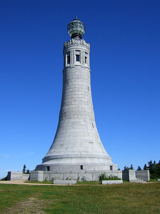
The next day was the Fourth of July and the weather was beautiful again. We arrived at the summit of Mt. Greylock in the morning to find it packed with people. Mount Greylock has a road to the top, and a hotel called Bascom Lodge. There is also an observation tower on top called the War Memorial Tower. Of course there is a snack bar there as well. We had been to mountaintops accessible by road on a few different occasions so far on the trip. Clingman's Dome, Roan Mountain, and High Point, New Jersey were a few. Each time had been out of season for tourists, so there had been no one around. This time we arrived at the busiest time of the year and it seemed strange to be amongst all the people that were milling around. We enjoyed the views for a while, but quickly moved on. We were anxious to get to Williamstown where we planned to get a place to stay for the night. The next day my parents were coming to meet us there, with a picnic lunch. We planned to spend a lot of the day with them. On our way down Greylock, we saw a porcupine waddling along next of the trail. It was our first and only porcupine sighting of the whole trip.
We came down to route 2, also known as the Mohawk Trail, between Williamstown and North Adams Massachusetts. Near that point we found the Redwood Motel and we checked in for the night. We thought about trying to find a way to see some fireworks, but we didn't know of any in the area and we simply ended up eating out then going to sleep for the night. For once Dave and I split up for dinner. There was a Mexican restaurant near the motel. I love Mexican food and I hadn't had it since before I had started the trip. Dave is not a fan of Mexican and he did not want to go there. I just couldn't pass it up so I went by myself while Dave found something else to eat.
Picnic
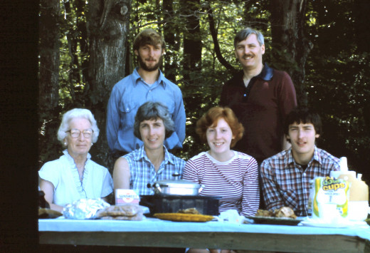
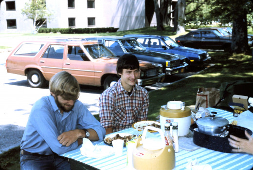
The next morning my parents arrived around 10:30 in the morning. I called the night before to let them know we were outside Williamstown and the name and location of our motel. With my parents were my sister Karen, and my grandmother. It was a great reunion. We talked a lot about the trip and Dave and I had many questions to answer.
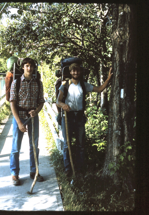
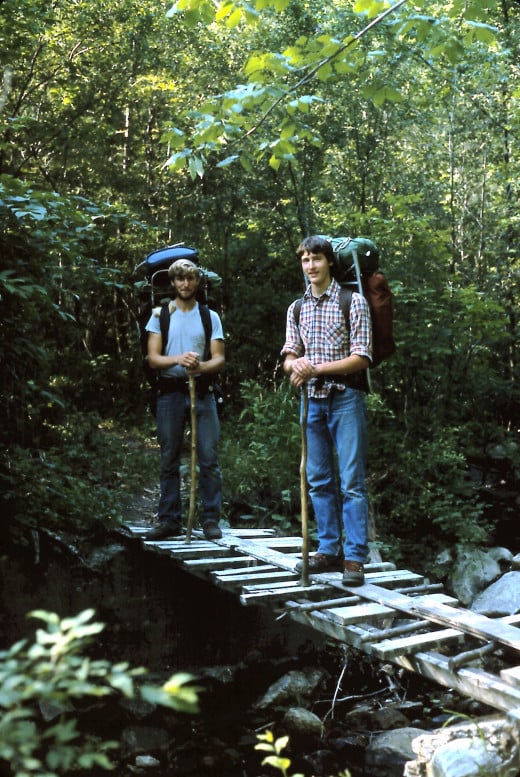
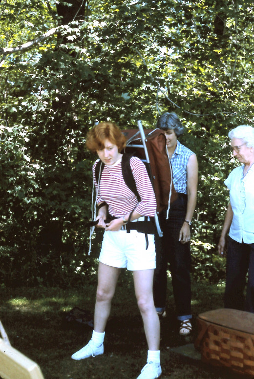
We found a Park with picnic tables and my parents broke out the food. The main course was fried chicken. Dave and I ate piece after piece. My father later commented that watching us eat was like watching a conveyor belt on an assembly line. Of course many pictures were taken, including some of my sister trying on my backpack. In the afternoon my parents took us food shopping to buy supplies for the next five days. Before we returned to the trail, we went to Friendly's for ice cream sundaes. Finally we drove back to the trail and we had to say our goodbyes and get our hugs from the folks. Dave and I posed for a last few pictures, then we turned and trudged down the trail over a small foot bridge. Not far ahead was the Vermont state line, but we didn't quite make it there that evening. Our packs were loaded down with supplies and after the torrid pace we had been keeping since midway through Connecticut, our hiking ambition seemed to have drained away. After only about a mile and a half on the trail, we stopped and set up our tent a little ways off the path. It seemed like Massachusetts and Connecticut had been a blur – the miles had flown so fast under our feet, but we enjoyed the beautiful forests, the challenging climbs, the views, and the people we encountered during our time in the lower half of New England.
