Using your smartphone for Self Defense and Disaster Prepardness
Smart Phones
The first thing a good Karate instructor teaches is “is not to be in spot the opponents punch or kick is going to land”. Avoiding the problem is not always possible, but there are ways to stay out of most situations that most people face today. Simply knowing where a swat team is involved in a shoot out, or a hazardous spill on the freeway can be a life saver. The use of police scanners has enabled many people to avoid and go around the situations that they encounter daily. People living in high hazardous, fire/flood areas, have relied on scanners to listen to ongoing fire and disaster personnel to help protect themselves and their property for many years.
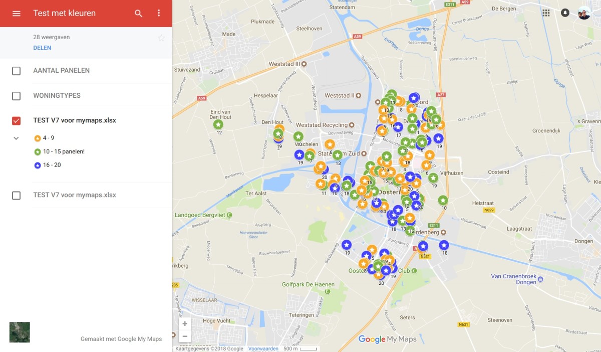
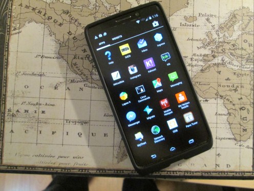
Smart phones, with the a radio scanning app becomes a general purpose scanner and electronic map. In conjunction with google maps a group of people can collaborate information heard, mark the maps so others can simply look at the map and know where a problem is. With this information they and others can get around the area and stay out of the way of police/fire or other emergency workers. I know you could text each other the information but that leaves out to much information, and would be quite cumbersome to explain to each person how to get around the area from where they are at the time. The map shows this information and can be used easily by everyone no matter where they are at the time, and can be updated easily and monitored constantly.
I have been doing this with scanner radios and will continue to use radios, but I will also use this to justify the high cost of a smart phone, and associated Internet costs that is required by smart phone use. To use this idea to its full advantage you need to decided which map you are going to use. I use google maps and have several maps saved. The one used for the monitoring the county where I live is named Metro Fire and has all fire stations and sheriff stations marked. This is not required but I find it helpful knowing the battalions and stations, when dispatched this can be a clue to where and what is going on. For example one battalion is equipped for water rescue, therefor, I know that something is going on at a lake or river. I can know if there is hazmat involved, by knowing the battalions and the vocabulary used by dispatch. I typically do not monitor sheriff activity, as the fire department is called out to situations requiring sheriff or highway patrol, and I do not waist time listening to parking enforcement doing their jobs. I also back up this map with an old Thomas Map book, because the internet/phone service is not 100 percent reliable. The number and type of equipment dispatched is helpful in knowing what is going on. Finally the street address is always given, and with this information I can know if I know that particular address being someone I know.
Now that I have started collaborating I find I have to pay attention to all the dispatches and mark the map accordingly. This is for the others that are working with me, so that they can be informed and possibly informed of something happening to some one they know. I have had this happen, more than once. While listening to my scanner I heard an address that sounded familiar and called my friend I thought was at that address and asked them if they were OK. They thought I was crazy until they heard the fire trucks and swat teams, arriving across the street and found out that the house across from them was in fact the intended destination of the officials. I had heard the dispatch and called before the fire companies arrived at the scene.
I think you are starting to see the advantage of using the radio scanning application that is available for smart phones, and by using Internet map applications such as google maps and collaborating with others can be of great value in self defense and disaster preparedness. With enough collaborators no one has to listen 24/7, you can use the morning news to update your map making sure not to duplicate but supplement what others have done that night or morning. And if things get really out of hand, with total power outage and Internet unavailable, you can use an old fashioned radio and a laptop with Thomas Maps, running on battery power to keep up with what is going on. Old School Rules in times of distress.
From my experience, the majority of map programs work basically the same. There is a dialog box to put in an address and when you click find, it finds the point on the map. There is usually an icon that is placed on the map, and this can be changed, enlarged, and information can be entered in about this point or address. You can insert photos, links and many other options. You can save this point or delete it. Like everything the more you use it the better you get at making it do what you want it to do. Don't wait until the power goes out to start learning how to work the map, the radio, the smart phone, start NOW! I use a little yellow house with a red roof to mark a fire station, I use an icon that looks like a fire to mark a fire. There is a truck icon that I use to mark a hazardous spill, and a policeman I use to mark a hostage situation. Use what you find suits you, but make it a point to be consistent in the use of the icon. The more consistent you are the better the information will be to you and those you are collaborating with. Be creative and document your procedures, which you can do right on the map itself by using an icon different from everything and putting in all your notes and documentation. It may prove beneficial to acquire a hard copy of Thomas Map book to back up everything.
To get the scanner application for your smart phone just go to the phone web page and down load it. If you are going to have a smart phone you need to know how to download applications and this is a good application to learn how . Don't forget to get some music while you are at it,and a book or two would be great. The US Army survival manual is available in PDF format and will serve you well. Save all documentation and learn how to use this application. A good users group may be found that will get you up and running quickly. Or you can go to the store you bought your phone at and have them help you get things set up for your area and what you want to listen to. And you may just get a new collaborator to join you.
Next get on the Internet and go to google.com and sign up for an account. Now you are ready to go to google map. Click on my maps and give it a name, something like scanner map, or collaborator map and follow the instructions to invite collaborators to develop the map. Assign the icons best for your use and keep track of what/and how they will be used. While you are doing this don't forget to listen to your smart phone, a dispatch of interest may come up and you should be ready to capture it. Expand this idea as far as you can, and you can use it almost anywhere you travel, in the USA.
At first you may have trouble understanding what the dispatcher is saying, don't let this bother you, you will learn and will build your vocabulary. Just concentrate on the address and type of dispatch. You will build your ability to understand as you learn how to listen and understand different voices under various levels of noise conditions.
Do not think you are going to do any public official, police/fire or news media a favor by being at the scene. This could get you into more trouble than you can afford. This is to keep you away from this type of situation. The biggest favor you can do for your self or anyone is to stay away and listen only.
- http://www.cq-vhf.com
CQ VHF is a quarterly magazine dedicated to Ham Radio Above 50 MHz focusing on all aspects of VHF and UHF amateur radio. It combines operating and historical articles with technical material aimed primarily at the experienced VHF ham radio operator.
amazon
- Amazon.com: Online Shopping for Electronics, Apparel, Computers, Books, DVDs & more
Online shopping from the earth's biggest selection of books, magazines, music, DVDs, videos, electronics, computers, software, apparel & accessories, shoes, jewelry, tools & hardware, housewares, furniture, sporting goods, beauty & person

