FAR NORTH QUEENSLAND HOLIDAY


Thought I’d share some of our holiday stories with you. My partner and I love holidays (who doesn’t!) and thoroughly enjoy jumping in our 4WD and getting out and exploring this great country of ours. I always keep detailed trip notes on our holidays so I always have this wonderful memory and resource for future holidays, so I thought, why not share our experiences with others!
Hopefully I’ll get some more trip notes up here as well, but let’s start with our Far North Queensland holiday.
WHERE DID WE GO?
Far North Queensland
WHEN DID WE GO?
27.12.2005 - 14.01.2006
TOTAL DISTANCE TRAVELLED?
7,026 km
Date: TUESDAY 27TH DECEMBER 2005
Distance: 948km
We left our caravan at Anna Bay and drove straight through, only stopping briefly at Kempsey for lunch and, of course, various toilet stops along the way! Arrived at Gympie around 9.30pm and checked into the Gympie Motel, grabbed some dinner and sleep ready for the full day of driving ahead of us. It had been a long day, but we want to reach the Daintree as soon as possible and then take our time from there. We awoke the next morning and found that the motel owners had cleaned the windscreen and mirrors on the car and left a note saying “have a happy and safe journey” – such a nice touch, you could clearly tell that we were well and truly out of Sydney!!
Date: WEDNESDAY 28TH DECEMBER 2005
Distance: 1,079 km
Left Gympie and again drove straight through. Arrived in Ayr at 9pm and checked into the Shamrock Motel. Not long after getting settled in our room all the electricity went off. We went outside to investigate and attempted to walk around with the torch and lantern – big mistake, we were subsequently attacked by huge bugs!! We walked out onto the road and saw that the whole town was in complete darkness (except McDonalds!!). It was quite a strange experience, all the locals just going about their business and all the tourists wondering what the hell was going on! We found that that apparently this is a regular occurrence for the locals, the electricity grid overloads and power shuts off to the town!!
Date: THURSDAY 29TH DECEMBER 2005
Distance: 570 km
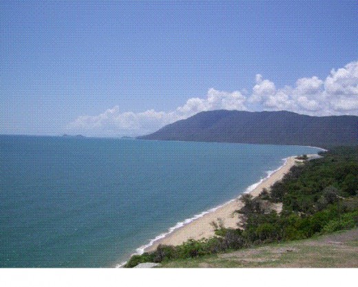
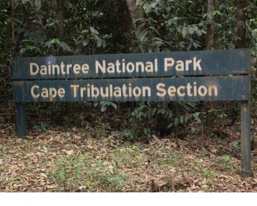
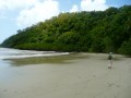
So today commenced the real start of our holiday. After 2 very long days of driving, we have reached the Daintree and can start to slow down and enjoy all this amazing part of the country has to offer. Today we crossed the Daintree River on the vehicular ferry and then drove through the World Heritage listed Daintree National Park as far as Cape Tribulation. We then drove back down to the Rainforest Village Caravan Park and set up camp for the first “camping” night of our holiday.
Now anyone who knows me, knows that I’m a huge frog lover, I love everything about them (I even have two pet Green Tree Frogs, Lotus & Hemi!), so when I saw a little frog sitting on the wall in the camp kitchen I was so excited!! - little did I know that he was just the first of many I was going to see over our trip, but you just don’t get this in Sydney so I was very excited!
We were also introduced to gecko’s and the enormous bugs that they have in Queensland – even the cockroaches are overgrown!!
Interesting Facts:
- The traditional name for Cape Tribulation is Kulki, as used by the Kuku Yalangi, the local aboriginal people who have inhabited the area for many thousands of years.
- Cape Tribulation has an annual rainfall of up to 4.5 meters and is home to over 3,000 plant species (including the world’s largest and smallest tree ferns and Cycads).
Date: FRIDAY 30TH DECEMBER 2005
Distance: 132 km
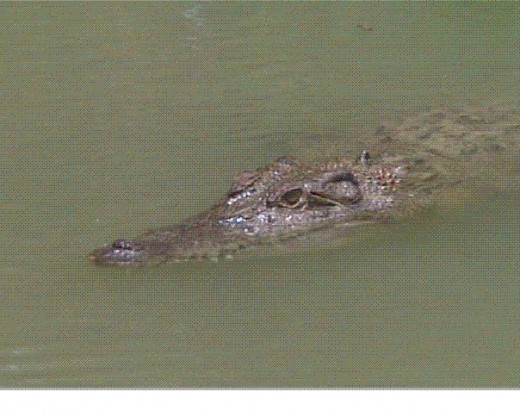
After leaving our camp site, we drove through the Daintree National Park to Cape Tribulation. From Cape Tribulation we took the coastal route and drove up the Bloomfield Track to Cooktown (approximately 120km of 4WD only dirt and gravel tracks). There were a few steep hill climbs and descents through the Daintree National Park and, as there had not been any rain lately, the roads were in quite good condition, although very dry and dusty. We had a few river crossings along the way through croc inhabited waters (but we didn’t see any).
The strange thing about this area is that you can drive past one creek that is apparently inhabited by crocodiles, but drive a kilometre down the road and it says you can swim there! We stopped at a waterhole at Little Annan for a swim, really nice and refreshing.
We got our first look at the Bloomfield River and drove to the Bloomfield Falls (in the Aboriginal community of Wujal Wujal). On arriving in Cooktown we went for a drive around the town and saw Captain Cook’s landing memorial (Captain Cook beached the Endeavour here for 48 days on 17th June 1770 to make repairs after extensive damage was caused on the reef). We went for a drive slightly further north to the Aboriginal community of Hope Vale and saw horses and cows on the road and many termite mounds on properties lining the road.
Interesting Facts:
- The kangaroo was originally discovered and described in Cooktown, named Kangaru by indigenous people.
- Cooktown is the closest Australian town to the Great Barrier Reef
- Queensland is implementing Alcohol Management Plans in many indigenous communities (including Wujal Wujal & Hope Vale). You cannot take alcohol into these communities and penalties include $37,500 for a first offence, up to $75,000 or 18 months imprisonment for a third offence. You can also have your car confiscated if you are found carrying alcohol within these communities.
Date: SATURDAY 31st DECEMBER 2005
Distance: 303 km
Before leaving Cooktown, we made a stop at the Cemetery which was officially opened in 1875 and found the following graves:-
· Mary Watson - Mary was the wife of a fisherman, Captain R. F. Watson, and she survived an Aboriginal attack on Lizard Island in September 1881, only to die later on Number 5 Island of the Howick group. The attack was provoked because their homestead was built on Aboriginal sacred land. She witnessed the spearing of one of her two servants, but Mrs Watson, her infant son Ferrier and the other Chinese servant escaped in a boiling down tank to Number 5 Island. There was no fresh water and they finally perished. Their remains, together with her diary, were found in 1882.
· Normanby Woman (Buried in 1886) – During the Palmer Gold rush, travellers sighted a fair-skinned woman living with Aborigines. She was captured by police and put on a horse bound for a new home in Cooktown. Aborigines attacked the party and the woman was injured falling from her horse. She died in Cooktown Hospital after refusing all food. Later, people were charged one shilling to view this strange woman. Mystery and intrigue will always surround this woman - whether she was European or a fair skinned Aboriginal, or whether she died of a broken heart is speculation and no-one is sure where the truth ends and folklore begins.
· Rev. Francis Tripp – This is the oldest identifiable grave in the cemetery. Francis died on 20th May 1874 at the age of 46.
I love cemeteries and it was very interesting looking around this one, lots of old graves and interesting stories to accompany them. After leaving Cooktown we took a side route to Archer Point. Although you cannot swim here, the area had great panoramic coastal views and photo opportunities. Amazing place, it was just beautiful and we were so glad we made this detour.
Next stop was the Lion’s Den Hotel at Helenvale for a beer. The hotel was built in 1880 and was originally an important stop on the supply route from Cooktown to the Annan River Tinfield. The hotel is surrounded by mango trees and mango’s lay all over the ground. A wooden deck runs around the pub, which also has an outdoor stage and pool table. Very different to any pub i’ve ever been to in Sydney!
On our way back through Cape Tribulation we stopped for a swim in a swimming hole at Woobadda River.One of the few places in Cape Tribulation that does not have crocodiles – probably ‘cause the water was so damn cold!!! From the Daintree, we detoured off the road down a 5km dirt track to Cape Kimberley. Another beach, white sand, crystal blue water – but no swimming!!
Date: SUNDAY 1st JANUARY 2006
Distance: 104 km
Today we spent majority of the day at Hartley’s Crocodile Adventures at Palm Cove (Cairns). We saw crocodile feedings, a snake show, went on a river cruise amongst the crocodiles and had our photo taken holding a baby crocodile. It was a great day out – we even had crocodile burgers for lunch, surprisingly it was actually quite nice!
Later on this afternoon we took a drive out to Mossman Gorge for a swim and look around. It was here that we were also attacked by fish … now attack may not be a word most would use to describe a fish!, but they were bitting and they were hurting …. A LOT!!! The Mossman River tumbles over and around huge granite boulders that line the gorge, creating the freshwater swimming holes. Although very refreshing, the water was very cold compared to the other swimming holes we had been in.
Interesting Facts:
- Hartley’s Creek Crocodile Farm is home to “Charlie”, the oldest crocodile in captivity, who was captured at Browns Bay, east of Cairns in the 1930’s. Charlie was awarded Queenslander of the Year in the 1991 for his contribution to the community!!
- Hartley’s was the first place in Australia to host crocodile shows and demonstrate the crocodile death role.
- The Mossman Gorge is part of the Daintree National Park.
- Kuku Yalanji legend has it that the local landmark, Kuburri, also known as Good Shepherd Rock, keeps watch over the area and that as long as it remains, Mossman will continue to prosper.
- The Mossman Gorge is home to the Kuku Yalanji people, who are the area’s traditional Aboriginal landowners.
Date: MONDAY 2nd JANUARY 2006
Distance: 101 km
This morning we woke to pouring rain. It had rained most of the night and didn’t look like it was going to let up at all, but eventually the rain stopped around 1pm and the day ended up hot and humid again! Typical Queensland weather!
This morning we went to Port Douglas, which is a very pretty place with palm tree lined streets and many resorts and boutiques. Although it seems a little more upmarket than most places we have visited, it’s still very laid back and relaxed. At Port Douglas we had a look around the shops and the marina and booked our Great Barrier Reef tour for tomorrow.
Date: TUESDAY 3rd JANUARY 2006
Distance: 122 km
Today we headed out on our Great Barrier Reef cruise. Neither of us had ever been to the Barrier Reef so we were quite excited. I’ve snorkelled in Fiji and New Caledonia so was interested to see how our own reef compared. Our cruise was actually going to the “Outer” barrier reef, so our initial boat ride was longer than most other cruises, but apparently it meant that we saw more colourful and undisturbed coral and fish.
Once we arrived on the reef, we changed into our “stinger suits”. These are basically just lycra wetsuits that protect you from the jellyfish/stingers that make their home in far north Queensland! Some of the tropical species, such as the Irukandji Box Jellyfish can actually be lethal, so we weren’t taking any chances!
We spent a great day snorkelling and swimming, checking out all the fish and coral. It’s amazing that all of this is just off the coast of Queensland. Everyone needs to experience this for themselves. The different shapes, the fish, the colours ..... amazing. We even saw a baby shark swim past us, it’s just hard to explain exactly how amazing this is!
Date: WEDNESDAY 4th JANUARY 2006
Distance: 104 km
Today we went to Kuranda with some of our Sydney friends, who happened to be in Cairns at the same time as us. We really enjoyed Kuranda, it was very laid back and a little alternative or hippie-like.
We did a return trip on the Skyrail – This takes you in a gondola and you travel for 7.5 km above the rainforest canopy and over the Barron River, stopping along the way to walk the boardwalk trails through the rainforest. It was on one of these stops that we had our best view and photo opportunities of the Barron Falls.
We walked around the shops and markets – heaps of souvenirs, handcrafts, clothes, arts and crafts. I had to limit myself to how much I could buy as we just didn’t have the room in the car!
We also went to the Kuranda Koala Gardens (Koala’s, crocodiles and snakes and a walk through reptile exhibit), theAustralian Butterfly Sanctuary (Live butterfly exhibit with hundreds of colourful tropical butterflies, including the Ulysses) and Bird World Kuranda (This is home to the giant cassowary (2 meters tall) and the largest collection of free flying birds).
Kuranda is also home to one of the most scenic railway lines in the country. The Kuranda railway was built between 1886 and 1891 and winds its way up from Cairns combing more than 300 metres through tropical rainforest, passing through 15 tunnels, around 98 curves and over 40 bridges.
Date: THURSDAY 5th JANUARY 2006
Distance: 117 km
This morning we walked around the shops at Cairns. Cairns is very laid-back, but also very much catered for the tourist. We went swimming at The Esplanade Lagoon (As you cannot swim at most places around Cairns they have created a 4800 sq metre saltwater lagoon-style pool in the middle of town where everyone goes to swim. Saltwater is pumped from the inlet and filtered. The pool is surrounded by grass, sand, timber decks, trees and landscaped gardens. Unlike your normal council pool, the lagoon is not enclosed in any way and does not attract any entry fees.)
Later that night we headed back to the unit and cooked dinner and then headed out to the night markets. These are held every night in the middle of town and offer a wide range of arts and crafts, souvenirs, jewellery, clothing etc. After a bit of a shop at the markets, we headed to The Reef Hotel Casino. This wasn’t very big and had no dress codes (we wore shorts and thongs!), nothing like the Casino in Sydney!.
Date: FRIDAY 6th JANUARY 2006
Distance: 288 km
Today saw us driving through the Atherton region. We stopped at Lake Barrine and went on a 40 minute, 6km cruise around the lake – While on the cruise we saw turtles, fish, birds and a python curled up in a tree. There were a lot of ducks too, which kept flying up onto the boat and walking around! Lake Barrine was once a volcanic crater, surrounded by rainforests. Members of the Curry family have been operating Lake Barrine Rainforest Cruise and Tea House since 1927. Lake Barrine is home to the 1100 year old twin Kairi Pines.
Next stop was Ravenshoe – Situated on the western most edge of the Tablelands, Ravenshoe is Queensland highest town. Ravenshoe is also home to the wind farm which was created on the extinct Windy Hill volcano in 2000. It’s 20 wind turbines are over 45 metres tall and have 22 metre blades, which provide a renewable energy resource for the community. We stopped at Millstream falls (just past Ravenshoe). This is Australia’s widest waterfall and it was definitely big. To see this absolutely full of water would be truly amazing.
Tonight was are staying at Innot Hot Springs, so we made use of the various hot and cold pools (two pools heated to 35 degrees (Celsius) and one at 42 degrees). Innot Hot Springs is famous for its unique natural thermal mineral springs, which have been said to have healing qualities. Very relaxing – even the 42 oc!. . The mineral water at Innot Springs was bottled up until the 1900’s and sent to Europe for its medicinal purposes. Apparently you can find hot water bubbling up out of the sand.
Date: SATURDAY 7th JANUARY 2006
Distance: 593 km
Today’s driving took us along the Kennedy Highway onto the Gregory Development Road to the towns of Greenvale, Charters Towers, Mingela and Ravenswood (Queensland’s oldest town). Today’s driving was fairly remote compared to the last few days driving. The scenery was totally different, there was allot of cattle on road, very dry red dirt, burnt trees, road trains, dry creek beds and dead animals and road kill absolutely everywhere!!
Today was our first experience with road trains! The road trains can have 3 or more trailers and are 53 metres long, they are big! When you see one coming you just get out of its way. Only problem is that the road is generally a single track bitumen road, and the side of the road isn’t graded very well and there is sometimes a good three to six inch drop, as well as the side being full of corrugations! Driving with road trains takes practice and at first it’s a little intense to say the least! Anyway, unfortunately our first experience with road trains led to a cracked windscreen for our 4WD. Lesson learned ....... get well out of their way!
Date: SUNDAY 8th JANUARY 2006
Distance: 206 km
As we approached Airlie Beach this morning the rain just kept getting heavier and heavier!! Eventually the day ended up clearing up and we had a walk around the shops and went for a swim in the Lagoon. Another lagoon like the one in Cairns, such a great idea and so pretty.
Date: MONDAY 9th JANUARY 2006
Distance: 543 km
This morning we went to visit Vic Hislop’s Shark Expo at Airlie Beach. Vic has over 30 years hands on experience of understanding sharks and shark attacks. This expo shows newspaper articles and photos of shark attacks and shark attack victims. Part of the expo includes viewing the movie “Shark Hunter”. The exhibit also includes a large frozen Great White Shark which Vic caught, which is kept in a big freezer with glass walls, at 25o below freezing.
Tonight we headed to Rockhampton for the night.
Date: TUESDAY 10th JANUARY 2006
Distance: 521 km
Today we stopped at Miriam Vale for lunch. Miriam Vale is a small remote town, with a population of 400, on the Bruce Highway between Bundaberg and Gladstone. After lunch we called into the Bundaberg Rum Distillery and had a look around. Here they sell Official Bundaberg Rum merchandise and they also run tours of the distillery (The Bundaberg Distillery Company was first formed in 1888).
Tonight we stay at Hervey Bay, reading to head over to Fraser Island tomorrow, can’t wait!
Date: WEDNESDAY 11th JANUARY 2006
Distance: 182 km
We left on the 9am “Fraser Venture” barge from River Heads and arrived at Wanggoolba Creek, Fraser Island at 9.40am. So excited to finally be on Fraser Island! We stopped at Lake Mackenzie for swim. This is the most beautiful place, a short walk from the car park and you are on this beach with the whitest talcum powder-like sand. The water is crystal clear and the most amazing turquoise colour.
After leaving the lake we did a little more exploring and found ourselves a campsite for the night. We camped in a little cove just up behind the beach and had this all to ourselves. After setting up camp we took a drive down to the shipwreck and had a walk around. The Maheno, once a luxury ex-trans Tasman liner, washed ashore in 1935 after being hit by a cyclone while on tow to Japan for scrap metal.
Interesting Facts:
- Fraser Island is World Heritage Listed and covers an area of 184,000 sq km, is 123km long and ranges from 7km to 22km wide.
- There are more than 100 freshwater lakes on the island.
- It was first sighted by Captain Cook in 1770, but was named after Eliza Fraser, whose ship, the Stirling Castle, was wrecked on the Great Barrier Reef in 1836. The local aborigines held the survivors captive and Eliza was separated from the rest of the group and kept prisoner for months until rescued by John Graham, who had lived with the local aborigines.
§ The beach, 75 Mile Beach, is a designated highway and therefore normal road rules apply, including an 80km speed limit. We were actually pulled over by a police “road block” for breathe testing!
Date: THURSDAY 12th JANUARY 2006
Distance: 203 km
Unfortunately we only had time for the 1 night on Fraser Island, but we will definitely be back. Fraser Island is very different to what we expected. We wouldn’t even have come close to covering half of the island in our 1½ days there. There is so much to do and see and we will be back for longer next time and take our time seeing the whole island. We didn’t even see any dingos this time, next time maybe!
After a few hours swimming back at Lake Mackenzie we head back to get the barge off the island and headed down to Maroochydore for the night.
Date: FRIDAY 13th JANUARY 2006
Distance: 890 km
This morning we went to Underwater World at Moloolaba. If you’ve never heard of it, it’s a truly amazing aquarium, I just love it. definitely one of the best i’ve been to. After spending a few hours here, we headed home :( The end of our amazing holiday, visited some awesome places and met some great people. The end of another great trip in this huge country of ours, but still so much more to explore.
Until next time ...........
Daintree Coast
- Daintree Rainforest.com - Tropical North Queensland, Australia. - Daintree -
The Original Daintree Tourism Website. The World Heritage Listed Daintree Rainforest is an emerald set in Tropical Far North Queensland, Australia. Enjoy a complete guide to the area including Daintree tours, beaches, walking tracks, accommodation, t
Great Barrier Reef
- Great Barrier Reef
Australia's most remarkable natural gift, the Great Barrier Reef is blessed with the breathtaking beauty of the world's largest coral reef, impressive coral cays, literally hundreds of picturesque tropical islands and some of the worlds most beautifu
Fraser Island Info
- Fraser Island Accommodation
Full listing for Fraser Island Accommodation, Guided 4WD Tours and Self-drive 4WD Hire.

")