Ten Biggest Earthquakes in History
Quakes That Shook The Planet's Very Axis
What are the ten biggest earthquakes in recorded history?
Sadly, we've just witnessed one. It's hard to wrap our minds around the scale of the devastation we're seeing. It's even harder to realize that nearly anywhere else would have had much worse devastation: Japan's architects and engineers should be justly proud of their quake-proofing. Yet it wasn't enough. Tsunamis, spilling over even the world record seawalls built for them, have proved an even stronger foe than earthquakes.
As a matter of fact, most of the biggest earthquakes have included a tsunami as well. Below are their stories. I hope and pray that I won't have to update this list any time soon.
Poll: Have You Ever Felt an Earthquake? - I've been through several...how about you?
Have you ever felt an earthquake?
#10 - Great Lisbon Earthquake, 1755 - Estimated M8.7 (At Least)
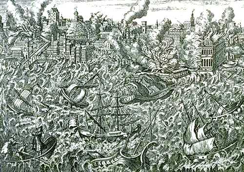
Obviously, no seismographs existed back then, but eyewitness accounts in Portugal and farther away suggest a magnitude approaching 9.0. At least a quarter of Lisbon's 250,000 residents died, many of them in churches where they were celebrating Mass for All Saints' Day.
The city caught fire. Thousands fled to the harbor to escape the inferno, only to be swept away by tsunamis. Europe, just emerging into the Age of Reason, was stunned. How could this have happened? Pioneering scientists collected eyewitness accounts, sketches, and observations: thus was born the field of seismology. Theologians, philosophers and poets grappled with theodicy.
The Great Lisbon Quake and tsunami carved a swath of destruction through North Africa and Spain as well. Seiches (seismic waves in water) occurred as far away as Finland.
Recommended Link: About the 1755 Lisbon Earthquake
Moment Magnitude Scale vs. Richter Scale
The Richter Scale is based on seismograph measurements, which aren't accurate for powerful quakes. This excellent article on the Richter Scale vs. Moment Magnitude explains why.
Here's a useful Moment Magnitude chart relating M.M. numbers to well-known events like Mt. St. Helens and nuclear testing.
#9 Off Coast of Ecuador - Jan 1, 1906
Magnitude 8.8
Americans would classify the 1906 Great Quake of San Francisco among the top ten, but in fact, Ecuador's quake in the same year was ten times greater. It just didn't make the news in Europe or North America, because it happened so far away.
Countless towns and villages were pulverized. Several small islands disappeared. Tsunamis claimed hundreds of lives in Columbia. The port city of Esmereldas got smacked by a tsunami. Nevertheless, casualty estimates are in the 500-1500 range. The waves reached as far as Hawaii, causing flooding, rivers to run backwards, and some local shoreline damage.
Recommended Link: NOAA's Report on the 1906 Ecuador Quake and tsunami
Megathrust Earthquakes - The World's Biggest Earthquakes
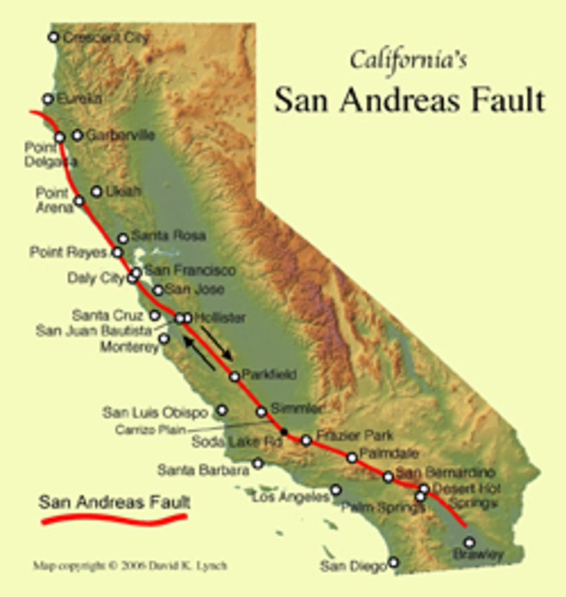
Nearly all earthquakes of Moment Magnitude greater than 8 ("Great" Earthquakes) happen along subduction (Latin sub "under" + ducere "to lead, draw, proceed") zones where plates are not simply grinding past each other (like the San Andreas), but one is actually diving under the other. The largest ten earthquakes have all happened around the Pacific Ring of Fire, where the ocean is bordered by a horseshoe of deep subduction trenches.
This animation by Professor Miho Aoki, University of Alaska-Fairbanks, shows how these faults rupture and create tsunamis.
#8 - Chile Earthquake - Feb 27, 2010
Magnitude 8.8: A testament to Chilean engineering
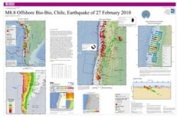
The Chilean earthquake of 2010 was incredibly powerful, as this in-depth USGS poster on the Chile earthquake (thumbnail at right) shows. Shaking lasted as long as 90 seconds.
There were about 500 deaths, many caused by tsunamis. Damages totaling $30 billion in U.S. dollars don't begin to capture the hardship and loss faced by thousands of Chileans. A few tall buildings fell, many homes were destroyed, bridges and roads were cut, and power was knocked out across most of Chile. Nevertheless, I was impressed at how few urban structures in Concepción and Santiago collapsed. I fear that Los Angeles, 60 miles from me, may not fare so well when our time comes.
The Chilean quake actually moved Chile's second-largest city, Concepción, 10 feet to the west, caused tsunami damage to Japan's fisheries and spawned standing waves in bodies of water as far away as New Orleans.
Recommended Link: NYTimes map and summary of Chile 2010 Earthquake.
#7 - Cascadia Megathrust Quake - Jan 26, 1700 - Magnitude 9+
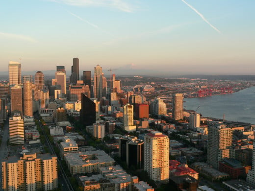
The Cascadia Earthquake of 1700 was preserved in the oral traditions of Native Americans and caused major tsunami damage in Japan.
The rupture was some 1000km (620 miles) long, from Vancouver Island to Northern California -- in other words, the Pacifica Northwest of the U.S. was hit by an earthquake larger than the one that just hit Japan. And while Japan hasn't been hit with one this big in over 1000 years, the Cascadia fault lets go with one of these every few hundred years.
Here's a Youtube video showing evidence of past Cascadia quakes plus a recreation of what the next will be like. Seattle may be the next Sendai. Maybe the GOP shouldn't be so hasty to slash budgets for NOAA and the USGS, which run our nation's tsunami warning system and earthquake preparedness programs.
The good news is that it's not doomsday. Japan and Chile have shown cities can survive a 9M earthquake with excellent engineering, although infrastructure may be seriously compromised for weeks. Also, megathrust quakes usually happen out in the ocean, giving people at least some warning and a chance to reach higher ground before tsunamis arrive. With preparation, the next Cascadia quake will be costly and cause lots of property and economic damage, but people can get through it.
Recommended Link: The 1700 Cascadia Earthquake: Evidence and Native Accounts
#6 - Kamchatka, Russia - Nov 4, 1952 - Magnitude 9.0
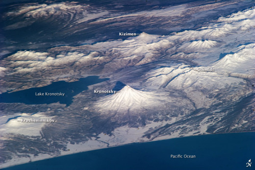
The remote wilderness of Kamchatka Peninsula in Russia, across from Alaska, is a geologists' dream come true. Kamchatka sports some of the most spectacular volcanoes in the world and produces massive earthquakes. Luckily, there aren't too many cities there even now. There were fewer in 1952.
In 1952, Kamchatka's biggest megathrust quake set off tsunamis that smacked Alaska -- not too badly -- and once again gave Hawai'i a tsunami practice run. The damage from these waves did up to a million dollars in property damage, but took no lives (Source: USGS).
Did You Feel That One Just Now?
News anchors get excited when they view real-time earthquake maps and discover tons of aftershocks. Actually, while every big earthquake has aftershocks, there are hundreds of earthquakes happening every day.
Here's a realtime map of earthquakes where I live. Unless you see a 5+, I probably didn't feel it! In countries built for earthquakes, we can weather a 6 without many problems unless the epicenter is shallow and right under us.
#5 - Arica, Peru (Now Chile) - Aug 13, 1868 - M9.0 - One of the First With Photographic Records
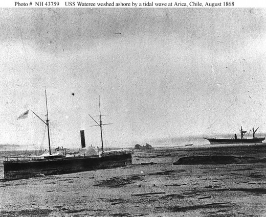
As with many megaquakes, the exact casualties are unknown, but estimates are as much as 70,000. The great quake leveled towns and villages, then tsunamis scoured the coasts, completely obliterating the port of Arica. Heavy freighters and warships were flung onto the shore. Tsunamis caused flooding and damage in Hawaii, and New Zealand took a hard hit from this one, damaging homes and harbors. Amazingly, the tsunami waves seem to have continued disturbing New Zealand for several days.
Recommended Link: USC's Arica Earthquake Page
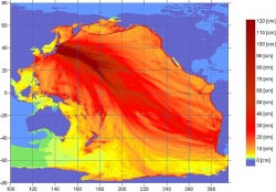
#4 Tohoku, Japan Earthquake - March 11, 2011
Magnitude 9.0 (Initially estimated as 8.9)
It's harder for me to encompass this tragedy in words: Chile's was bad, but Japan's Tohoku quake was catastrophic. Here's the USGS write-up, with lots of stark information.
The fault ruptured a distance of 310 miles, moving Japan itself 13 feet, tipping the planet's axis by six inches. The size of the quake shocked even seismologists, who thought this section of faults was too irregular to create such a long break.There continue to be aftershocks six months later, some larger than the 6.3 earthquake that struck Christchurch, New Zealand in February.
Japan's buildings withstood the earthquake, for the most part, which again is a testament to top-notch engineering. I'm also impressed that Japan actually has an "imminent quake" warning system: they can't predict earthquakes, but at least they can send out signals faster than seismic waves travel, so that people in Tokyo had about 12 seconds warning to grab hold and/or dive under a desk.
Unfortunately, while their engineering held up through an incredibly powerful quake, nothing could stop the tsunamis. I would guess that most of the 15,782 killed (plus 4,086 missing), were taken by the waves. The tsunamis are also what damaged Fukushima's nuclear plant. Sadly, the nuclear disaster drew government and media attention away from the struggles of the rest of the quake-damaged area, leaving hundreds of thousands of quake and tsunami victims to fend for themselves even longer before emergency services began to catch up with everyone's needs.
(Link: Before and after satellite photos from tsunami-hit areas).
That was months ago. People are out of aid shelters now, and rebuilding is ongoing in most areas. Contamination from the nuclear plant makes recovery impossible in some towns (map). The greatest toll on the survivors may be psychological: they've lost homes, families, friends, neighbors, jobs, and a sense of safety. It will take a long time for them to recover.
See the CSM on where to donate (including TEXT numbers for Red Cross and World Vision).
#3 - Indonesia / Sumatra Quake - Dec 26, 2004
Magnitude 9.1 - Boxing Day Earthquake
Credit: Vasily V. Titov, NOAA, Wikimedia
The Boxing Day Earthquake that struck Sumatra in 2004 has almost been forgotten in the wake of the massive tsunamis that claimed an estimated 230,000 lives in 10 countries. The quake itself lasted for 8 to 10 minutes, the longest sustained ground shaking ever recorded. The rupture under the sea floor was 1500 kilometers (900 miles) long, the longest fault break seismologists have ever measured. Islands rose or subsided. While most earthquakes are not considered to be causes of seismic events at great distances away, this one may have triggered smaller earthquakes as far away as Alaska. Some scientists argue that the Indonesian quake was actually 9.3.Recommended Link: Pepperdine's Indonesian Tsunami Resource Page
Is The Earth Getting More Active?
Having felt both a 6 and a 7 in 2010, I sometimes worry the Ring of Fire is waking up!
It is possible that the mass lifting from the poles as ice melts is causing some shifts, as happened at the end of the last Ice Age.
However, there are other factors: Booming population centers on coasts, near faultsWorld Wide Web and global communication
24/7 news coverage pouncing on every disaster
Scientists able to monitor with many more instruments
Digital cameras everywhere
#2 - Prince William Sound, Alaska - Mar 27, 1964 - M9.2: The Good Friday Earthquake
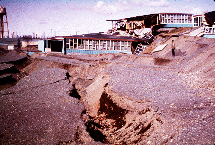
(Many other impressive photos at that link give you a sense of what a 9.2 can do)
The Great Alaska Earthquake of 1964 is to date the biggest earthquake recorded in the U.S. (remember, we're talking records, which have only been kept for a few hundred years). The intense shaking lasted 3-4 minutes, depending on the location. Some parts of Alaska moved horizontally as much as 18 meters, and wound up 4-9 meters up or 3 meters down. The most startling figure is the 67 meter tall tsunami in Valdez Inlet, where narrow, steep walls and an underwater avalanche compounded the waves. No, that's not a typo. Seiches (sloshing water) also sunk boats as far away as Louisiana.
Every time I see photos of this earthquake, I'm boggled. It's not just the damage to Seward and Anchorage, with streets broken and shoved up and down like a few surviving levels of a house of cards. It's also the bizarre chopped-up land in the back country, with humps like ski moguls and subsidence trenches that look Photoshopped. This quake was felt across all of Alaska (a huge area), into Canada, right down into Washington State. Somehow, only 122 people were killed, 11 in Crescent City, California, which has the unfortunate distinction of having a topography that magnifies Pacific tsunamis.
Recommended Link: The Great Alaska Earthquake | The Earthquake That Started It All
#1 - Valdivia Earthquake, Chile - May 22, 1960 - Magnitude 9.5: The Biggest Earthquake Ever
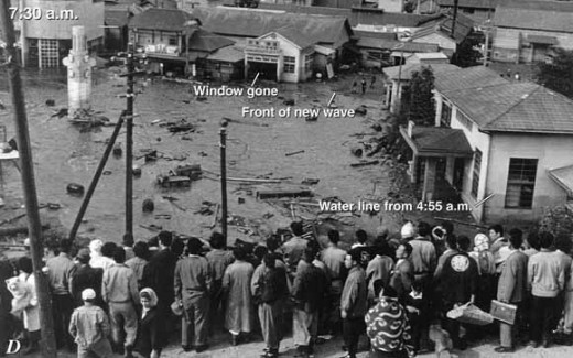
This was yet another megathrust quake, with the Chilean city of Valdivia near the epicenter giving its name to the catastrophe. For once, there was a clear warning: 7.0 foreshocks preceding the main quake had already sent people scrambling out of buildings before the megaquake hit. Amazingly, although two million in Chile were left homeless, the official casualty count is something like 2000, 61 one of those in Hawaii. This was the tsunami that battered downtown Hilo and left Hawaii jittery and careful about the tsunamis which assail it from all directions. The Philippines and much of the Pacific coastline, including Los Angeles and San Diego, had damage and/or casualties.
In Chile, the tsunamis were unbelievably huge -- as much as 25 meters, over 85 feet high. The temblor may have triggered the eruption of Puyehue Volcano, well within the radius of major shaking. Landslides, subsidence and flooding added to Chile's woes, and only a heroic effort by military and workers averted an even more dangerous catastrophe by diverting floodwaters when the Pedro River, running right through Valdivia, was dammed by landslides.
Recommended Links: Chile Earthquake | World's Largest Recorded Earthquake |
Links to Top Ten Earthquake Lists - There Are Different Ways to Measure Megaquakes
- List of Historical (Notable) World Earthquakes - USGS
I sorted this list by magnitude to compile my own Top Ten List. - Earthquakes with 50,000 or More Deaths- USGS
Another USGS earthquakes list sorted by destructiveness to human populations. - Top 10 Earthquakes - TLC
TLC's list of the most destructive earthquakes since 1900. It's subjective: they include M7 quakes like (San Francisco which were infamous, but not as big as megaqakes (Sichuan, Haiti and Christchurch show that it doesn't have to be a 9 to be devasta - World's biggest earthquakes since 1900 - CNN.com
CNN's list of the top ten earthquakes by seismographic records (the same as my list, except I included some pre-1900 quakes for which records have allowed estimates).
Grab 'n Go Kit

Poll: Are You Prepared for Earthquakes? - Fellow Ring of Fire Residents, This Means You!
I had some supplies (flashlights, snacks, a little water, cat food, kitty litter... shows you priorities, eh?) around the house, but it wasn't until the Mexicali Easter Earthquake in 2010 -- one of several 6-7s that I've felt at a distance -- that I finally got around to preparing a good 5-day earthquake prepareness kit for home and car. See the link after this poll for a really good free ebook on "Putting Down Roots in Earthquake Country" put out by California emergency agencies. Also keep in mind that if you live in a tsunami zone, it's best to have a grab-and-go kit.
If you live in an earthquake zone, have you prepared for earthquakes?
© 2011 Ellen Brundige

