Why I Don't Want to Live in Oregon: The Cascadia Subduction Zone
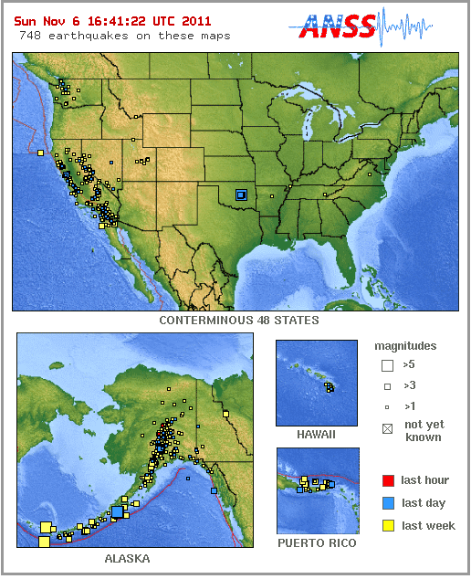
USGS Earthquakes Map
Not Enough Earthquakes?
[Nov 6, 2011] Oregon. Nice state. Lovely people. There's just one little problem. Or rather, a big one. The ground is not moving.
Check the USGS current earthquake map, and you'll probably see something like this: a weekly patter of minor earthquakes along most of the west coast from Alaska down to Mexico, and a cluster in Oklahoma, fracking central. 5s don't worry me. They're not a problem, unless you're a wine bottle on an open shelf.
What worries me is the coast of Oregon. It's silent, eerily silent, like the calm before a storm. It's been like that for years. You may see a few tiny quakes, but nothing like the quake frequency of the fault zones to the north and south.
On the Oregon coast, the earth is holding its breath.
What Do Big Earthquakes Have in Common?
All 7.5+ earthquakes in the past five years, gleaned from the USGS "Significant Earthquakes" lists:
- 2011 Japan quake, M 9.0
- 2010 Chile quake, M 8.8
- 2010 Indonesia quake, M 7.7
- 2009 Samoa quake, M 8.1
- 2009 Santa Cruz Islands, M 7.8 (SE of Indonesia)
- 2009 Indonesia quake, M 7.7
- 2008 Sichuan quake, M 7.9
- 2008 Othosk quake, M 7.7 (coast of Russia)
- 2007 Sumatra quake, M 8.5
- 2007 Peru quake, M 8.0
- 2006 Kuril Islands, M 8.3 (off coast of Russia)
- 2006 Tonga quake, M 8.0
- 2006 Kamchatka quake, M 7.6
- 2006 Java earthquake, M 7.7
What do they have in common? They're along subduction zones.
Megathrust Is Mega-Scary
The earth's surface is composed of tectonic plates, like the panels of a car's exterior. However, unlike your car's panels (I hope), the earth's plates are moving, dragged by currents in the earth's superheated interior.
In California where I live, we've got strike-slip faults. These are two plates sliding past each other in opposite directions (like hands rubbing together). The Pacific Plate is heading slowly north, grinding against the North American plate as it heads for Alaska. Strike-slip faults are nasty: they catch, stick and let go. They can let loose with earthquakes up to the 7-8 magnitude range, enough to stress quake-reinforced buildings to the limit.
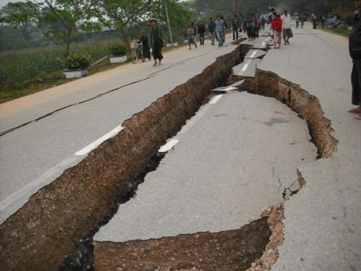
However, they are dwarfed by megathrust earthquakes. These quakes occur along subduction zones where one plate is being driven down under another one. A megathrust happens when the top plate's edge starts to curl down, down, down... then springs back up along a rupture that can be hundreds of miles long. This "springboard" action on the ocean floor causes tsunamis.
Recent examples of megathrust quakes: the 2011 quake in Japan, the 2004 Indonesian quake, and the 2010 Chilean quake which was a weak megathrust quake at 8.8. Megathrust earthquakes are 9.0 and up.
Remember, the earthquake magnitude scale is logarithmic: each number on the scale is 32 times more powerful than the one before. Japan's 9.0 quake was about 1000 times stronger than the 7s which Californians dread as "The Big One."
So? Well, most of the subduction zones around the Pacific Plate have big quakes fairly often (box, right), letting off pressure. All the megathrust subduction zones have let go with a ~9 or thereabouts in the past 50 years. Except one: Cascadia.
The Cascadia Subduction Zone
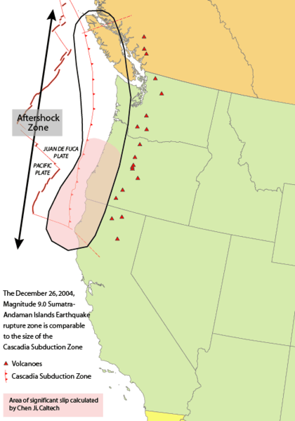
Cascadia Subduction Zone
In the Pacific Northwest, a remnant of an older plate, the Juan De Fuca plate, is being subducted under the North American plate. Historically, this subduction fault zone has let loose with a megathrust quake every few hundred years, creating tsunamis up to 100 feet high. Japanese ports were damaged by tsunamis from the last Cascadia quake in 1700. Extensive evidence shows it was a killer of magnitude 9.
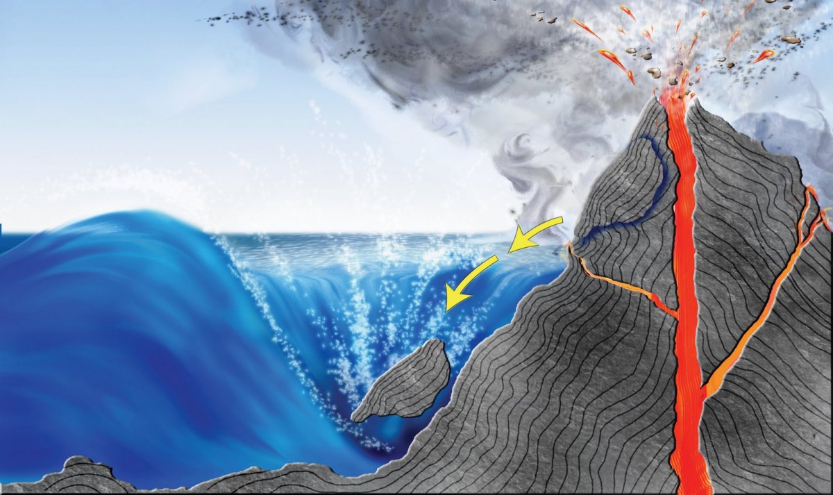
The Cascadia Subduction Zone is also the reason for Mount St. Helens and the other volcanoes in Oregon and Washington State. As a plate gets thrust down into the earth's molten core, it melts, dragging with it ocean-bottom sediments and seawater that boil and release gases. Pressure builds. Molten rock and gases bubble back up to the surface through fractures parallel to the fault zone, eventually erupting as volcanoes.
The section of the Cascadia Fault off the coast of Oregon (right) is stuck. Sooner or later, it's going to let go.
When it does, it will probably unleash a 9 like the Indonesia, Chile and Japan quakes. Oregon, Washington State, and northern California will take the brunt of it.
Video: "The Next Megaquake" (Warning: Scary Reconstruction)
Map: Pacific Northwest
The Really "Big One"
California buildings are designed to withstand magnitude 7-8 earthquakes, and I'm sure Oregon's are too. Still, I'm wary: I think an 8 will prove too much for some buildings and shred the power grid, gas, water and other utilities. Roads will be cut or blocked by debris.
Whata about a 9? Amazingly, Japan and Chile had few buildings collapse outright in their megathrust quakes, but many buildings cracked, and their infrastructure took a beating. I don't think our engineering and building codes are as strict as theirs. Even if our buildings hold up, the best engineering on the planet cannot hold back tsunamis. Quakes shake. Tsunamis bulldoze.
The only good news is that major cities of the Pacific Northwest tend to be inland. Seattle is at some risk on Puget Sound, but it's got a buffer between it and open ocean.
As in Japan, broken roads, runways and tsunami damage from a Cascadia megaquake will be too vast for emergency services to reach everyone quickly. It will take days to penetrate the worst-affected areas. People inland may have to hang on for over a week without help, sheltering in cracked homes with no power, water or gas, and no food coming into nearby stores.
So what can Pacific Northwesterners do? You can survive this, and you can prepare! Get your earthquake kit together and be ready to shelter in place for at least a week, in case infrastructure and emergency services are overwhelmed (think Katrina). Get your homes checked and earthquake-retrofitted. Consider earthquake insurance— I have it. Find out whether quake insurance also covers tsunami flooding, if you have oceanfront property.
When visiting the coast, scout and familiarize yourself with tsunami evacuation routes— here are free tsunami evacuation maps from the Oregon State Department of Geology! Remember that roads may be broken or clogged with cars, so that the only way to travel is on foot. Go as high as you can, as fast as you can. Some of Japan's ports were hit by waves 60 to 100 feet high. Also remember that tsunamis are seldom just one big wave. They often come as a series of waves over an hour or more.
Most importantly, educate yourself and make a plan! Start with Living on Shaky Ground: A Survival Guide to Earthquakes and Tsunamis, a free, printable pamphlet put out by the Oregon Department of Geology. Then check out the earthquake preparedness sites below.
PSA From Oregon's Department of Geology (MUST see!)
Any Nuclear Threat?
As Japan discovered, it's hard to focus the government's resources on earthquake rescue and recovery when you've also got a nuclear meltdown. Nuclear disasters trump all others, because radioactive contamination can make areas uninhabitable for decades. So what nuclear plants might be impacted by a Cascadia megaquake?
The good news: both the Hanford, Washington, and Trojan Nuclean Plant, Oregon have been de-commissioned. Both sites are many miles from urban areas.
The bad news: Oregon's Trojan Nuclear Power Plant (Google Maps) stores 800 spent nuclear fuel rods in a containment pool near the Columbia River (source). It's too far inland for tsunamis, and it's well downriver of Portland, but I wonder if there's any danger of the river breaching the pool in a large quake.
Still, a worst-case scenario of radiation leaking into the Columbia River is not as serious as airborne contamination. (The salmon may not agree.)
Cascadia Earthquake Preparedness
- Notes on ".....everything west of I-5 will be toast": By a Pacific NW Geologist
[Update Aug 2015] FINALLY. Kathyrn Schulz's New Yorker article on a possible Cascadia Megathrust Earthquake has reached mainstream America, and now people are talking about it. Here's one of my favorite geologist bloggers sifting facts from hype. - Welcome to Earthquake Country!
Earthquake preparedness site originally created for Californians, but it's been expanded for everybody. I used their pamphlet "Putting Down Roots in Earthquake Country" for my own EQ kit and prep. - Great Oregon ShakeOut - Get Ready!
The Great ShakeOut, started in California, is an annual large-scale earthquake drill in which you can participate! The site has preparedness booklets, information, and a lot of resources to help you get prepared. - Oregon Department of Geology and Mineral Industries Homepage
State of Oregon's Dept. of Geology, which put together the PSA above. Also look for their Earthquake Preparedness video series on YouTube, starting with the one at the bottom of this page. - Are You Ready? Guide | FEMA's Disaster Guide
FEMA's disaster preparedness booklet for individuals, families and communities is a must-read for anybody, unless you live in the one place in the planet with no earthquakes, bad weather or fires. It covers all kinds of unexpected disasters. - Disaster Planning Toolkit For The Small Business Owner | CREW
Cascadia Region Earthquake Workgroup, a disaster preparedness program for Oregon, has a free handbook for small business owners which may also be useful for homeowners in planning and insuring your home, family and valuables. - "Horizon" The Next Megaquake (TV episode 2005) - IMDb
IMDb listing for "The Next Megaquake" narrated by Jack Fortune, clip of which was shown earlier on this page (with the talking heads).

