- HubPages»
- Travel and Places»
- Visiting Europe»
- United Kingdom»
- England
10 Bays In a Day in Newquay Cornwall
10 Bays in a Day
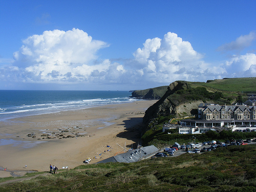
If you love the coast, but don't want to sit on the beach all day, this great walk takes you to 10 different beaches in one day - even if you're quite a slow walker. Following the coastal footpath around Newquay, you'll have the chance to take short cuts across the beaches, if the tide's out, stay on the coastal footpath, or get back onto the road.
This is a great walk too if you need regular refreshment as there are lots of great food and drink places along the route.
We'll be starting north of Newquay, at Watergate Bay, then following the path west until we reach Crantock Beach. Beaches you'll pass are:
- Watergate Bay
- Whipsiderry Beach
- Porth Beach
- Lusty Glaze Beach
- Tolcarne Beach
- Great Western Beach
- Towan Beach (HALF WAY: If you want to break it up over two days)
- Newquay Harbour Beach
- Little Fistral Beach
- Fistral Bay
- Crantock Beach
Each of these is unique and you'll have a lot of enjoyment.
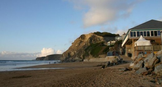
Watergate Bay, Newquay
We'll start the walk at Watergate Bay. If you like to get off to an early start, then head north and you'll find a large car park at Watergate Bay where the road bends at Watergate Bay Hotel. Don't use the beach front car park, but the one just behind the beach and inland by 100 yards.
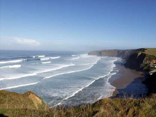
I'll guide you on the road taking the coastal path, but you could simply go down to the beach and walk to Whipsiderry Beach across the sand - IF - and ONLY IF - you know the tide times because a lot of people get cut off between Watergate Bay and Whipsiderry and with 200' cliffs there's nowhere to run to!
From the car park, follow the road back up to the top of the cliffs west of Watergate Bay. Here you'll find a layby/stopping point for cars, where you can admire the view. You'll see the coastal footpath marked, or you can walk on the road. The road doesn't have a footpath or a view though.
It's a 1.6 mile walk from here to the next beach...
Whipsiderry Beach
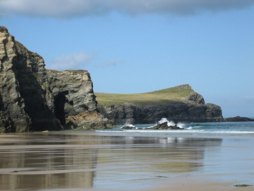
If you've managed to walk along the beach, then you'll have just had a very exciting one mile flat walk. Going by road it's a bit further, with a hill climb at the start - and about 1.6 miles long. I love the feeling you get when doing the beach walk, although it can be nerve-wracking when if you have to clamber over the rocks, wondering if you'll slip or the tide'll come in!
If you're on Whipsiderry Beach, you now have a choice of whether to continue on the beach, round the headland and into Porth Beach, or go up the 100 steep steps to the top and walk over the top. I'd suggest you go up the steps and walk along the top as it can be quite tricky and dangerous leaping over rocks and boulders, which is only possible at low tide, to get through.
There are a couple of small caves to explore on Whipsiderry beach. But now it's onto beach three of our jolly jaunt ...
Porth Beach, Newquay
- Porth Beach, Porth, Newquay, Cornwall
Porth is a good beach for families. There's good access, plenty of soft sand - and shops for that all important ice-cream or bag of chips.... and for a slightly more refined experience you can pop into the Mermaid Inn for lunch, which can be enjoyed
Porth Beach
If you're following the road route between Whipsiderry Beach and Porth Beach (which is recommended), the footpath offers you the chance to walk out to the end of the peninsula. I'd suggest you do this. This area is the site of an old iron-age fort and will only add about 20 minutes to your overall journey.
At the top of Whipsiderry Beach, you'll notice an old detached stone/granite cottage, see it's name - Cave Cottage - you might recall seeing a cave under that spot when you were on the beach...
As you descend down, to Porth Beach, you'll spot a tempting beachside pub, The Mermaid. If it's time for a cool fruitjuice and the pub's open then I'd certainly recommend you pop in. You can sit out on the terrace and admire Porth Beach while you relax for 10 minutes ... but no more, we still have another 7 beaches to do!
At this point, by road, the route has covered just under two miles. As there are a variety of routes you can take (across the beach, coastal footpath, following the road) and with the latter two being quite winding, it can be tricky to pin down exactly how far you'll be covering. There are so many extra nooks and crannies and points of interest to explore along the way.
Our next port of call will be Lusty Glaze Beach. Again, if the tide's out, it is possible to paddle round the headland to get there. If you want to take the coastal footpath, then you need to cross Porth Beach to the point where cars can access the beach for parking - and follow the footpath that goes up the cliff from there. This will take you up past Glendorgal Hotel and a few feet beyond that are the steps to Lusty Glaze Beach.
Lusty Glaze Beach
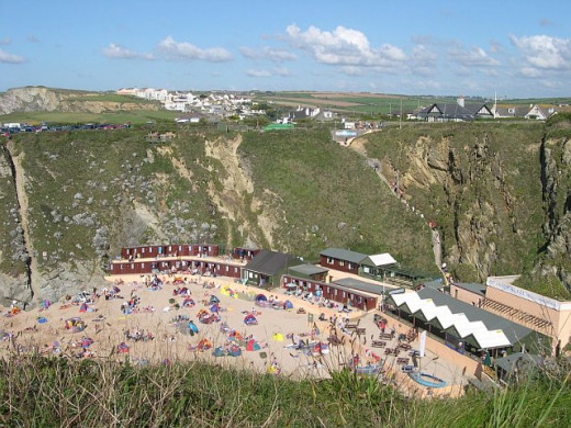
OK, we're onto the 4th beach of the day now. I'll presume you came along the coastal footpath because it's rare that the tide is out sufficient to be able to walk round from Porth. It's possible as I've done it, but I did get my feet wet.
Looking down onto Lusty Glaze you'll see it's an almost perfect amphitheatre. This is a privately owned beach where they hold courses in surf rescue among other things. They also put on events such as night surfing and beach rugby. You're perfectly free to walk down the steps and enjoy the beach though - there's even a cafe down there and a bar which was recently voted as one of the best beach restaurants in Europe.
Again, what you do next is tide dependant. If the tide is out, you might think it's worthwhile walking down the steps, to cross the beach and walk along to the next one, which is Great Western Beach. If the tide's in then (unless you want top quality food immediately) you'll probably decide it's a long way down just to turn round and come up again.
At this point, you've done roughly 2.5 miles.
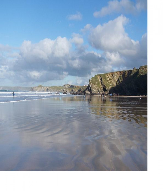
- Beachside Restaurants In Newquay Cornwall UK
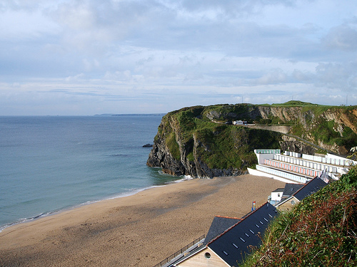
There are two eateries on Tolcarne Beach, Venus Cafe and the Kahuna Restaurant.
Tolcarne Beach
Walking between Lusty Glaze Beach and Tolcarne Beach, on the coastal footpath, you'll pass by a sign which tells the story of how they tried to build a canal in the area to carry goods from Lusty Glaze Beach. In fact, if you look closely at the cliff at Lusty Glaze you can still see some faint marks made from that time. The canal idea never worked. A lot of money was lost.
You're walking across Barrowfields now, which is an area with a few ancient buriel mounds. It's an open and public space, so you're able to walk across them though. By the time you get to Tolcarne Beach you've covered less than 3 miles still. Access to Tolcarne Beach is either via the narrow roadway, or down 130 steps. I think it's 130, I always count every one of them - then promptly forget how many there were! This is another private beach, where you're free to enjoy the beach, or use one of the two restaurants there. The decision of whether to walk down to the beach or not is probably dictated by your thirst/hunger and what the tide is currently doing. From Tolcarne, if the tide is out, you can stay on the beach and walk all the way through to the Harbour Beach.
This private complex on the beach has beachside holiday apartments to rent, a bungalow, some day-time beach huts, or even some special modern beach huts along the sand's edge that you can sleep in overnight, allbeit incredibly cramped and expensive for what you get compared to booking one of the large apartments with balconies.
If you're on the road though, the next beach is Great Western. You've covered about 3 miles so far.
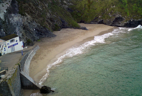
Great Western Beach
If you're on the road at the top of Tolcarne, then to get to Great Western Beach you simply follow the road for about 100 yards and go up the side of the Great Western Hotel and down the narrow dead-end road to the beach. Apart from a tiny shop that sells ice creams and public loos there's not much to see here. There are a couple of caves to explore on the right hand side, but they'll take just 3-4 minutes maximum.
At this point, I'd recommend you continue your walk across the beach if possible. It's much more pleasant and perhaps you can even take off those walking boots and paddle through the shallow water.
If you stay on the beach and head west to reach the next beach, you'll notice on your left an archway - this is the exit point for Hotel Victoria guests who have the use of a lift which takes them down to the beach. The lift, however, plummeted to the ground early in 2010 so right now I don't know if it's operational or not.
There are a few hotels and private houses along the beach which have their own private steps to get down to the beach.
If you've had to take the road route, then from the top of Great Western Beach, simply follow the road along and turn right up the side of Aldi/Travelodge, down the Tramway. This is a pedestrianised walkway that follows the route of the old tramway that took goods to/from Newquay Harbour years ago. Once you emerge from the far end of the tramway, look to your right where you'll see a wide expanse of grass, this is Killacourt. Cross Killacourt and you've a choice of which steps to take down to Towan Beach.
At this point, across the beach, you'll have probably covered about 3.25 miles.
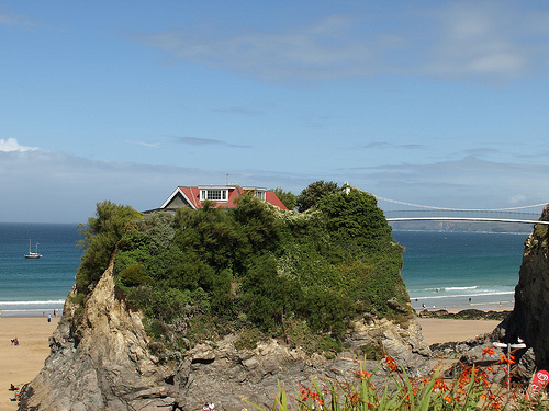
Towan Beach
As you approach Towan Beach across the sand you'll see The Island to your left, with its private suspension bridge - which is the only way to access the house on the Island. If you've come by road, you'll see the Island as you walk down the steps onto the beach. The house on The Island is currently for sale at £1.25 million.
This is Towan Beach, the main beach for the town. There is always plenty of activity on this beach, lots of people playing football, surfing, sunbathing - and the occasional seasonal sandcastle contest.
If you cross the beach to the Harbour, you can go up the Harbour steps. If the tide's out, and you don't mind getting your feet wet, you can walk round into the Harbour while staying on the sand. If the tide is in, then leave the beach via the road, after 20 yards or so, the road turns to the left - go forward about another 50 yards and there are some steps to your right, before the Chy pub. Go up these steps and continue up until you're in the top car park, above the bowling green, where you'll find public lavatories. Turn right along the road for about 75 yards and take the next road to the right down to the Harbour.
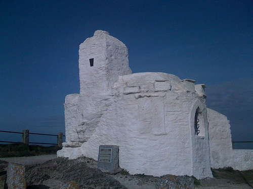
- Discover Newquay - Huer's Hut
For many, this is a fascinating building, perched temptingly on the headland of Newquay Bay, just beneath the Atlantic Hotel. Dating back to the 14th century in part, this Grade II listed building is part...
Harbour Beach
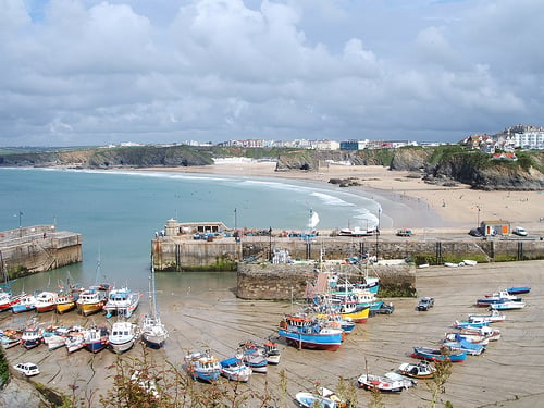
The Harbour Beach is a working harbour, so there'll always be boats anchored and small boats tied on ropes fixed on the beach, which you might have to step over. The sand is fabulously silky soft on this beach.
The RNLI Lifeboat is launched on the Harbour Beach, you'll see the lifeboat station alongside the harbour. There's a seafood restaurant on the beach, called the New Harbour Restaurant.
If you look around, there's quite a few interesting and quirky things to see. Depending on the height of the sand, there's the top of a tunnel which goes under the harbour wall - the one separating Harbour Beach from Towan Beach. When it was built that was a pedestrian walkway between the two beaches, but over time it's become filled with sand. It was, however, exposed in about 2009 briefly.
Over on the left hand side, you'll see some old dates carved into the slate where boats are tied to big rings.
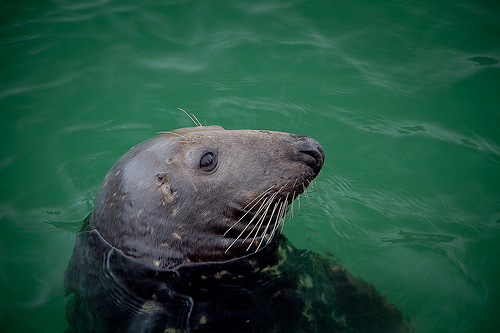
There's often a lot of debris on Harbour Beach, dead crabs and random crab claws - these are from the fishermen who throw the dead crabs overboard when they land their catch 2-3 times a week. When the tide's right, you can often see 1-3 seals that come into the Harbour to be fed by the returning fishermen. Or you might see Newquay Gig Rowing Club taking out their old wooden gig boats for a row around the Bay. The RNLI Lifeboat Day is also hosted here once a year.
The next beach is now some way away and you'll be following the coastal footpath as there's no way to get to it across the sand, although you can take a shortcut via the road.
At this point, you've probably walked 4 miles.
Cross the Harbour and go up the steps on the far side. If the tide's in, you'll have to go back up the road the way you arrived, then along the top road to the mini roundabout and turn right to get to the same point. At the top of these steps, you're at the side of the Harbour Hotel. From here you have two choices:
- Skimp and take the road route: turn left and up 50 yards to the mini roundabout, then turn right and after about 100 yards take the next left to Headland Road.
- Take the full coastal path route: turn right and then take the left fork after about 20 yards, following the signs and the path.
There's not a lot of distance difference between the two routes, the road one is slightly shorter, but the road is an easier walk. Also, if you take the road, you can miss out Little Fistral entirely, saving you over half a mile.
Coast Path
Taking the coastal path will take you past the Huer's Hut, this is an ancient building where fishermen used to watch out for pilchard shoals and then direct the fishing boats to where they were. From the Huer's Hut simply follow the well-beaten coastal route until you get to the road on the far side, just underneath the big red Headland Hotel that you'll have seen for some time.
Road Route
Taking the road route, once you're going along Headland Road towards the Headland Hotel, keep an eye out for a right hand turning and take that, you'll see that the Hotel is then on your left and where you've already walked today is in the distance to the left.
You're heading for the old lifeboat station and Little Fistral Beach.
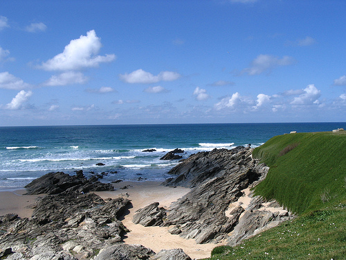
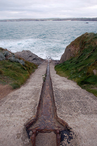
Little Fistral Beach
This is a small beach, which was doesn't get much use.
As you approach the beach, there's the Old Lifeboat Station at the edge of the car park and directly opposite is the original 45o lifeboat launching slope. There are public lavatories on the far side of the car park in the stone building.
There's an interesting, but small, cave on the beach - and what look like the remains of an old quay that must have been destroyed years ago by the waves. At high tide it is possible to walk from here to Fistral Bay, but it can be tricky as you do need to do some rock hopping to achieve it.
Instead, you can take the coastal footpath between the Headland Hotel and the sea. Simply follow this path along and it brings you to the 9th beach on the list: Fistral Bay.
Fistral Bay, Newquay
- Fistral Beach, Newquay
Fistral Beach, Newquay is world-famous for surfing competitions. This long, south-west facing sandy beach is perfect for swimming, surfing, or relaxing. Free music festivals, events and surfing competitions provide entertainment most summer weeks.
Fistral Bay
This is where all the major surfing championships are held. Just under 10 years ago, the new Fistral Surfing Centre was built, complete with modern public conveniences, surfer showers, shops and a cafe/bar. In 2010 a new Lifeguard Station building was added.
The beach is long and west-facing. You can either walk across the beach to the far side, or, from the car park, you can walk through and behind the dunes to get to the far end.
Once you're at the far end of Fistral Bay, there's just one more beach to go. And you have a choice of routes. I'll take you the longest route, of course!
If you walk to the right, to the end of the road, a track continues up and round - follow this track. You end up on the headland. You can walk to the end of the headland if you want. This is Pentire Headland. Along there, there's a bar if you're thirsty, but if you get to the end of the track and walk straight ahead on the tarmac road, you'll find there's another track down the other side. Follow that track down until you reach the bottom road. Now, a few houses along on the right hand side, you'll see a bungalow with a sign on: Fern Pit Cafe. This is the route you want.
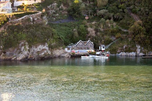
Fern Pit Cafe
This is a simple cafe that's been running for years, tucked away in a residential street. But, in its garden is a set of steps that take you all the way down to the bottom, to the estuary. This is the route you want, don't feel awkward at walking straight up their driveway, through their garden and down the steps. It IS the right route.
The steps number about 100 or so... again, I did count, but I can never remember by the next day! As you descend, you get glimpses through the trees of the Gannel Estuary, sand dunes and Crantock Beach.
Once you get to the bottom of the steps, what you see will depend on the tides. When the tide is out, you can simply walk across the water. There's a small bridge. When the tide is in a small boat operates between the steps and Crantock Beach.
You can now decide whether to cross over to Crantock Beach, or to call it a day and walk back the way you came, or through the town... or just to he Bus Station to catch a bus back to where you parked the car!
I hope you've enjoyed your walk. Overall, you've probably covered about 8-10 miles.
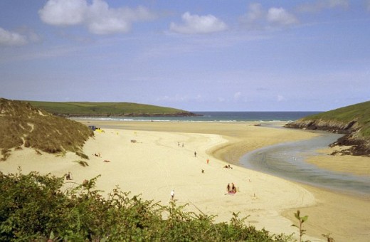
Crantock Beach
This is a long, sandy beach, with the Gannel Estuary running down one side of it. When the tide starts coming in the estuary really fills up with water quite quickly, so you do need to be aware of which side of the estuary you're on, which side you'd prefer to be on when the tide comes in - and whether you think you'll get cut off or not. If you're cut off, you'll probably have to sit it out for 4-6 hours on the rocks until the tide goes out again, so try not to get it wrong!
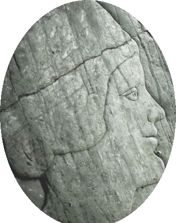
There are sand dunes around the beach - and, allegedly, there's a buried village under the sand dunes. On the far side of Crantock Beach there are some caves, inside one is a carving and poem about a woman on a horse who, it is thought, got cut off by the sea and drowned.
In Crantock village, just behind the sand dunes, there are two holy wells to explore, as well as The Old Albion Pub, described as "probably the most photographed pub in Cornwall".
- Crantock Holy Wells
Discover the two holy wells of Crantock - Choosing A Holiday Park in Newquay Cornwall
Looking to choose a holiday in Newquay, Cornwall this year?. One option is to stay on a Newquay Holiday Park. The advantage of these is they are quite a cheap form of self-catering and the campsite will...
Coastal Walk in Newquay
Photos By:
Watergate Bay: - MattLake | Watergate Bay: - J Blackmore
Whipsiderry Beach: - Geoff Welding | Whipsiderry Beach: - Eryka Hurst
Barrowfields: - Pengannel | Barrowfields: - Pablo BM
Tolcarne Beach: - Pengannel | Great Western Beach: http://www.flickr.com/photos/lionheartphotography/3762242899/ - LionHartPhotography
The Island: - AlexHealing | Harbour Seal: - Pengannel | Huers Hut: - Cowley_Mail
Little Fistral: - Pengannel | Old Lifeboat Launchslip: - Jim68000
Fern Pit Cafe Ferry: - Bob Jones | Crantock Beach: - Tony Atkin
