GPS +Fish Finder

Fishing With A GPS!

GPS Fish Finder
Have you heard of a gps fish finder a diferent way to go fishing these days ?
Fishermen use marine GPS to locate themselves and track the movement of shoals of fish both in real time, and also to predict where they will be the next day. Having GPS fixing means that co-operative fishing has become much easier, where there are several boats all relaying their locations to each other while they locate the best fishing waters.
Special kinds of marine GPS, known as fishfinders, also combine several functions in one to help fishermen. A fishfinder comprises GPS and also sonar, along with advanced tracking functions and storage for various kinds of fishing and maritime information.
What Is A GPS ?
You might be asking yourself " What on earth is a GPS "?
Wikipedia, the free encyclopedia explains a GPS as a Global Positioning System (GPS) is a space-based global navigation satellte system (GNSS) that provides reliable location and time information in all weather and at all times and anywhere on or near the Earth when and where there is an unobstructed line of sight to four or more GPS satellites.
Uses For A GPS
The GPS system was developed to meet military needs and the system has been used in aircraft and ships, but there are many other ways to benefit from GPS.
GPS is helping to save lives and property everywhere as ambulances , police cars and fire trucks make the most of GPS to get to the emergency the fastest way possible in life-or-death situations. GPS-equipped aircraft can quickly plot the perimeter of a forest fire so fire supervisors can produce updated maps in the field and send firefighters safely to key hot spots.
Mapping, construction, and surveying companies use GPS extensively. During construction of the tunnel under the English Channel, British and French crews started digging from opposite ends: one from Dover, England, and one from Calais, France. They relied on GPS receivers outside the tunnel to check their positions along the way and to make sure they met exactly in the middle. Otherwise, the tunnel might have been crooked. GPS allows mine operators to navigate mining equipment safely, even when visibility is obscured.
. GPS-equipped fleet vehicles, public transportation systems, delivery trucks, and courier services use receivers to monitor their locations at all times for both efficiency and driver safety.Automobile manufacturers are offering moving-map displays guided by GPS receivers as an option on new vehicles. The displays can be removed and taken into a home to plan a trip. Several major rental car companies have GPS-equipped vehicles that give directions to drivers on display screens and through synthesized voice instructions.
GPS-equipped balloons monitor holes in the ozone layer over the polar regions as well as air quality across the nation. Buoys tracking major oil spills transmit data using GPS to guide cleanup operations. Archaeologists, biologists, and explorers are using the system to locate ancient ruins, migrating animal herds, and endangered species such as manatees, snow leopards, and giant pandas

Map Book --- Tom Tom
Do you still use a map book to find your way around like we used to for a long time ?
Years ago we always used to a map book to get ourselves from one end of New Zealand to the other & we always found our way .Even around the cities amazingly enough!
While we were living in Wales we planned a big trip from Chepstow inWales down to Dover in the south of England to take a ferry across to Europe where we enjoyed driving through Belgium , Austria , Germany Italy & back through France we used a map book to find our way.And that was in countries we couldn't understand the signs along the way , still I am pleased to say we didn't have a problem !
However we decided to buy a GPS recently as it was getting harder to read the maps as we drove with both of us needing glasses to see the maps - They seem to be getting smaller so we gave in to modern technology
GPS devices have become an essential travel companion for vehicles like cars, motorcycles and even marine vessels and aircraft. Thanks to its convenient, accurate and easy to use navigation technology, you can now quickly plan the shortest and safest route to your target location.
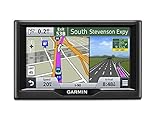
After looking at a few brands of GPS it got a bit confusing as there are dozens of GPS brands and models that are available in the market today. However, Garmin, Magellan and TomTom are considered the three major market players for travel GPS systems.
We chose a Tom Tom & most of the time he sends us in the right direction !
They clearly show which lane to take at junctions so you don’t miss your turning. On the most difficult highway intersections, realistic 3D representation of the junction keeps you relaxed and safe.
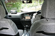
GPS are good in Taxi's
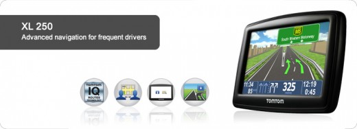
GO 1050 World
This is the one I would like as Your TomTom GO comes with the latest and most complete maps of Australia, New Zealand, Europe, US and Canada which would be great for when we go overseas.
It has an Intuitive design with a fluid touch screen which you pinch to zoom in and out of maps, or scroll through menus with the tip of your finger – the screen responds intelligently and sensitively to your touch.
It can be personalised by choosing icons for your most frequent destinations and add your own text. This makes your navigation experience truly your own with even easier and quicker navigation to the places you go most often.
This one has the latest in speech recognition technology lets you control your TomTom GO using voice commands. From planning a route to making a call, over 100 tasks are easily activated by voice, making your drive smoother and safe.
GPS for bike riders

Bike Navigation !
I hadn't thought about using GPS on my bike !
Only TomTom uses actual speed data collected from millions of users to calculate the fastest routes at any point in time. Imagine a route that takes into account rush hour, traffic lights, zebra crossings, school exits or even shopping crowds, every minute of every day. That's how smart IQ Routes is!


