- HubPages»
- Travel and Places»
- Visiting North America»
- United States
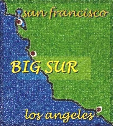
Big Sur: Driving the California Coast

Exploring Big Sur

California's Dramatic Central Coast
Between Carmel and Cambria, a narrow road winds past some of the state's most dramatic scenery. Mile after mile, towering coastal mountains drop away to meet the crashing waves of the Pacific Ocean.
Waterfalls and secluded coves lie around nearly every hairpin turn along the area's one highway.
Inland, stands of coastal redwoods tower and impress, while elephant seals congregate on the beaches to the south of Big Sur.
When to Visit Big Sur
The best time visit is in the late winter or early spring when the mountains turn a dazzling green and waterfalls come to life.
Visitors in other seasons will see a starker landscape with mostly dry, straw-colored hillsides.
- In the winter, come prepared for rain. In the summer, be aware of wildfires. Expect morning and evening fog throughout the year.
California's Central Coast in Winter

The Route to Big Sur
Big Sur lies along a relatively hard-to-reach stretch of California's central coast. Exploring the scenic Pacific Coast Highway between Carmel and Cambria is half the pleasure of naming Big Sur as a destination.
From San Francisco
- Take 101 south past San Juan Bautista, then take 156 toward Castroville, where the road meets Highway 1. Stay on 1 heading south past Monterey.
- Distance: 150 miles, one way
From Los Angeles
- Take 101 north to San Luis Obispo, then take Highway 1 toward Morro Bay. Stay on 1 heading north.
- Distance: 300 miles, one way
Scenic Big Sur

California's Highway 1
Winding and narrow, with vertigo-inducing lookouts, Highway 1 through Big Sur is not the easiest drive. But the views along that narrow ribbon of road are spectacular.
More about Highway 1
See "California's Pacific Coast Highway" by Rickie Longfellow. It's one of a series of road stories found at the U.S. Department of Transportation Federal Highway Administration's Highway History page.

Big Sur's Bridges
High, arched bridges such as this one have carried traffic along the jagged Pacific coastline since the 1930s.
They've become an important part of the scenery. The bridges are photographed as often as the gorges they span.
Soaring Big Sur bridges include Rocky Creek Bridge and Bixby Creek Bridge.
McWay Falls, an unusual cliff-to-beach cascade, is one of the highlights of Julia Pfeiffer Burns State Park.
There's no trail down to the beach, but that emptiness makes this scene all the more stunning to see.
Waves at McWay Falls
Other Big Sur Waterfalls
McWay Falls is not the only waterfall worth seeing near Big Sur.
- Salmon Creek Falls: Round a bend in the highway and two shoots of water join in an impressive "V."
- Limekiln Falls: Wildfire damage has left Limekiln State Park closed for now, but when open, the falls and trails in the park are beautiful.
Limekiln State Park

Stop in San Simeon and see the seals
The mountains fade as you pass San Simeon, but the real scenery is on the ocean side: elephant seals.
According to the Cambria-based group Friends of the Elephant Seal, about 15,000 seals call the coast here home. Stop and have a look over the beaches of Pierdas Blancas, just north of Cambria.
Elephants Seals

Music for a Big Sur road trip
- 100 Songs About California
The ultimate California playlist. - 10 Songs About Southern California
These 10 songs about places in Southern California journey across the region from San Diego to San Simeon. - California Calling: 10 Songs About Moving to California
Thinking of leaving home for California? These 10 songs will get you packed up and moving to the Golden State. California's calling. (Specifically, the California coast is calling.) - 10 Songs About Northern California
Few cities in Northern California get sung about the way Los Angeles does. Here's celebrating 10 Northern cities that have made their way into song. Includes Big Sur! - 10 Songs For A California Road Trip
In California, life takes gasoline. Find proof in these 10 songs celebrating California's car culture. - 10 California Beach Songs
California beach songs are as bright and mellow as sunshine itself, and these 10 songs are great for a California beach party. - 15 Classic Songs About California
15 Classic Songs About California: A list of the best California songs from the 1960s and 1970s.
More about Big Sur
How Include Big Sur in a California Road Trip
- "Driving California's coast in 10 days," By Christopher Reynolds, Los Angeles Times, January 28, 2009.
Hiking near Big Sur
- Hikinginbigsur.com, trail maps, photos and current conditions.
Camping near Big Sur
- Andrew Molera State Park
- Pfeiffer Big Sur State Park
- Julia Pfeiffer Burns State Park
- Limekiln State Park, currently closed (Summer 2009)
Hearst San Simeon State Park, includes Washburn and San Simeon Creek campgrounds
Gas Stations along Highway 1
- Big Sur, near Andrew Molera State Park
- Gorda
Other Ways To Explore California
- California Trips: An Ideabook
All trips to California require some tough choices: what to see, and what to skip. The state is simply too expansive and varied to take in everything all at once. - Death Valley Flowers: Spring Wildflowers in a Desolate Land
Death Valley National Park is a striking place, a place with extremes in topography and temperature. And some years, if the conditions are just right, the park erupts with a wild show of wildflowers.


