An Appalachian Trail Thru-Hike: Part 33 - The 100-mile Wilderness and Katahdin
We should have suspected at that point that there might be some issues with the trail maintenance coming up, but at the time we were blissfully ignorant.
Monson
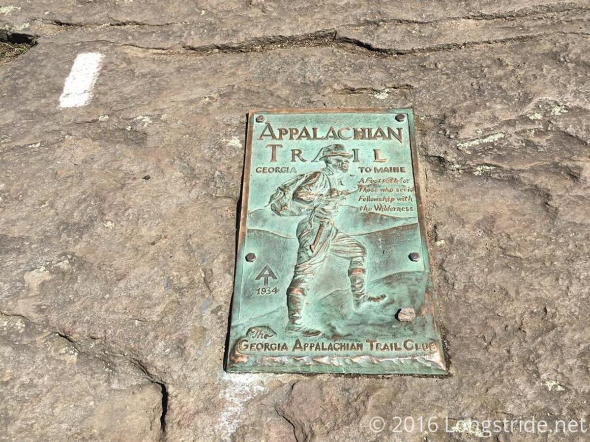
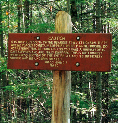
For 4 1/2 months my friend Dave and I had been hiking the Appalachian Trail. We had started on March 16th at Amicalola Falls State Park in the state of Georgia. We stayed that night at the top of Springer Mountain, the southern terminus of the Appalachian Trail. From there we had been following an unbroken series of vertical white rectangles painted on rocks and trees along a pathway that stretched for more than 2000 miles. When we woke up and started hiking on the morning of August 5th we had a little more than 100 miles to go until we reached the northern terminus of the Appalachian Trail at the top of Mount Katahdin in Baxter State Park, Maine. There was easy hiking that day. The weather was misty. We climbed Pleasant Pond Mountain and hiked along Moxie Pond, then stayed the night at Joe's Hole lean-to. The day after that was sunny and warm. We hiked 15 miles over Moxie Bald where we enjoyed a nice view on our way to reaching the town of Monson, the last chance to buy supplies for over 100 miles. We had some trouble following the trail at times that day, because it was badly marked in places. This was unusual for the AT. The marking of the trail had almost always been thorough and clear. We should have suspected at that point that there might be some issues with the trail maintenance coming up, but at the time we were blissfully ignorant.
In Monson Dave and I signed the last of our travelers checks. We bought nine days of food and loaded our packs up as full as they had ever been. Of course, they were as heavy as they had ever been as well. Our days of finding accommodations in trail towns were over – we simply didn't have the money. Before we left town that evening, we treated ourselves to some pizza at a wonderful pizza place called "The Celler Restaurant". That evening we camped just outside town. Of the $1,200.00 I had started the trip with, I had less than $10 left. Dave was in the same boat. The packs were heavy on our shoulders as we walked away from the town and I had an uneasy feeling because I could feel another cold coming on – just the way I had felt less than a month ago when I started feeling a little sick a day or two before reaching Manchester, Vermont. Then I had ended up getting very sick and I had to call my parents from a motel in Manchester. The result was that I went home for 11 days to recover. I wasn't going to be doing that this time. Beyond Monson there were no motels, no towns, no paved roads, no phones.... just a lot of trees, lakes, mud, mountains, and a few moose wandering around in the woods. I kept my symptoms from Dave, but in my journal I wrote: "I think I'm getting a cold, but I'm pretty sure I can get rid of it." They were hopeful words, but there was no way I could be sure that things would work out that way. Nevertheless, I don't remember even considering turning back or calling home at that point. Even after the illness in Manchester, I had the youthful belief that everything would work out in my favor – not due to any special plan that I had, but because I literally couldn't think about the situation in any other way but as having a positive outcome.
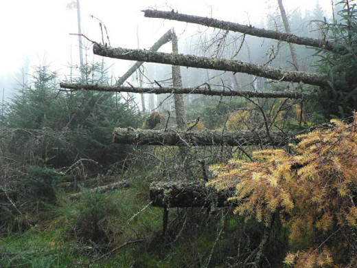
Blow downs turned the trail into an obstacle course where we had to climb over the trunks of trees, usually spruce bristling with sharp needles....
“Not Feeling Too Good”
The cold was still with me the next day. It was easy hiking and good weather, but I was going slowly because I was so tired. By the afternoon I could tell Dave suspected something but I just blamed my lethargy on the heavy pack. I could tell he didn't buy it. Even with my slowness we made it 15 miles that day to Long Pond Stream lean-to. We stayed there with a guy who was hiking south from Katahdin.
The next day, I was even worse. The trail was harder and it hadn't been maintained in a while. We encountered several blow downs and lots of mud. The trail led us over a number of mountains – Barren Ledges, Barren Mountain, and Fourth Mountain. Blow downs turned the trail into an obstacle course where we had to climb over the trunks of trees, usually spruce bristling with sharp needles or fir with softer but thicker needles coated in places with sticky sap and clustered on springy branches that whipped us in our faces as we tried to force our way over. The blown down trees were often chest high and the spruce and fir trees were so thick with branches radiating out from the trunk that they formed an impenetrable barrier of branches driven into the ground below, keeping us from crawling under. The forest was often so thick on either side and the blown down trees were so long, that going around was not an option either.
With all the blow downs and the mountains, I was exhausted. Time after time I fell way behind Dave and after plodding along alone for what seemed like hours, I would come across him leaning against the tree, waiting for me with arms folded. Throughout the trip and other situations where one or the other of us was way behind, there would be a wisecrack when the other finally caught up, but now there was silence. Dave just gave me dagger-like stares when I finally reached him. At some point he asked me what was the matter. I finally had to admit to him that "I didn't feel too good." All he could do was shake his head. His frustration was bubbling over. He knew that if I got sick like I had been back in Manchester, that it would be on him to somehow get me out of there, and it looked like history was repeating itself.
At some point during that long day, Dave decided to try a different trail. He saw on his map a trail that led downhill to a place called Chairback Mountain Camps. From there he saw another path, a jeep trail or a logging road, that intercepted back with the AT. I'm not sure why he wanted to go that way – I was too exhausted to pay any attention. He just said we were taking the side trail and I followed. If Dave was hoping that the side trail would be in better condition than what we had been traveling on, he was sorely disappointed because it turned out to be even worse. Not only did the blow downs continue, but the trail itself was badly overgrown with spruce and fir branches poking into the trail's corridor of space so that we were often whipped and scratched on the arms, even between blow downs. There was also more mud and a lot of slash from logging activity on either side of the trail, making blow downs more frequent and making it even more difficult to go around all the downed trees that blocked our path.
Dave was in a terrible mood, but I was just dimly aware of it. My head was down, and I was staring at my feet flopping down one after the other on the brown trail. All my concentration was focused on putting one foot in front of the other. My senses were dulled so that the outer world seemed distant. I was achy, a little feverish, and there was a strange buzzing feeling in my head. Finally in the early evening we came to a shallow rushing stream.
"We’re going to camp here," Dave announced.
We shrugged out of our packs and got the tent set up on a little gravelly bank about 25 feet away from the stream. We had hiked all day with no long breaks and we had only covered about 12 miles. We had some dinner and then I crawled straight into my sleeping bag and fell asleep with the rushing of the stream in my ears.
It was a feeling that I had experienced a few other times on the trip – the feeling that I had dodged a bullet.
Recovery
When I awoke the next morning the rushing of the stream was still in my ears, but it was accompanied by pattering of rain on the tent’s roof. I still felt sick, and I did not want to hike in the rain. When we poked our heads out of the tent we could see that the clouds were thick and the rain was steady. It looked like it was going to last for a while. After a few moments of cursing my luck, I decided to use the situation as an opportunity to get some extra rest.
"Let's not hike today," I said.
Dave did not reply at first. My suggestion meant that we would have to eat a day’s worth of food without covering any miles. We had purchased nine days of food to cover 100 miles, which should have been plenty, but we knew from experience that what we estimated to last nine days in the grocery store didn't always last nine days in the woods, especially when we were passing through territory where there were no general stores to stop at for snacks. We were already off to a slow start with two days in a row of what we considered to be subpar mileage. Still, I didn't think we were in trouble with our food supply yet, and I knew that even though he wasn't sick, Dave didn't like hiking in the rain any more than me.
As it turned out, Dave's concern with staying had more to do with our tent site. He spent a fair amount of time trying to assess whether or not we should move the tent. So far the floor of our tent was dry, but we were camped close to the stream. Only about two weeks earlier we had been camped in the tent just north of Mahoosuc Notch with a similar rainfall. We had camped in a place that had looked flat to us but which turned out to be a slight depression. Water had collected under the tent and it soaked through the floor, getting our sleeping bags wet.
Dave still wasn't saying a whole lot. I don't know if he ever verbally agreed to not hike that day, but he never made a move to pack anything up. It was as if we silently agreed to wait and see what would happen as the day progressed. After we ate some breakfast, I got back into the sleeping bag with "Sitka", the Louis l'Amour paperback I was carrying. I spent the day alternately reading chapters from the book and napping, while Dave studied the trail guide and maps and checked the level of the stream and whether any water was pooling around the tent. At some point during the morning I remembered that I had brought the last few pills of the medicine the doctor had prescribed while I was home in July. I dug them out of the bottom of my pack. There were a few pink pills – some sort of antibiotic, and a few green pills – the Imodium for diarrhea. Luckily, I had not been revisited with the diarrhea that had been so devastating to me in Manchester, so I put the Imodium aside. I did finish the antibiotics though, over the course of the day.
The rain lasted the entire day. Luckily the site we chose actually turned out to be a great spot. We were far enough away from the stream so that it’s rise did not flood our site, and the bank we chose was composed of gravel and sand that sloped away from the tent in all directions. It all made for good drainage so the tent stayed dry. It was also convenient to have a water source about five steps from the door of the tent.
The relaxing day was followed by a second good night’s sleep in a row, and when I woke up the next morning I could tell that I was improved. When Dave asked if I was better, I was cautiously optimistic. I could still remember in Vermont feeling better for most of a day after a good dinner, a good night’s sleep, and some aspirin, only to have it all come back even worse by the end of the day. Shortly after that, the diarrhea had begun. Due to that previous experience, I wasn't ready to pronounce myself cured, but I did report that I felt better and ready to hike.
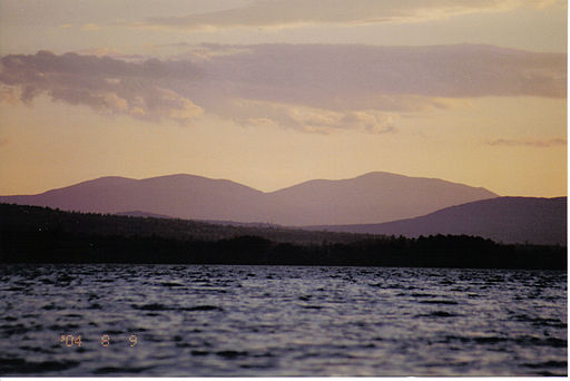
As the day progressed, I kept up a normal hiking pace and a normal energy level. We went over at least three mountains – Gulf Hagas Mountain, West Peak, and Hay Mountain. Although the day began cloudy and the woods were wet from the rain, the sun eventually came out and dried the trail. The air was humid and the views from the mountains were hazy. By the end of the day I was still feeling good. We reached Mountain View Pond and camped there. With no sign of any returning illness, I was in good spirits and to top off my good mood, I saw the first moose I had ever seen in the wild. The moose was out in the middle of the pond feeding on water plants. It was in the evening and the moose was a good distance away. At first when we spotted it, we thought it might be a jumble of rocks or a snag of logs that was sticking up out of the water. Then we saw it moving and we knew it had to be a moose. When I went to sleep that night I was relieved to know that with the help of the extra day of rest and the last of my antibiotics, I had shrugged off the sickness that had threatened to derail me once again. It was a feeling that I had experienced a few other times on the trip – the feeling that I had dodged a bullet. If I had gotten real sick in the middle of the 100-mile wilderness, it would have been very difficult to make it out on my own. Instead, I was feeling great and had seen a moose for the first time in my life.
A View of Katahdin
The next day we climbed Little Boardman Mountain and enjoyed level terrain for the afternoon. We took advantage of the easy hiking and covered 20 miles, ending up camping along Sandy Stream. Along the way we had come across a place called the Old Antlers Camp. Someone had left some food there with a note that said it was for any hikers that came along and wanted it. Dave and I looked through it and took a few items, but history does not record exactly what we scavenged. As always, the opportunity to get a little edge on calories beyond what we carried on our backs was welcome.
Even though we were in the midst of the 100-mile wilderness with no access to towns, or permanent human habitation, there was still evidence of human usage outside of the trail and lean-tos. We encountered no paved roads, but we often came across dirt logging roads. Sometimes the trail followed the logging roads for a while. On either side of the roads alder shrubs often grew in thick profusion. Sometimes those same type of alder shrubs grew in clumps next to streams that we came across. The alder grew 6 to 8 feet tall with many stems protruding from the ground so that the shrubs formed natural hedges along roads and streams where they liked to grow. In a way it reminded me of the thickets of rhododendron that we had hiked through way back in Georgia.
On the next day, August 12th, we climbed Nesuntabunt Mountain and got our first good view of Katahdin. For so long we had been hiking northward with that mountain in the backs of our minds and suddenly it was there before us. It was my first time seeing Katahdin, but Dave was already familiar with it. During the year before we had started our trip, Dave had visited Baxter State Park with some friends and he had climbed the mountain. When we came within sight of Katahdin, Dave began recounting all he could remember of his previous trip and what the great mountain had been like. It was all information he had already shared with me but now that I was so close, and could actually see what he was talking about, his descriptions were more meaningful. One thing he had told me over and over was that Katahdin stood out all alone. It was like it rose up from flat land all around, the only mountain in sight. Now I could see what he meant. Surrounded by low tree covered slopes, Mount Katahdin was literally head and shoulders above anything else nearby. The mountain was above tree line and it was composed of a central pointed peak balanced on both sides by two plateaus that looked like a pair of shoulders on either side of the peak. Trees formed a dark green skirt around the lower portions of the mountain, but the central peak and shoulders looked to be bare rock. There was no other mountain like it in the area. It was a 5,200’ giant chunk of rock rising up in the midst of an undulating landscape of 1,000’ to 2,000’ foothills. I had never seen anything like it. Any big mountain I had ever seen was clustered with other mountains of similar size.
When I stopped next to them, the big logger looked at me and growled, "You screwed up!"
A “Screw-up”
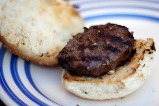
We came down off Nesuntabunt Mountain and hiked to Rainbow Spring for the night. On our way we met up with some interesting people. The first was a burly, bearded logger that Dave met before me. When I came along he gave me a gruff greeting. I walked up to where Dave was standing next to this very large man at a campsite near the edge of a lake. The logger had driven his pickup to the lake through the maze of logging roads that laced the woods and that area. He had a propane grille set up near the truck and a cooler setting on the ground. Dave was having a beer with the guy. When I stopped next to them, the big logger looked at me and growled, "You screwed up!"
"Huh?" I asked.
"You screwed up!" he repeated.
I had been in a great mood. It was a nice evening and the image of Mount Katahdin was still dancing before my eyes. To be so close to our longtime goal was exhilarating. But suddenly there was this mean looking guy telling me that something had gone wrong and the fault was mine.
"Uh ... What do you mean?" I asked.
He shook his head and said it again, this time slower, "You really screwed up!"
Now I glanced over to Dave who was trying to contain a smile. "You came along too late, Dave," he said.
"Yep," said the logger, "I grilled up a hamburger for your partner, but the grill is shut down now. You're too late."
"Ohhh....," I was actually relieved that it wasn't something more significant, like – ‘You forgot this really important thing back in Georgia and now you have to go back and get it!’
"Oh well, that's okay," I said, even though I was already starting to think that a hamburger would've tasted pretty good.
"Yeah, it was a really good hamburger," Dave said.
"Oh well," I said again.
"Aw, I’m just jokin’," the logger said, still in a gruff voice. It didn't seem like he knew any other way to talk.
"I’ll grill another one up for ya."
At that he bent down and got a hamburger patty out of his cooler. He also offered me a beer which I declined. That earned me a suspicious glare from the logger, but he cooked me the burger anyway. While he cooked and I ate, the logger told us about the logging business in Maine and the fishing in the lake. In the end he found a soda to give me and by the time I was done I had to admit that regardless of my first impression, he was actually a pretty nice guy.
We said our thanks and moved on then, only to come across a couple young women just a little ways further. They were also camped near the lake and they quickly recognized us as thru-hikers. They told us they had been thru-hikers the year before, and they had gone by the trail name "The California Girls". They had needed to stop the previous year at Rangeley, Maine, so this year they were back to finish up. They seemed to be excited to be within view of Mount Katahdin, just like we were.
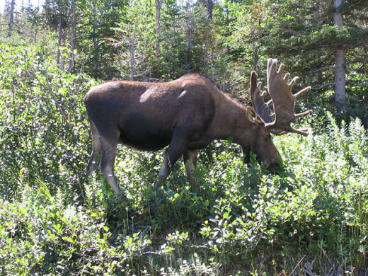
His head was crowned by a magnificent rack of antlers that looked to be about the size of a snowplow.
Two Moose
When we finally made our own camp for the night at Rainbows Spring, we had hiked 19 miles for the day and Dave informed me that we were about 12 miles from Abol Bridge. At Abol Bridge there was a store – the first one since Monson. Dave knew all about the bridge and the store since he had been there on his previous trip to Baxter State Park. He described the bridge, the road over the bridge, and the store to a tee, just like he had described Mount Katahdin earlier in the day at the top of the Nesuntabunt Mountain. Reaching a store had always been a happy occasion for us, but we were especially looking forward to this one. It would be the first general store since Monson, and the last one we would hit on the entire trip.
Abol Bridge was a small bridge where a gravel road crossed over the West branch of the Penobscot River. Next to the bridge was the store. We hiked the 12 miles between Rainbow Spring and Abol Bridge very quickly. The little bit of money that we had left was burning holes in our pockets and when we walked out of the store we had 42 cents left between the two of us. It would have been hard to cut our budget for the trip much closer.
We didn't hike very far past the bridge that day, but as we were hiking along a section of trail bordered on both sides by a natural hedge of thick alder bushes, we suddenly heard some snorting noises and some crashing sounds. We turned and looked over the top of the alder to see a big bull moose trotting on the other side. All we could see was his head, neck, and antlers in profile. He was very alert. He seemed to be sniffing the air, but he wasn't looking our way. His attention was focused on the distance in front of him. He was about 50 feet away. The size of the moose was startling to me. His head had to be 7 to 8 feet off the ground. I was glad the thick hedge of alder was growing between us and him. At first his antlers look strange. I thought there was something wrong with him, but then I saw that there was velvet hanging in shreds from his antlers. Apparently he'd been rubbing his antlers on some trees which is something they do as they get ready for mating season.
Not long after we saw the moose, we found a flat area among a stand of tall trees spaced wide apart. We set up the tent and made a dry camp. We decided we would check the weather the next day to see whether or not we should climb Katahdin. Dave's parents were scheduled to meet us in two days. We knew that we could either hike up Katahdin the next day or, if the weather looked bad, we could wait until the day after and climb it then.
The next morning we awoke and checked out the sky. It was not raining but it was overcast. We decided to wait a while to see weather conditions would improve or get worse. We laid in our sleeping bags relaxing, every once in a while we would look out of the tent again to check the weather. Nothing changed – we felt like it could go either way. Finally we got tired of lying in the tent, so we decide to pack up and move on down the trail little further, just in case the sky started clearing. We were just starting to pack up when we heard some thumping and snapping outside the tent. We poked our heads out to see an enormous bull moose ambling straight toward us. His head was down slowly swinging back and forth as he browsed for things to eat on the forest floor. Unlike the one we had seen the day before, he did not seem agitated. At first I was fascinated. His head was crowned by a magnificent rack of antlers that looked to be about the size of a snow plow. Little by little I started getting nervous. The moose was getting very close. It seemed like he didn't know we were there, but if he kept coming he would have to discover us eventually. Dave and I were both stock still and silent with our heads poked out of the front door flap of the tent. The only way to get away was for us to crawl out of the tent toward the moose who was coming toward us. I had heard that an angry moose was more dangerous than a bear. They could attack with antlers and hooves and do some serious damage with both. The moose got to within 30 feet of us when he suddenly stopped. He raised his head and seemed to sniff the breeze. Then he turned 90° and ambled away with his head back down to the ground. It was one of the strangest wildlife encounters I ever had.
We were aware of the moose, but it apparently did not know we were there. He might have figured out something was ahead of him at the end, but he certainly was not alarmed. Therefore the normal reaction I expected from a wild animal – flight or fight – did not take place. Instead, the moose just slowly went on his way. It was almost like watching my dog walk past me going from the living room on his way to the kitchen.
Read Henry David Thoreau's account of his adventures in the Maine Woods, including his ascent of Mt. Katahdin
Waiting for Weather
After the moose disappeared into the woods, we broke camp and packed up. Soon we were back on the trail. At some point we were able to ask someone that we saw on the trail about the weather. We were told that the weather was going to improve by the next day, so we decided we would only go a little ways farther, then set up another impromptu camp – this time closer to a water source. After about 5 miles of hiking, we found it – a small spring near the trail. Once again we set up the tent. We were staying away from the official campgrounds – Daicey Pond, and Katahdin Stream, because we were afraid we would have to pay to stay at those campgrounds since they were part of Baxter State Park. Since we were out of money, we didn't want to show up at one of the campgrounds and be told by a park ranger that we had to stay in a campground, and that we needed to pay a fee to stay in a campground. We wanted to show up at the campgrounds only on the morning that we intended to hike up the mountain.
The morning of August 15th dawned about the same as the previous morning, with an overcast sky. I was feeling antsy. Holding back from hiking the mountain the previous day had been hard. There were no options today. Dave's parents were going to meet us in the afternoon, so we had to get to the top. I was hoping that the day would be bright and clear, so I was a little disappointed that the weather had not improved from the day before. At least the weather hadn't deteriorated. Within a mile Dave and I made it to Daicey Pond campground where we registered at the ranger station that was there. We didn't stay very long. We marched on to the next campground that the trail passed through on the way to Katahdin. Katahdin Stream Campground was the jumping off point for the trek up to the northern terminus of the Appalachian Trail. There were a lot of lean-tos, campsites, and a few log buildings where park rangers had their base. Dave and I thought about how we should climb the mountain and we figured that since we would be coming back to Katahdin Stream Campground to meet his parents, it made sense to leave our backpacks at the campground. We could just carry a few essential items in our windbreaker pockets or in Dave's camera case. The trouble was, we weren't sure where to leave our packs. All along the trip we had left our packs leaning against the outside walls of general stores from Georgia all the way up to this campground. In the beginning of the trip it seemed strange, but we had quickly gotten used to it. It was never longer than 15 or 20 min. at a time. To leave our packs at the campground while we climbed Katahdin would mean leaving them unattended for about four hours. When we left them unattended at general stores we were only a few steps away so if it started to rain outside or if anything else happened we could be there in seconds. We never figured there was much to steal our packs when we were outside a general store, but at a campsite we figured that some people might see things differently. The stove or a tent or some fuel bottles or the packs themselves might seem attractive to campers at a state campground. We had on occasion also hid in our packs in the woods. We could've done that but both Dave and I were feeling quite impatient that morning and we didn't want to take the time. In the end we noticed that one of the log buildings had a screened in porch. We went in to look around. Inside the porch was clean, dry, and empty. It looked like a good place to lean our packs for a few hours while we hiked the mountain. Still we weren't sure because we knew it was a park building of some kind. While we were standing there deciding, the door of the building opened and a park ranger walked out. We instantly asked him if we could leave our packs on the porch while we hiked Katahdin. His reaction was to give us an irritated look and tell us that we could do what we wanted with our packs but it wasn't his job to babysit them. He then quickly stalked off, leaving us looking at each other in surprise.
Suddenly I felt transported back in time about six or seven months when I had still been walking through the halls of my high school. There I had been a kid surrounded by adults who were all authority figures. One of the things that Dave and I had gotten used to over the course of the trip was that the adults that we met along the way had all treated us like adults. We'd been treated as peers, not kids. With his answer the park ranger hadn't destroyed that change in self-perception, but he did reveal that a change had taken place. Six months earlier I would have taken my pack off the porch and figured out some other plan, but after he left Dave and I just decided to leave them there anyway. Apparently we had annoyed the man, but he hadn't told us “no”, so we left them on the porch. We didn't expect him to babysit them for us. If the packs were gone when we got back, we knew it would be on us.
Attitude Adjustment
Now we were ready for the final climb of the trip. It felt strange hiking without our packs. We seem to fly along the trail. As my feet flew along, my mind was flying as well. I was supposed to be excited and full of euphoria, but I just couldn't find it. Instead, I was irritated and grumpy. I thought the park ranger had gotten under my skin with his comment, but after a while I realized that there were other reasons. While Dave was getting ready to celebrate the completion of his trip, I didn't feel the same way. The 200 miles and 11 days I had missed were what was really bothering me. For a while that morning I kept looking over at Dave with some envy. Maybe he sensed my mood, because he wasn't showing much emotion about the impending completion of our goal. Part of our ambivalence might have been that we were sad for the end of the trail. Completion of the goal meant going back to the real world. This fabulous adventure and the lifestyle that came with it was coming to an end. For Dave that meant back to work to start making money instead of spending it. For me it meant an uncertain future of going to college.
All these thoughts and feelings were intruding on what I really wanted to be experiencing. What I wanted to be experiencing was....what? I guess it was the satisfaction of having finished the trail, but the gap in my trip was keeping me from feeling that way. Instead I was cranky and mad at myself for being cranky as I climbed the slopes of Katahdin. As I went higher and higher I was aware that I had to shake the negative feelings. I knew that this was an important moment in my life and I didn't want it to be marred by a disappointed attitude. I started to talk myself into a better mood. I thought about the two ladies we had met a few days earlier – "The California Girls". They had hiked all the way from Springer to Rangeley the year before and were back to finish up their trip this summer. I also thought about the guys we knew who had bailed out of the Smokies due to a sudden snowstorm. I also thought of someone we had met who had ended his trip due to an illness. From a certain point of view I had to consider myself lucky. I had only missed 11 days, I wasn’t forced to quit the entire trip, and I was hardly the first person to have to go back the following year to complete parts of the trail that were missed.

Simply put, Mount Katahdin turned out to be, for me, the coolest mountain on the entire Appalachian Trail.
The "Coolest Mountain"
Thinking about my situation in that light helped, but in the end it was the mountain itself that dissolved my bad mood. Simply put, Mount Katahdin turned out to be, for me, the coolest mountain on the entire Appalachian Trail. It really started dawning on me as we began leaving the forested lower slopes behind. The climb became steep and rocky. As we climbed up the steep, rocky portion of the mountain we started entering a series of billowing clouds. They drifted past us, alternately obscuring the views around us and then parting to reveal portions of the mountain and pieces of the landscape far below. At one point we had to climb up a rock face that brought us to the top of a ledge. There were no hand or footholds so some ingenious people had drilled holes into the rock had pounded some thick iron bars into the holes to serve as ladder rungs. The trail led up and over the rungs and onto the ledge. Then it continued steeply over more bare rock obstacles. Before long I was too engrossed in the rugged climb to be feeling sorry for myself. After a good distance of climbing up the rocks, we finally came out to a long level plateau. Dave had told me about the plateau which was called the Tableland. He told me that there was about a mile of perfectly flat hiking along the Tableland just before the final short ascent to the top. Even though he explained it to me, I was not prepared for just how flat it was up there. The ground on the plateau was so level that it seemed unnatural. It was as flat as an athletic field in many places, except that there were lichen encrusted rocks scattered all over. The trail was the only surface that was clear of rocks. The whole plateau was above timberline and it was wide as well. It felt like we were strolling through a park as we hiked across the Tableland – like we were passing through some sort of Japanese rock garden. The effect was only enhanced when we came to Thoreau Spring. The spring was tiny – just a spot were water seeped up from the ground to form a puddle on the surface. It wasn't even a recommended water source, but the fact that it was a spring above timberline made it of interest and since it had been named after the famous New England philosopher and naturalist Henry David Thoreau, there was a metal plaque set into a rock next to it. In the distance we could see other hikers following various trails that seemed to be converging around the tallest point which we could see in the distance. It was our destination, Baxter Peak, the highest point on the mountain where we would find the famous sign indicating the spot as the northern terminus of the Appalachian Trail.
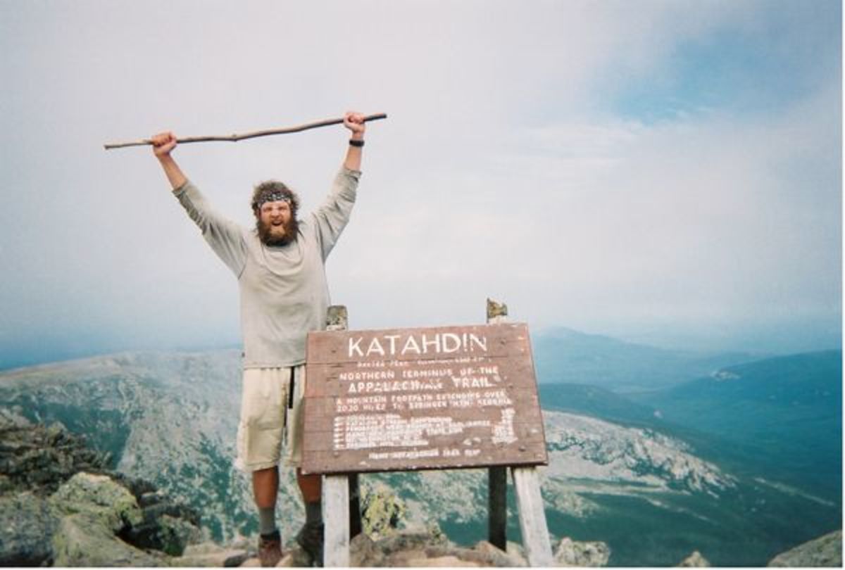
We moved on from the spring, the clouds still blowing past, hiding then revealing the views all around us. Finally we reached the final portion of the ascent over the jumbled rocks of Baxter Peak. The Tableland disappeared as more clouds enveloped us. We climbed until we could finally see a triangular structure the size of a tall sawhorse looming in the mist. There were a few people sitting around it and we started hearing their voices. A few dozen more steps and it was before us - the wooden sign on top of Mount Katahdin that stood at the highest point on the mountain. We both reached up and touched the sign, then turned and shook hands. Neither of us made a big fuss. It was only after Dave got out his camera to get pictures that people asked us if we had hiked the trail. We told them yes that we had just completed it. We were congratulated by the small group that was there, and one of them took our picture standing next to the big wooden sign. The completion of our trip was in stark contrast to how we had started the trip, when we walked around to every campsite on top of Springer Mountain informing everyone that we were going to hike the whole trail all the way to Maine.
We stayed at the top for half an hour. The clouds continued to blow past, giving us glimpses of the country all around us, as well as other parts of the mountain. Dave pointed out Knife's Edge, a part of Katahdin that he had hiked along when he visited the year before. It was well named. The mountain fell away almost vertically on either side, making the narrow trail that ran along the crest of the ridge look like it was running along the edge of a knife blade. The longer we stayed, the more views we saw between the banks of clouds. We started getting the feeling that the skies were gradually clearing. In those moments where the clouds gave way, we could see the country for miles all around. There were cloud shadows across some of the landscape and sunshine lighting up other sections. I felt like I was staring out at a representation of my future. Bright spots and dark spots superimposed on a beautiful landscape where I couldn't identify any particular feature. Sometimes it was in clear sight and sometimes the clouds hid it from me. There was also sadness that the trip was over. When I looked into the distance further north, I couldn’t help wondering what was out there. Part of me wanted to put my pack back on and keep going. I knew that those lands had been explored before by others, but they had never been explored by me. There were other adventures in other places, though – other parts of life had to be explored. Dave and I had set off one day short of 5 months earlier to find adventure, test our mettle against the rugged world of the AT, and to show that we were more than just a couple kids. Now that was done, and it was time to return home. As for my lingering disappointment about the 11 day gap in my trip, climbing Katahdin had caused it to recede to where it belonged – into a small compartment of my brain where it would do nothing more than fuel my determination to come back to the trail the following summer. For the present I was proud and happy to have completed my thru-hike.


Family and Home
We thought about hiking the Knife's Edge on our way back to Katahdin Stream Campground, but it would've added several miles to the hike back. We knew that Dave's parents were probably waiting for us so we ate a couple snacks and went back the way we had come. The descent was quick, and sure enough, the skies cleared as we descended so that by the time we neared Katahdin Stream campground, sunlight was filtering through the tree branches above. The trail was wide and level near the campground. We were about 5 minutes away when suddenly two familiar figures came into view. It was two of Dave's younger brothers. As soon as they saw us they turned around and yelled back the way they had come, "Here they are!"
Dave hadn't seen either of them in five months, "Hey guys," he said, "where's Mom and Dad?"
"They're back there a ways," they replied, "so you guys are done now?"
"Yeah," we answered, "we just finished."
"Congratulations," they told us.
Soon Dave's parents and two of his sisters showed up. Then there were handshakes all around and hugs and kisses from Dave's mom. We trooped back to the campground, picked up our packs, and found a picnic table where we sat to eat a bunch of food that they had brought with them. There were dozens of questions which we answered as best as we could between mouthfuls of sandwiches and cookies. Before long it was time to leave. We loaded our packs into the back of their big white and yellow Chevy van, then took one last look at the Maine woods and the massive mountain that towered over everything else in the region. I said a silent goodbye to the trail then stepped into the van. I took my seat and the sliding door slammed shut. I heard the engine and the gravel crunching under the van’s tires. Our Appalachian Trail adventure was over and we were on our way home.


