Interesting Facts about Africa: Vol 6
Africans profess a wide variety of religious beliefs, and statistics on religious affiliation are difficult to come by since they are often a sensitive a topic for governments with mixed religious populations.
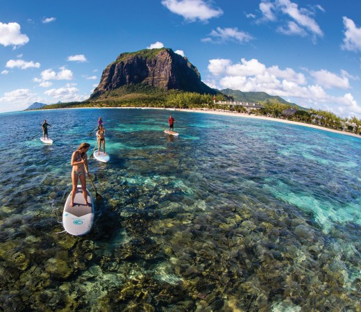

Mauritius
- The name of Mauritius is a derivation from the name of Maurice de Nassau, a prince of the Orange principality, a former feudal state of Provence.
- The first historical evidence of the existence of an island now known as Mauritius is on a map produced by the Italian cartographer Alberto Cantino in 1502. It has an estimated population of 1.1 billion people as at 2013, with a land area of 30,221,532 km2 making it the most densely populated country in Africa and the 17th most densely populated country in the world.
- The Flag of Mauritius is unique in having four equal horizontal bands. The colours derive from Mauritius’ coat of arms. Red represents the bloodshed in the liberation struggle, blue represents the Indian Ocean, yellow stands for the bright future afforded by independence and green for the for the island's’ lush vegetation.
- Among all developing countries, Mauritius has the highest life expectancy at 73 years.
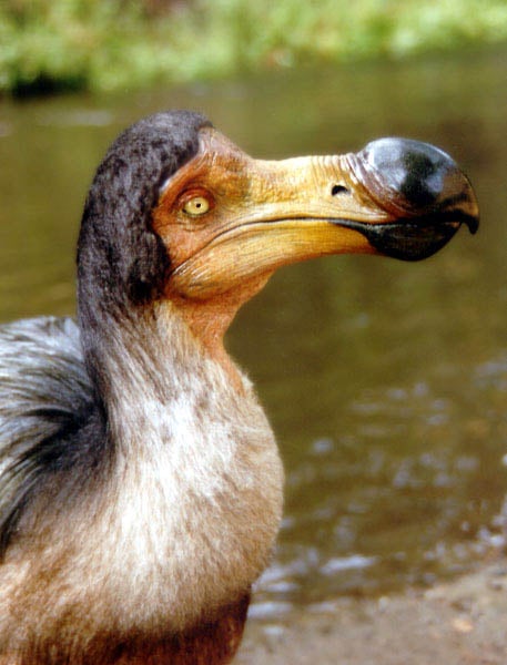
- The legendary dodo bird was found only in Mauritius before it became extinct but despite its extinction, the dodo remains Mauritius’ national animal.
- Mauritius is an island created by underwater volcanic eruptions. The first people to set foot on it were the Portuguese.
- Mark Twain has been quoted as saying, “You gather the idea that Mauritius was made first, and then heaven, and that heaven was copied after Mauritius.”
- Mauritius does not maintain a standing army instead all military, police, and security functions in Mauritius are carried out by 10,000 active-duty personnel under the command of the Commissioner of Police.
- While many countries consider it polite to receive gifts with both hands, Mauritians prefer to receive things with the right hand only.
- The top money earner for the economy of Mauritius is sugarcane, which is planted on 90% of the country’s arable land.
Morocco
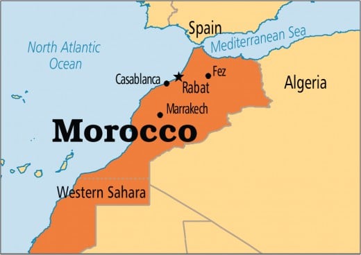
- Morocco is an Arab nation has a population of over 33.8 million and an area of 446,550 km2 (172,410 sq mi) and Rabat as its political capital and Casablanca as its largest city.
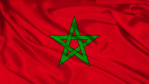
- Morocco has flown a red flag since 16th century. The green pentagram (five-pointed star), called the Seal of Solomon, was added in 1915. This design was retained when Morocco gained its independence from French and Spanish rule in 1956. Morocco’s flag is red with a green pentacle (five-pointed linear star) known as Sulayman’s (Solomon’s) seal in the center of the flag. Red and green are traditional colors in Arab flags, and the pentacle represents the five pillars of Islam and signifies the association between God and the nation. Its design dates to 1912.
- Morocco’s national animal is the Barbary lion. DNA evidence from two lion skulls found in the Tower of London proves that English royalty owned at least two Barbary lions sometime between the 13th and 15th centuries.
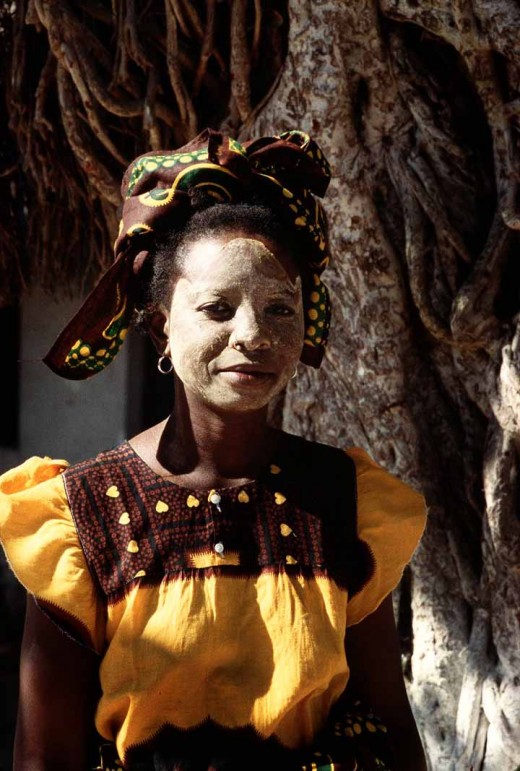
- Moroccan Berber women still have tattoos in geometric designs on their faces, sometimes covering much of their forehead, cheeks, and necks. These are marks of tribal identification and date from a time when it was necessary to be able to spot women of one’s tribe who had been carried off in raids.
- Koura, or soccer, is Morocco’s most popular sport. The national team is called the Lions of Atlas. In 2011, the 45,000-seat Stade de Marrakech was completed, allowing Morocco to host World Cup-type football events.
- The Venus of Tan-Tan, a 2.36 inch (6 cm) stone carving found in a nearby river bed in 1999 in Morocco, is alleged to be between 300,000 and 500,000 years old and may be the earliest artistic representation of the human form.
- Berber's “whiskey,” tea has become the national drink of Morocco. It was introduced to Morocco in 1854 when blockaded British merchants uploaded large quantities of tea at major Moroccan ports, Thé à la Menthe (Green Mint Tea) is Chinese green tea brewed with a handful of mint leaves and liberally loaded up with sugar.
- One of the major sources of income for families in Morocco’s Northern Rif region is cannabis (marijuana) cultivation. In fact, the word “reefer” derives from the word rif. The cannabis, known in Arabic as kif, is then processed and sold as hashish.
- The Kairaouine Mosque became the world’s first university and the world’s foremost center of learning at the beginning of the second millennium. It was built in A.D. 857 by Fatima al-Fihri, the daughter of a wealthy Kairaouine refugee. The Kairaouine Mosque became part of Morocco’s state educational system in 1963, and today it is known as the University of al-Kairaouine.
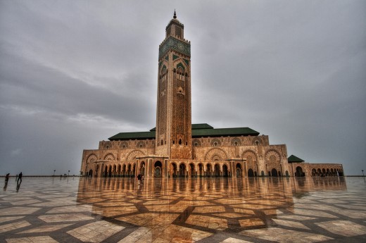
- The Hassan II Mosque in Casablanca is Morocco’s largest Mosque and the world’s seventh largest mosque and took five years of intensive labor by over 30,000 workers and craftsman to complete in 1993. The mosque’s minaret at 689 feet (210 m) high is the world’s tallest, and it is Casablanca’s chief landmark. In terms of covered area, the Hassan II Mosque is the largest in the world and has space for 80,000 worshippers.
- Founded on the banks of the Fez River by Moulay Idriss, Fez remains Morocco’s grandest and oldest imperial city. Fez el-bali (Old Fez) is the world’s largest active medieval city.
Africa has the best Tourist locations in the world
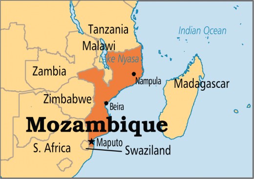
Mozambique
- The country derived its name from Musa Al Big or Mossa Al Bique or Mussa Ben Mbiki, an Arab trader who first visited the island and later lived there but was named Moçambique by the Portuguese after the Island of Mozambique.
- Mozambique is country with an estimated population of 24,692,144 according to 2014 census and covers an area of 801,590 km2.
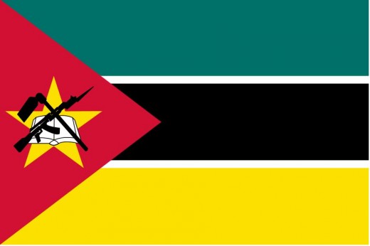
- Mozambique’s flag was adopted when the country became independent from Portugal in 1975. The green stripe represents fertile land, the black stands for Africa and the yellow for mineral wealth. The badge on the red triangle contains a Kalashnikov AK47 rifle, a hoe, a cogwheel bayonet and a book, making only national flag with a modern weapon on it.
- Mozambique is the only country in the Commonwealth never to have been part of the British Empire.
- Half the people in Mozambique are under-17. More than half the women have their first child before they are 19.
- Because of poaching, rhinoceroses have three times become extinct in Mozambique.
- Mozambique is the only country with a single word name that includes all five vowels.
- Mozambique has won two Olympic medals, both won by Maria de Lourdes Mutola in the women’s 800 metres, a bronze in 1996 and gold in 2000.
- The total fertility rate in Mozambique was 5.9 children per woman, with 6.6 in rural areas and 4.5 in urban areas, according to a 2011 survey.
-
Christians made up 56.1% of Mozambique's population and Muslims comprised 17.9% of the population. 7.3% of the people held other beliefs, mainly animism, and 18.7% had no religious beliefs.
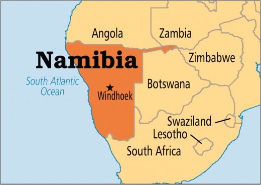
Namibia
- Namibia is the second least densely populated country on earth after Mongolia which is also a vast country. It has a population of just over two million people which ishalf the size of Alaska with a land area of 825,615 km2.
- The Namib Desert, at 80 million years, is the world’s oldest desert. Namib means “open space”.
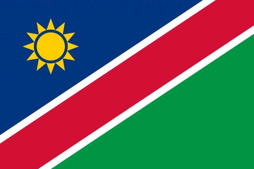
- The National Flag of Namibia was adopted in 1990 when it gained its independence from South Africa. The red diagonal stripe and white borders are symbols of Namibia’s human resources. The green and blue triangles with the gold Sun represent the country’s natural resources.
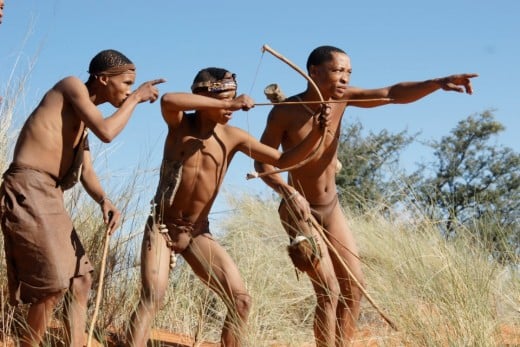
- The first people to inhabit Namibia are the San Bushmen of the Kalahari Desert who traditionally followed the migratory patterns of the animals and still have no homeland. They speak a clicking language.
- Namibia is the first country in the world to incorporate environmental protection into its Constitution which yielded a positive result of many community based tourism initiatives that provide social and monetary benefits to the communities and an authentic experience for visitors.
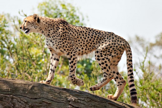
- Namibia has the largest free-roaming cheetah population in the world with estimated 2,500 – 3,000 cheetahs. Cheetahs are under pressure from farming and ranching encroachment on their habitat. Leopards and lions are also indigenous big cats in Namibia. Namibia is also home to the world’s largest population of free roaming black rhinos.
- Stunning Fish River Canyon is the second largest canyon in the world, after the Grand Canyon – it is 161km long, up to 27km wide and 550m deep, formed about 500 million years ago. You can hike the canyon but only during the cooler months between May and September.
- Etosha National Park is one of Africa’s finest parks, both in size and diversity of wildlife – home to Africa’s tallest elephants, the endangered black rhino, and 91 other species of mammal.
- The largest meteorite shower ever, the Gibeon meteorite shower, was discovered in Namibia in 1838.
- The Welwitschia Mirabilis, a fossil plant that can be found in the Namib Desert, has a lifespan that can reach 2,000 years.
- Namibia’s national anthem “Namibia, Land of the Brave’ was composed by Axali Doeseb. The words of the first verse echo the country’s long struggle for independence: “Namibia, land of the brave, Freedom’s fight we have won, Glory to their bravery, whose blood waters our freedom”.
- Namibia has 4 Olympic Silver medals – since its Independence in 1990, with help of the United Nations, Namibia was allowed to compete on the Olympic circuit (Commonwealth Games – African Games – Olympics) as Frankie Fredericks (born in Windhoek 1967) is Namibia’s first and so far only Olympic medalist.
Niger
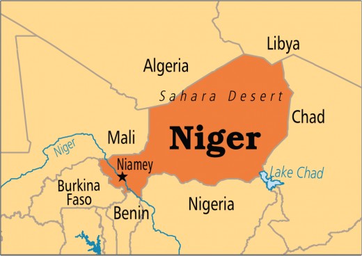
The name Niger is derived from the phrase gher n-gheren which means “river among rivers,” in the Tamashek language.
Niger is a country with a population of 17.1 million people and a land area of 1,267,000 km2 making it the largest country in land and one of the biggest in the world.
The country of Niger is one of the hottest countries in the world and is famously nicknamed as ‘Frying Pan of the World’.
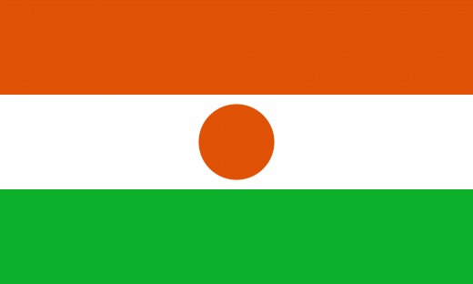
The National Flag of Niger was adopted shortly before she became independent from France in 1960. The Orange stripe represents the Sahara in the north and the green represents the grasslands in the south. Between them, the white stripe represents the River Niger, with a circle for the Sun.
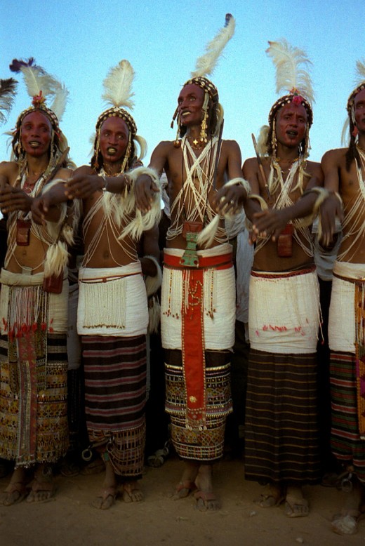
Niger is home to one of the world’s largest protected reserves, the Air and Tenere Natural Reserves, which is the refuge for animals like addax, Cheetah, oryx and the gazelle.
The country has some of the world’s largest Uranium deposits that flourished their economy due to uranium production in 1970s but when uranium prices fell in the 1980s, its brief period of prosperity ended.
The country suffered a devastating drought from 1968–1975 during which an estimated 2 million people were starving in Niger, but 200,000 tons of imported food (half U.S.-supplied) substantially ended famine conditions.
Mont Idoukal-n-Taghès in the Aïr Mountains is the highest point in Niger. It stands approximately at 2,022 m (6,634 ft) tall. While the lowest point is Niger River, with an elevation of 200 metres (656 ft).
Niger has lowest ‘Human Development Index’ on Earth.
Nigeria
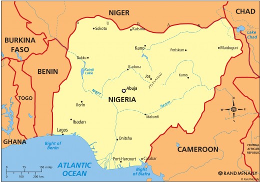
- Nigeria, with a 2013 estimated population of 174,507,539 is the most populous Black nation and the 7th most populated nation in the entire world, trailing after (rom least to most) Pakistan, Brazil, Indonesia, USA, India and China (1.3bn). It covers a land area of 923,768 km2.
- Nigeria derives her name from river Niger, which is the largest and longest river in West Africa. The river covers a distance of about 2,600 miles (4,180 km) from its source in the Highlands of Guinea, inside south-eastern Guinea.
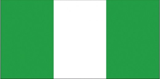
- Nigeria’s flag was adopted in 1960 when Nigeria officially became independent from Britain. It was selected after a competition to find a suitable design. The green represents Nigeria’s forest and fertile agricultural lands. The white in the centre stands for peace.
- The oldest discovered boat in Africa and 3rd oldest in the world is the 8500-year-old Dufuna canoe which was discovered by a Fulani herdsman in 1987 in Dufuna village, Fune LGA.
- Based on amount squandered, of an income of $81 billion per year, Nigeria is the most corrupt nation in the world. Nigeria has the highest paid legislators in the entire world but has the 4th highest number of poor, living under a dollar a day in the entire world while 100 million are ‘destitute’ according to figures from the NBS (National Bureau of Statistics).
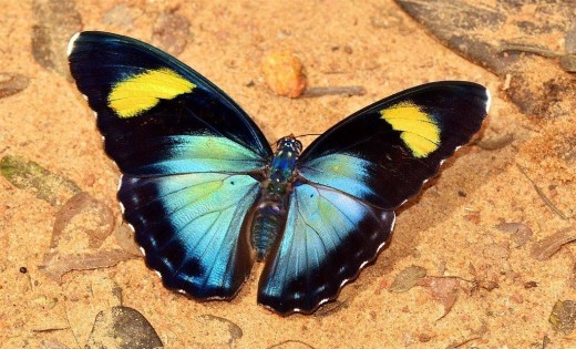
Calabar, Cross River State, located in the southern region of Nigeria, are widely believed to harbor the largest diversity of colourful butterflies in the world.
In 1976, Nigerian currency was one of the strongest currencies in the world as 75 kobo exchanged for one British Pound and 60 kobo for one US dollar. A dollar was 90 kobo at the beginning of Babangida’s term in 1985.
According to current demographics, after Hausa-Fulani (29%), Yoruba (21%), Igbo (18%) and Ijaw (10%) comes Kanuri (4%) and then Ibibio (3.5%) and Tiv (2.5%).
Measuring about 11.8 kilometers long, the Third Mainland Bridge in Lagos State, Nigeria is Africa’s longest bridge, which was built in 1990 by General Ibrahim Babangida and it connects Lagos Island with the mainland.
The capital city of Kanem-Borno, Ngazargamu, was one of the largest cities in 1658 AD; the metropolis housed “about quarter of a million people” and had 660 well planned, wide and unbending streets.
In 1966, a mischievous Igbo owned bakery allegedly made a loaf of bread with a label that depicted Nzeogwu as the Saint in the ‘Saint George and the Dragon’ medieval tale, killing Sardauna, the ‘dragon,’ this labeled bread provoked deadly anti-Igbo riots.
Nigeria has a history of human existence that has been dated back as far as 9000 BC. The Nok civilization is the earliest civilization in the country, which took place around 500 BC up to 200 AD.
