- HubPages»
- Travel and Places»
- Visiting North America»
- United States
Railfanning Stevens Pass
A Bit of History
Stevens Pass was found by John Stevens a surveyor hired by James J Hill to survey the route from western Montana to Washington state. Stevens first found Marias Pass in 1889 with the help of the local Blackfoot Indians. This had long been an Indian trail and had been known locally for hundreds of years.
The pass that would come to be named after him, was discovered at the headwaters of the Skykomish River. The pass it self was known by local Indian tribes but John Stevens was the first white man to lay eyes on it.
The Great Northern conquered Stevens pass and the line opened to traffic in 1893. The first tunnel was a 2.2 mile long bore that became famous in 1910 as the worst disaster in Great Northern History as an avalanche swept two trains off the rails killing a number of passengers and railway employees.
Due to the disaster in 1910, as well as the ongoing fight against the Winter weather, the Great Northern realigned the route through the current tunnel that opened in 1929. The bore is 7.79 miles long and until 2006 was the longest tunnel in the world, but is still the longest tunnel in the Western Hemisphere
BNSF Through Stevens Pass
Rail Traffic on Stevens Pass
Traffic today is limited by the fact that Cascade Tunnel needs to be Flushed out with cleat air after each train goes through. This is especially true of eastbounds coming up from Everett.They must wait until the fans on the east portal clear out the exhaust from the 7.79 mile bore. This typically takes 25-30 minutes, On the othe other hand if there is a westbound ready to enter right after an eastbound is clear they can push enough clear air in front of them, if there is a wind from the east as well. It is all about physics and conditions have to be just right.
Trains number 7 and 8 the westbound and eastbound Empire Builders respecively. Freights include container/double stack and mixed freight. There are some Coal and Grain trains, but becaise of the 2.2 grade on the Pass between Skykomish and Scenic on the west side, these trains often operate through Portland and then up to Seattle.
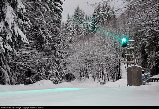
Signals on the Pass
The Pass is considered Dark Territory. The signals stay dark until a trained in the block before or after it. The signals are two miles apart so when train is 4 miles away and heading in your direction, you will see a red light. However, keep an eye on it, as if it turns Green then you know something is in the block and is only about 2 miles away. Now if it is Red and then goes Dark, a train just went through and is heading away from you.
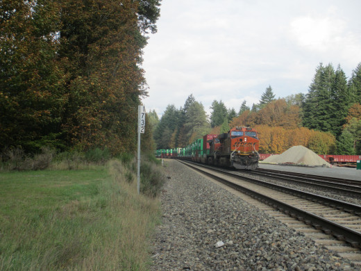
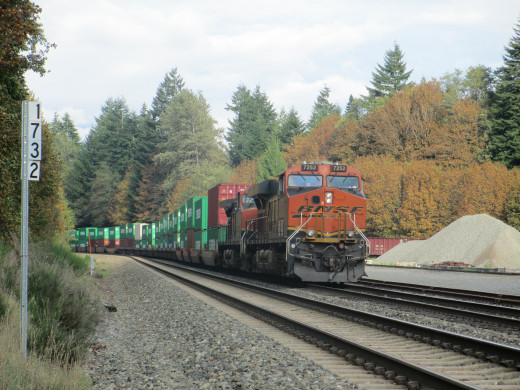
Photo Spots
West Side of Pass
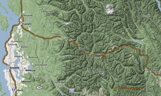
Route 2 paralells the line starting in Monroe on the west, Through Sultan Gold Bar and Baring. Rt 2 is with in a block or so of the tracks, if not right next to the road. The siding at Baring is a good spot to catch eastbounds in the morning and westbounds in the afternoon. The west Baring Switch is a good place to see if there is anything with 2-4 miles in each direction. The line swings away from Route 2 and through a town called Index, and I suggest you pull off and head the mile into town. It is a quaint little area, the town isn't much but the town park is right by the tracks so parking there and walking to the tracks is easy. Be warned that the trains fly through there at close to track speed and you have no warning of westbounds as they are headed downhill.
Heading up Route 2 you arrive one of the most well know towns of the entire Pass. Skykomish was a railroad town to the core. It was the western terminus od the Great Northern electrification that operated through the Cascade tunnel and to Wenatchee 59 miles to the east. Helpers were stationed at Skykomish until the late 1990s, when more powerful locomotives were put on the route and made the helper district obsolete. Mind you there are still some helpers on the line, but there are Distributive Power Units (DPU) on the heaver trains.
There is a small park right next to the former Great Northern station put in by the town for railfans that come to visit. Stop by the local watering hole the Whistling Post Tavern in business continually since 1903.
Further east on Rt. 2 the line crosses You loose the line until you cross the Foss River, The railroad is to your right and crosses at one of the most well known photo spots on the West side of the pass.
The Cascade tunnel is 10.6 miles from Skykomish. off the Old Cascade Highway, it is hard to find if your not looking, for it, as you get to the bridge over Scenic, Old Cascade Highway goes off to the left into the forest. Take this for half mile and pull off. There is a little dirt path leading to the tunnel portal. Make sure to keep an eye on the signals here.
While the BNSF's Cascade Tunnel crests the Pass at 2200 ft, route 2 has another 1856 feet to climb to reach it's summit of Stevens pass at 4056 feet above sea level. Heading down the other side, you can stop at the east portal of the Cascade tunnel. You can't miss it as Rt 2 crosses right over the top of the fans that clear out the tunnel after each train.
East Side of Pass
The east side of the pass is a little harder to get shots from only because Rt 2 and the line are a little further apart. There are some side roads that will get you closer, and Highway 207 and 209, just west of Leavenworth WA parallels the mainline through the Chumstick Canyon. The tracks do disappear for a while. East of Leavenworth, it is easier to follow the line, take route 209 north to "N" road and follow it east. Amtrak has now built a new station where N Rd intersects with the BNSF so there are Amtrak Station signs to help you get to the tracks from Leavenworth. Follow N road east to Peshastin where N Rd turns to Main Street. After scouting the town it's time to return to Rt 2 and head to Dryden, another small town warrants a check as there are a few industries that have sidings.
Instead of getting back on Rt 2 where you would loose the tracks, get on the frontage road that parallels the highway. Frontage turns into Old State Hwy and then Stines Hill Rd. It is the closest road to the tracks at this point, even though there are fields separating you at times. Stines Hills Rd merges with Sunset Hwy which will take you right into Cashmere. This is the first town serving the apple industry. There is a small yard serving the many cold storage facilities in the area. The busiest time for local traffic in this region is during harvest season between late August and early October.
Time to jump back on Rt 2 and continue East. there is a small Hamlet called Monitor only about 10 minutes east, a quick run across the tracks to check for activity might be a good idea. At this point in time, it is a quick run into Wenatchee on Rt 2 unless you decided to follow the line using the back roads through the orchards, there are not many spots for pictures in this area, so Rt 2 might just be your best bet.
Wenatchee Washington is a very active place as it is the hub for the regions Apple industry, as you enter the city take the N Wenatchee Ave Exit and head south, this main drag follows the tracks just one block to the east. There are two yards in town servicing many cold storage facilities as well as making up perishable fruit trains to head east.
Hope you enjoyed a brief tour of Stevens Pass, and bring a map as well as a GPS. Have fun and remember to railfan safely.
© 2013 Clayton Hartford

