H80 CG04Political Patterns
Political Patterns
I. INTRODUCTION
Political geography involves the study of how, on an adult scale territory is organized in different environments under different cultural conditions. Traditionally, political geographers have concentrated mainly on the development o f the independent state on the theories of the international power balance, and the possibilities of world conquest. This fascination is hardly surprising because the independent nation sate has dominated the recent political history of the colonial empires, the shifting alliances among the world’s industrial states, the destruction of two kind into two world wars. And the unstable fluid mosaic nations states—each based in a specific locale, defending a “homeland”, enveloped in a distinctive culture, and identifying an “ud, and “them”—shows no signs of disappearing from our lives.
Geographers of the past century could hardly turn their backs on this spatial reality, but political geography involves much more than independent sate and world power balance. Spatial differences of political nature take many other forms and appear on a variety of scales, from small voting precincts to the mountain domain of guerrilla force. In recent years, voting patterns, congressional redistricting, and the spatial aspects of guerilla war fare.
Any aspects of political geography, any spatilal Phenomena are the product numerous causal forces, both cultural and environmental. The political geographer’s main task is to identify and evaluate these forces in order to understand spatial variations. This chapter introduces many topics that interest political geographers, and it is structured by themes of culture are, cultural diffusion, cultural ecology, cultural integration and cultural landscapes.
II. POLITICAL CULTURE AREAS IN POLITICAL GEOGRAPHY
· Political geographers- are interested in both formal and functional culture areas
· Formal culture- areas are based on the spatial distribution of one or more culture traits
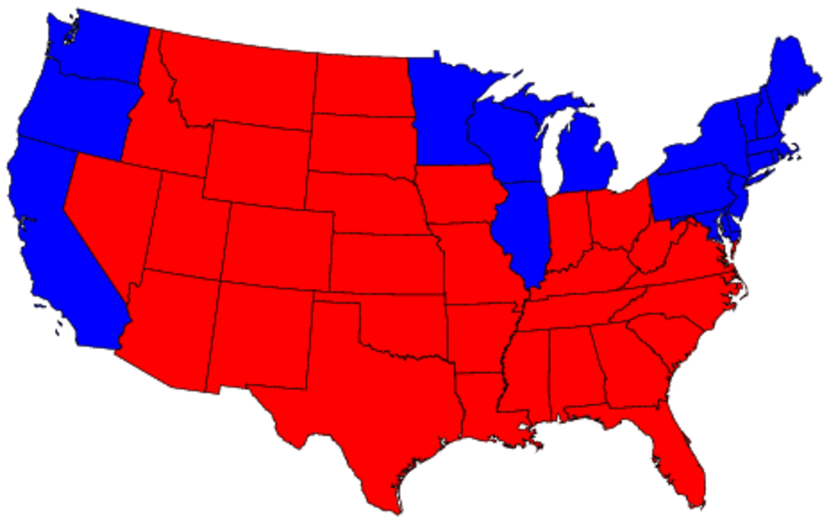
· Election- can provide data on the distribution of cultural attitudes toward such topics as race relations, food taboos, and separatism
Ex: the vote for Alabamian George Wallace in the United State presidential election of 1968 was the political expressions of the lower southern culture
Explanations:
ü The vote suggested that the political core of the old confederacy was still intact over a century after the American civil war.
ü It also suggested that the culture and society that seceded from the Union in 1861 are still viable
· There are many local examples of formal culture area, within your own country.
Ex: the vote of mayor in Los Angeles in 1969 revealed some striking spatial variations. Tom Bradley, later elected mayor of the city, was defeated in 1969 election by incumbent Sam Yorty
Explanation: the election provide a rather clear-cut choice, even though both candidates were registered Democrats
· Bradley- a black had a liberal philosophy and felt that the city police needed to be more tightly controlled. He campaigned the right to assemble and demonstrate.
· Yorty- a white campaigned on a “law-and-order” platform and made an issue of student’s demonstrations and street riots.
· Developed destructive bodies of law.
1. Ancient Europe
2. The Romans
3. Germans
4. Slavs
· 1800’s –Anglo-American settlers seized political control of the province and super imposed their system of English Common Law.
· Laws of Texas- provide a fine index to the political movements of the Spanish and British Culture.
B. Functional Culture Areas in Political
1. Geography: independent States
· Functional culture area- is rather different from the formal type. It deals with a region that is organized to function in some way
· Heterogeneous- a region that may have its cultural make-up.
· Independent state- is such a culture area. One of the most advanced expressions of human territory
· Functions: Functional Culture Area
1. It is organized to function politically
2. When political power is organized to control a particular piece of territory.
3. An independent state can be the result
4. Makes the independent state a functional rather than ta formal region.
· Territorial imperatives- a group of people to control the earth and its own territory, this need is sometimes called “territorial imperatives”.
2. Distribution of National Territory
ü Many factors help determine the fate of independent staes. Not the least of such influences in the state’s shape
ü The more compact a nation’s territory, the more Cohesive it is likely.
ü The most desirable shape for a nation is circular or hexagonal
· Ideal degree of compactness
1. France
2. Poland
3. Zaire
4. Brazil
· Damaging states Future
1. Enclaves- is a district surrounded by state but not ruled by it
2. Exclaves- are pieces of national territory separated from the main body of a country by territory of another
· Alaska is an exclave of the United States
· Pakistan provides a good recent example of national instability, created in 1947 as two main bodies of territory separated from each other almost 1000 miles of northern India.
· West Pakistan had the capital and most of the territory. Hoarded most of the nation’s wealth, exploiting East Pakistan resources
· 1973- a quarter of a century after its founding Pakistan disintegrated.
· “shoe string”- nation- states such as Chile and Norway that can be difficult to administer.
· West Indies federation- a short lived union of island in the Caribbean disintegrated in part because the sea encourages islander to develop local rather than national allegiances.
3. Core areas
-including many of the stalest and oldest, grew from a small nucleus
· Core areas
1. Nile River Valley of Egypt
Ø Some particularly attractive set of resources for human life and culture.
Ø Has a long served as a stable core area for Egypt.
Ø The valley attracted settlement because it supports lush farm in the midst of the dessert.
· France expanded to its present size from small core area around the Capital City of Paris
· China evolved from a nucleus in the northeast
· Soviet Union originated in small principality of Moscow.
· Examples of without core areas
1. Belgium
2. West Germany
3. Zaire (formerly Republic of Congo)
4. Capital Cities
ü A typical core are contains the capital of the nation, a city that is often also the largest in population and has the greatest concentration of economic and cultural functions
· Primate cities- call such “dominant Capital”
· Core Area primate capitals
1. Moscow
2. Paris
3. Mexico City
ü Economic and cultural factors can also influence the movement of capital. For instance, a capital might move closer to a border in order to be near the main routes of commerce and cultural exchange, the result is Head Link Capital.
· 1703-1918(2 centuries) - it replaced Moscow as the Russia capital because the Czars wanted more contacts with Europe.
ü In a certain cases, a country’s political head quarters are moved nearer to its expanding Frontier.
· Forward-shrust Capital- “a new capital”
· Brasilia
Ø A modern example of core- area capitals.
Ø The present capital of Brazil
Ø Main population of Brazil has clung to the nations elongated sea cost.
Ø Was meant to symbolize their nation’s new interior-directed, continental attitude.
· Rio de Janeiro- a world-famous port City.
· Towns/cities adopted nicknames such us their:
1. Capital
2. Hub home
3. Center
4. Heart
5. Cradle
6. Crossroads
7. Birth place
5. Centrifugal and Centripetal Forces
ü Using a business church or school as an example of list Centrifugal and Centripetal forces
ü A common goal may be a centripetal force to promote unity.
ü Personality conflicts may be a Centrifugal force to cause disruption
· Centripetal Forces- political geographers refer to factors that promote national unity and solidarity.
· Centrifugal Forces- whatever disrupt internal order and encourages destruction of the state.
· Raison de etre(reason for being)
Ø A unifying force, which stands out above all others in any given states.
III. THE TERRITORIAL IMPERATIVE
· Zoologist- has for some time recognized that animal behavior in May species is in part motivated by territorial instinct.
· Territorial Instinct- a need to possess and defend a home areas individuals or as member of a group.
· Territory- provides a sense odf identity to these animals and satisfies a basic need for belonging.
· Robert Andrey- published the book entitled “the territorial imperative”, says that humans are territorial animals, motivated by same instinct that affects mocking birds and prairie dogs.
· Territory involves:
1. A family’s suburban yard
2. The domain of street gang in the ghettos of New York City.
3. The hilly refuge of stone age tribe in New Guinea.
4. The expanses of an Empire.
IV.MUNICIPAL EXCLAVES
· Yokers, New York is a good example of a city’s exclaves
· Hudson River- a large, navigable river
· Bronx river- was more than a winding brook about ten feet(3meters) wide that flowed through Swampy Valley.
ü As railroads and highways were built, the brook was twice “relocated”—straightens to fifty human needs.
· As in larger nation states, these tiny exclaves create a variety of problems
1. Seemingly simple matters as providing police protection.
2. Sewers
3. Postal services for the exclaves become enmeshed in a web of difficulties and confusion.
*The Geography of the Human Heart: Winning a Guerrilla War*
In 1948, Jack Belden an American war correspondent travelled across North China with Mao Tse-tsung's guerrilla armies. Belden left a graphic first hand account of how a guerrilla force could defeat an army far larger and better equipped than itself. He wrote about a small area he visited, "In Anyang county the people's war started with little help from the army and primarily because conditions of life become unbearable. The main fighting force in the county was the militia-that is, farmers with rifles, armed civilians, who came out and fought for two weeks and then went back to their villages to resume farming.
On his arrival in Anyang, raids were spreading ever deeper and wider into Kuomintang territory. Every night small groups of men were going behind the lines to gather information to do propaganda work, to fight. Raids were social institutions, government organs and private individuals. Thus, raiding militiamen would free a girl who had been forced into marriage, depose a hated village chief or kidnap a landlord. In brief, this war aimed at people's emotions and sought to conquer hearts and not territory.
*Functional Culture Areas in Political Geography: Insurgent States*
The insurgent state is a product of guerrilla warfare, in recent years has commanded more attention from political geographers. If successful, guerrilla war passes through roughly three stages,of which has a particularterritorial traits and can be treated as a functional political region. In fact, guerillas themselves must become good geographers. They must be keenly aware of both the physical and the cultural environment. They are usually less well-armed than their adversaries. Therefore, if they do not know the land they are moving across, they will be trapped and destroyed.
The first stage of insurgency is mobile warfare, in which small guerilla bands mobile warfare, guerrillas strong enough to establish permanent control over territory and is constantly on the move to avoid capture. These bands confine their operations to specific, carefully chosen regions, usually in mountains or other inaccessible lands where the guerillas can easily conceal themselves. At the same, this chosen area should be largely self-sufficient economically, discontent politically and located near key military objectives, such as cities and transport lines. The Sierra Maestramountains provided them with concealment in the rugged terrain and dense vegetation, access to such key population centers as nearby Santiago, and contact with a mountain people who had experience in guerilla warfare during the period of Spanish rule. In the second stage, the guerillas become strong enough to establish permanent bases that they continuously control. The base area expands outward into surrounding areas , and guerillas are dispatched to establish new bases in other suitable regions. As a result, the insurgent state has bases scattered throughout the country. Such fragmentation ,although necessary, often produces the same weakness that plagues territorially fragmented independent states. Communication between the bases is difficult, and there is real danger that each base will become a separate insurgent state, more and more out of touch with the leadership and goals of the original revolution. In the final stage of a successful insurgency, the revolutionary forces abandon guerilla tactics and engage in conventional warfare. In effect, the rival governments are now military equals competing for territory. At this stage, the guerillas make major efforts to enlist the support of all dissident elements and to portray the revolution as inevitably successful.
*Diffusion of Political Innovations*
Political ideas and states spread from place to place by means of cultural diffusion. Relocation diffusion and both types of expansion diffusion occur in politics, and barriers to spread are also encountered.
Instances of political ideas, systems, and states carried by relocation diffusion are very numerous. Empires are typically built in this way. The presence of "British-Type" governments in Australia and New Zealand, on the opposite side of the world from Britain, is explained by relocation diffusion accomplished in the nineteenth century by settlers from Great Britain. Relocation diffusion is not always the result of mass migrations. However, small groups or even individual, with political ideas can accomplish the same political diffusion, although it is harder for small groups and they do not always succeed (e.g "Che" Guevara was sent by the communist government of Cuba to the South American nation of Bolivia, where he unsuccessfully tried to organize a communist guerrilla movement). Contagious expansion diffusion frequently operates in the political sphere. "Friends and neighbors" effect is contagious diffusion that results from interpersonal communication within the small area.
*Political Ecology*
Political culture areas do not exist, nor do political ideas diffuse, in an environmental vacuum. Spatial variations and the spread of political pbhenomena often can be linked to terrain, soils, climate, vegetation, and other facets of the physical environment. In the decades following 1940, political geographers have adopted a less rigid viewpoint when considering how the physical environment affects political features.Possibilists acknowledge that the environmental forces influence political life, but they deny that these forces are the only influence.
*Folk Fortresses*
Before modern air and missile warfare was developed, a state's survival depended on some sort of natural protection, such as surrounding mountain ranges, deserts, or bordering marshes or dense forests; or outward facing ridges. Political geographers call such natural strongholds folk fortressses. In either case, the folk fortress was a valuable asset.
*Terrain and political Geography*
The Bavarian town of Berchtesgaden is known today mainly because Adolf Hitler and some other high Nazi officials had resort homes nearby. To the political geographer, Berchtesgadenhasanother significance: It is an example of the political importance of terrain. Berchtesgaden is situated in the Bavarian Alps, in the midst of a wreath of high mountains. In the era before modern transportation and communication, these mountains isolated and sheltered the valley. It was shielded from both cold winter winds and invading armies. In this setting, Berchtesgaden developed as an independent principality. For 7 centuries, from 1156 to 1803, it maintained its independence. The borders of the principality, which followed the surrounding mountain ridges, scarcely changed at all during this long period. And even after Berchtesgaden lost its independence and was annexed by Bavaria and Germany, most of its mountain-marked border survived as part of the international boundary between Germany and Australia.
*Landform Patterns*
Closely related to the concept of the folk fortress is the distribution of landforms. Ideally, a state should have rugged mountains and hills around its edges and plains in the interior. Such a pattern not only makes defense easy, but is also provides a natural unit of enclosed plains as the basis for a cohesive state. Mountain-ridge borders are also desirable, because they stand out on the landscape and cross thinly populated country. Rivers, by contrasts, are much less suitable as borders. An undesirable arrangement of physical features may disrupt a state's internal unity. Separatist sentiments grow better when shielded by environmental barriers.
For nation-states, perhaps the best borders of all have proved to be those marked seacoasts. In addition, disputes still arise among nations about the placement of borders in adjacent ocean areas. Expanding states often regard adjacent coastlines belonging to other states as the logical limits to their territorial growth. This was true of the United States drive to the pacific Ocean in the first half of the nineteenth century, an expansion justified by the doctrine of manifest destiny. The doctrine of manifest destiny was based on the belief that the Pacific shoreline is the logical and predestined western border for the United States.
American leaders discarded the idea that the Pacific coast was America's natural limit almost before settlers reached it. Within fifty years of the achievement of a Pacific border for the continental United States, the government overcame or purchased Hawaii, Alaska, Puerto Rico, and the Philippines.
*Environment and the Balance of Power*
Discussions of environmental influence, manifest destiny, and the outward probings of the Russian state lead naturally to one of the earliest theories proposed by a political geographer, the so-called heartland theory of Halford Mackinder, a British geographer. As early as 1904, Mackinderwas concerned with the "balance of power" in the world and in particular with the possibility of world conquest. Mackinder thought that the continent of Eurasia would be the most likely base from which a successful campaign for world conquest could be launched. Eurasia dwarfs all other continents in size and natural resources and is home to almost four-fifths of the human race. In examining this huge landmass-this "world island" as he called -Mackinder discerned two physical regions. The heartland, or interior of Eurasia, was isolated from the sea.
Halford J. Mackinder (1861-1947)- "Founding Father" of British geography. The Royal Geographical society of London had been interested mainly in exploration rather in analytical studies and theories. In 1945, he was awarded the Royal Geographical Society's highest honor, the Patron Medal.
-By 1904, the Russian state had largely accomplished the first step having spread over six centuries, from a small core area in the East European plain to most of the heartland.
One result of this ferment was Nicholas Spykman's rim land theory proposed in 1944 in his book the Geography of peace, he placed greater value on the coastlands which he called the Rim land. Spykman felt that the huge population of the rim land amounting to about two-thirds of the human race. Coupled with the areas sizable mineral and agricultural resources made these coastal lands far more important than the thinly populated and environmentally harsh heartland. The rim land is one of the most thoroughly fragmented political zones in the world. Much of American foreign policy since 1946 has been based on the Spykman theory, aimed at keeping the rim land divided and the rim land states either pro-west or neutral. In the "domino theory" "containment" policy and other common phrases of Americans post war foreign policy, we can hear the echoes of both Mackinder's and Spykman's theories.
*Cultural Integration in Political Geography*
Influenced by physical environment factors are largely explained in cultural terms. In addition, political decisions often have far-reaching effects on the distribution of such cultural element as religion, type of economy, land use, and migration.
*Religion and Language*
Political stability is closely bound up with the spatial distribution of religions and languages. In fact, religion and language are perhaps the most potent forces in the modern independent state. When religions and linguistic diversity are combined in the same state. The situation becomes even more critical especially if languages and religions display similar spatial variations, thus reinforcing one another.
*Population Distribution*
Traditionally, a clustering of people in the interior of the state, with a sparser population in border regions was considered particularly desirable.
*Ideology*
Ideally, there should be no great differences in political and economic philosophy within a state, especially if a diverging view is strong in one specific region to maintain a strong state. For example, France, Italy, and some other democratic countries contain districts that regularly vote communist.
*Common Historical Experiences*
National unity gets much of its strength from past experiences "shared" by the population. Ideally, a people should feel that their state exists because they or their ancestors will fully establish it and defended it against alien enemies. For this reason, most stable states emphasized certain aspects of their own past and deemphasize others.
*Economy*
Laws and government policies can have far reaching effects on nation's cultural patterns. For example, the United States Canada border in the great plain crosses an area of environmental and cultural sameness.
*Politics and Prostitution*
Certain forms of economic activity are legal in some areas and illegal in others. Gambling and prostitution fall into this category. Both are widely practiced in many areas where they are illegal. Nevada laws permit both of these activities with important economic results for the state. In this way, the distribution of laws has direct effects on the spatial distribution of a form of economy.
*The Political Landscape*
The cultural landscape clearly shows the relationship between politics and culture. There are three major categories of visible political phenomena. The imprint made on the land by the legal code, the physical traits of borders and the visible expressions of government authority.
*Imprint of the Legal Code*
Among the most noticeable are those that regulate the land surveying system. In most of the United States a rigid rectangular system was imposed on the land producing a distinctive checker board appearance that is striking from the air. Even political borders that no longer exist can remain imprinted on the landscape through the legal system.
*Physical Properties of Boundaries*
Political borders vary greatly in the degree to which they stand out in the landscape. As a general rule, political borders are most visible where tight restrictions limit the movement of people and goods between neighboring states.
*The Impress of Central Authority*
The attempt to impose centralized government appears in many facets of the landscape. A power central authority backed by military power tends to produce a landscape in which the rural population is dispersed and the cities are without defense installations. Clustered farm villages and the town are physical signs of an absence of central authority.
Conclusion
Political spatial variations- from local voting patterns to the spatial arrangements of international power blocs-add yet another dimension to the complex human mosaic. In particular, independent and insurgent functions political state as vital culture many. They shape other facets of culture. Are these functional culture areas the product of humankind's innate animal behavior? Are they the cultural expressions of an instinctual need?
Whatever their origin, political culture areas constantly change as political innovations ebb and flow across their surface. Political phenomena as varied as guerrilla movements, women's suffrage, and territorial expansion of nations move along the paths of diffusion.
Cultural ecology helps us understand the links between systems of power and the physical environment. States do not exist in an environmental vacuum. The spatial patterns of landforms, hydrogeography, and vegetation are frequently reflected in boundaries, core areas, and folk fortresses. For example, distinctive geopolitical theories and global strategies have arisen concerning Eurasia. Although the environment molds the political state, the state also molds the environment. Governments can act as agents of destruction or conservation.
The cultural-integration approach underscores the relationships between politics and other facets of culture. Harmony and stability within nations often depend on relative cultural homogeneity of the population. This is so critical that leaders sometimes seek to impose homogeneity by force. The integration of politics and culture is also revealed in the economy. A map and Canada illustrates this point.
Finally, politics leaves an imprint on the cultural landscape. The imprint is often overlooked, as in the patterns of survey systems or highways. Occasionally the imprint is brutal, as in the Berlin Wall. Frequently it is overt, as in the billboards and banners of totalitarian regimes.
The billboards and banners also demonstrate the impact of language on the landscape. Language acts as the basic form of communication for the development and expression of human culture. The languages of the world fall into a few major language families with thousands of regional variations. Although we may not be aware of it, languages are linked to the land and the landscape. The next chapter will show how.
