The Erven Nunataks in Antarctica: A Meteorologist's Adventure at the South Pole
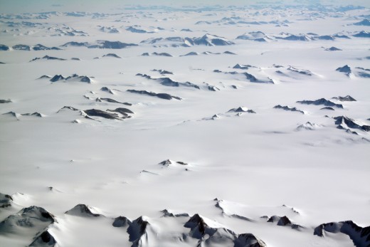
Nunataks in Antarctica
Digging Out Byrd Station from the Inside Each Morning
Life is moving right along...
…and then recently I found out my uncle Ray is “famous”: part of the planet is actually named after him.
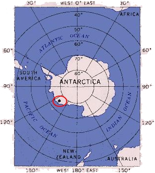
My mother got a call from him awhile back saying that he’d just Googled his own name and found that part of Antarctica, not far from the South Pole, is actually named after him and has been for decades, completely unbeknownst to him. Uncle Ray was pleasantly surprised that his scientific work done in 1964 as the meteorologist at the South Pole weather station, as part of the United States Geographical Survey, had been recognized in this way. Apparently when they were handing out names to the geological features on the map, they looked at the people who had lived and worked and researched and risked their lives to do so in Antarctica.
The news of this “new discovery” spread like wildfire among Uncle Ray’s friends and relatives, and there was a front-page article about it in his home-town paper titled "A Cool Honor".
Antarctica Live Video (if it's not too cold for the camera to operate)
- The USAP Portal: Science and Support in Antarctica - South Pole Station Webcams
South Pole Webcam in Antarctica
Live Satellite Video of Antarctica
- SCCF Satellite Access Schedule
Live satellite video of Antarctica when it isn't dark and there is no eclipse.
Ray Erven, Meteorologist at Byrd Station in 1964
Ray Erven Today

So, what's a nunatak?
Good question—we had to look it up, too.
Merriam-Webster (http://www.merriam-webster.com/dictionary/nunatak) had this to say on 5/12/2012:
“nun•a•tak
noun \ˈnə-nə-ˌtak\
Definition of NUNATAK: a hill or mountain completely surrounded by glacial ice
Origin of NUNATAK: Inuit (Greenland) nunataq”
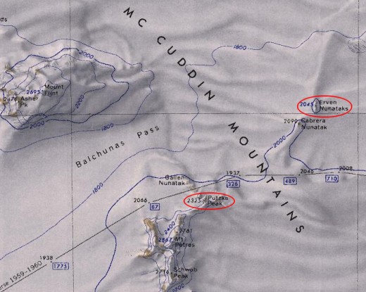
Therefore, the Erven Nunataks are a small grouping of these rock outcroppings surrounded in the sea of a glacier. To our knowledge (including his own), Ray Erven never saw the Erven Nunataks that are named after him; he was simply chosen for that honor by working at the south pole as a meteorologist near the beginning of his career in 1964.
A Can't-Miss Video Showing a Glimpse of Antarctica "Condition 1" Weather
Operation Deep Freeze and Byrd Station, Antarctica
Ray Erven was part of Operation Deep Freeze, and he and up to 100 others lived in a giant underground, plowed-out cave in the ice known as Byrd Station (NBY) at 80° S, 119° W: all of them members of the United States Antarctic Research Program.
“Marie Byrd Land hosted the Operation Deep Freeze base Byrd Station (NBY; originally at 80°S, 120°W, rebuilt at 80°S, 119°W), beginning in 1957, in the hinterland of Bakutis Coast.”, according to http://en.wikipedia.org/wiki/Marie_Byrd_Land as retrieved 3/25/2012.
Putting Antarctica into Perspective
Click thumbnail to view full-size


Full Data About the Erven Nunataks
Antarctica ID:
| 4586
|
|---|---|
Feature Name:
| Erven Nunataks
|
Class:
| Summit
|
Latitude:
| 754500S
|
Longitude:
| 1281000W
|
Description:
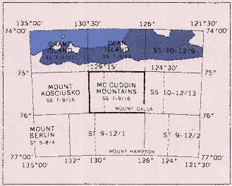
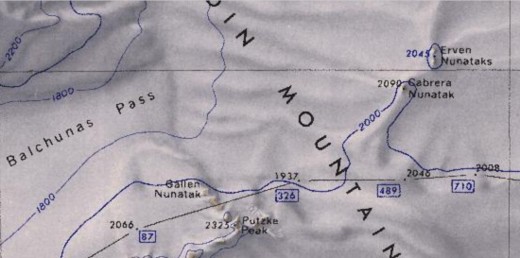
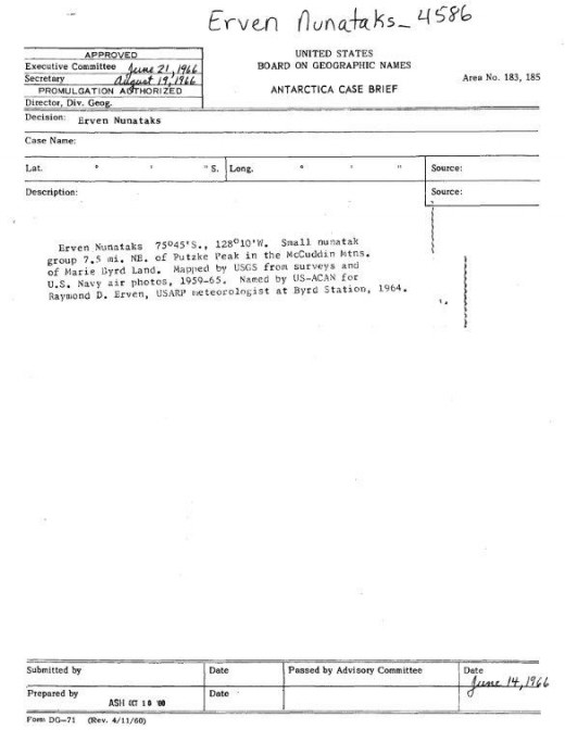
| Small nunatak group 7.5 mi NE of Putzke Peak in the McCuddin Mountains of Marie Byrd Land. Mapped by U.S. Geological Survey (USGS) from surveys and U.S. Navy air photos, 1959-65. Named by Advisory Committee on Antarctic Names (US-ACAN) for Raymond D. Erven, U.S. Antarctic Research Program (USARP) meteorologist at Byrd Station, 1964.
|
Decision Year:
| 01-JAN-66
|
Did you know what "nunatak" meant before reading this article?
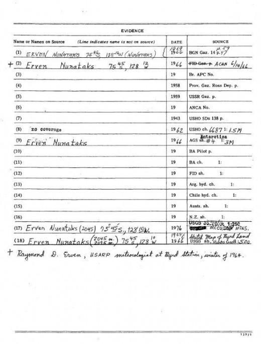
Official Paperwork

For more information:
More information is available at http://antarcticsun.usap.gov/.
Also, check out their latest news and headlines at the Antarctic Sun: http://antarcticsun.usap.gov/aboutTheSun/ .
See also Geography of Antarctica - Geography, Nature, and Weather ...
© 2012 Laura Schneider


