The Blue Gray Byway - Traveling North Carolina's Coastal Plain
The Blue Gray Byway has been designated by the North Carolina Department of Transportation as one of 45 scenic byways in the state. These routes have been selected because they embody the diverse beauty, culture, history, and geography of the state while providing travelers with a less-hectic alternate route. The routes are clearly marked with highway signs and the Scenic Byways logo
The Blue Gray Byway
Length: 82 miles
Drive Time: 2 Hours
Counties: Jones, Lenoir, Johnston, Wayne
This region had a great impace on the Civil War. Begin the byway near Smithfield in Johnston County from the U.S. 701/I-95 interchange at exit 90. From the exit and U.S 701, turn onto Devil's Racetrack Road (S.R. 1009). Known locally as the "Devil's Racetrack," the road parallels the Neuse River and Hannah's Creek. The legend has it that that people could see and hear the footsteps of a horse as the devil rode through the area, but no one ever saw the horse or its rider. Follow the Neuse River to your left and Hannah's Creek to your right for the next 8 1/2 miles, where you will cross Hannah Creek. This road also travels over Civil War battle sites, which are noted on the historic markers along both sides of the road. About a mile after crossing Hannah's Creek, cross over Mill Creek. At this point, General Johnston's troops were prevented from attacking General Sherman's troops from the rear because of a flood. The Confederates were able to escape after their defeat.
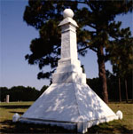
In the community of Bentonville, 1/2 mile further, Confederate forces kept naval stores of tar, pitch, and turpentine. These stores were burned by Confederates on their retreat from the Bentonville Battleground. It is a litle over 1 mile from the community of Bentonville and where the byway and S.R. 1009 veer left. It is an additional mile to Harper House Road (S.R. 1008). Turn right and follow the road for ovwe 2 1/2 miles to reach Bentonville Battleground Historic Site. This 1865 Civil War battle slowed the march of General Sherman and was the bloodiest ever fought in the state. Visitors can see reenactments of this historic battle each March. Along the sides of the road are reminders of the battle. The Harper House was used as a Union field hospital and is included in the site's tour.
After visiting the battlefield, backtrack 3 miles on Harper House Road (S.R. 1008) before turning on the third route to the right, St. Johns Church Road (S.R. 1196). Follow this road for 3 miles, which becomes Bentonville Rd./S.R. 1205 at the Wayne County line, to the stop sign. Turn left and travel north on U.S. 13. It parallels Falling Creek to the south. Turn right 4 miles later onto Grantham School Road (S.R. 1006) in Grantham. Grantham, located between Falling Creek and the Neuse River, was settled in the 18th century. Follow Grantham School Road for 3 miles, then turn left at the intersection with Oberry Road (S.R. 1120). Follow this road for a little over 7 miles before crossing U.S. 117. Continue into the community of Dudley, settled in 1837 and named for North Carolina Governor E. B. Dudley. The road name changes to Sleepy Creek Road (S.R.1120). At this point you are about 10 miles south of Goldsboro. About 2 1/2 miles east of Dudley, turn right onto Eagles Nest Road (S.R. 1933) and follow it for about 3 miles. Cross over Sleepy Creek 1/2 mile after turning on Eagles Nest Road. The Saponi Indians thought these waters had medicinal qualities and would drink it and fall asleep on the banks of the creek. Turn left from Eagles Nest Road and follow Indian Springs Road (S.R. 1744) for 3.8 miles to N.C. 111.
The rich farmlands in the area are part of the Neuse River Basin. The soils are the result of years of flooding and the changing pattern of the river and creeks feeding the soil. At N.C. 111, the byway shifts north 1/2 mile on N.C. 111 to the Cliffs of the Neuse State Park. The cliffs, rising 90 feet from the Neuse River, were formed when a fault shifted. Erosion over the years has exposed multi-colored sedimentary layers in a formation that makes it possible for laurel and other mountain plants to grow here. Nature trails and a museum are available to park visitors.
Return along N.C. 111 to Indian Springs Road (S.R. 1744). Turn left on N.C. 55 then about 1/4 mile later turn left again on Spring Street (S.R. 1739). This dirt road takes motorists by the Seven Springs Hotel above the Neuse River. Now a private residence, this hotel was named for the surrounding mineral springs and was once the site of a Victorian resort that operated between 1881 and 1944. Turn left onto Main Street (S.R. 1731) and venture to the Neuse River where the Confederate ironclad C.S.S. Neuse was built. This also was the site of an early Civil War skirmish, the Battle of Whitehall. During this batle, Union troops damaged the C.S.S. Neuse. Seven Springs was originally called Whitehall for the plantation house built in 1741 by William Whitefield, a prominent pre-Revolutionary War settler.
Turn right on Main Street (S.R. 1731) in Seven Springs, climb the short hill, and turn left onto N.C. 55. Follow this route for a little over 4 1/2 miles and cross into Lenoir County. In the community of Strabane, named for an early Irish settler, turn right past the mill onto Smith Grady Road (S.R. 1152) and follow for 3 1/2 miles. As the road makes an elbow turn to the left, stay right on Old Pink Hill Road (S.R. 1111). Look to the right for the 180-acre Tulls Mill Pond, formed in 1875 at the head of Southwest Creek. At the intersection of Old Pink Hill (S.R. 1111) and Deep Run (S.R. 1143) roads, turn left toward the farming community of Deep Run. Deep Run was established in the 1880's when a turpentine distillery was opened. It was originally called Red Town because all the houses were painted red. Deep Run is nine miles south of the town of Kinston where the C.S.S. Neuse is located. Continue straight for 2 miles from Deep Run on John Green Smith Road (S.R. 1141). Turn right onto Big Oak Road (S.R. 1138). One-half mile later, turn left on Waller Road (S.R. 1137). Stop at U.S. 258 1 mile later and cross the road, continuing on Lightwood Knot Road (S.R. 1925) for almost 5 five miles. The land between Deep Run and this point is part of the upland swamps of the Bearwell Pocosin on the southern side of the road. The Bearwell Pocosin empties into the Trent River south of here. Turn left at Vine Swamp Road (S.R. 1922). Make a right on N.C. 58 1/3 mile after that. From the Lenoir and Jones County line, it is 9 miles to the Trent River and another 3 miles into Trenton along N.C. 58. Trenton was established as Trent Courthouse in 1779 and was named for the Trent River in England. By 1784 the name Trenton was adopted. The route ends near a mill and pond on the southern portion of town at S.R. 1165.
Nearby places of interest include New Bern and the beaches of the Crystal Coast. New Bern, the colonial and state capital from 1746 - 1792, is 25 miles northeast of Trenton. About 35 miles southwest of Trenton is Bogue Sound and the beach recreational areas.

