New Crime Mapping Technology

Crime Analysis as it is used today by police agencies has evolved from the days of pushing pins into a map on the wall to a highly organized technological field. This field is teamed with individuals who have higher levels of education and expertise in fields such as software application managers and geographical analysis. The ever accelerating use of this technology has given rise to new analysis systems and methodologies that are recognized as the future of police tactical and strategic planning for the new era.
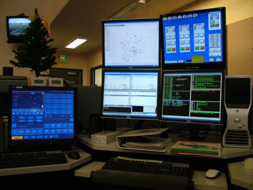
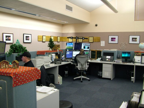
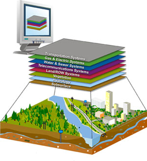
Crime analysis starts with a systematic process of collecting, categorizing, analyzing, and disseminating useful information that describes crime patterns, crime trends, and potential suspects. This process starts with the actual calls for service, by the public, or calls from field personnel that relay the information that is gathered. The data gathered from these calls are entered into powerful computer systems at police dispatch centers. These information systems run software systems called Computer Aided Dispatch (CAD) and Geographic Information Systems (GIS). Each piece of information becomes a piece in a puzzle that is matched together using database software that will identify patterns and similarities of crimes. These patterns and similarities identify locations of crimes within a close proximity, of other crimes or offenders that have like modus operandi (mo.). This information is then compiled into reports that map crime information that can be used for strategic planning in the future.
The reports from the CAD and GIS systems include identified “Hot Spots” that are areas that can become a focus of a policing model called, Situational Crime Prevention. This data identifies areas where crime opportunities exist based on factors that create the opportunity to commit the crime. Furthermore, this data will indicate areas were increased police presence may deter crimes from happening in the first place.
Another useful concept in using this software is the ability to create a profile of individuals that have committed crimes in a hot spot area. Similarities of individuals might include a particular vehicle spotted in the vicinity of a crime, or the identification of gang activity in a particular area. This information is only limited by the personnel that use the system. Sufficient training along with extensive experience in using the system creates more and more identified hot spots that increase the police agencies effectiveness and efficiencies. Crime data mapping is also done sooner and with less margin of error, a major contributing factor in the acceptance of the program in many policing agencies.
Success in the use of crime mapping has been measured in multiple studies across North America. One study included the Jersey City (NJ) DMAP Weisberg and Green Study, where it was cited, “The Jersey City DMAP Program found that well-planned crackdowns in street-level drug markets followed by patrol maintenance resulted in significant reductions in disorder calls for service,” (Braga, 2008). This example signifies the overall acceptance of police agencies all over the world.
This has a direct impact on the satisfaction of public opinion in the communities. It reduces crime and it does this at a savings to the tax payers. A better machine at a cheaper cost is always a pleasing addition to a public project. Crime mapping data also shows a commitment to the community, by the police force, to reduce crime. This is ever important at a time when public opinion of the police is at an all-time low.
Crime mapping has challenged us to look to the future of policing with an expectation that there are still major developments that can significantly reduce crime. The changes that this new technology has brought to the field can only become better. We must maintain the diligence in gaining the knowledge to develop these systems to their fullest extent.
References
Boba, R. (2000, October). Community Oriented Policing Services. Retrieved July 16, 2011, from US Department of Justice COPS: http://www.policefoundation.org/pdf/F3E.pdf
Braga, A. A. (2008). U.S. Department of Justice Office. Retrieved July 18, 2011, from Crime Prevention Research Review No.2: http://www.cops.usdoj.gov/files/RIC/Publications/e040825133-web.pdf
Foster, R. (2005). Police Technology (1st. ed.). Upper Saddle River, NJ: Pearson/Prentice Hall.
For further reading..
- JUSTNET - Geospatial and Crime Mapping
A program of the National Institute of Justice (NIJ), the NLECTC System is the conduit between researchers and criminal justice professionals in the field for technology issues. - The History of Crime Mapping and Its Use by American Police Departments | Alaska Justice Forum
A brief history of crime mapping, its advantages and disadvantages, and its use by American police departments. Includes a brief bilbiography.