An Appalachian Trail Thru-Hike: Part 14 - Pearisburg, Virginia
We told Mark and Paul we would hike with them down to the road but then we would continue on down the trail. They told us we would probably reach Pearisburg the next day and they would probably stay over a day so they would see us there.
Taking the Trail
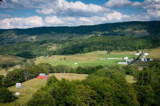
On the morning of April 29th, we woke up inside the old linesman’s cabin next to the beautiful overlook known as High Rock. The overlook provided a picturesque view of the valley below, which we enjoyed while we ate breakfast on top of the cliff. Mark and Paul conferred with us while we ate. Mark had a blister on his heel that was bothering him and Paul was anxious to get to the next post office to pick up a package. They planned to walk roads into Pearisburg. They told us that the hostel there was run by a Catholic Church. Dave and I decided to stick to the trail. The day looked promising with a clear sky brightening as the sun rose. The trail had been pleasant the day before and we were looking forward to more the same. We told Mark and Paul we would hike with them down to the road but then we would continue on down the trail. They told us we would probably reach Pearisburg the next day and they would probably stay over a day so they would see us there.
We started the day by descending from Big Walker Mountain. We went down a long series of switchbacks through the woods until we entered the upper end of an open pasture. We entered the pasture through a stile in a barbed wire fence. Stiles were frequently used on the AT to allow hikers to get into and out of private fields and pastures where the owners had granted permission for the trail to go over their land. A stile was like two short fixed ladders leaning on either side of a fence. A hiker would climb up one side of the fence, usually three steps to the top, and then descend the three steps on the other side to enter the field or pasture. Once the hiker passed through the private land bounded by the barbed wire, there was typically another stile to let him or her out. In this case we went over the second stile and climbed down an embankment to a small country lane. The trail followed along the lane for a while before a double white blaze on a large tree trunk that stood along the road indicated a turn. The trail led up another embankment there, and passed over another stile to enter a different field. Dave and I took our leave of Mark and Paul at that point. They kept going down the lane while we mounted the embankment to the stile in the fence above.
Pastures, Woods, and Creek
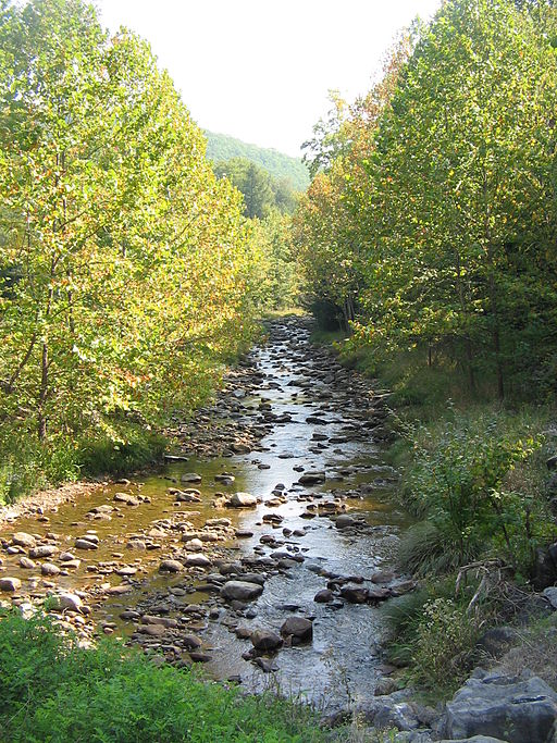
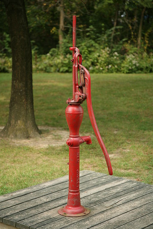
The hiking on that day was wonderful. The trail led us through a patchwork of woods and pastures. The trees shone with bright green new leaves and the trail, when it cut through the pastures, formed a brown stripe across a lush green carpet. Many times there were small brooks that meandered through the pastures. Sometimes there were a few cows, but often the pastures were empty. The clear cool weather, combined with the interesting country made the time and the miles slip past quickly. As lunchtime approached we found that the trail had left the fields and pastures behind. We were back in the woods and found ourselves hiking along a beautiful stream that our trail guide identified as Dismal Creek. Lucky for us, there was nothing dismal about it on that day. The sunlight sparkled off the rivulets in the shallow stream, and its crystal-clear water babbled over a bed full of rounded stones. The trail followed Dismal Creek for several miles, and we ate lunch somewhere next to it. Later in the afternoon the trail turned away from the creek and led us in a different direction. We spent some time walking along gravel forest roads. At one point we passed an empty picnic area with picnic tables, some grills, and an old-fashioned water pump. We tried the pump to see if we could get some water from it, but we weren't able to raise any. Fortunately our water bottles were still well-stocked with water from Dismal Creek.
The opportunity to surprise Mark and Paul was too tempting to resist. We knew they would be at the hostel in Pearisburg and they believed we wouldn't be able to make it there until the next day.
Going For It
The afternoon was fading when we reached Doc’s Knob Shelter. Already we had put in a good days hiking - about 23 miles. We studied our maps and terrain profiles and saw that there was a gradual ascent for a few miles from Doc’s Knob until we reached a short steep climb to the top of Pearis Mountain. After that it was a long downhill all the way to a road in the town of Pearisburg. All told, it was about 7 miles with two hours of daylight left.
The opportunity to surprise Mark and Paul was too tempting to resist. We knew they would be at the hostel in Pearisburg and they believed we wouldn't be able to make it there until the next day. We decided to push on and get to town that evening. We didn't know how to get to the church hostel, but we figured we would cross that bridge when we came to it. We made a dinner of Jell-O instant chocolate pudding mixed with raisins. There was a spring at the shelter and we carried Carnation dried milk with us. We combined the dried milk with the pudding mix, added the cold spring water, and mixed it up with raisins. Since we didn't have refrigeration, the pudding didn't set, so we split the mixture in half and we each drank our share like a milkshake, occasionally stopping to chew up our raisins. Although it was unconventional, the dinner did provide a surge of energy and we went back to hiking with renewed vigor.
As our maps had shown us, there were a few miles of fairly tame terrain followed by a sudden steep ascent. The steep part was memorable because it went straight up with no switchbacks. We had only encountered a few places like that so far on the trip. We were familiar with trails that went straight up without the use of switchbacks due to our experience hiking in the Adirondack Mountains in northern New York. We considered a slope steep when we could reach out our hands and touch the ground in front of us as we climbed. Pearis Mountain, Albert Mountain, Cheoah Bald, and parts of Roan Mountain were the only places I could think of to that point where we had climbed a steep section of trail like that on the AT.
If you want to read this series from the beginning, click the link below:
- An Appalachian Trail Thru-hike: Part 1 - Deciding to...
Two teenagers hike the Appalachian Trail from end to end in 1982. This episode describes how they decided to hike the trail and their preparation for the trip.
An Urgent Descent
We reached the top of the mountain without taking a break. I felt some satisfaction because I was comparing how my legs were performing with how they did less than a month earlier when we tried to hike 30 miles into Hot Springs North Carolina. On that day I had pooped out, but on this day I was cruising along just fine. There wasn't much time to enjoy the view, known as Angels Rest, on top of Pearis Mountain. The sun was dipping below the horizon and I seem to remember seeing a few lights already twinkling in the valley below. We stopped for maybe a minute or two. We didn't even take off our packs. There was just enough time for our breathing to slow down to normal after the steep climb to the top and then we were hustling down the trail again.
Whereas the climb up had been a straight shot, the descent was a succession of switchbacks. As the sun sank, the shadows grew and so did our sense of urgency. We started jogging. We had our flashlights out, but they just created thin bobbing beams of light, barely enough to help us pick our way down the trail over roots, rocks, logs, and other obstacles. I can remember the sound of macaroni shaking in its packaging to the rhythm of my jogging footsteps. It sounded like I was playing maracas. Dave had a fuel bottle that kept clanging against the top of his stove which sounded like some other kind of percussion instrument. It was surreal running endlessly down the darkened mountainside listening to the various squeaks and thumps of our packs slamming up and down on our shoulders accompanied by the metallic clang, clang, clanging and the maraca-like chck, chck, chck’ing emanating from our packs.
After what seemed like forever, we reached the bottom and the trail flattened out. By this time it was completely dark. We had expected that the trail would come out to the road right at the bottom of the mountain, but we were mistaken. We could hear the road and we could see the glow of the streetlights through the trees, but the trail ran parallel to the road, it didn't intersect it. We kept going in the darkness, expecting the trail to intersect the road at any moment, but it just kept going parallel. Finally Dave had enough. We came to a spot where a streetlight could be seen through the trees. Dave veered off the trail into the woods and I followed. We slowly worked our way toward the light with our hiking sticks and hands outstretched before us to move branches and shrubs out of our path. It took a few moments, but finally we emerged from the woods at the edge of a parking lot. Before long we were hiking along the shoulder of the road on the outskirts of Pearisburg. We could see a brightly lit sign for a place called Big T at the top of a hill. It was glowing like a beacon. We desperately hoped that the Big T was a restaurant and not a gas station.
We could barely see them by the light of the streetlights. We didn't think much about them as we walked along until a loud slurred voice shouted at us from one of the darkened buildings, making us jump in mid-stride.
Startled in the Night
The road was a state highway and the cars zipped by pretty fast. No one was stopping in the night to pick up a couple guys with backpacks and sticks, so we just trudged up the long hill toward the glowing Big T sign. There were a few old abandoned houses along the road, setback about 50 feet or so. We could barely see them by the light of the streetlights. We didn't think much about them as we walked along until a loud slurred voice shouted at us from one of the darkened buildings, making us jump in mid-stride. We weren't able to understand what the voice said and neither of us tried to engage in conversation. We just kept walking up the hill. It was a creepy moment. I looked back a few times to see if anyone appeared at the road's edge behind us, but no one did.
Fortunately for us, Big T was a burger joint and we were able to chow down when we reached the top of the hill. My memory of how we got to the church hostel from Big T is hazy. I think we rode there in the back of someone's pickup truck. The Catholic Church was at the top of a hill on the other side of town, and I remember the contrast between driving past dozens of brightly lit nice homes on our way to the hostel after we had so recently hiked past a set of dark abandoned houses where the disembodied, alcohol-ridden voice had startled us.
A Successful Surprise
The headlights of our ride illuminated a small brown barn behind the Catholic Church. Hung on the side of the barn was a large green and white reflective signed with the Appalachian Trail symbol where the crossbar for the “A” also forms the top bar of the “T”. Before we knew it, we were walking into the dimly lit hostel. The first person we saw inside was Mark. He laughed and started repeating over and over, “I don't believe it!”
Dave and I were both pretty tired. We gave Mark a quick rundown of what we had done that day. He told us that Paul had already turned in for the night, and soon we were doing the same.
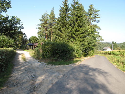
We stayed 3 nights and 2 full days at the hostel in Pearisburg. I have memories of sunny blue skies and perfect temperatures during our time there. I also remember how nice the hostel was. It was a small building designed like a barn with exposed post and beam construction, and dark stained wood siding. Inside, was a rustic common room furnished with varnished plank tables and benches. Along one outer wall there were a few booths like what would be found in a restaurant. On one end of the building was a small kitchen and bathroom with a shower. A steep set of steps led up to a loft where the sleeping quarters were located. Outside in the morning we found that the hostel was in a residential neighborhood on the top of the hill outside of town. Looking down the hill we could see the roofs of houses and other buildings clustered around the main highway that ran through town. On the other side of town we could see the large bulk of Pearis Mountain.
It took 15 to 20 min. to walk into town from the hostel. On the first full day in Pearisburg Dave and I went into town twice. We continued our focus on holding down the spending that we began in Damascus. I wrote in my journal for the first day in Pearisburg, “For dinner I had a frozen pizza and some watermelon – it cost $2.94 in all.” Even though we fixed our dinners at the hostel, we did eat our lunches in town. One major attraction was a Pizza Hut with an all-you-can-eat lunch special. We had heard a rumor that the Pizza Hut in Pearisburg had shut down their all-you-can-eat special due to too many hikers coming in and clearing them out. We had been told they were unable to make any money off their all-you-can-eat specials, so they had discontinued the practice. Luckily the rumor turned out to be wrong and we were able to get in on the buffet.
Repairs
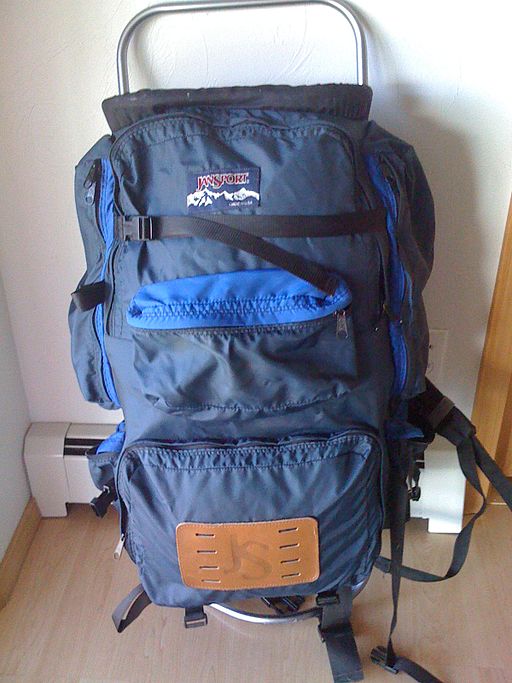
As always, there were chores to accomplish while in town. On the day after our late entrance into the hostel, Dave discovered that the metal tubing of his JanSport pack frame had cracked on both sides about midway along the frame. After some speculating, we figured that the run down Pearis Mountain combined with the weight Dave typically carried in his pack had put too much stress on the frame, causing it to crack. Buying a new pack was out of the question. He needed to figure out a way to fix it. He ended up going to a hardware store and buying 4 approximately 4 inch bolts with nuts and 4 hose clamps. In all, it cost him no more than $2.00. From those materials, Dave fashioned 2 splints to support the frame tubing on either side of the cracks. He threaded the nuts a little way down the bolts and positioned two of them on either side of each crack. Then he tightened the hose clamps around the bolts to hold them in place. His $2.00 repair held up for the rest of the trip.
Dave and I had a friendly competition about our equipment. When there was nothing else to talk about while we hiked or did things in camp, we would argue about whose equipment was better. Recently Dave had enjoyed the upper hand due to a repair I had gotten for my hiking boots while in Damascus. That gave Dave ammunition to tell me how much better his boots were than mine. Now I thought I had an opening on the backpack front. I quickly started getting in my digs about how his JanSport wasn’t built for the rigors of the trail like my CampTrails pack was. I was only able to enjoy this advantage for a short time because before long I noticed the hip belt on my pack wasn’t providing the correct support on the right side. After a quick investigation, I found that the stitching that attached my hip belt to the strap around my pack frame had completely given way. When the pack was on it listed to the right and was not held tight against my hip. Luckily, I was able to set up an inexpensive repair of my own. I simply lashed the hip belt to the pack frame with a long shoelace and that simple repair lasted for the rest of the trip as well.
Being Questioned
As with the hostel in Damascus, we met up with other through hikers in Pearisburg. One was a guy we had briefly met in North Carolina the evening before we reached Wesser. He had been hiking with another guy at the time who had since quit his hike. Now he was hiking solo. One of the days we walked into town with him and had lunch at a Dairy Queen. As thru- hikers normally do, we compared notes about our trip so far. He started talking about the trail over Mount Rogers and we told him we had taken the old trail over Big Walker Mountain.
“Why did you do that,” he asked us. “What's the point of hiking the Appalachian Trail, if you’re not really going to hike the trail?” he wondered.
Dave and I were unprepared to answer that. All we could think of as a reply was that it was the old trail. A couple years before it had been the official trail and Paul and Mark had told us that the scenery was beautiful on the ridge. We then assured him that the scenery had indeed been beautiful. He was obviously disturbed, but he didn't seem to direct any anger toward us. As our walk into town continued and he kept talking, we got the sense that he thought we were being led astray by Paul and Mark. Dave and I assured him that we were doing what we wanted to do. We didn't want to discuss it with him anymore than we had to, preferring to stick to more agreeable subjects during our walk to town and back. Later on, when we were by ourselves, Dave and I talked it over. Our main sentiment was best described by the question: “Why does it matter to him?”
We were a little bewildered by his disapproval. Later on we saw Mark and told him about some of the comments. I'm not sure if we were expecting to hear outrage or resentment from Mark, but I still remember what he had to say.
“He’s a purist," Mark said in a very matter-of-fact manner, “He thinks that the only legitimate way to hike the AT is to hike every inch of the official trail."
He then went on to say that he just didn't view his trip in the same way. Everyone has to decide for themselves how they want their own hike to go.
One thing we didn't convey to Mark or Paul was that the guy seemed to blame them for leading us astray. I think we were both thinking the same way on that subject. The guy might have meant that as a criticism of Paul and Mark, but Dave and I took it personally. To us it meant that he believed we were dependent and didn't make decisions for ourselves. Dave and I both believed he was wrong. The decision we had made to take the trail while Paul and Mark took the roads into Pearisburg was proof of our independence from them and anybody else.
We reveled in the idea that we could choose to hike down any road we came across to see where it would lead. We could stop at any town, hear about a place or an event and, if it caught our fancy, go there.
Thinking About Our Journey
Although it annoyed us, the questioning did cause us to think about the actions we were taking and how those actions fit into the journey we were on. Up till that point, we were traveling along, doing whatever seemed right from day to day. It had never occurred to us to define what our trip was all about. It didn't seem necessary, but after that conversation, we did start talking about what our hike was all about. Adventure, freedom, and life in the open pretty much summed up our priorities. The romance of the open trail, or road had captured our imaginations. We began to realize, that the essence of the trip for us was the opportunity to pursue our own destiny. In that time we considered the highest form of freedom to be having everything we needed strapped to our back with nothing scheduled except to be in Maine before the fall semester of college in 1982. We reveled in the idea that we could choose to hike down any road we came across to see where it would lead. We could stop at any town, hear about a place or an event and, if it caught our fancy, go there. That was what we did when we went down roads that brought us to Franklin Tennessee, and Robbinsville North Carolina. In both those cases we hadn't planned to end up in those places, but it seemed that the current of life had brought us there without warning. Those side trips had been the result of our own choices, but our choices had been so spontaneous that they created an impression of a flow that we were connected to, something that was carrying us along. We were not resisting the flow to follow a set of rules about hiking the trail. We might deviate from the trail for a while to see something new or go someplace different, but we would always bounce back to our primary focus – the Appalachian Trail. If we needed a change, a break, or diversion, we would look for opportunities that would deliver those to us. If we strayed too far from the goals of our trip, we would wend our way back to the trail. Traveling in this way, over the course of a month and a half, we had managed to stay on schedule, and our money was holding out well enough to get us to the end. In other words, so far we were on time and on budget, and that made us less concerned about taking chances that we might lose time or get stranded by taking side adventures or hiking unconventional routes. So far we had been fortunate. All our excursions had worked out well. What we didn’t realize yet was that our side trips wouldn't always work out they way we wanted them to, but that was a lesson to be learned further down the trail.
Evenings in the Hostel
During the evenings at the hostel, the hikers would gather together in the common area around the tables and in the booths. Dave and I cooked our dinners in the kitchen and ate at a booth. On our last evening there, Paul had set himself up in a different booth to catch up on his correspondence. He had bought a 1 quart bottle of beer and had poured the contents into a Tupperware bowl. He sat there smoking a cigarette and sipping his beer while writing page after page of letters to everyone he knew. Even sitting inside the hostel he had his maroon cap perched on the top of his head. A low wattage bare lightbulb hung over the booth, casting a dim yellow glow across him and the table. As I watched him I couldn’t help thinking of Paul as some type of Ernest Hemingway-like character. He had the white scruffy beard, the nose for adventure, the storytelling ability, and now to watch him so engrossed in his writing, the comparison clicked.
Our time in Pearisburg had been relaxing, yet eventful. The weather had settled into a pattern that was the best springtime in southern Virginia had to offer. Our legs were once again getting restless and it was time to shoulder our packs and head north toward more adventures along the trail.
If you want to read the next episode in this series, click the link below:
- An Appalachian Trail Thru-Hike: Part 15 - The Hike to Cloverdale, Virginia
The Double Daves depart from Pearisburg and deal with the "doldrums" as they make their way toward Cloverdale. Along the way they have a final encounter with a hiking buddy.


