Larry's Pony Express Hike
Introduction
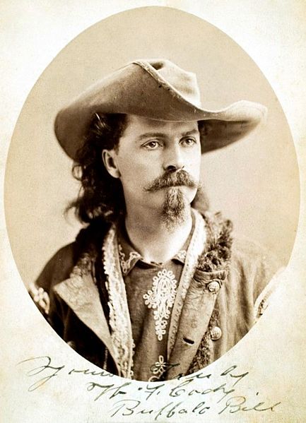
The Pony Express mail service ran for 18 months in 1860-1861 from St Joseph, Missouri to Sacramento, California. It was relatively fast by the standards of the day, requiring only 10 days to deliver a piece of mail. Brave young riders and their hardy steeds would zoom across the American West. At intervals, the riders would get fresh horses at the way stations. The most famous Pony Express rider was William "Buffalo Bill" Cody, shown in the photo at right.
If I had to ride a galloping horse for 12 hours straight, I'd be 'walking over a barrel' for the next several days! Here's a LINK to Gypsy Willow's awesome hub on the subject, which includes plenty of photos that capture the flavor of the Wild West.
For a small part of its nearly 2000-mile length, the old Pony Express Trail parallels Highway 50 in the Northern Sierras of California. And our hike is along a segment of this famous trail, which has been lovingly maintained by local history buffs.
No, we're not talking epic trek here. This day-hike is more like 3 miles each way. Although there are several great hikes in the area, this one has the least amount of elevation gain.
I'd estimate the average altitude to be between 5000 and 6000 feet, which is intermediate for the area. I consider this outing to be more of a forest hike than a mountain hike. Are you still with me?
Hiking survey
What kind of hikes do you enjoy?
The drive
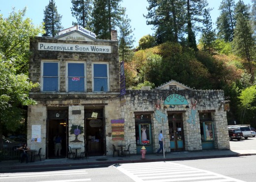
Starting from Sacramento, drive East on Highway 50 towards South Lake Tahoe. You'll pass by the yuppie community of El Dorado Hills, then past Cameron Park, and Shingle Springs. The freeway is interrupted by two stoplights in the charming little town of Placerville--formerly known as Hangtown. Then you'll drive by Camino, and Pollock Pines, which has an outstanding family-style Chinese restaurant.
If you want to eat dinner there, take the Sly Park exit. Turn North. That's AWAY from Jenkinson Lake. After 200 yards, you'll see a Safeway off to your left. Turn right when you get to the T intersection, just past the supermarket. Then make a quick right turn into a small shopping center. Go most of the way to the end. Then you'll see The Mandarin off to your left.
After Pollock Pines, you'll start on the downhill grade, which passes Freshpond. At the bottom of the hill, you'll see Icehouse Road going off to your left. Ignore it. At this point, Highway 50 ceases to be a freeway, and it becomes a simple mountain highway, which parallels the South Fork of the American River.
After a short distance, you'll pass by a nice German restaurant, St Pauli Inn. If you choose to dine on the deck in back, you'll have a view of the river.
When you get to the service station in the microscopic town of Silver Fork, that'll be your last chance to fill up your tank and to use a public restroom.
Then you'll pass by another microscopic town, Kyburz. If you don't stay the night or at least buy something, the employees of the lodge there will give you a dirty look when you ask to use their restroom.
That said, you may wish to drive up to Kyburz the afternoon before your hike, and spend the night at the lodge. It'll help you adjust to the altitude if your aerobic fitness is marginal.
After Kyburz, start watching the mileposts. When you reach Milepost 42 on your right, you'll see a small parking area off to your left. That's the trailhead.
Here's a mnemonic for Milepost 42: In the late Douglas Adams' famous science fiction novel, Hitchhikers Guide to the Galaxy, 42 is the Answer to the Ultimate Question of Life, the Universe, and Everything. Our historical hike could also be interpreted as a Meaning of Life hike!
Misc: Near Milepost 42, you'll also see a sign for Forest Road 71, which goes off to your right. Going from there to the Silver Fork Road should be a great ride for physically fit mountain bikers, because there are lots of pine trees on the sides, and very little motor vehicle traffic. No, I haven't done that ride yet.
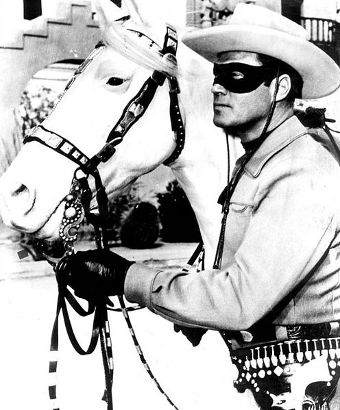
Gentle Reader, if you're old enough to remember the Lone Ranger of yesteryear, you may want to play a CD of the William Tell Overture in the car stereo, starting at Kyburz. This should help get you in the mood for the hike. If you bring your children, you may want to add a hearty "Hi-yo Silver! Away!" at the appropriate place in the piece.
Be prepared
On most Summer days, there's no rain in this area, but you should be prepared anyway. Listen to the forecast. If you don't have a fancy-schmancy Gortex rain jacket, bring a large plastic garbage sack, with pre-cut holes cut for the neck and arms, just in case the weather guys didn't get it right.
Bring sturdy, comfortable footwear. Sneakers will do the job.
Also bring 2 quarts of water, lunch, and TP.
Optional: bandana. Wearing a bandana bandito-style is the most weight-efficient way to add warmth on cold early mornings. It also keeps the trail dust at bay.
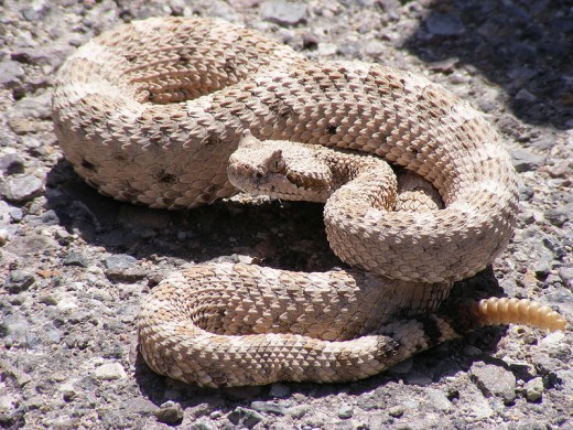
This hike is above the Poison Oak zone. But there are rattlesnakes, and there may be an extra-large kitty-cat in the area. Rattlesnakes are not aggressive towards people. They won't bother you if you don't bother them. But be sure to look where you step.
Here's a LINK to my hub about mountain lion safety for hikers.
The hike itself
Most of the trail is fairly well-marked. However there's one place where the trail appears to peter out. At that point, you should head downhill a bit, and walk beside the highway for about 100 yards. Then you'll need to be on the lookout for the point where the trail picks up again.
At another point, you'll reach an apparent dead end at a dirt road that goes straight uphill. No worries! Turn right. After a short distance you'll see a continuation of the trail off to your left.
The main disadvantage of the hike is that you're never far from Highway 50, and you'll hear some road noise for most of the way. That's why this hike is more enjoyable in a group, because the conversation drowns out the road noise. Hint: There's less traffic--and less traffic noise--on weekdays.
The road noise can also also an advantage. You'll have to work pretty hard at getting lost on this hike. If you're beginning to feel lost, just follow the road noise (mostly downhill) to the highway.
There are some gentle ups and downs, and a small creek crossing. That said, I would not want to ride a galloping horse along that trail!
The best lunch spot is near a historic horse trough, fed by a spring. From there, it's a short distance to the end of the trail segment at the partially paved Wrights Lake Road. That is, if you're feeling virtuous.
If you want to push the Lone Ranger metaphor a bit further, at the end of the hike, you can ask your kids, "Who was that masked man?"
