How to use survey info to identify locations in the forest.

Forests are full of valuable information you can use
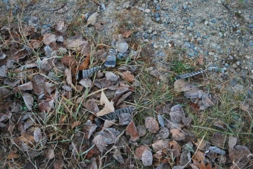
The United States is divided into townships for legal land descriptions and you can use that information for navigation. For instance, the photo shows a corner marker, erected where four one square mile sections meet. If you know how to read the numbers, you can locate this spot on a map. No GPS necessary.

What's a township?
The United States is made up of townships that are 6 miles square, or 36 square miles, with each section numbered starting at the upper right in the manner shown in the illustration. The north/south orientation has a township number and the east/west orientation is called the range, and is also numbered.
The corners of these square mile sections have been surveyed and marked throughout the forest. Before the advent of Global Positioning Systems, these corners were used to identify property lines for stumpage or land sales.
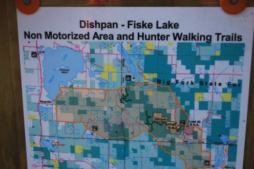
The illustrations and maps used in this lens are for the Chippewa National Forest in northern Minnesota.
This is a corner marker


Where are you?
The marker tells us we are at the corner of sections 21 and 22 and 27 and 28, and the township is 150 North and the range is 27 West. The photo shows where this marker is located on a USGS 7.5 minute quadrangle map. You can see the section lines and where they intersect at the south end of Glove Lake, the spot is about where the cartographers decided to print the elevation.
Follow the numbers - click to enlarge and rotate.
Click thumbnail to view full-size


What the heck is a base tree?
There are generally four base trees marked near a corner monument. The base trees will have big red blazes at eye level on one side of a tree, the corner will be inside the area marked by these blazes on all four trees. Very often, the letters B/T are also painted on the tree to indicate it is a base tree. Base trees are not a certainty though, as trees may blow down, rot, burn, etc.
There are other location markers!
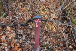
Commonly called "Red Tops" these posts could be anywhere in a section and mark the approximate location in the township/section. The red tops also tell the township and range numbers and bearing and distance to the nearest corner.
detailed information - click to enlarge and rotate
Click thumbnail to view full-size


Keep your eyes open.
Although often placed on posts, these information tags could be simply tacked to a tree, usually at eye height. However, you have to know that with the advent of GPS technology, these markers started losing their value and they are disappearing.
prototype port-a-potty?

Photos just for fun! - click to enlarge and rotate.
Click thumbnail to view full-size


More info on Rainy Lake, International Falls and Voyageurs National Park. .
- Learn more about Minnesot's Vacation Paradise, Rainy Lake!
A website with detailed recreation and lodging information.