A Closer View of Google Street View

In March 2001, Larry Page, the co-founder of Google started a project that would later become a Google-sponsored Stanford research. Ending sometime in June 2006, this project, however, gave birth to an awesome technology now known as Google Street View.
Google Street View is arguably a lesser-known technology incorporated in the more popular Google Maps and Google Earth. While all three technologies allow their users to view any location on Earth, Google Street View gives anyone an access to panoramic views of any location, any place in the world at a “street level.”
This technology makes use of panoramas based from stitched images, which in turn can be taken in any manner, mostly via the use of any land, air, and even submerged modes of transportation.

The Early Years
Google Street View was formally launched on 25 May 2007 in some parts of the United States using technology provided by a digital imaging company known as Immersive Media Company.
In the succeeding year, Google made it known to the public that it will use a computer algorithm that can search and blur the faces in its image database.
In the same year that it tested its face-blurring technology, Street View was also incorporated in Google Earth 4.3, S60 3rd edition maps application and on Apple's iPhone maps. Later that year, an icon called the "pegman" was introduced, which serves as a guide in using the street view.
In 2009, another major improvement was introduced when it integrated the full-screen option and the Smart Navigation which allows its users to explore the panoramas in-depth just by double-clicking the images. The following year, Google Street View continued with its expansion by encouraging its users to contribute panoramas through the use of their gadgets with Android 4.2.
The blue icons were integrated in the maps to indicate which panoramas were contributed by users, making them easily identifiable by other users. Google then proceeded to create websites which highlighted the locations where the users can find the user- contributed panoramas. Business interior views also started to become available in the same year.
In 2013, as more and more business interior views were contributed to the Street View, Google integrated the small orange circles for the users to be able to identify them. Various kinds of business establishments saw this technology as an opportunity to advertise their establishments and took advantage by procuring the services of professional photographers.
Google for its part, created a program which gave third parties the opportunity to contribute images by letting them borrow its camera called the Street View Trekker. In 2014, past images became readily available for viewing, albeit on a limited scale.
In 2015, Street View has expanded the use of its technology when it partnered with Aclima, an environmental monitoring company. Through this partnership, Google aimed to be able to map pollution by using cars with sensors that can help detect air pollutants in the atmosphere as it drives around.
In the same year, Google added virtual reality support to its users, allowing them 360 degree access to explore street view through Google Cardboard.
The Technology Behind
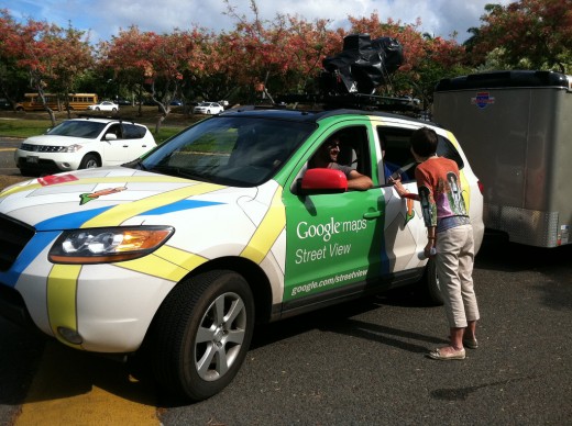
As Google Street View is a constantly evolving technology, the imagery made available through it was a product of Google-developed camera systems, which made use of CMOs sensors and electronic rolling shutter in lieu of an ordinary shutter.
There are basically four generations of cameras used in the expansion of the Street View technology. The earliest version in the array of cameras was referred to as R2 which had commercial wide-angled lenses and a ring of eight 11-megapixel sensors.
A later version, the R5 made use of a ring of eight 5-megapixel CMOS sensors with custom low-flare lenses and a fisheye lens that enables it to capture images on the upper levels of buildings. R7 is the current setup which is largely similar to the R5 except for the fisheye lens.
Apart from the camera technology, the global positioning system, inertial navigation sensor and wheel speed sensor have all been crucial in recording images for the Street View. Sick AG, a global manufacturer of sensors, provided the large range scanners that were used for recording the actual dimensions of the subject to be photographed.
Vehicles prove to be the most useful means of capturing images as data recording equipment are placed on them. UNESCO World Heritage Sites such as the Stonehenge for example, were photographed through the use of a tricycle, while a snowmobile was used to capture images of the sites for the 2010 Winter Olympics. For the interiors of establishments such as museums and narrow roads, a trolley was used while boats were instrumental for images captured of canals such as the one in Venice, Italy.
The Icon and the Mascot
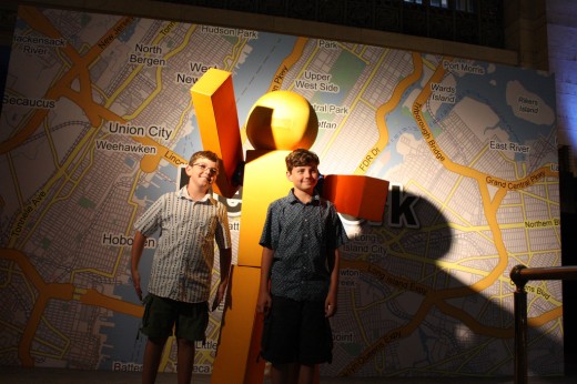
The Pegman which is the icon in using the Street View, is also its mascot.
This man has already made various appearances during Google’s special events alongside its peg friends in Google Maps.
The Pegman icon on the other hand, is just as helpful as he is funny. If a user would drag the Pegman in Street View near Area 51 for example, its appearance changes into a flying saucer. It would also change into Doc Brown, the famous character from Back to the Future when a user tries to access older views.
The Challenges
Street View is currently available as an integral part of Google Maps. It is also a mobile application for both Android and iOS.
It also has a JavaScript application programming interface, which is probably why the newer version is said to be slower than the older version.
Fortunately, Google has provided its users the option to switch to the older, faster version of Google Maps. Street View has its share of controversies as well.
It has found an enemy out of those who are staunch advocates of privacy in various countries. The face-blurring technology and privacy rights violations are two major issues being raised against the Street View.
In Switzerland and Japan for example, people have raised their concerns with regard to the height of the cameras used in gathering images for the technology. In countries like Germany and Australia, investigations were undertaken to determine whether legal actions can be taken against Google for this technology.
These privacy issues have somewhat limited Street View’s availability in some parts of the globe. In 2011, Street View discontinued taking pictures of the streets of Germany and India. A year prior to that, it also terminated its operations in Australia amidst investigations conducted by the local authorities.
In July 27, 2011 however, Google released updated images for Street View of Australian towns and cities, a clear indication that Google has already ironed out its issues with the Australian authorities.
The Borderless Reach
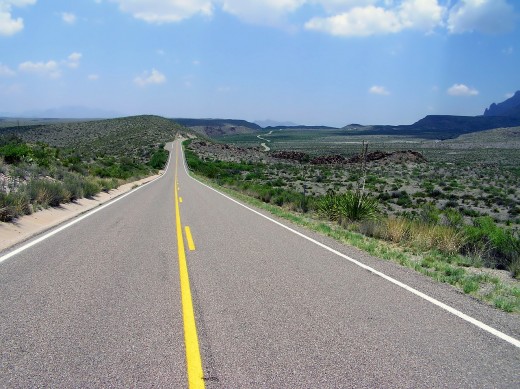
To this day, Google Street View is constantly growing worldwide, even reaching the remotest parts of the globe.
In June 2012, Google announced that it has already captured 20 petabytes of data, which includes photos spanning over 39 countries and approximately 3,000 cities, covering about 5 million miles of roads.
Its data includes panoramic views of remote locations, historical landmarks, natural wonders, underwater scenic spots and the highest to the lowest terrains the world over. However, it has limited to no coverage of some places in the Caribbean, as well as some parts of South and Central America.

