All Inclusive Guide to Understanding GPS with GPS Unit Reviews

The concept of forestry being used to sustain and maintain our forests has been around for 100 or so years in America and many more before that in Europe. However, in 1993 a major revolution occurred that affected the way in which foresters went about their work. 1993 was the year that the Global Positioning System (GPS) was put into full effect by the United States government. And while it would take several more years until it was widely used in forestry, the seeds were planted.
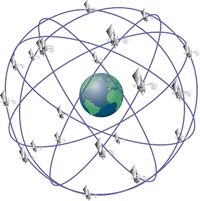
GPS is a space based satellite navigation system that allows anyone with a capable receiver to locate their position anywhere as long as they are on or near the earth. GPS works by triangulating your position. That is, as long as the receiver can pick up a signal from three of the 24 different satellites that orbit the earth, a computer is able to use the position of the satellites to triangulate your current location. If the receiver is able to pick up more than three satellites, then you are in luck as your position will be more accurate.
GPS systems fall under three different classifications; recreational grade, mapping or resource grade and survey grade.
Recreational Grade GPS Receivers
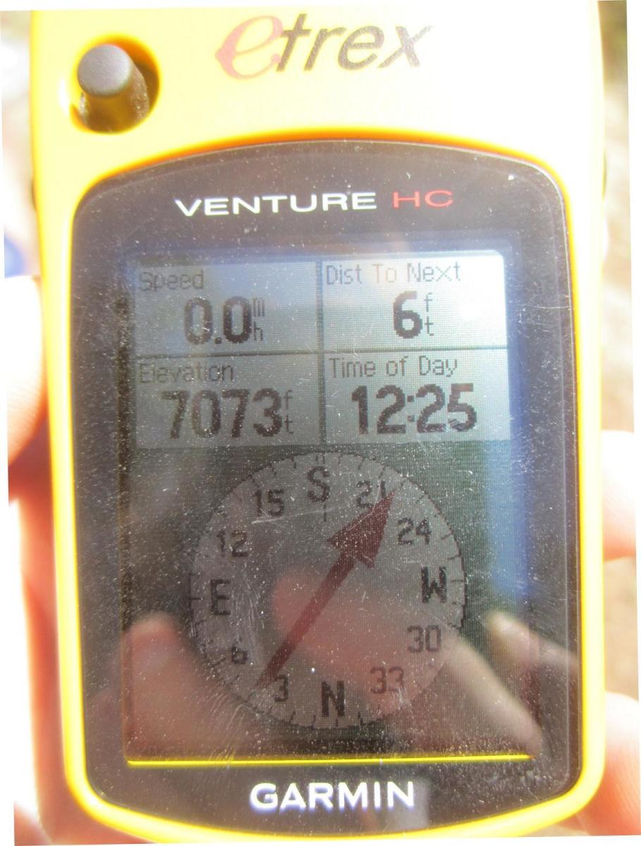
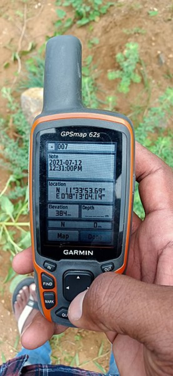
Recreational grade receivers are the cheapest and easiest to use. They usually cost fewer than 500 dollars. Now days it is common to find this type of GPS software in cell phones and other multi-use devices. However, the Department of Natural Resources and the Forest Service, for basic route planning and data collection, commonly use nicer models.
This type of receiver can be used to easily collect x-y coordinates of an area or to pre-plan routes. With an average accuracy of <15 meters they can be used to measure the area of a stand of trees with good enough accuracy or even to mark a point in a forest as long as it can be visualized once you get close. Some of the higher end units such as the Garmin 60CS and the eXplorist 710 series are differential correction capable (DGPS).
DGPS: This is a system that allows a ‘roving’ GPS unit to check the position it’s given with that of a stationary post. The underlying principle of the DGPS function is that two satellites that are geographically close will experience the same kind of atmospheric errors. DGPS requires that a stationary post be set up on the ground in a known, unchanging location. The data from the satellites is then compared with the data from the stationary point and applied to check and refine the rover accuracy.
Mapping or Resource Grade Receivers
Mapping or Resource grade receivers are the next step up. Typically, this type of receiver costs anywhere from 500-10,000 dollars. These receivers are required if you are going to be collecting data to be used with GIS software. This is also what the Forest Service and the Department of Natural Resources (DNR) uses for their data collection projects. Depending on the quality of your receiver, you can get anywhere from 15’ to under 4’’ of accuracy with one of these units. Also, units of this caliber always come equipped with differential correction capabilities (DGPS).
A Bit of GPS History
Until 2000 all civilian users of GPS software were subjected to the concept of Selective Availability (SA) by the U.S Department of Defense (DoD). The DoD introduced software that produced a random timing error between satellites and their base communication stations. This put in place in order to keep the best GPS signals available only to the military. However, a bill signed by president Bill Clinton in 1996 and put into place in 2000 eliminated this system entirely. Now DGPS is not necessary to have high accuracy but many users use it in order to increase their accuracy even more.
Several popular and free to use DGPS systems are Wide Area Augmentation System (WAAS) and the U.S. Coast Guard Maritime Differential GPS. The former of the two, WAAS, was set up by the Federal Aviation Administration in order to improve the accuracy of GPS in airplanes so that they could fly blind, in complete reliance on GPS, if necessary.
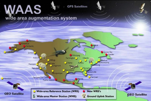
There are 37 WAAS stations set up around North America including in Alaska, Canada, Newfoundland and Mexico. These ground stations transmit the correction messages to three geosynchronous satellites (having a period of rotation synchronous with that of the earth's rotation) in orbit around the earth. These satellites also broadcast regular GPS data increasing the number of satellites available for a fix. WAAS makes horizontal data collection much more accurate but its main purpose was to increase the accuracy of vertical positioning. This way planes can even take off and land in sub-prime conditions.
Coast Guard Maritime DGPS
The Coast Guard DGPS system operates with one control station and 86 remote ground stations around the continent. The System provides service for coastal coverage of the continental U.S., the Great Lakes, Puerto Rico, portions of Alaska, Hawaii, and a greater part of the Mississippi River Basin. Many foreign nations are implementing standard DGPS services modeled after the U.S. Coast Guard's system to significantly enhance maritime safety in their critical waterways.
There are several ways that you can integrate DGPS into your data, in real time or with post-processing software. Both however, use the same data it is just at a different time that you integrate the corrections. As the name implies, real time corrections are those that are done right on your receiver as the information is coming in. This means that the only data logged and saved in the unit will be the corrected data. The receiver will get the signals from the normal satellites as well as from either a WAAS satellite or Coast Guard station. Then the data will be combined to create the corrected points
Another way that you can implement these corrections is with post-processing software. To do this you must first collect your points out in the field and then download them into a computer of some sort. This can either be done back at your home base on a stationary computer or using remote computers. Some of the higher end models of GPS receiver such as the Trimble GeoXT are compatible with handheld computers that can transfer the data directly from the device to an external computer while in the field. Then, software is used that collects information from the fixed ground points and makes the corrections leaving you with two sets of data; one that has been corrected and one that is not. By using DGPS, it is possible to get to sub-meter accuracy with any grade of receiver.
Survey Grade Receivers
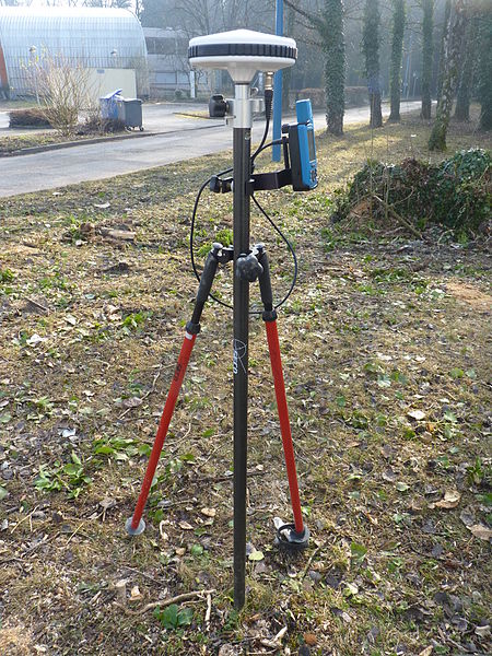
There is a third grade of receiver that is known as survey grade receivers. However these are often huge, heavy, expensive and simply way, way more than a forester would ever need. The cheapest of these units can start at around 20,000 and the sky’s the limit for how high they can go. This type of unit is one that an engineer would require when planning out roads or developments. They are always using real time correctional software and when paired with post processing software, can be used to get accuracy down to <1cm!
A receiver of this quality is not necessary or practical for anyone outside of the military or engineers or if you are just a boy (or girl) who loves expensive toys!
Recreational Grade...easy

My Personal Accounts and Reviews
The Garmin CS60
From my research I have found that one of the most popular and inexpensive GPS receivers is the Garmin CS60 recreational grade receiver. I have used these extensively for forestry projects and they seem to be the go to for basic GPS in that field.
This unit is pretty cheap as far as GPS goes costing right around 400$. They are also small enough to fit easily in ones pocket and weighs in at just under 8 ounces. They are also waterproof to IEC 60529 IPX7 standards, which means that they are able to be submerged in one meter of water for up to 30 minutes with out sustaining damage. This unit also comes complete with an easy to read large color display. Up to 10,000 track points can be stored in the unit at one time, which is plenty of points for an outing in the field. It is capable of receiving WAAS information making this a great choice for anyone looking for a simple, easy to use unit without shelling out big bucks.
One shortcoming of this unit is that it only has 56 MB of internal memory capability. It is possible to upgrade this but it will cost more money so if you know that this is something that you will eventually be upgrading, I would recommend getting a different unit.
Magellan eXplorist 710
Something like the Magellan eXplorist 710 would be another great choice. It has up to 8 GB of internal storage, which is a big step up from the 56 MB of the Garmin. It also has a slot to accept a microSD card that can be used to make the memory really as large as you need. The eXplorist 710 weighs only 6.5 ounces making it a little bit lighter than the Garmin but really…in the field, chances are you will not notice the difference of a couple of ounces. WAAS compatible as well as compatible with many different post processing, DGPS software.
One set back of this unit that I have read about this unit compared to others is that it tends to have a shorter battery life. This could be because of the larger, full color screen but even when fully charged this unit claims to only last up to 16 hours…so we can predict that when in use it will only last for 6 hours at best and that’s only on the first charge. Of course, as it seems with all new electronics, the battery life is the first thing to go the more times you charge it up. It also costs a little bit more at 500$ but comes with a built in camera and microphone for those of you who like extra gadgets.
All in all, both of these units are perfect for foresters or just outdoorsmen in general. They are both compatible with GIS and very reasonably priced.
Resource Mapping Grade
Trimble GeoXT
If you feel the need to get a little more intense with your GPS units then you will have to step up the price game substantially. The most popular mapping/resource grade unit that I found in my research is the Trimble GeoXT. These babies are a little confusing to get used to because of all the functions and buttons they have but they do their job exceptionally well.
There are several different additions to this unit but the cost, new, is somewhere between 1500-5000$. However, you definitely get what you pay for. When combined with WAAS and several Trimble made post processing software’s, you can get accuracy down to <50cm. This unit is a combination receiver and handheld computer which means that the about of data it can hold and the things besides GPS you can do on it are immense. You can take pictures with the built in 5-megapixel camera and access the Internet wirelessly using the included windows 6 mobile operating system. Im pretty sure some of the newer ones have bluetooth and can even play music.
This machine is definite overkill for those who just want to be able to find themselves in the backcountry, but if you have extra money to play and like cool toys, it doesn't get much cooler than this.
Conclusion
In our quest to describe, classify and understand our world, GPS technology has been making things possible since it’s inception in 1993. It has aided science in almost every way including but definitely not limited to aviation/boating/driving advances, environmental data collection, military/civilian intelligence, outdoor safety and cartography. However, it is important to note that this data means nothing until it is observed and put to use by human beings. What ever your reason for wanting a GPS unit, don't forget to have fun with life!!
More Sources and References
- http://www.proaxis.com/~johnbell/guest/GPS_Canopy_Tests.pdf
An epic review of GPS units and their viability of use for forestry data collection - USDA Forest Service Global Positioning System: Home Page
Technology and development information from the USDA Forest Service. - Navigation Programs - WAAS - How It Works
The Federal Aviation Administration is responsible for the safety of civil aviation. - 1-Differential GPS Explained
An easy to understand article about Differential GPS and its capabilities


