GeoTag Digital Photos with GPS Accuracy
You may have already taken your first steps into the world of GPS technology. Garmin, TomTom and Magellan are just three of the major GPS industry players that most of us are aware of. But, have you ever considered using GPS technology for your digital photos? That's right, GPS for your digital photos!
Geotagging is the technology of inserting latitude and longitude data into your data file. Why would you want to do that? With Geotagging information your digital photo can be matched up to a map such as Google Earth which will then display exactly where the photo was taken. Photo sharing sites such as Flickr lets you post your photos and when the viewer clicks "map" on the menu bar dots show up to notate where that particular photo was taken.
These little gadgets really interest me. I admit that at first I had a difficult time getting my mind wrapped around how they work. Most everything I read about several different models is that they work their magic simply by correctly setting the time of day on both the camera and in the geo unit itself. Once the time is in synch the digital photos match up with the time you were at any particular location. Both photos and the geo tag information are loaded into the provided software program and then the two are married. Photos can be viewed from a map perspective that shows exactly where the photo was taken. Google Earth appears to work very well with these gadgets.
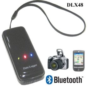
Ecom North DLX48 3-in-1 GPS for Navigation Bluetooth Receiver, Photo Shooting/Photo Tagger (Flikr, Google Earth) and Data Logger/Travel Tracker Tracking is very versatile. It uses a rechargeable battery - but I'd just have to learn to work with it. I always have my laptop with me so I could steal some power if need be. The included USB cable can be supplying power while the unit is tracking. This unit is a 3-in-1 device. As a GPS receiver this unit works well with a cell phone, a PDA or laptop that is Bluetooth enabled and loaded with mapping software. It works as a photo tracking GPS device and it will map your movements along a route.
The Ecom North DLX48 works with Windows as well as Mac.
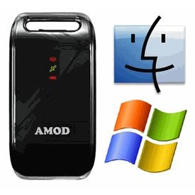
Amod AGL3080 GPS Data Logger (SiRF III, Driverless, 128MB, Push to Log) Windows and Mac Image Software Included. This one really gets my attention. It requires no drivers and when plugged into a USB port it appears as an external drive. It also doubles as a USB flash drive. It requires 3 AAA batteries which is a bit more cumbersome but definitely not a deal breaker.
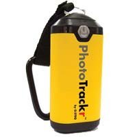
GiSTEQ Digital Photo Trackr Lite runs on one AA battery. I think that this is good because AA batteries are easy to come by and can be pulled out anytime and anywhere - No electrical outlet needed.
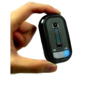
GiSTEQ Photo Trackr (CD110BT) - Bluetooth Version has voice cue (allows you to turn on or off) and an integrated speaker. I like this feature because it gets your attention incase the unit is not ready or if there is a problem with the GPS tracking. To save power the Bluetooth feature can be turned off. Vibration sensor helps to manage the power resources. Compared to the other units listed in this hub this one appears to have the longest life per charge. Google Earth is supported.
These are just a few of the GPS Geotagging units on the market. Each one has good points and bad points. Even though this is not a new technology I think that many people have not even heard it. It does not help that there are so many names such as Geotracker, Geotagger, Geo Tracker, Geo Tagging - and so on.
I really want one of these gadgets and I will update this hub when I get one. I am leaning towards the Ecom North DLX48.


