30. Australian Road Trip: Cyclone Larry
Eye of the Storm
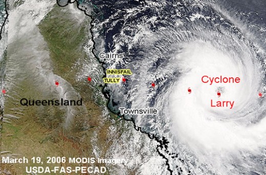
Hello Larry, Welcome to Queensland
Cyclone Larry is brewing somewhere off the coast of Far North Queensland. It has been upgraded by the Met Office to a category four and is moving west at a speed of 25kmh. It is predicted to make landfall at about 08.00 somewhere between Cape Tribulation and Townsville. It has a diameter of over 250 km and has the potential to cause mass destruction along its path.
Mt Garnet on The Savannah Way (Kennedy Hwy)
Mt Garnet: a small mining town on the Kennedy Hwy (Savannah Way), a 3 hour drive west of Cairns and 600 kms east of the next main town, Normanton.
The Savannah Way
Mt Garnet Sunday 19 March 2006. 5.00 p.m.
We are sitting in our mobile home in a campground in a one-pub town called Mount Garnet, 130km due west from the coast. We pray that we’ve come far enough inland to avoid the worst of the impending storm, but at this stage, no one knows where it will make landfall, so all we can do is sit and wait.
Mount Garnet is at the edge of the outback. It’s one of only a few small communities along an overland route called the ‘Savannah Way’, a seemingly endless strip of potholed asphalt that crosses the vast, wild land below Cape York. We had always intended to travel along this stretch of road, at least as far as the town of Karumba on the Gulf of Carpentaria coast, over 700 km further west. Me and Karumba were first introduced in 1982 when I worked for a short while on a prawn trawler in the Gulf. It was a crazy little outback town back then and a return visit to check it out was always going to be part of this journey. I never thought for one minute however, that a Category Four cyclone would have any influence on us actually getting there.
So here we are, late in the afternoon in Mount Garnet. One thing we will remember Mount Garnet for, aside from the imminent cyclone, is the insects – walking ants, flying ants, moths, beetles and large stick insects clog the atmosphere and crawl over everything. Big cane toads and charmless baby ones hop about in the short dry grass, daring not to stop for too long as the ants would soon overwhelm them and eat them alive. It’s very, very hot too, stifling. The caretaker of the campground reckons the insects are worse than usual because the approaching cyclone is creating some kind of atmospheric air pressure that draws them out of their holes. Phew!
The B-Movie, sci-fi, apocalyptic disaster flick
Earlier in the day…
On our journey here from Cape Tribulation, we stopped at a café in Mareeba. The broad main street of the normally bustling cattle town was eerily deserted. It felt like a scene out of a 1950s Sci-Fi B-movie, an apocalyptic thriller. Whirls of dust eddied down the broad main street. Pennants and flags hanging over the various used car yards fluttered dissolutely in the hot dry wind while the broiling sun itself hid behind a thin layer of dust and high cirrus. There is something in the air. The café was the only place open that we could see and as we had been driving for several hours to get this far, a good leg-stretch and a flat white coffee sounded like a bloody good idea.
Early that morning the dude at the Cape Tribulation campground reiterated his advice that all tourists should leave the Cape Trib region post haste as Cyclone Larry had turned west overnight and was aiming for a Daintree landfall. We struck camp and Geoff and Oliver followed us back down the road to the Daintree ferry. I expected to see a mass evacuation taking place but the traffic was light, mainly due to the fact that there weren’t that many people up here in the first place. Once over the river we parted company with Geoff for the last time at the little town of Mossman. He headed home to Machan’s Beach to batten down the hatches and we headed up the long mountain road to Mt. Malloy then on the Mareeba.
The proprietor of the Café came and joined us at our pavement table. He told us that he'd heard there is an element of panic in Cairns with people frantically stocking up on food and petrol. If Larry hits the city at its predicted strength… think Darwin 1974 or New Orleans 2005 - anything is possible! After fleeing Cape Tribulation this morning, our sole purpose has been to find a safe place to ride out the Cyclone, when and if it hits land. Mareeba is one possibility. The café guy, however, hints that perhaps we should go further inland, just in case. It makes sense. We are living in a mobile home - a flimsy aluminium box bolted to the back of a small van. We will not survive cyclonic winds in a flat, open place like Mareeba. There is nowhere to hide.
We found a nearby IGA supermarket that was still open and stocked up with bottled water and assorted supplies and then headed south toward the next town, Atherton.
Driving is compulsive and once you get started it is difficult to stop. The Tablelands are a beautiful agricultural region - rolling hills, farms nuturing exotic fruits and vegetables, cattle grazing, distant mountains, coffee plantations. We could easily spend time here but the cyclone is dictating what we do now.
We drive into picturesque Atherton township and think seriously about stopping here to weather the storm, but we are mysteriously driven to cruise right on through. What the hell, we decide to keep going as far west as we can while we still have a few hours of daylight. We travel at a top speed of 80kmh. That is it – 50 miles per hour, and on uphill bits we go much slower. Every mile we cover is a great achievement for us. Our vehicle may as well be a horse and cart. Beyond Atherton there is the town of Ravenshoe and beyond that there is only one road that heads west into the outback, the Savannah Way.
Out of the billycan...
The Savannah Way is billed as one of Australia’s great driving routes. In all, it stretches over 3600kms from Cairns on the east coast to Broome in Western Australia, crossing some of the world’s most inhospitable and rugged countryside. It is, under any circumstances, a daunting and adventurous undertaking; with a category four cyclone on our tail we feel like we are jumping out of the billycan and into the barbie. As the daylight melts away into a watery, late afternoon twilight, we reach a high point on the road before descending into the vast savannah country that covers much of Australia at these latitudes. Looking east over the Tablelands behind us we can see mountainous black clouds massing out to sea.
Ravenshoe is the highest town in Queensland and as we descend into the vacant regions beyond, with the vast Bush lurking menacingly on either side of the strangely narrow road, we sense that we are at last entering the fabled Outback. Our road map is devoid of features other than the thin red line that we are driving on. It is a road with several names - Highway 1, The Kennedy Highway and The Gulf Developmental Road, but the complete, trans-continental route is called The Savannah Way. Mt. Garnet, about 50kms beyond Ravenshoe, is the last town on the map that we can reach before darkness descends.
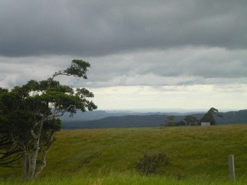
Savannah Way vistas
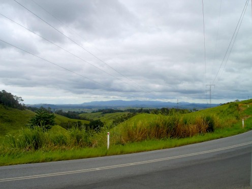
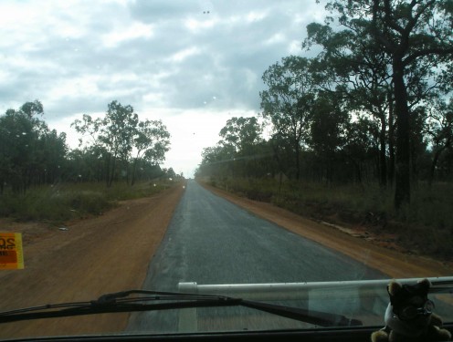
Down goes a blood red sun
Mt Garnet: Sunday 19 March 2006
10.30 p.m.
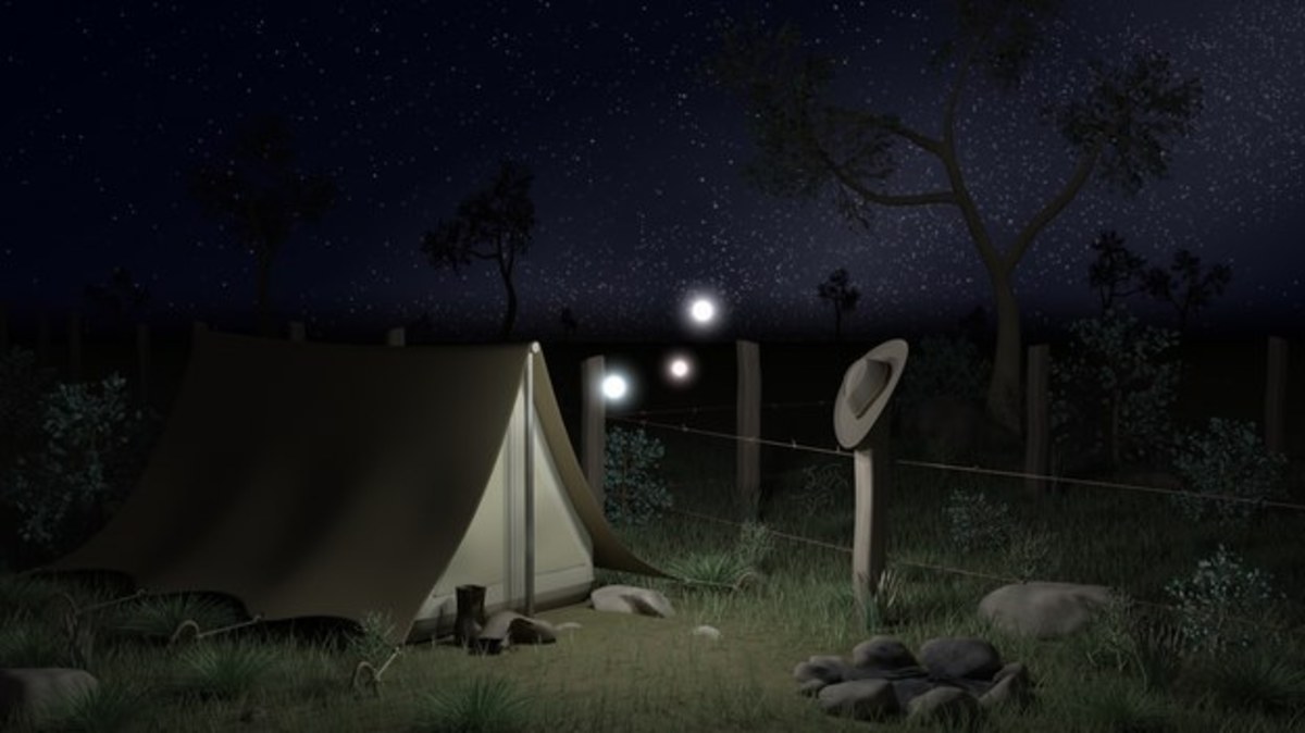
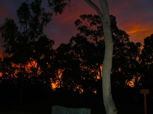
For Sheila, as an Englishwoman in the outback, this might be the ultimate nightmare – extreme heat, extreme insects and an extreme cyclone in the offing. As for me, I am seriously shitting myself while remaining outwardly calm. It’s the waiting that is hardest. Before we turn in for the night, we pack everything away and make sure our bikes and my surfboard are securely lashed to the van. We unplug the power and turn off the gas. Darkness descends after a blood-curdling sunset which silhouettes the stringy barks and acacias that stand motionless about the campground. The waiting continues as we prepare for bed.
It’s 10.35pm and the rain has started. A breeze has developed and the insects have disappeared. Is this the beginning?
Blood in the sky
Storm watch
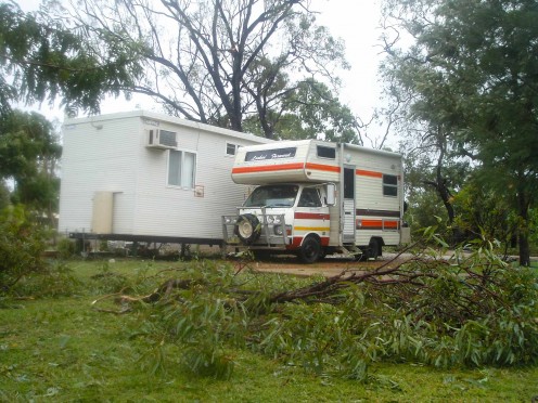
Life behind the donga
Written on the road: Mt Garnet, Monday 20 March 2006
10.40 a.m.
I HAVE TO SHOUT TO BE HEARD ABOVE THE NOISE. CYCLONE LARRY HAS BEEN BATTERING US SINCE 7.00 AM!
I woke up after a fitful, dream-addled sleep at 4.00am and turned on the car radio. Spent ages trying to find a station that wasn’t crackling and chopped with static. In between gaps in the high frequency squelches I learn that the cyclone, upgraded to a Category Five, has finally made landfall almost exactly due east of us at the town of Innisfail. The announcer says that the area resembles Darwin after Cyclone Tracy. It has been declared a disaster zone. Cairns is battered; power out all over the tablelands; Atherton badly hit too. The massive storm continues to head west at the painfully slow speed of 25km per hour, following the valleys that lead up to Ravenshoe. F#*k!
The first gusts of wind and lashings of rain bring down small branches around the Mt Garnet campground at exactly 7.00am. Our Winnebago is already shaking, and I look out the window and see a large branch come down on a caravan parked 50 metres from us. The couple inside emerge and the man begins wrestling with the limb. I force open our door, against the strengthening wind and Sheila’s protestations, and run across the open field to lend him a hand in dragging it away. There are now sticks and leaves and bits of light debris flying all about. The larger trees are beginning to thrash and bend.
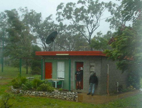
The caretaker comes over to our site, straining against the wind, his hand holding down his hat and his raincoat flying behind him like a super hero’s cloak. Shouting against the racket, he advises us to quickly move to a better site that is sheltered by a metal cabin bolted to a concrete slab. Time is running out, and the cyclone is almost upon us as we repark in the relative shelter of the steel hut (called a donga).
It’s here that we are watching the drama unfold. Huge trees split, crack and topple to the ground, one crashes onto a shed near us. The Owner’s carport blows away and all about there are trees down, branches lying about and debris filling the air. The gusts of wind are phenomenal. Over 240kmh recorded at Innisfail, according to the earlier radio report.
Nature 1, man 0
Cyclone Larry, The Movie. Warning: This film contains strong wind, one F-word and two wows!
Mt Garnet 20 Monday March 2006
11.40 a.m.
We’ve lost electricity and there are no more radio signals or cellphone coverage . The wind SCREAMS like a living creature in agony. Just as you think a gust of wind can blow no harder, it defies logic and BLASTS like a nuclear sneeze.
Large trees in the distance are bent at right angles and are then whipped back with a crack as the enormous gusts suck and blow the air. An unholy sound echoes behind the wailing winds - the snapping and cracking of tree branches in the bush beyond the campground, like staccato gunshots, machine gun fire; It is a frightening sound.
Strangely, we feel relatively safe and secure, despite the deadly tempest outside. The metal cabin, known colloquially as a “donga”, is the ideal cyclone shelter. The wind, the debris and the raindrops like bullets, are absorbed against the shed rather than Winnie. I’m able to stand by our door with a cup of tea in hand and watch the cataclysm take place outside like I’m watching telly. Sheila is reading! She is actually reading and it is good that she can hide in her book. I think “Make us another cuppa will you please Sheila, I’m busy watching a Catagory 5 cyclone tear the place to shreads.”
There is a breeze block building containing a toilet about 20 metres away from us. Sheila eventually and inevitably must use it. In a 10 second lull between gusts, she runs across the branch-strewn space to the building and goes inside. At that moment, a HUGE gust howls and swirls and there is a deafening crack as a gum tree thirty feet away snaps and crashes to the ground with a dead-weighted thump. Sheila pokes her head out the door and I yell at her to wait, to be careful, to check for flying debris and falling trees. She can’t hear a word I’m saying but scampers over the piles of fallen branches, back to the relative safety of Winnie.
Mt Garnet, Monday 20 March 2006
2.00 pm
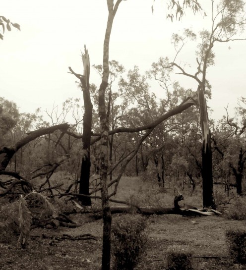
By 1.00pm the tempest finally passes, as it arrived, in a deluge of rain. As the sky clears people emerge from their shelters to survey the damage. Amazingly, there is only moderate destruction around here. Two huge trees have toppled onto one of the brand new shower blocks, twisting the metal eves and guttering but sparing the breeze block structure itself. Some carports and old sheds have been flattened and anything flimsy, like tents and tarps are gone. There is nowhere in the park that isn’t strewn with trees and branches. The landscape resembles a First World War battlefield – stark tree trunks, splintered, leafless and broken.
Each person we speak to has a different estimation of the force of the wind; I average it out at 180kmh with guts of over 200kmh. Who knows? The thing is, we survived Cyclone Larry intact, and spend the rest of the day and that night thinking about the power of nature in a pocket of civilisation now devoid of any power. We also think about Geoff’s house in Machan’s Beach - it would be very vulnerable, as would Mike and Ruth’s lovely tropical garden and house in Kuranda. The caretaker says it’s the worst cyclone to hit Mount Garnet in 30 years. It isn’t easy to find out anything in the immediate aftermath of the disaster. All phone lines are down; there is still no cell phone coverage and apparently the roads are blocked by fallen trees and flooded creeks all the way back to the coast; there is no electricity at all in Mount Garnet. In the absolute blackness of the night a multitude of stars appear above us.
Are we mad?
The morning arrives with warmth and a weak sun that soon forces its way through the high cloud cover to remind us that it is bloody hot in this part of the world, post-hurricane. We strike camp and drive into town, stopping at the Police station to enquire about the roads. We find out from the officer that Innisfail has been devastated, but as there is no electricity, and the roads back to the Atherton Tablelands are completely blocked, any news received is third hand via erratic radio reports or hearsay. Even the police officer is in the dark. The power is gone for at least a week and for us, the only way forward is to follow our original, intended route – across the Savannah Way to Normanton and Karumba. We must now make a decision. Do we stay here in Mount Garnet until we can make a better assessment of the situation or do we press on, into the outback where we could face equally treacherous road conditions and where there is little in the way of civilisation once we leave here. The Police officer can’t advise us. No vehicles have come through Mount Garnet from the west this morning so he doesn’t know what the road is like. We decide to take the chance and head west. Yes, we are mad.

