39. Australia Road Trip: Crossing the Kimberley - An Aussie Space Odyssey.
The Kimberley
Katherine - the Northern territory crossroads - go north, go south or go west!
Kununarra, Western Australia - across an entire time zone
Halls Creek - a Tidy Town described as "Feral and hostile".
Fitzroy Crossing - a bloody long way from anywhere else
Broome, Western Australia - if you had to choose a port in the storm then Broome would be it. A Pearly jewel on the Indian Ocean
Blast off Into the vast unknown
We leave Katherine at dawn and by 8.00am we are too far down the highway to turn back - we are committed to the Road Trip once again. Leaving the familiar surroundings of Katherine is like casting off from the last port before crossing an ocean, and without looking at the map, we can almost smell the Indian Ocean, only 1600kms down the road. But those 1600kms cross what was, until recently, Australia’s last frontier, the fabled Kimberley region. If truth be told the Kimberley is still the last frontier, especially for us in our slow-moving, increasingly unreliable truck. We shall not, cannot, rush the crossing to Broome, but sensibly, we know we are facing at least three full days of all-day driving to make it across the void. At the very least, we would like to make it between towns or roadhouses before dark each day, and there aren’t many of either on this long lonely highway.
For the first 125kms of the Victoria Highway, we could be anywhere on roads we have previously travelled. The narrow blacktop rises relentlessly ahead of us, the landscape featureless except for mulga scrub, termite mounds and mucky creeks that border and enclose the asphalt strip like the walls of a bush tomb, claustrophic and fearsome. Then it changes.
Red Ramparts
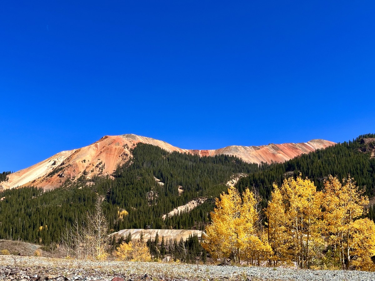
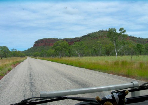
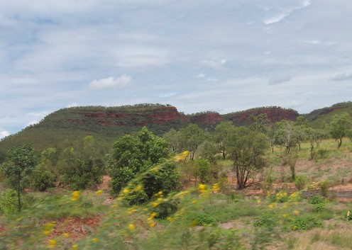
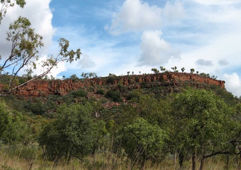
The road develops broad sweeping bends, the scrub opens up and in the distance, rugged hills appear above the low tree-line. Escarpments crown the hilltops - long red ridges like crusader castles on Arabian mountaintops. Sheer red cliffs skirt the road and glimpses are offered of canyons and gorges. Then, after about 175kms, we come to Victoria River Crossing - a narrow bridge across a broad, muddy river. Beached driftwood and shreaded vegetation hanging from branches show how high the river rose in the floods of just a week or so ago. At the dusty carpark of the Victoria River Roadhouse, hundreds of white, cockatoo–like carellas, dirty with the local red dust, squawk and chatter in the trees. Travellers pull in intermittently while we eat our bacon and egg sandwiches on the porch. After brunch, it’s on the road again. The red escarpments, sometimes close to the road, and sometimes distant, are comforting ramparts after the endless miles of scrub that we’ve become accustomed to.
The road is plastered with dead cane toads. I’ve never seen it so bad. Most are squashed pancake flat - an oily black blot on the asphalt - but many are petrified in what looks like mid-hop. They have obviously been nicked by vehicles, fatally injured and their bodies dried and fried by the relentless sun into grotesque but humorous ‘death-leaps’. They line the edge of the road like a 3D cartoon strip. Let me tell you - there is something about dead cane toads that makes people laugh. In Queensland, they tan their hides and turn them into novelty purses or stubby holders and they even stuff them and dress them up in various costumes ranging from the historical to the hysterical.
Speaking of road-kill, we sweep around a broad bend and see a large black and tan lump in the middle of the road ahead. It’s a Brahmin bull that has been hit by a road train, and its bloated carcass is definitely the largest chunk of road-kill I have ever seen. It shimmers in the road mirage and as we veer around it, we see it is bristling in a coat of flies; its pong seems to follow us for miles.
Keep your eyes on the road and your hands upon the wheel
We're going to the roadhouse / gonna have a real / goodtime. Roadhouse Blues, The Doors.
The Aussie Roadhouse is far more than a place to have a drink and a good time. It is often the only facility for hundreds of kilometres, where you can fill up with fuel, buy food or camp overnight secure in the company of other travellers. The further west you go, the less frequent and more important are the Roadhouses. Our first proper outback roadhouse stop was The Burke & Wills in Queensland (sandwich stop and petrol). Then there was the Barkly Homestead in the Northern Territory (Bacon and egg sandwich, coffee, petrol and dead locust removal). There are a couple on the highway north between Tennant Creek and Katherine, but we stopped overnight at the querky Daly Waters Roadhouse and Pub (beer and feral butcher birds).
West from Katherine there is the Victoria River Roadhouse, Timber Creek, Turkey Creek and just outside of Broome, the Roebuck Plains Roadhouse. Considering the immense distances down the west coast of Australia, there are remarkably few roadhouses and even fewer towns. Consider stopping and filling up in all of them - it's a welcome break from the endless highway.
Roadhouse Blues
Timber Creek - more a Roadhouse with a wildwest town tacked onto it than a town with a roadhouse, is about 100kms beyond Victoria Crossing and over 280kms from Katherine. Maybe we’ve been cooped up in Winnie for too long but there’s a lawless feel to the place as we pull up to the pumps. There’s a fair number of Aboriginal people, some slaughtered, and others just shouty, wandering about the place with no apparent aim; and though there is no threat, we are not anxious to stick around any longer than it takes to top up and maybe brave the dunnies out back. To add to the High Noon atmosphere, a little whirlwind of Aussie dust, called a willy willy* (from the Aboriginal: willi willi), dances down the dirt frontage road and in amongst the wandering souls, rendering them ghost-like in the swirling haze.
* In Western Australia a willy willy and similar cyclonic winds are referred to as a ‘Cock-eyed Bob’.
Perhaps I’m being unfair to Timber Creek as we barely stay long enough to make any judgements or experience any awkward moments; we just fill the tank, pay and bugger off, checking in the mirror that we haven’t been followed. Just out of Timber Creek we trace the course of the spectacular Victoria River for many miles along a high road that looks down on the river valley. Then the road veers away from the river and cuts, shimmering like a blade in the midday sun, through a landscape of harsh dry scrub. It’s harsh dry scrub, and more harsh dry scrub for quite a while until, eureka! - we reach the border with Western Australia. It's afternoon tea-time. There is a border crossing about 80kms out from Kununarra. It is primarily a Quarantine station where we must hand over our fruit, veg and honey. The lone officer then uses a convex mirror on wheels to check under our rig, not for bombs, drugs or illegal immigrants. But, you guessed it – he’s checking for toads.
Like a Sci-fi B-movie the lone border guard fights a deadly battle against the relentless advance of the invading Cane Toad hoards whose conquest has yet to reach Western Australia. Sheila and I had remarked about 120kms back that the Toad-Road-Kill Count had dwindled to none. Meanwhile, The War against the Toad continues. The Toad must be stopped. Exterminate.
Kununarra - gateway to the west


The Time Travellers and the Battle of Kununarra
Once over the border, the highway skirts the shores of Lake Argyll, the largest man made reservoir in the world. The town of Kununarra was built to service the Ord River irrigation scheme for which the vast lake was created in the 1960s. After a long 508 kms, pleasant looking Kununurra greets us. It is a modern “Tidytown” on the shores of Lake Kununarra, and is surrounded by striking rock formations and distant tabletop mountains.
When we stop at the IGA we realise we have crossed a bloody time zone! It’s no longer 5.30pm, it’s only three o’clock. “It gets dark early here”, we are told by the lady at the checkout. We have literally gone back in time. Or have we?
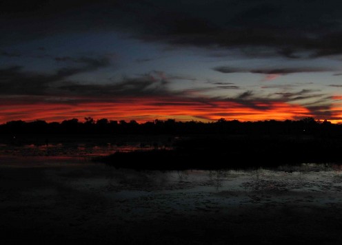
We find a campground just out of town on the lake shore. It is a nice spot with a broad view across the water toward a distant rocky escarpment. The sunset that unfolds across the expanse of water is otherworldly. But in the first minutes of nightfall, in the stifling heat, we are attacked by an unimaginable insect plague. First we are driven inside by sandflies and mozzies. Later, when I open the door to go to the toilet, an unusual bright red dragon fly and a large, shiny black jumping jack whip inside and start bouncing off the walls, ceiling, windows, and our heads... a squadron of moths and a battalion of small beetles the size of lady birds have somehow infiltrated our force fields too and are dropping from the ceiling into our hair. Our sandalwood and citronella anti-insect sticks keep the mozzies and sandflies at bay and the citronella candle is luring the moths to their doom in the hot wax, but not even a liberal coating of Aerogard® can stop the beetles, the jumping jack and the dragon fly. Only death will suffice.
Much later in the night, well after lights out, and the insects that we haven’t killed have retreated to lick their wounds, we go outside to cool down and are greeted by a vivid meteor shower in the star studded sky above. It’s Astronomical!
One good thing we bought in Katherine is a new, larger, oscillating fan – christened Big Fanny! Now, both fans are working overtime to stir the breathlessly hot, sticky air. We have taken to sleeping separately during these furnace-hot nights. Sheila has little fanny up in the upper stateroom (not as grand or as kinky as it sounds) and I take the bed in the living area, but with the luxury of big fanny.
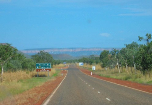
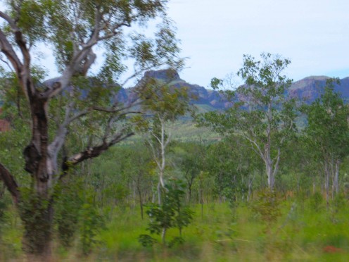
We are up early for a good start, greeted by a sunrise over the lake that promises a fine day. The morning air is fresh and invigorating, but we know it won't last. Straight out of town the vistas are inspiring: the escarpments follow the contours of tabletop mountains across the field of our vision. The road climbs small hills, and crosses creeks and rivers that are beginning to dry up with the end of the Wet. We turn left at the junction with the Great Northern Highway. The Victoria Highway continues to the port of Wyndham about 60kms north. Near this junction is the start, or the end, of the Gibb River Road, a reknowned 4x4 road through the heart of the Kimberley. I’d love to drive it, but not today, not in Winnie.
Lunar surfaces
Turkey Creek, Wolf Creek and the Nmungan Cliffs
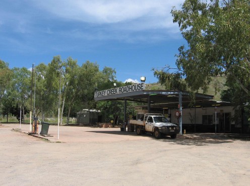
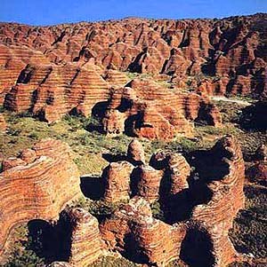
Turkey Creek is a roadhouse in the middle of this landscape; a single shop, tavern and fuel stop that services travellers and a nearby Aboriginal community. Unlike Timber Creek, It is a calm and peaceful place, almost uninhabited except for the girl in the shop and a couple of locals chilling under a tree. It is also a gateway to the alien mandscape known as the Bungle Bungles. We can’t drive there even if we wanted to, as the long rough road out to it is flooded. Out of Turkey Creek one vehicle overtakes us, and that is all we see of other humans for the next 200kms, until the early afternoon, when we roll into the desert town of Halls Creek. It looks OK, like any other Tidytown, but Halls Creek has been prominent in the news of late, and not for its outback charm and desert ambience. It’s been called “feral and hostile”, and has one of the largest unemployment ratios in the country. A scandal of alcohol, drugs and child abuse amongst indigenous males has caused the whole nation to sit up and take a deeper look at the plight of the Aboriginals. We are kind of driven now, and even feral towns can’t keep us out of the air-conditioned Tourist centre, where we get some hot chips and a half litre of ice coffee each. Oh yea, and fill our empty petrol tank.
Now we must begin the last leg of this second day of driving, all the way to Fitzroy Crossing, another 290kms on from Halls Creek. There are no roadhouses, no roadside anything between here and Fitzroy Crossing so we must reach it by nightfall. We could easily a pull off on the side of the road for the night, but this is wild country and we are feeling extremely vulnerable with our slow-moving, increasingly unreliable vehicle. And that distance will drain our petrol tank down to the rust flakes at the bottom. Our 20 litre jerrycan of petrol is a now a necessity rather than an accessory. Once we are halfway there is no turning back. I feel wired to the road.
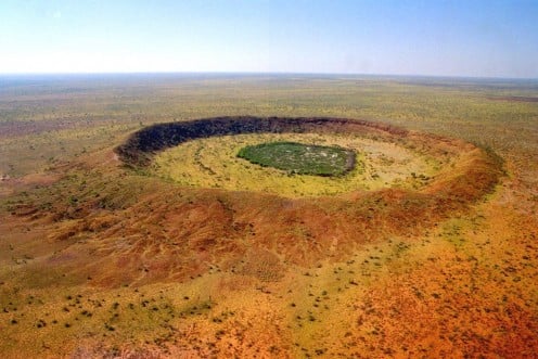
Only a few miles out of Halls Creek and We pass the Wolfe Creek turn-off. For those who haven’t seen the movie of the same name, Wolfe Creek is a huge crater in the desert, formed by a meteor strike zillions of years ago. The Wolfe Creek road is actually part of the Tanami Track and it is an alternative adventure route to Alice Springs, over 1000 red dirt kilometres away, with only the remote, Rabbit Flat Roadhouse in between.
The landscape changes yet again after Hall Creek. The highway passes through a dry, desertland, flat, vast and hot. That’s the Great Sandy Desert to the left, desert wilderness as far as the mind can imagine. Infinite it may as well be.
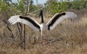
A Jabiru strides nonchalantly across the highway. We slow down for the large stork-like bird until it stretches up and rises from the road like a mythical creature morphing out of the white line and the blacktop. As it rises in front of us we can see that its wingspan, with characteristic black and white markings is over two metres wide. It soars over the low roadside bush and lands in the distant scrub, out of harms way. Sometime in the timeless afternoon, the Nmungan Cliffs appear out of nowhere. One minute we are in flat, straight-road, no-bumps territory and then suddenly we are at the top of these orange cliffs that form the edge of a vast plateau that looks out over another infinite wilderness. The road descends steeply through a gap in the escarpment, and takes us down to an immense wooded floodplain, that stretches to haze in the hot western sun. This is the last stretch to Fitzroy Crossing.
We reach the crossing just before nightfall. It looks like an unmanageable sort of town, stretched out as it is on either side of the Highway, with buildings dotted about in the darkening bush. There are many natives fishing along the debris strewn banks of the muddy river, and a quick stop at the shop to buy tobacco convinces us that a night on the town would be too challenging for us in our state of advanced overdrive. Instead, we spend another insecty, but relaxed night at the rather smart, and very popular Lodge Resort and Caravan Park on the banks of the mighty Fitzroy River. This place is built for travellers like us who want a relaxing place to stay after the long adventurous drive that it takes to get here, from any direction. I can taste the salty Broome air in my fancy as the hot night draws in around us.
The last stretch...
the Lure of the Pearly Gates
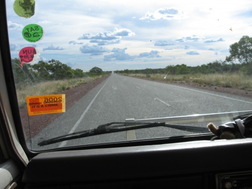
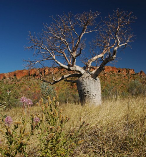
We are on the road again at the break of dawn. Only 450kms to go – it looks like nothing on the map. The road is long and dead straight for so many kilometres that we imagine that we might be driving in a huge circle, so monotonous is the landscape. But later, the boring roadside scrub is punctuated by amazing Boab trees. These strange ‘tree-creatures’ resemble pregnant women raising their arms toward the sky, if you squint. They are beautiful and bizarre and we love them as much as you can love a tree.
After 250kms we reach the turn off to the port town of Derby, 45kms away on the King Sound, but all we really want to do now is reach this place called Broome by noon. The final 25 clicks from the Roebuck Plains Roadhouse to Broome is as drab and featureless as any road we’ve driven on so far, but then the ubiquitous roadside signs appear advertising the services of mechanics, hotels, caravan parks, tattoo parlours and pearl shops. Tin roofed bungalows begin to grow out of the scrub and then, in the distance, across a salty tidal plain, we see the pearly white buildings of Broome glistening in the midday sun.
The Ultimate Kimberley tearjerker
A few fact about the Kimberley region of Western Australia.
Source: www.kimberleyaustralia.com/
Size
The Kimberley in Western Australia covers an area of 424,517 km2(163,907 sq miles). Here is a size comparison...
- for Australians - a sixth of all of Western Australia, or twice the size of Victoria
- for Europeans - three times the size of England, and larger than Germany
- for Americans - comparable to California
- for Asians - 15% larger than Japan
And now consider this: there is exactly one sealed road through the Western Australia Kimberley. One. Imagine there was only one road through Germany or California...
Population
The population of the Kimberley in Western Australia, an area the size of California, is...
...a whopping 38,000 (estimated).
At last count in 2004 the population was 34,000. The Kimberley population growth rate is high (2.5%) when compared to Western Australia (1.4%) and projected to increase.
The median age of our population is low, 28 years, compared to the Western Australian average of 34 years.
Another comparison: about half of the Kimberley population is of Aboriginal descent, the number for the rest of Western Australia is 3.5%.
Most of the Kimberly population is evenly distributed aross the region. People live and work on cattle stations (ranches), Aboriginal communities, mining camps... Only three towns in the Western Australia Kimberly can boast a population of over 2000:
- Broome: 14,500 (45,000 during the tourist season)
- Kununurra: 6500 (double and more during tourist season)
- Derby: 4500
Finally, consider this: the entire state of Western Australia larger than all of Western Europe and is four times the size of Texas. We intend to explore as much of it as we can - or as our vehicle will allow. SM
