- HubPages»
- Travel and Places»
- Visiting North America»
- United States»
- California
Black Diamond Mines Regional Preserve
Where is the Black Diamond Mines Site?
About an hour to the east of San Francisco, lies the historic Black Diamond Mines site. It's a part of the East Bay Regional Parks District. The park features a former sand and coal mine, with many interpretive exhibits.
If you’re planning a visit to San Francisco or the greater Bay Area, this is an interesting side trip for history buffs to explore, for both the history and the views, wildlife and many assorted plant species. Open to hikers, equestrians and bicyclists, there are miles and miles of trails to travel.
Coal Use in History
The use of coal has a long history, and dates back to the dawn of the Industrial Revolution, when it was widely used in weapons factories, notably during the American Civil War, and also in steam locomotives, when firewood or charcoal were not easily obtained.
A major advantage of coal is that it can be used “as is” when it is mined from the ground, without need for any processing. It is one of the group that comprise the fossil fuels, the others being petroleum and natural gas.
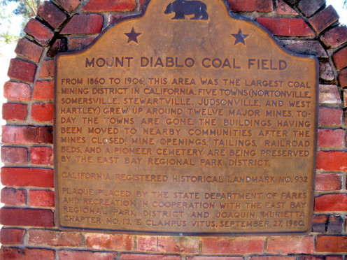
Not a great many people today realize that the coal used in the late 1800s and early 1900s in the San Francisco Bay Area, notably, San Francisco, Sacramento, and surrounding areas actually came from very nearby.
Before electricity became common in people’s homes, heating was often accomplished by steam heat, fired by coal-fueled boilers. It was also extensively used in manufacturing, and in steam-fueled pumps on horse-drawn fire engines. Hence, there was a great need for coal, and it was found in abundance in the Black Diamond mines near what is now Antioch, California.
A Bustling Batch of Boom Towns
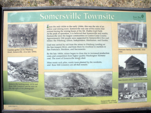
The area around the Black Diamond coal mine soon developed into several boom towns, complete with a school, and a cemetery. Everything you needed from birth to death. A little tidbit I gleaned from a park ranger, is that the school was considered the best in the area, because the residents gave 1% of their pay for the school, and kids would walk 6 miles over from Clayton to attend the Somersville school because it was so much better.
There were actually five towns in the area: Somersville, Stewartville, West Hartley, Judsonville, and Nortonville. Nothing remains of any of them, but Somersville is remembered in the name of a major street in Antioch.
There is a Nortonville road, on the western side of the park boundary, near the current town of Clayton, but it is not open to the public, and a Judsonville road to the east.
It was a hard, rough-scrabble life, though, and dangerous work. Deaths at young ages were common both among the miners and the population at large. Some deaths were from illnesses for which we now have cures or treatments; many others died in mining accidents of one sort or another. Children, too, suffered these fates, as there were no child labor laws back then, and young boys would work in the mines along side the men.
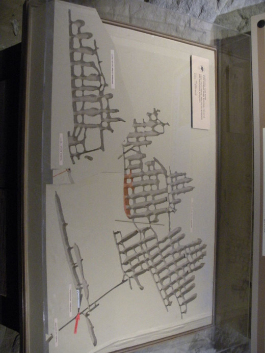
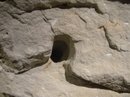
In the coal mines, many of the shafts were as thin as 18 inches, and so were an extremely tight fit for a grown man. Boys were probably used to scoop out the mined coal, and possibly to wield picks as well. It was hard, dirty work.
When the coal was mined out past the point of being economically feasible, the towns died out and the residents moved on.
The Next Chapter
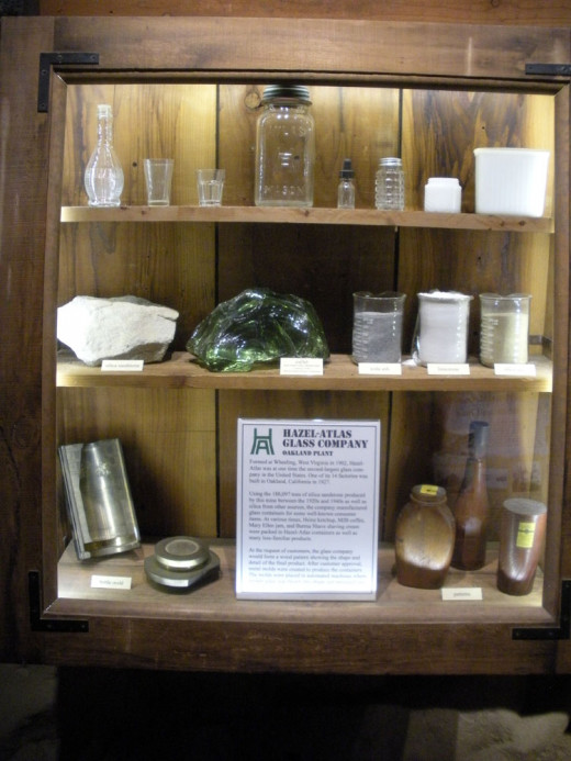
In the 1920s, the area was revitalized when high-quality silica sand was begun to be mined for glass production, and also for foundry use in making sand mold castings for steel products. This revitalized both the Somersville and Nortonville townsites for the duration of this mining venture.
The two main players in the sand mining were the Hazel-Atlas Glass Company, which made glass from the sand at its plant in Oakland, California, approximately 36 miles away. Also involved, on the steel-casting side was the Columbia Steel Company in nearby Pittsburg, California.
The sand mine, and all mining in the area ceased in the late 1940s when competition from other glass makers and the closing of the steel foundry left no further demand.
There is little left of the old towns, the buildings having long since been removed. What remains is seen from the hiking trails or perhaps with binoculars from the hilltops.


In Remembrance
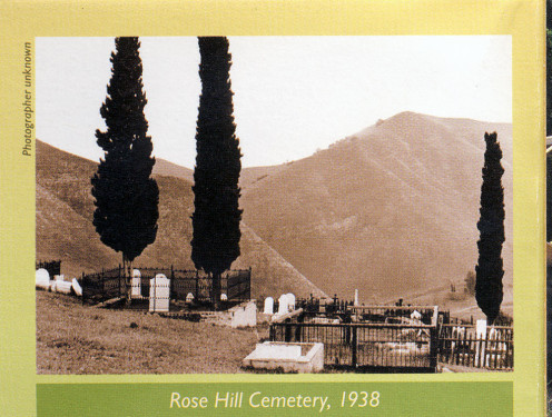
The former town sites are not all that remain of the old mining days. There is also the Rose Hill Cemetery, which is in the process of being restored. Unfortunately, prior to the acquisition of the area by the park system, there was a lot of vandalism and theft of the old headstones. Much information about who lies buried there has been lost.
It is a short, but steep walk to the cemetery from the visitor center, and well worth the trek for both a spectacular overview of the surrounding area and a somber visit among the ghosts of the past.
Within the Park
As you drive up the road going into the preserve, you will notice a collection of old buildings on the western (right) side of the road. These are not yet within the park’s boundaries or jurisdiction, but they are looking into acquiring them sometime in the near future. They are, however,
representative of the types of structures you would have seen in the old towns of the area.
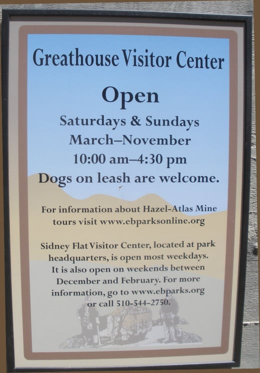
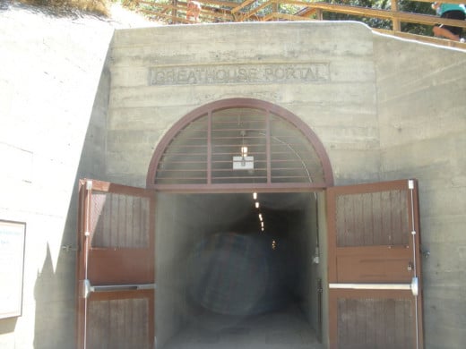
The remaining vestige of the sand mining operation is seen in the Greathouse Visitor Center, which is carved out of a large part of the old sand mine, so named for R. Marvin Greathouse, the original owner of the Hazel-Atlas Mine.
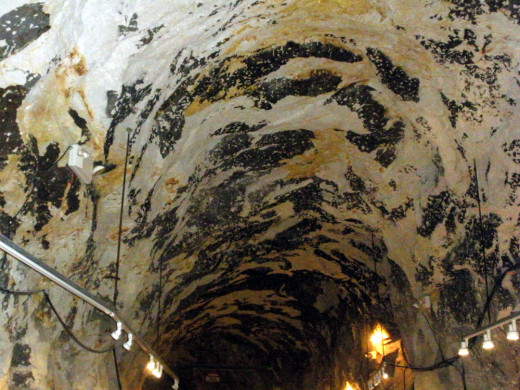
Mine tours are available of a portion of the sand mine, but not of any of the old coal mines, as those are too dangerous to enter.
The park boasts over 6,000 acres of preserved area within its boundaries, and also abuts the Contra Loma Regional Park on its north-eastern side.
There is a paved road leading into the preserve from Somersville Road in Antioch, California and it takes you to the parking lot, from which it is a short walk to the visitor center. It does, however, go up and down a couple of hilly areas, so keep this in mind if you have any mobility issues. (The park rangers told me that it is sometimes possible (but not guaranteed) to arrange a ride up from the parking area for disabled visitors, depending on staffing and how many visitors there are.)
The rest of the park trails are open to hikers, mountain bicyclists and horseback riders.
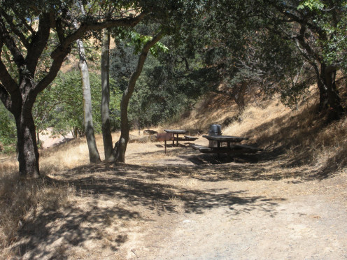
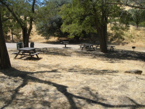
Picnic tables are available for day use visitors near the parking lot areas, as well as vault toilets and drinking fountains.
If you’re going:
From the West and North-West:
Navigate to California State Highway 4, eastbound. (Signs will read “toward Stockton).
Take the Auto Center Drive/Somersville exit, and turn right (south) from the exit ramp. Follow Somersville Road to its end, and keep going; this is the entrance to the preserve. The ranger entrance kiosk is approximately 1 mile up this road, which winds, and is narrow, but it is paved.
From the East and South-East:
Navigate to California State Highway 4, westbound, and take the Auto Center Drive exit; stay in the right lane on the exit ramp, which follows a U-turn off the freeway. Turn right onto Auto Center Drive, which becomes Somersville road as you pass under the freeway and cross the signal at Deltal Fair Blvd. Do not turn; stay going straight on Somersville, and follow directions as above to the preserve.
Remember never to approach any wildlife; it is both illegal and dangerous
— Park Rangers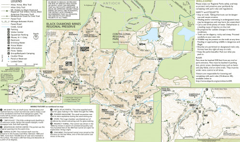
What to Look For
As you walk the various trails and roads in the park, (over 60 miles worth!) you will cross a number of different areas, and possibly see some wildlife, depending on time of day. Remember, it is both dangerous and illegal to approach any wildlife. Appreciate them from a distance, and take only photos.
You will see native vegetation and various types of terrain, including chapparal, grassland, foothills and stream vegetation. There are also some areas of evergreen forest, as well as some exotic non-native plants originally introduced by the miners.
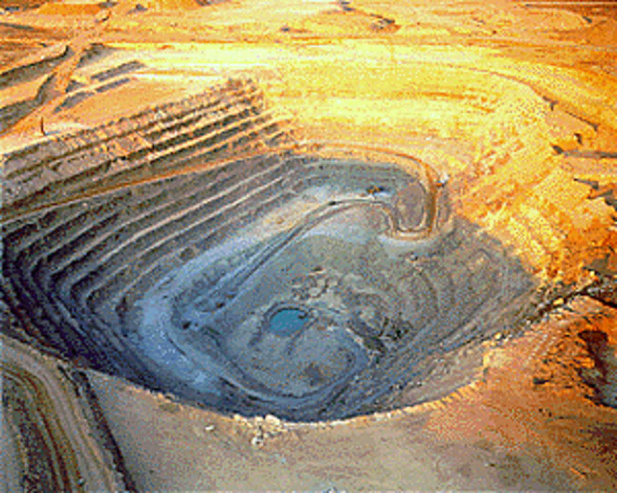
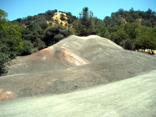
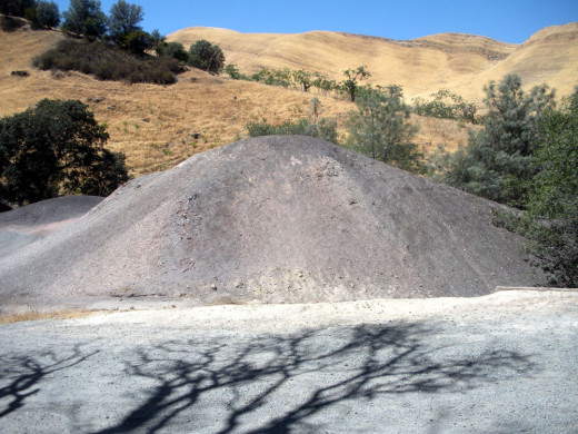
Also, in several spots you will come across great piles of mine tailings, or the non-usable rubble that was hauled out of the mines in the search for those black diamonds.
Some of the tailings also probably come from the sand-mining era.
Mine Tours
The mines are open for touring on weekends from March through November; reservations are strongly recommended. Children under the age of 7 are not permitted on tours for safety reasons, and all children 7 and above must be accompanied by an adult.
Fee for the tour is $5 per person; the duration is about 90 minutes. Temperatures in the mine hover at around 56 degrees Fahrenheit, so a jacket is probably advisable. Hard hats and flashlights are provided by the park.
**************************************************
About 5 times per year, Mine Open Houses are held, at which time, the mine tours are free between the hours of noon and 4:30 p.m.
Dogs are not allowed on mine tours, though they are welcome, on leash, in the visitor center.
The park is under the jurisdiction of the East Bay Regional Parks District, and full details can be found at its website.
Camping
There are 2 campsites: one for the general public, and a group camp. Both are limited to a 2-night stay; reservations required at both.
Public:
The Stewartville Backpack Camp is on the western side of the park, about 3.2 miles from the preserve headquarters, near the Stewartville and Upper Oil Canyon Trails. This camp can accommodate 20 campers. Picnic tables, pit toilets and non-potable water for horses is available. (Water must be treated or filtered for human consumption, or pack in your own.) Fee is $5 per person per night, open spring, summer and fall. Reservations must be made at least 5 days in advance.
Groups:
There is also the Star Mine group campsite on the eastern side of the park, also by reservation only; reservations must be made at least 10 days in advance. This camp is available year round, for organized educational groups only. There is space for 35 campers, and parking for a maximum of 8 cars. No water at site; haul in your own, and pack out your own trash. Picnic tables and pit toilets are available. Limit of a 2-night stay.
Reservations
East Bay Regional Park District Reservations:
1-888-EBPARKS (1-888-327-2757, option 2).
Monday through Thursday: 8:30 A.M. - 4:30 P.M
Friday: 8:30 A.M. - 4:00 P.M.
This is a central number. Be sure and state the name of the park and facility you wish to reserve.
Reservation office is closed Saturdays, Sundays and all District holidays.
Photo Credits
All photos by Liz Elias, © July 2015,
unless otherwise noted with the photo
© 2015 Liz Elias

