Curious insights on Majorca and its treasures

Majorca: a surprise!
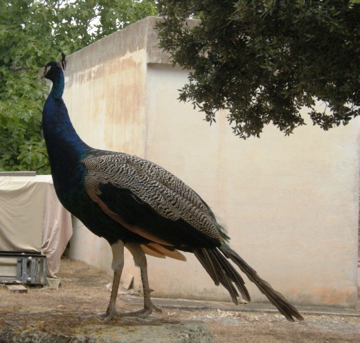
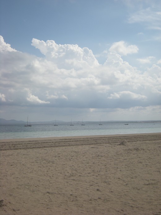
For those tourists who have a stereotypical idea of the island: beach, sun, sea... this may be a good occasion to discover the natural splendours of Majorca and its rustic, untarnished interior. The tourist development for this more agricultural tourism is increasing a little every year. Each of the Balearic Islands has its own typical biosphere. The landscapes vary widely, not only from one Island to another, but also within the Islands. Majorca for example accommodates some rough mountain ranges on one side of the island and much smoother hills on the other side, with some wide plains, green forests and many olive or orange tree fields in between. Menorca is mostly known because of its clean environment, and Ibiza and Formentera because of the pine trees and salt mines. The smaller archipelago Cabrera that also belongs to the Balearic Islands accommodates a variety of rare flora and fauna species, which are definitely worth a boat trip to these nature paradises. The sky above the Balearics is filled with many bird species. The rocky coves, the plains, the forests and the mountains all accommodate their own bird life. To protect all this natural beauty against tourism, a Balearic activist group has created several Natural Parks. Discover the natural wealth of the Balearics....
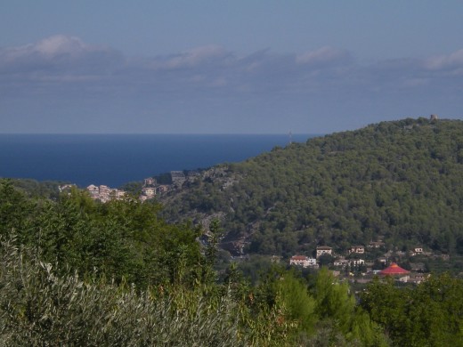
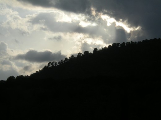
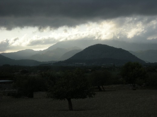
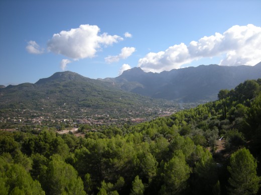
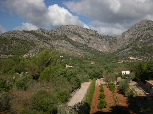
There are two significant parts of the island that are occupied by mountainous terrain. The first mountainous part is Serra de Tramuntana which is scattered over the north-western part of Majorca. This mountain range includes the highest peak of the island, the Puig Major and the neighbouring, Puig Massanella as the highest accessible peak. Serra de Tramuntana. The second mountainous region which is not as steep as Tramuntana is the mountain range of Serra de Llevant and this is situated on the opposite side, in the southeast. Despite being a smaller range it is still popularly visited by trekkers who want to admire the fantastic surrounding sceneries. In the center of the island is the flat fertile plain of Es Pla, where most of the island’s agriculture takes place as the flat land is ideal for farming.
Serra de Tramuntana & Ferrocarril de Sóller
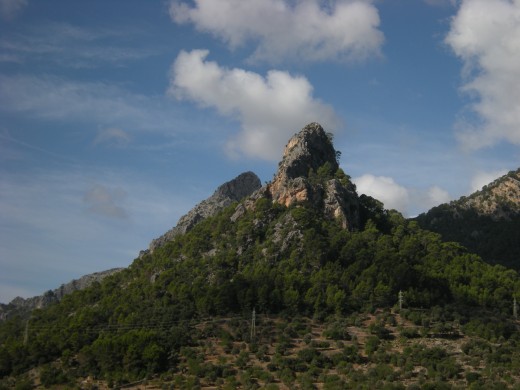
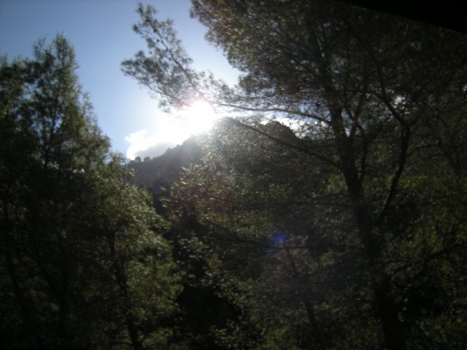
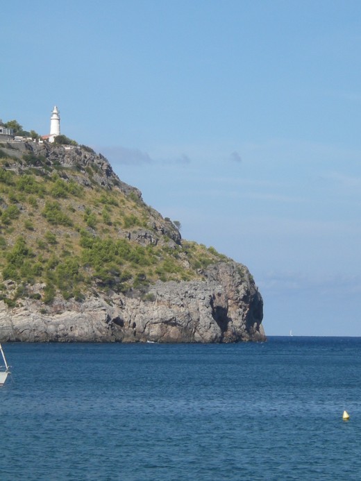
‘Mountains of the north wind’, the Serra de Tramuntana is a mountain range running from southwest to the northeast region, thus forming the northern backbone of the Spanish Island of Majorca. Around 88 km long, this range runs from Andratx to Pollenca, with pine covered trees and the rocky protrusion of Cap de Formentor and Sa Dragonera along with peaks mostly concentrated around Lluc area, with the highest in the Puig Major and Puig Massanella. As one climbs higher, the forested hills devolve into barren land and peaks. One can get the best view on foot with the smell of rosemary, sound of the sheep bells, the fresh air, the marvel at pine trees growing through the red rock and the lovely Majorcan village houses. The drive through these mountains gets exciting from the Soller to Lluc through tunnels and ravine making its way between the Puig Major and Puig Massanella. The roads are dangerous and driving through the parade of the harpin bends and calls in for total concentration. Its geological formation, dominated by calcareous rocks, makes this sierra the main hydric reserve on Majorca. As far as vegetation, holm oak groves cover the lower part of the mountains. Birds stand out amongst the fauna, particularly the majestic figure of the voltor negre (black vulture). The coast is dotted with towers and lighthouses, structures of great historical value. Outstanding amongst the former is that of sa Calobra, Picada tower, sa Pedrissa, and sa Mola tower. The most interesting lighthouses are those of Formentor, that of la Creu (at the port of Sóller), and the two on the island of Dragonera.
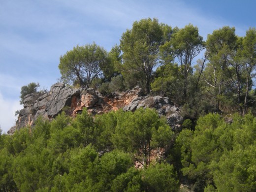
The scenery is one of the main merits of this sierra. There are several miradors and points from which the views are magnificent, such as Ses Tres Creus, in Sóller, where the panorama is fantastic. Abrupt, rugged reliefs, with an altitude of up to 1,450 metres very close to the sea, consisting predominantly of extremely hard permeable limestone rock, resulting in a landscape with karstic formations. It is criss-crossed by a dense network of streams, dry torrent beds, old streambeds, gullies and torrents, as well as aquifers that supply the many springs, as part of what is a Mediterranean water system. A climate marked by Mediterranean characteristics, distinguished by dry hot summers and mild winters, and an irregular rainfall pattern with peaks in rainfall in autumn and spring and a pronounced rainfall gradient oscillating between a wetter central mountain area and progressively drier extreme areas. Mediterranean woodland vegetation with forests of evergreen Balearic holm-oaks (Cyclamini-Quercetum ilicis) that represent a climax plant community, replaced in areas that are less wet by wild olive macchia or scrub of a thermophilic nature - extremely common in the Mediterranean - which colonizes places where holm-oak woods are in a significant state of degradation. This macchia is heavily colonized by the Aleppo pine (Pinus halepensis) species. In the Tramuntana area, there are also plant communities that make up high Balearic ground cover (Hypericion balearici), an extremely low plant formation featuring an outstanding abundance of endemic plants.
Wild fauna, also abundant in the form of endemic species, marked to a large extent by the double insularity entailed by the presence of a mountain district, in itself already isolated from the rest of the region, within an island. The environmental importance of the Tramuntana area is therefore especially well known in terms of the singularity of its reliefs – particularly the karstic landscape -, the originality of its plant communities, presence of endemic, rare and relict taxonomic groups of flora and fauna, and the environmental diversity of its habitats and fauna and flora. In the case of flora, the Tramuntana area contains 65 of the 97 native species described in the Balearic archipelago, and 65 of the 68 plants endemic to the island of Mallorca. Moreover, the Tramuntana area was and still is an important source of resources for Mallorca´s society, supplying not only agricultural, forestry and livestock products, but also significant water supplies that are decisive for the rest of the island.
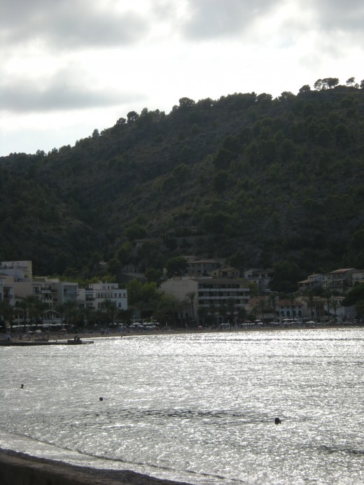
Ferrocarril de Sóller is a train powered by electric locomotive, created on a time machine in 1895 by H.G. Wells and is the only one of its type ever. Moves on its narrow gauge track with beautiful landscapes on the sides, the soller railway takes you to the north side of Majorca, across the plains and then into the mountains crossing thirteen tunnels of Serra de Tramuntana to reach the valley of Soller. The whole journey starts from Palma de Mallorca and it takes exactly one hour to complete the track. For a Majorca base ideal for exploring both the Serra De Tramuntana mountains on foot or cycling, plus the striking jagged West Coast and other smaller centres like Deia, Soller and the Port of Soller are the perfect choice. Soller is in a valley, hence it's nickname 'Valle de los Naranjos (Valley of the Oranges), and well sheltered by the Alfabia mountain massif, with the enormous 4740 foot Puig Major always visible. Easy to get to, it's only 7 miles north east of Deia. Within Soller, as far as museums and attractions go it's a bit thin, however the spot is scenic with the mountains jutting up in the background and ample cafes, bars and restaurants in the centre. You can take the 'toytown' train from Palma or alternatively driving their is pretty easy now with the two and a half mile tunnel from Palma to Soller. This is a particularly popular attraction in Majorca, so expect it to be crowded in peak summer season!
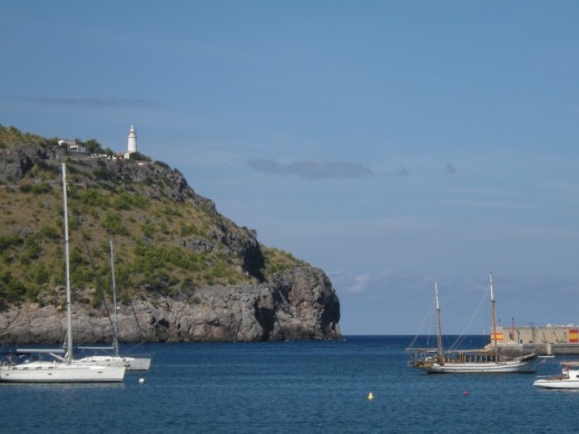
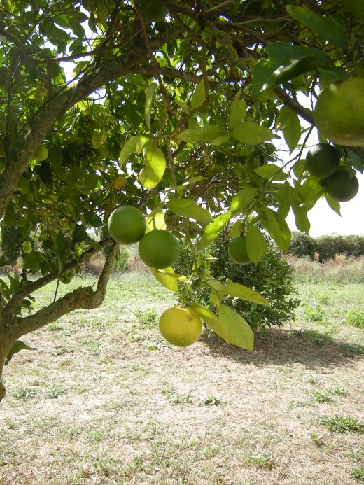
Before the tunnel Soller was a bit of a remote place in Majorca, difficult to get to and fairly isolated. Residents did rather well out of their citrus trade, Soller and surrounds are covered in orange and other fruit groves, and forged trade relationships with Barcelona and France. This brought considerable wealth to the area in the 19th and 20th centuries. Soller comes from the Arab word Suliar which means golden bowl. It was the Arabs in the late 8th century who built the canals and irrigation ditches in Soller, which by extension fed into the orange and olive groves. Soller has a very strong link with France. Check out Port de Soller as well, with it's attractive harbour, ample bars, cafes and restaurants, attractive harbour, two beaches and a lighthouse. Port de Soller on the coast, just two and a half miles, from Soller, has a rather grainy Spanish feel about it with it's rather attractive harbour and family friendly atmosphere. There's cliffs on either side of the bay, with a navel base to the north, and a two sandy beaches. The citrus fruit trade operates out of this harbour, and as you'd expect there's an interesting history behind the area, involving pirates and invasions! One such invasion involved the destruction of the port in 1561 by a pirate attack, so they built vast stone jetties and lighthouses to protect it. The tramline stretches conveniently right down to the port, harbour and many bars and restaurants. Platja d'en Repic beach is on the western side of the bay and you can take a walk upto the lighthouse from there, to discover glorious views at the top.

The dragon's cave
The caves and bays of Majorca are great tourist attractions, along with the sandy coves which are predominately located in the eastern region.
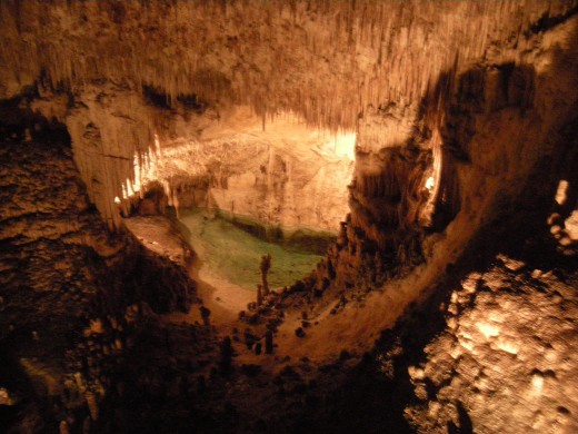
The Drach caves are some of the largest of the island, thanks to their nearly 2,400 metres of length and a maximum depth of 25 metres under the sea. The Drach Caves are actually four caves connected to each other called the French caves, Louis Salvador, the White Cave and the Black Cave. They are formed by the entrance of seawater and it is believed they date from the Miocene period. Discovered in 1896 by Eduard Martel, the Caves of Drach – Dragon Caves – are one of the most popular attractions on the island and attract visitors from all over the world. The name Cuevas del Drach is, of course, derived from the dragon. The first inhabitants of Mallorca gave the dragon rather different attributes: on one hand, he is evil, a sort of devil, on the other hand he is a symbol for strength. This second aspect was definitely the reason, why King Jaime I is shown on the medieval paintings of Francesc Comes and Pere Nisart with the dragon on his helmet. In the medieval legends, in the Rondaies mallorquines, the most important collection of mallorcan fairy tales, the dragon has a third aspect: he is the sentinel of a treasure. With his horrible looks, snake like body and bat like wings, and his enormous strength, he defends the treasure against intruders.
Your trip to the caves allows plenty of time to explore the mysterious caverns which have been formed over millions of years. See the weird and wonderful shapes of the stalagmites and stalactites which have been beautifully lit for dramatic effect. This magical space is a natural auditorium and classical concerts take place at regular intervals throughout the day. The classical music and colourful lighting adds to this enchanting experience and there is also the chance to take a short boat trip across Lake Martel to view more of the bizarre limestone formations. The lakes and the different areas are full of pillars and stalactites, which make up a fairytale landscape, which has evolved over thousands of years, drop by drop. The existence of these dates back to times immemorial although it must be said that they had never been explored touristically. It happened that one day in 1878, three people got lost in the cave and were wandering around aimlessly for more than thirty hours, with only a remote hope of finding their way out. The real scientific and rigorous study of the cave dates back to 1896. Inside them is one of the world’s largest underground bodies of water, Martel Lake, which measures 117 metres long by 30 metres wide. The lake has a temperature of 17°C and is slightly salty: proof of its connection with the Mediterranean Sea.
Pollentia & Alcudia
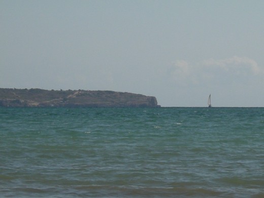
Majorca has a very rocky coastline with intriguing caves and bays. The northeast side is covered up by two sweeping bays, the Badia de Pollenca and the Badia d'Alcudia and of course the large famous Bay of Palma in the southwest.
Alcudia is an historic town with Roman and Moorish influences, Puerto Alcudia a lively modern resort with one of the finest beaches in the Mediterranean. Playa de Muro (though part of a different municipality) joins onto Puerto Alcudia and also boasts a terrific beach, some oustanding hotels and a vast nature park - S’Albufera.Puerto Alcudia enjoys a deserved reputation as an excellent holiday destination. The main beach in Puerto Alcudia is one of the finest to be found in the whole Mediterranean, and it boasts a multitude of bars, restaurants and shops. The port area itself, that formed by the wide, pedestrianised promenade (the Paseo Maritimo) and the yacht marina, is modern and generally attractive without having any great cultural or architectural pretensions. The vast beach is sandy and deep, so much so that you don’t get cramped for space, the water shallow and, usually, there is enough breeze to take an edge of the heat. The beach at Puerto Alcudia is rated with four stars, the highest award for an "excellent" beach.
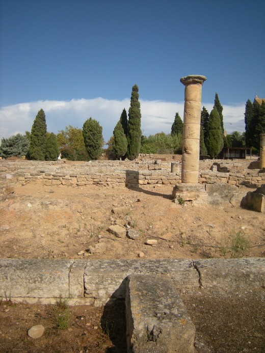
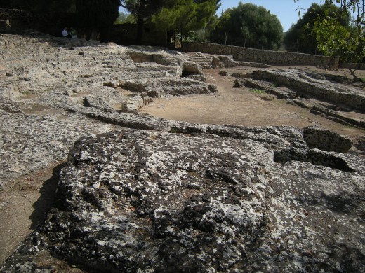
Near this beautiful sandy beach there is the archaeological site of Pollentia. Pollentia is the only Roman city that can presently be visited in Mallorca. It is also the best example of the Romanisation of the Balearic Islands, its ruins telling us of the pax romana times. Pollentia, meaning "power", was founded by Quintus Caecilius Metellus in the year 123 AD on top of an ancient Talayotic or Bronze Age village. It started off as a small hamlet but, from the imperial era, large mansions and public buildings grew up; at about this time, the settlement reached an area of twelve hectares. Its position could not be more ideal: in the north of Mallorca and a short distance from a port which managed to divert the heavy traffic with the Italic peninsula and the Spanish coast .The name Alcúdia, where it is located, derives from the Arabic toponym meaning hill. According to documents speaking of a light in Pol·lèntia, it must have been in this period that the island's first lighthouse was built. Although its exact placement is not known, it is known that the lighthouse was built on the side facing Rome. In the 3rd Century, a far-reaching economic and political crisis in the Empire meant the limitation of Pol·lèntia's perimeter as well as the construction of a wall. With the fall of the roman empire the village disappeared: from this moment on began its demise, later aggravated by the constant invasions of the Vandals in the 5th Century. After the fall of the empire it disappeared as a settlement but continued to shelter occasional inhabitants until the Moorish era. Excavation work in Pollentia began around 1920 and continues to this day. Also worth a mention is its Roman theatre, the only still preserved in the Balearic Islands. It was built in the 1st Century and had a seating capacity of almost two thousand persons. Today a portion of the tiers and the stage can still be appreciated. An interesting complement to the visit is a trip to the Museu Monogràfic de Pollentia, (Monographic Museum of Pollentia) where valuable pieces found during the excavation works are on display (however it's forbidden to take a photo there and there are no catalogues!)