MYKONOS- Live your myth in Greek island


MYKONOS
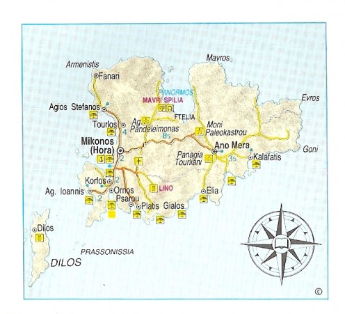
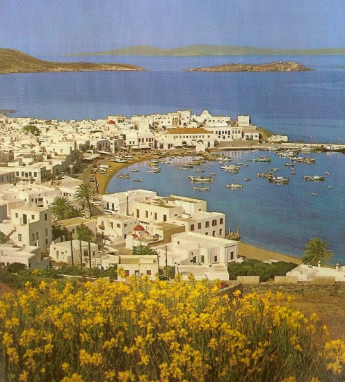
GEOGRAPHY. Despite its sophisticated ambience and thousands of visitors, Mykonos, between Tenos and Naxos, is still one of the most beautiful isles of the Cyclades. 85 sq. km in area, with 81 km of coastline, there is a regular boat service to and from Piraeus (110 nautical miles), as well as Rafina (71 nautical miles). Flights to the island are equally frequent and during the summer months there are planes to Rhodes, Herakleion in Crete and Santorini. Car and passenger ferries from Piraeus link Mykonos with Syros, Tenos, Paros, los, Santorini, Naxos (less often). Once a week there is a ferry from Rafina via Andros, Tenos and Syros. Finally, small local craft make excursions to Paros, los and Santorini (only during the summer) and Tenos. Mykonos has a population of 5,530. Renowned for its lovely beaches and distinctly Cycladic atmosphere, Mykonos attracts a host of visitors, arriving here by all possible means, including cruise liners.
HISTORY. Information about Mykonos' past is scant, for the island was not particularly important in antiquity. It was colonized by loniians in historical times and, judging from its meagre participation in the Athenian League, apparently remained impoverished. The ancient geographer Skylakas reports the existence of two cities on Mykonos: one on the west side, close to the present town, the other in the north, at Paliokastro. In the time of the Ptolemies the island experienced something of a floruit, as also under Roman rule, though this waned in the Byzantine era. Along with Tenos it was ceded to the Ghisi family between 1207 and 1390, from which date it was directly dependent on Venice. In 1537 it was laid waste by Barbarossa and then conquered by the Turks. Thence forth the islanders turned to piracy. One of the major events in its history was the setting up of the "Community of Mykonians" in 1615. By the end of the 18th century Mykonos had achieved an economic acme, assembling a mercantile fleet which was later to play a supportive role in the Struggle for Independence in 1821. One of the outstanding personalities of that time was the Mykonian Mando Mavrogennis. From the late 1950s onwards there has been sustained touristic development leading to a new period of economic prosperity.
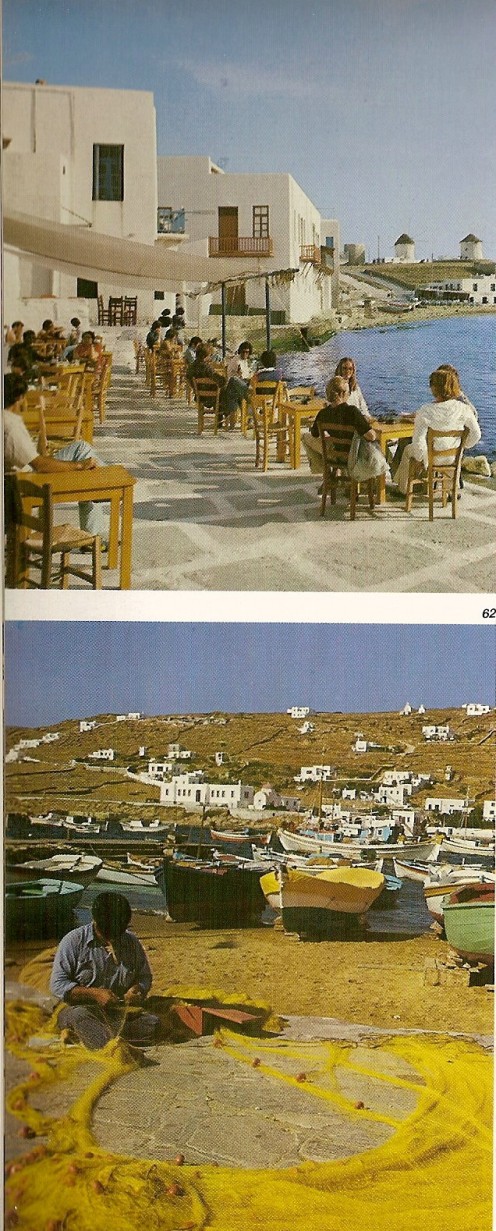
SIGHTS-MONUMENTS. The most important monument in the island's capital, Mykonos (Chora), built on its west side, is the church of the Virgin Paraportiani, outstanding among the 400 or so churches throughout the island, according to local tradition. It is located in the quarter of Kastro and its architecture, a combination of Byzantine, folk and Western elements, is unique. The quarter of Kastro is situuated on an elevated area and it was here that the Venetians built their castle, only vestiges of which are nowadays visible. On the south side, beneath Kastro, is "Venice", an enclave of quaint old houses actually built in the water, their wooden balconies and doors giving the captains who lived here in days of old direct access to the sea. In one of the squares not far from here the cathedral (metropolis) stands, as well as an old Catholic church. On the ridge nearby there is a row of windmills, standing sentinel. This seems to have been the site of the ancient city. Objects displayed in the Archaeological Museum, at the northeast edge of the town, mainly comprise finds from Rheeneia: sculpture, vases and figurines, while in the Folk Museum in Kastro, there is a collection of furniture, icons, sculpture and folk musical instruments. In addition to the many volumes in the Municipal Library there is a collection of Hellenistic coins and recent seals. The Nautical Museum, recently established, is also of interest.
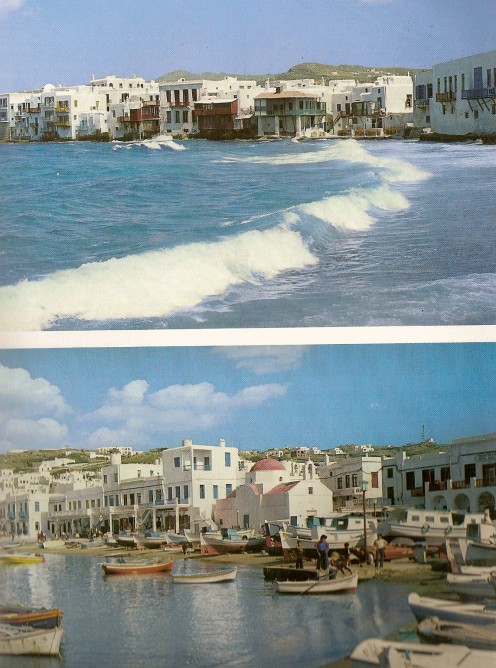
Chora, with its narrow, winding streets, archways, dazzling white houses and distinctive architecture is a veritable labyrinth, with a harmony and equilibrium which set it apart from other Cycladic towns. The island's villages have their own "couleur local", dominated by stark white volumes, grey rocks and paucity of vegetation. 1 km. south of the town, at Lino, are the ruins of a tower known as "Partes" by the locals. In the same area, on the north side of Platys YaJos, is the subterranean cistern known as Yannaros' Well (Pighadi tau Yannarou). In the region of Ano Mera (6 km. from the town) stands the monastery of Tourrliani, founded, so tradition relates, by two Parrian monks in 1542 on the site of an earlier church. It acquired its present aspect in 1767. The elaborately decorated, Western-style bellltower adds a distinctive touch to the monastery’s exterior. Further north, at Palaiokastro, there are remains of a fortification and the convent of Palaiokastro, a 17th century building. A pathway leads up to a knoll behind, on which there are remnants of an enceinte. From the remains of buildings and other finds of the Archaic and Classical period it is surmised that the hill was settled in antiquity. There is a small church in the centre. In this general area (Panormos bay) there are other prehistoric remains and at its western edge, in the locality of Mavri Spilia, an albeit limited number of Neolithic finds have been recovered.
From Ano Mera one can easily reach Kalafatis (12 km. from Chora) one of the most beautiful beaches on the island. There are seaside villlages at Tourlos, Aghios Stefanos (3.4 km. north of Chora), Ornos and Platys Yalos (south). Beaches in the south of the island particularly good for swimming and sea sports are Psarou, Aghia Anna, Paradise and Super Paradise (for nudists) and Elia. All can be reached by bus or caique from Chora or Platys Yalos. There are plenty of hotels, rooms and furnished flats to cater for the needs of the many visitors.
ENJOY YOUR DREAMS