- HubPages»
- Travel and Places»
- Travel Activities & Ideas»
- Outdoor & Adventure Activities on Vacation
Travel North - 57: Unwind in a Less Visible Corner of the Dales - Upper Swaledale
Start and finish at Muker
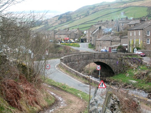
A ruined farm, a waterfall, and an infant River Swale that seethes between its banks to Reeth and Richmond...
You'll breathe in a different kind of fresh air as you pass a ruined farm with a history and an intriguing name.
Whether you drive or have arrived by bus at Muker (pronounced: Myooker) in Swaledale, start from the roadside and be careful of local traffic that might seem to appear from nowhere in the narrow lanes behind the roadside shops and dwellings. Take in the patchwork quilt of green fields and woodland. Squared barns seem to litter the hillside, their thick walls of local limestone. Follow the narrow lane near the small church, north away from the main road that snakes away east- and westward through the dale near its narrowest point.
You reach a stony, zig-zagging path that winds uphill. Look back to where you've come from, and westward beyond to Buttertubs Pass where the Yorkshire leg of the Tour de France cycle race passes. To the south-east is the steep, winding road that heads up to Askrigg Common. Both roads link Swaledale with Wensleydale. Before you achieve the crest of the hill turn right for where the track joins the Pennine Way.
You are at the narrow track that follows the upper northern rim of the dale. Below, the Swale looks like a silver ribbon, broken here and there by trees and brushes that line both banks of the river. At the top where your path takes you is craggy, outcrops of rock jutting like an old man's beard away from his jaw. The track begins to get rough, the view opening out to the deep Swinner Gill, a gash in the hillside. Steeper now, progress on this track will be slower as you negotiate the clumps of rock. Woodland obscures your view for a short way as the going gets a lot easier.
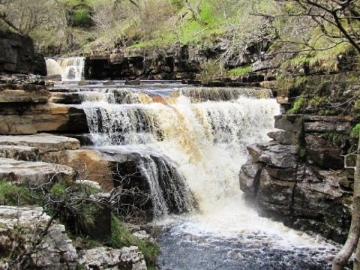
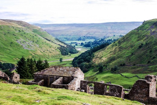
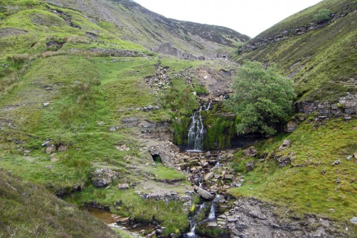
Stay with the main track before you come to the clutch of houses and farm buildings that is Keld, where fields show to your left. Take a sharp right turn to cross the footbridge below Keld's locally well known waterfall. This is a popular point for a picnic. There's a broad track above the falls that crosses the hill face through old lead mine workings and skirts above the tree plantation of Westwood. Your track passes above a downward hurtling gill or stream, This is where you come to ruined Crackpot Hall.
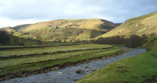
It's not - nor has ever been a 'hall' as such, a grand residence, rather an isolated farm with outbuildings that looks out over a narrow, winding green-clothed dale with steep sides marked by winding dry stone walls. The infant River Swale winds past on its way south from its source behind you to your right, and near Muker will veer eastward.
The 'Crackpot' is no mentally deficient hermit but an underground chasm made by many years of rainfall on and through limestone rock, a 'pot'. Some are navigable by pot-holers who take their hobby seriously, wearing diving gear and miner's helmets with strong lamps. They check their equipment regularly and before following underground watercourses, because their lives depend on the condition of their gear. Some 'pots' are gigantic, open to the general public. Ask locally before tackling them, and go with experienced pot-holers.
The farm was abandoned because of subsidence in the 1950s, the name being derived from the Old Norse - as are many names hereabouts - meaning 'crow' and 'pot', a local term for a cave. As did the farm's earlier inhabitants, take time to appreciate the grandeur of the rugged scenery, away right to Swinner Gill and down dale back toward Muker, unseen around the bend and past the steep hillside at the south end of the narrow dale. Across from where you stand you'll see and appreciate the heights of Kisdon Hill (499 m) that you passed after leaving the hamlet of Kisdon behind Muker. Below you, across a footbridge is a cluster of stone barns at Hartlakes where the Swale bends to the right
Pass the lower end of Swinner Gill, its waters rushing down between rough rock walls to your left, and with a steep hillside to your left make your way south almost level with the river.
---------------------------------------------------------------------------
*This part of the world sees fewer outsiders than neighbouring Wensleydale, and locals will thank you for following the country code. Basically it entails taking any rubbish with you, closing gates behind you and not harassing livestock. If you take a dog keep it on a lead whilst passing through grazing pasture. Not seeing sheep or cattle doesn't mean there aren't any around..
-------------------------------------------------------------------------
Keld and the infant River Swale
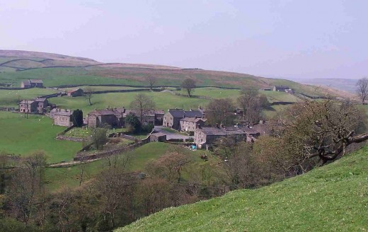
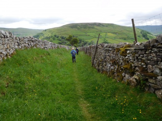
The track back to Muker winds along the dale below more woodland, and along the hillside.
Now your gaze takes in the crags high above, rather than down from amid them. A footbridge leads back across the river, a turn right along the waterside track to another stone barn. Where the track turns fives you a view up to Hooker Mill Scar between two peaks, the one on the right seen from here being Kisdon Hill. The track takes you uphill to a field corner where another lane takes you back into Muker along the base of the steep hill.
---------------------------------------------------------------
Getting there:
Muker is on the B6270 road west from Reeth, and Richmond beyond that, 22 miles from Muker. A bus service, Little White Bus, Swaledale Shuttle (littlewhite-bus.co.uk) has a service that goes through Muker three times daily;
'Explorer' Ordnance Survey Map No. OL30 covers the area, Grid reference SD 91068 97844;
To learn more about the region look into the Yorkshire Dales National Park web site:
Yorkshire Dales National Park
- Yorkshire Dales - Welcome to the Yorkshire Dales National Park
The Yorkshire Dales National Park is full of stone-built villages, stunning landscapes and vibrant communities.
The return leg of your walk

Nature in the Dales
If you'd like to find out more about the natural history of the area, why not look into natureinthedales.org.uk/get-involved/places-to-see-wildlife/muker-meadows
Of course you want to know where to rest your weary bones after this six mile hike, don't you...
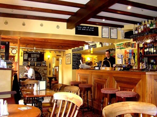
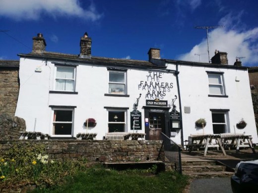
On your way into Muker you can't miss The Farmer's Arms' inn. I've been in there a few times on visits to the village, and it's genuine. No 'muzak', no massive TV screens, no slot machines. A village inn for locals or visitors to drop in, with a sign that tells you you're welcome to step inside whether or not you've got muddy boots on. It's open all day, so there's no need to rush back from your walk, breathless and panting for a bite and a slurp before it shuts its doors. Main meals, baguettes and sandwiches are available, with main meals priced from £8.25. Try it and see if I'm not wrong. Surprise yourself, maybe try your hand at conversation. People around here are friendly - they don't bite!
Phone: 01748 886297
http://www.farmersarmsmuker.co.uk
The Farmers Arms, somewhere to lean back on the upholstery with a good ale on the table before you ...
Down dale at Reeth - you may have passed through on your way from Richmond, or over the hill from Leyburn in Wensleydale
At the Swaledale Museum you'll be able to trace back 270 million years of local history, visit on The Green, Reeth, Richmond, DL11 6TX
01748 884118
www.swaledalemuseum.org.uk
(there are some good watering holes close by, to slake your thirst after travelling back through time. i'd recommend them both. If you're not the drinking type there are several tearooms dotted around Reeth, on and off the green).
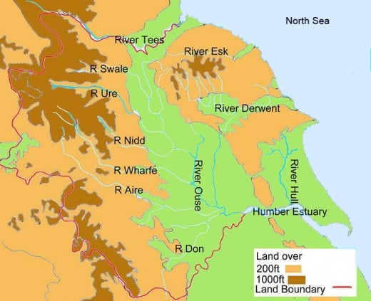
Yorkshire rivers - the Swale rises top left and flows into the Ouse north of York
© 2018 Alan R Lancaster

