Rivers aren't what they used to be!

Rivers used to be for transportation and commerce; now, rivers are for recreation and flood control
For the first few hundred years of European exploration of what has become the contiguous 48 states of the United States, even through much of the 1800s, rivers were primarily a source of transportation. People traveled by river. Trails followed rivers. Settlement locations were often determined in relation to the rivers.
I will be looking at some examples to share with you. I will mostly use examples here from the heartland, but the same situations occurred in other places. Specifically, this lens will share rivers of the Ozarks region of Arkansas and Missouri.
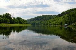
Photo is of the White River near Flippin, Arkansas; Credit: Wikimedia Commons

White River in Arkansas and Missouri
The most extensive river in the Ozarks region
Several of the other river systems we will share in this lens empty into the White River. Once a major interior Ozarks transportation artery, there are now five major dams on the river for flood control purposes which have also created tremendous recreational opportunities.
The White River headwaters are in the Boston Mountains and the river goes north into Missouri before in curves back east and south to empty into the Mississippi River near Batesville, Arkansas.
The map image is a Wikimedia Commons contribution from the White River (Arkansas) wikipedia section
Buffalo National River - Not a long river but very special; empties into the White River
- Buffalo National River
The Buffalo became America's first national river in 1972. This is the website on the National Park Service site. - Buffalo National River - recreational planning site
This site bills itself as a comprehensive vacation planning guide to the Buffalo national river area and the Arkansas Ozarks. - The Buffalo National River on Wikipedia
This is an excellent resource on this river. I especially like the graphic down the page a ways that provides an excellent overview of the entire river system, the watershed.

Buffalo National River
It empties into the White River
The Buffalo National River is noted for its steep ascents and several falls in the upper reaches before flattening out near the end.
Photo credit: Wikimedia Commons; from wikipedia site.
Ozark National Scenic Riverways
The Current River and the Jack Forks River are the basis for the Ozark National Scenic Riverways. They are two of the best float rivers in the nation, located in southern Missouri, and fed by large springs. The park also includes many caves. About 1.5 million people visit the Riverways in the Missouri Ozarks each year.
- Ozark National Scenic Riverways
This is the official National Park Service site. It has all the information you normally expect from these official sites at the NPS. - Ozark National Scenic Riverways Wikipedia site
This site I find especially useful for the maps as well as the descriptions.

Floating on the Current River
Part of the Ozark National Scenic Riverways experience
The headwaters of the Current River are in Montauk River State Park in southern Missouri. The river is fed by some of the largest springs in the region.
Rivers Poll


