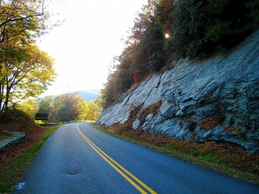
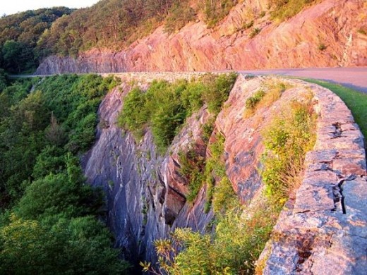
Views from the Blue Ridge Parkway

Pictures of the BlueRidge Mountains!
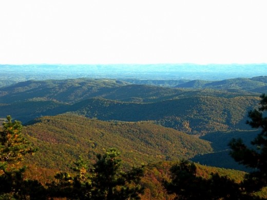
The Blue Ridge Parkway runs through the North Carolina mountains and covers 469 miles of some of the most beautiful landscape in the United States. And I'm lucky enough to live within one mile of it. My husband and I (and our chihuahua, Lexie, of course) love to explore the many hiking trails it offers. Sometimes when we're bored, we'll just drive the Blue Ridge Parkway and look at all the beautiful scenery of the North Carolina mountains.
I'd like to share with you my short videos and pictures of the Blue Ridge Parkway.
Have you ever been to the Blue Ridge Parkway?
The area I'll cover
The Blue Ridge Parkway runs from the southern terminus of Shenandoah National Park's Skyline Drive in Virginia at Rockfish Gap (mile marker 1) to U.S. Route 441 at Oconaluftee in the Great Smoky Mountains National Park near Cherokee, North Carolina (mile marker 469).
Unfortunately I haven't traveled the entire parkway so my photos are limited to the spectacular views between mile marker 216 and mile marker 305.
Video of the Blue Ridge Parkway
Brinegar Cabin - mile marker 238 on the Blue Ridge Parkway
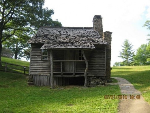
This tiny cabin was built by Martin Brinegar around 1880 and lived in until the 1930s when the homestead was purchased for the Parkway from his widow, Carolyn. Next to the cabin is a small garden which is still tended to today. Below the cabin, down the hill is a spring house where they got fresh water everyday. Inside the cabin, you can see the loom Caroline inherited from her mother.
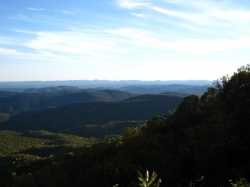
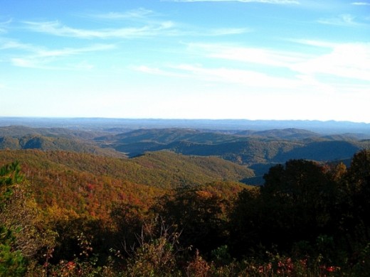
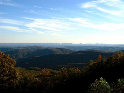
The Blue Ridge Parkway at Sunset - Pictures of the Blue Ridge Parkway

The amazing sunset was viewed from the Wildcat Rock Overlook, which is located at the start of the Fodder Stack Trail. Both can be found at mile marker 241. The guidebooks say that the Fodder Stack Trail is a moderate loop trail that runs for 1 mile. From personal experience, I can tell you that, while most of the trail is moderate, the last 1/4 mile is extremely steep.
Fodder Stack Trail and Wildcat Rock Overlook - Pictures of the Blue Ridge Parkway
Click thumbnail to view full-size


Cascade Falls - Pictures of the Blue Ridge Parkway
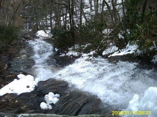
Cascade Falls is located at mile marker 272. It's a 1 mile self guided trail that leads to a beautiful waterfall. But unlike other waterfalls, you don't view this one from the bottom. The trail leads to about the middle so you can look up, or you can look down. It's a spectacular view either way.
The Linn Cove Viaduct - Pictures of the Blue Ridge Parkway
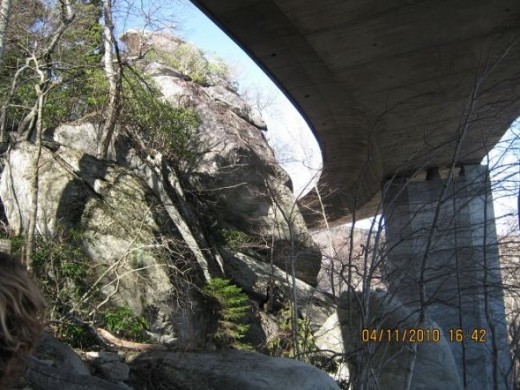
This is a bottom view of the Lynn Cove Viaduct as seen from the Linn Cove Viaduct Access Trail. The Linn Cove Viaduct Access Trail starts at mile marker 304. It's an easy trail that runs for .16 mile before it connects to the Tanawha Trail.
The Tanawha Trail - Pictures of the Blue Ridge Parkway
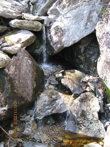
This is a mini waterfall seen on the Tanawha Trail. The Tanawha Trail starts at mile marker 305. It's a moderate trail that runs for 13.5 miles.
Personally, I think the Tanawha Trail is the best one I've hiked. It's full of big rock structures to climb through and it even has a few shallow caves to explore.
More Pictures of the Blue Ridge Parkway
Click thumbnail to view full-size


Driving the Blue Ridge Parkway
Sorry for the shaking at the end.
Great travel guides - about the Blue Ridge Parkway


Sunset on the Parkway PostcardsBUY NOW
Majestic Sunflower Mouse PadBUY NOW
Yep! You can virtually drive down the parkway and see the same views as if you were truly there! You can even shift your view left, right or even look behind you! It's amazing what technology allows us to experience these days.
Photos and text; © 2011-2013 Catherine Taylor. All Rights Reserved
Reproduction in whole or in part without permission is prohibited.


