What is a Hurricane Strike?


A hurricane strike refers to either a hurricane hitting a given location or the probable point where a hurricane will hit.
A hurricane may be hundreds of miles in diameter but the strike point of the hurricane is where the eye comes on shore.
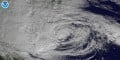
Typically the eye of the hurricane is the round center, often visible from satellite images.
While it is important to pay attention to where a hurricane is going to strike, it is also important to be prepared for last minute veers in the path.
Remember that the damage a hurricane causes from winds and floods can extend for many miles from its center.
Anatomy of a Hurricane
A hurricane typically has a circular or oblong eye (depending on the intensity). From the eye, bands of wind and rain extend out from and rotate around the center.
The strongest winds are typically around the eye wall. By contrast, there is very little rain or wind in the actual eye of the storm.
The rotation of the storm creates a suction which draws up the water from the ocean, sometimes intensifying it.
Though the surface temperatures of the water are typically warm during hurricane season, the outflow process does help to cool the ocean waters as it passes.
So in some ways, hurricanes are a natural part of the process for cooling the waters in the summer and fall.

The closer you are to the eye of the storm, the stronger the sustained winds will be. However, strong wind gusts can occur very far from the center of the storm.
Finally, the north east quadrant of the hurricane (picture the hurricane on a graph with an xy axis and the eye at the center) typically has the strongest winds, the most rain and can cause the most damage.
So a hurricane strike coming from the west, such as when a hurricane enters the Gulf of Mexico and then bends back towards Florida, could potentially cause more damage to the state than a hurricane that comes in on the east coast.

How Do Scientists Predict Hurricane Strikes?
Prediction of storms involves the use of satellites, computer models, history and luck.
Weather, unfortunately, is often unpredictable. Troughs that are supposed to move out of an area may stay put, pushing the hurricane further south.
Or they may rise more quickly, taking the storm safely out to sea. (Meteorologists often refer to those kind of hurricanes as "fish storms.")
The graphic to the right shows how the data from the models is used to predict a probable path. As you can see, models can vary from a few miles apart to a prediction that takes the hurricane in a completely different direction.
Because looking at the model data may confuse some who may inaccurately believe the models are an accurate prediction, the information is not usually included in the public forecast.
However, websites such as Weather Underground will usually include the models in their coverage of a hurricane.
At WU, professional and amateur meteorologists alike can discuss and argue about the interpretations of the data.
Usually, as the hurricane gets closer to land, the models will come into a closer consensus, allowing scientists to make a pretty accurate prediction of where the hurricane will strike.
Watches and warnings for coastal areas are then usually put into place.
Can We Stop A Hurricane Strike?
Over the years many methods have been suggested for trying to intercept, stop or divert hurricanes. Methods such as cloud seeding and even nuclear blasts have been floated around the science world.
But with these ideas come problems. Methods of implementation are a problematic and cost is prohibitive.
Further, what would happen if we stopped hurricanes? What would the environmental impact be?
As mentioned earlier, hurricanes are a natural way to cool down the atmosphere after a warm summer.
Ethical questions come into play as well. If we have the technology to stop hurricanes, are we then obligated to stop all hurricanes that pose a threat to land or just the ones headed towards the United States?

Budget Cuts and Hurricane Prediction
As discussed, predicting a hurricane strike takes a coordinated effort using many resources. But what happens if some of these resources become unavailable?
The short answer is that the accuracy of prediction and the ability for early warnings and evacuations goes down significantly.
Brian Fung of The National Journal points out that NOAA is already expecting to face a gap between the failure of one of their key satellites and the implementation of a new one.
But because of the sequestration, the replacement of worn out weather satellites could take even longer.
Sandy, the storm that slammed into New York in 2012, was accurately predicted because of satellite imagery and data. Most of the models believed that she would turn out to sea.
Taking away access to any of the equipment or methods used to predict storms could mean more damage to property and more lives lost.
References and Further Reading About Hurricanes
- Broken Weather Satellite May Hamper Hurricane Tracking - Various
- Why Can’t We Stop A Hurricane Before It Hits Us? | Popular Science
Hurricane Sandy has caused untold billions of dollars in damage and insane casualties. And we saw the “Frankenstorm” coming, for days in advance. We - Northeast Quadrant: A Hazardous Hurricane Location - AccuWeather.com
Why is this the most feared area of a hurricane? - Spotting the Next Superstorm Sandy Could be Harder After Sequestration - NationalJournal.com
Without accurate satellite data, we would never have known superstorm Sandy would be as bad as it was. In fact, New York probably would have underprepared, leading to a much greater loss of life and property. - Four groups predict very active 2013 Atlantic hurricane season