Revealing Atlantis's Secret

Quick introduction
On earlier Hubs to approach this subject we showed Antlantis's location on earth according to all researches evidence, historic sources, and most important: We have indeed, an open mind to understand knowledge in this research.
Whit this Hub you will judge if this history has scientific foundations to support the major goal for all Atlantis Civilization's technology achievements that would be inherited to the next human generation on earth after a global cataclysm, Egyptians.
Tropospheric Emissions
Now, with the Atlantis location we worked about geographic problems and provided substantial information about what would happened to this island do to the fact of Plate Tectonics and Mid Atlantic Ridge. Also provided information about definitions for those terms, so you can be aware about consequences: geographic instability and more.
Now we need to answer, why that place?: Tropospheric Emissions
As you may know, the Troposphere is earth's layer in which all weather conditions are regulated and all change to it are reflected, also has a complex structure that is study subject for meteorologists on our times to prevent disasters or cataclysms.
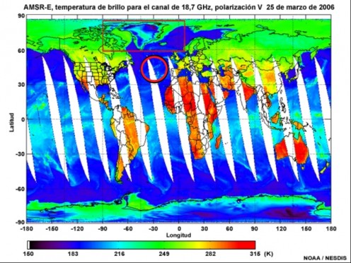
Thanks to MetEd (Meteorology Education and Training), we can see a picture for a Tropospheric Emission Spectrometer , picture that is NOT ease to get due to the corporations that control this information and its interpretation as value information researches for satellite orbits simulations or advanced weather condition simulations and forecasting (NASA's third earth Observing System , and many other systems as as well),
One of the high levels for Tropospheric Emissions goes across the Mid Atlantic Ridge, and also its top for the Emission's wave form is over Atlantis's location.
Tropospehric Emissions Specter
Troposphere Emission's Study Application
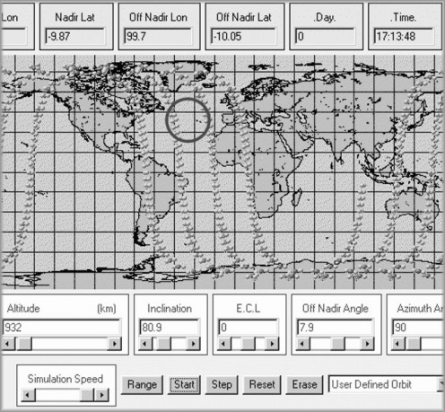
Here is the application for that.
Yes!!! Indeed we use that Tropo-crazy data to define a Satellite's path through the space so its transmissions can not been affected due to tropospheric emissions from earth to the space. Magic??? No, is Science and more.
EMUSAT
and NOAA Satellite Systems provides all this data, pictures, real-time monitoring, advanced statistical trends simulations, and a complete customer support for their services.
And so, what does all this mean and what could be Atlantis's reason for been in that island?
Simulating Satellital Orbits
The Ley Lines
Resuming data to get valuble Information.
You have seen that in our time we need to study Troposphere emissions not only for climatic statistic information, but also to global satellite distribution. Hardly ever we considered this wave distribution on earth as something relevant to our lives, but me in particular has been attracted for this information, so I decided to publish so you may judge yourselves.
The Planet Atmospheric Electric Polarity is in a boundary between the Troposphere and the next layer, Stratosphere, and this is called Tropopause.
A heavy understanding of all this data will give to you enough knowledge to manage the electric grid system located on earth's atmosphere, and most of all, you'll be able to use it as a giant electric field charged with a positive polarity, and you can use it to locate a plugging place, then figure out what to do with that!
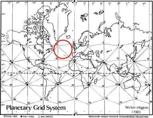
Distribution for this structure has been studied as an hypothetical archeology subject called Ley Lines.
Icosahedron Maps
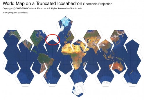
Final Aproach, Icosahedrons maps
This map shows a special geometric view of earth, in which converge all connotations that have been studied with an icosahedron face's edge in Atlantis location.
This maps are known as Dymaxion maps or Fuller maps, at moment are used by Newport Geographic and The International Map Trade Association (IMTA).
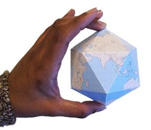
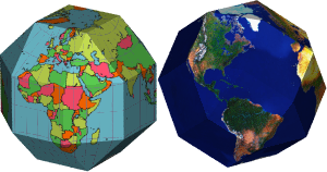
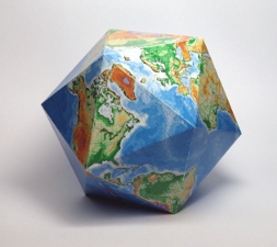
Pics to check Icosahedron
Click thumbnail to view full-size


![Newport Geographic's fountain, Newport Beach California[1]. Newport Geographic's fountain, Newport Beach California[1].](https://usercontent2.hubstatic.com/2230799_50.jpg)
![Newport Geographic's fountain, Newport Beach California[2]. Newport Geographic's fountain, Newport Beach California[2].](https://usercontent1.hubstatic.com/2230768_50.jpg)
Icosahedron Maps, another point of viewing our Planet
Many of you have seen a Football Soccer's ball.
That's a truncated icosahedron,
Yes you have played with it so many times and you didn't know!
=)
In conclusion
Atlantis was located in a special island, geographically was between North America and Europe, meaning that it was an strategical business and merchant point for sure, cultural interchange port for travelers as well for been located in an oceanic place.
Scientific achievements for this civilization where indeed inherited to Egypt, and this subject with evidences will be studied deeper in subsequent hubs, and then you will know what they were doing with this knowledge about Troposphere and more.
All links you need
- MetEd Home Page
The MetEd (Meteorology Education and Training) Website was established to provide education and training resources to benefit the operational forecaster community, university atmospheric scientists and students, and anyone interested in learning. - Newport Geographic
Geographic Fine Art: Satellite Imagery Maps, Giclee Prints, Prints on Ceramic tile, Wall Murals. - IMTA :: International Map Trade Association
The International Map Trade Association (IMTA) is the foremost worldwide organization of the mapping, geospatial and geographic information industry.


![Newport Geographic's fountain, Newport Beach California[1]. Newport Geographic's fountain, Newport Beach California[1].](https://usercontent2.hubstatic.com/2230799_f520.jpg)
![Newport Geographic's fountain, Newport Beach California[2]. Newport Geographic's fountain, Newport Beach California[2].](https://usercontent1.hubstatic.com/2230768.jpg)

