SANTORINI - Live your myth in Greek island


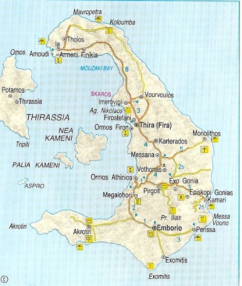


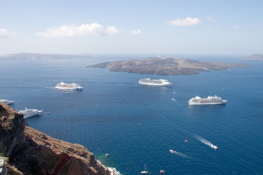
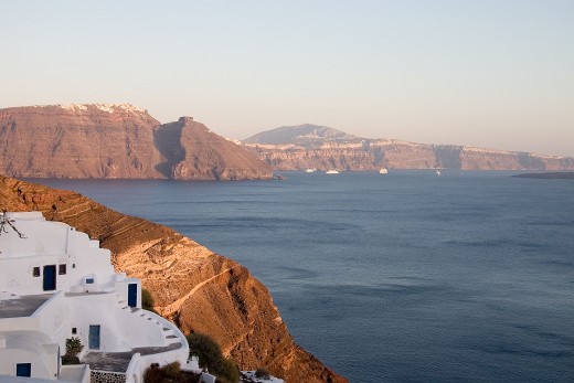
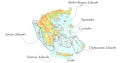
GEOGRAPHY. Thera or Santorini is quite unlike the other Cycladic islands on account of its geomorphology, resulting from the activity of its now dormant volcano. The present configuration of the island is due to the sinking of the caldera and it is surrounded by two other islands, Therasia and Aspronisi. Thera is on the southernmost fringe of the Cyclades, between los and Anaphi. It is 76 sq. km. in area, has 69 km. of coastline and is about 200 nautical miles from Piraeus. There is a daily boat service from Piraeus and with the rest of the Cyclades, daily during the summer. The boat on the Piraeus-Kavala route also goes via Santorini, linking it with Crete, the Dodecanese and the islands of the east and north Aegean, while in the summer there is a local connection with los, Paros, Naxos and Mykonos. There are also flights to Mykonos, Rhodes and Herakleion Crete. The island's capital is Phira, its main port is Athinios and its population is 7,083.
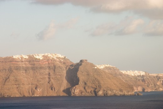
Most of the island's terrain n is covered by deposits of volcanic material; its west coast is sheer cliffs, while its east side is an extensive, fertile plain. In the interior of the island is the mountainous mass of Profitis Ilias (565 m. a.s.I.).
Santorin’s unusual landscape, impressive architecture, wealth of monuments and overall fascination attract visitors in their thousands especially during the summer months. They arrive by all possible means, including cruise liners and its albeit well-developed tourist facilities are often insufficient to cope with them all. However, despite this deluge of tourist the island's picturesque aspect remains un-spoilt and one can just as easily spend a quiet holiday as a cosmopolitan one.
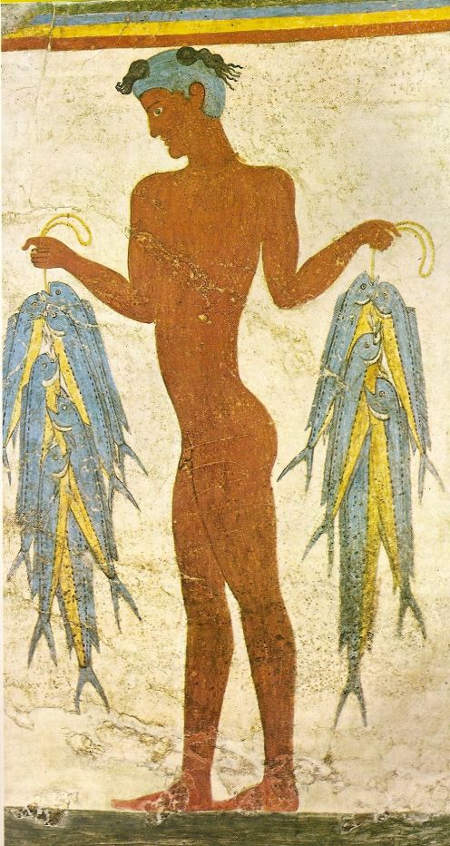
HISTORY. In antiquity the island was known as Strongyle (perhaps because of its shape); it is also referred to as Kalfiste (the most fair) and, historians tell us, was settled by Phoeniicians. Excavations have shown that the island was inhabited in prehistoric times, during the Early Cycladic period (3200 - 2000 BC), and the dig at Akrotiri (Sp. Marinatos - continued by Christos Doumas) indicate that the island reached its apogee during the ensuing period (2000 - 1550 BC), which was cut short by the eruption of the volcano in 1500 BC. Finds from the area of Monolithos suggest that the island was rein habited from at least the 13th century BC. Around 1000 BC Dorian colonizers arrived here, led by Theras, after whom it was named. In historical times its capital was on Mesa Vouno and contacts were established with Cyprus, Crete, Melos, Paros, Rhodes, as well as Attica, Corinth and Asia Minor. Therans founded the colony of Cyrene and in the 6th century BC minted their own coinage. In the following years it remained affianced to Sparrta, but in 426 BC became a member of the Athenian League. On account of its strategic position it was used as base by the Egyptian Ptolemies in Hellenistic times and an anchorage for ships was established in the harbor of Elefsis. The island's decline commenced in Roman times, though in the Byzantine period its political and military significance was exploited once more. From 1207 onwards it belonged to the Duchy of Naxos and was governed by several noble families -Barozzi, Crispo, Pisani. Though well fortified -castles and garrisons- the island was the victim of numerous piratical attacks, culminating in that of Barbarossa in 1537. It was ceded to Joseph Naze until 1579 and then taken by the Turks.
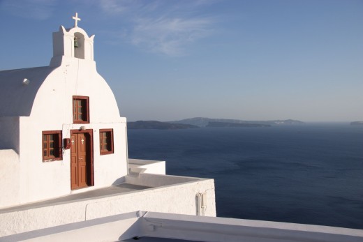
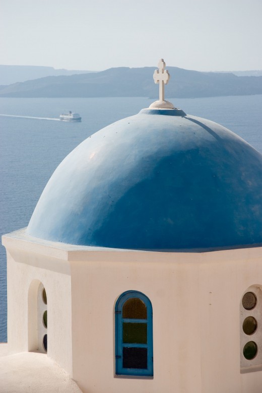
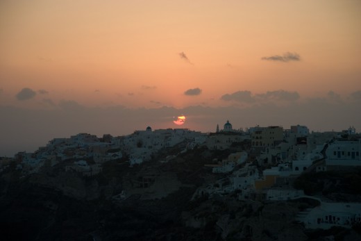
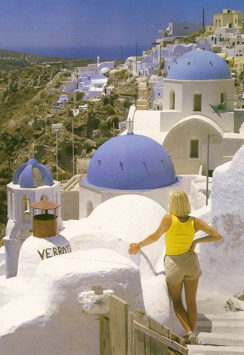
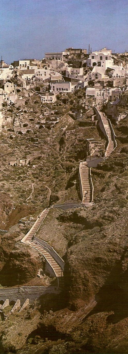
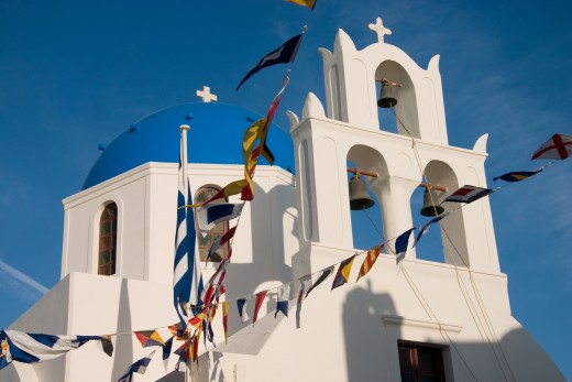
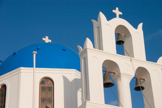
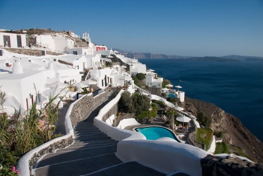
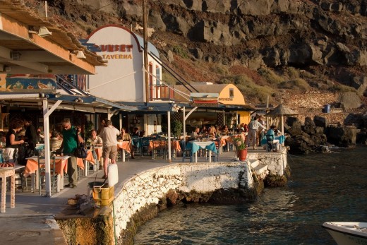
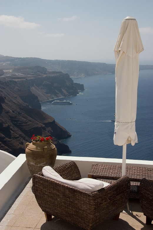
SIGHTS-MONUMENTS. Phira, the main town, is built amphitheatrically on the west side, atop the rim of the sunken caldera. A serpentine path of broad steps unites it with the harbor (Ormos Phiron) -much quicker ascent is assured in the recently built funicular railway- from which there is an astonishing view of the bay and the sheer cliffs. The architecture of the houses is unique; small, blinding white, with vaulted roofs and tiny windows. In and amongst stand grander mansions with courtyards. A little way beyond the Archaeological Museum is the Dominican convent, incorporating a cultural centre and school of carpet-making. Adjacent to it is the Catholic cathedral; the Orthodox metropolis is on the south side of town. North of Phira, at Meroviigli, once the home of aristocratic families, the remains of many impressive bourgeois mansions can be seen and the convent of St. Nicholas (founded in 1674). At its western extremity is Skaros, site of the medieval capital which endured until the early 17th century, from which time it was gradually abandoned. In 1811 the capital was finally transferred to Phira. From the harbor of Phira one can take a caique trip to the volcano, Nea Kameni, with its cinderous rocks and sulphurous vapours and warm gases issuing from fissures. There are thermal springs on neighboring Palaia Kameni.
On the south side of the island, close to the present village of Akrotiri, is the prehistoric city, revealed in excavations begun by the late Professor Sp. Marinatos in 1967 and continued by Professor Chr. Doumas.
The entire city with houses, streets, squares and workshops was destroyed by the volcanic eruption of 1500 BC and remained buried beneath the mantle of pumice and ash. Of the many finds recovered -pottery, stone tools and vessels, minor objects, bronze tools and vessels- the wall-paintings are outstanding, their subjects and style testifying to the socieety's high level of artistic and cultural achievement.
East of Akrotiri is Emboreion (9 km. south east of Phira) where there was another sturdy castle in medieval times, remnants of which still stand on a low knoll. The Goulas on the northern outskirts of the village is a square tower built during the Turkish occupation to protect the property belonging to the Patmos monastery of St. John. From here one reaches the beach of Perissa. A pathway leads from here to the region of Mesa Vouno, site of ancient Thera, which can also be approached from Kamari, as well as from Pyrgos. Excavations carried out by Hiller von Goetringen uncovered the' agora, temene, temples, theatre, gymnasium, public edifices and private residences, that is the remains of the city which was the island's capital in the 8th century BC and continued in use until at least the 1st century BC. Notable finds from here include an intact Archaic clay figurine and pottery. The churches of St. Stephen, built on the ruins of an Early Christian basiliica, and the Annunciation are also inside the archaeological site. At the base of Mesa Vouno is the 19th century monastery of Perissa. About 4 km. south of Phira is the village of Mesaria with several old mansions, and slightly further south is Vothonos with its quaint houses and churches, of the Virgin in Trypa, actually set in the rock, and St. Anne. To the southeast is Exo Gonia and then Mesa Gonia with the Byzantine church of Episkopi, dated to the 11th cenntury, in which there are valuable icons and significant wall-paintings. 1.5 km. to the west is the village of Pyrgos, its picturesque houses built amphitheatrically on the hill slopes. In the middle Ages the village was fortified with a castle of the same type as on Siphnos and Kiimol os, where the outermost row of houses comprised the enceinte and with a garrison at its summit -Kastelli- which is still in rather good condition. The 10th century Byzantine church of Theotokaki stands here. From Pyrrgos one can continue one's ascent to the monastery of Prophet Elijah, an 18th century building housing sacred keimelia, a small folkklore museum and an icon-painting atelier. A bend in the main road brings one to Megaloochori where there are ruins of a small 3rd century BC temple and the churches of the Presentation of the Virgin, Sts. Anargyroi and St. Nicholas Marmaritis. Southeast of Phira (7 km.) is the quiet little village of Monolithos. On the northwest side of the island (10 km. from Phira) is the traditional village of Oia which is particularly well preserved, its pristine white houses and brightly colored vaults, courtyards and mansions endowing it with a special beauty. East of Oia (1.5 km.) is yet another unspoilt village, Phoinikia.
Most of Thera's beaches (many with black sand and pebbles) are concentrated on its east side and are particularly good for swimming. Good beaches on the north coast are those near Oia, Armeni, Ammoudi and Baxedes. There is a refueling station for boats at Athinios. There are plenty of hotels, pensions, furnished rooms and apartments, as well as all manner of places of entertainment. The most popular beach is Kamari. Directly opposite Oia is the little island of Therasia (4 nautical miles from Phira) to which caiques make regular trips. A winding, stepped path leads up to the village with its Lilliputian houses. There are a few rooms to let.
- words is not enough to describe the island...