Oregon Historical Bridges

The Historical Covered Bridges throughout Oregon
Because of the easy availability of forest resources in Oregon, most of the early bridges in the state were timber structures. These timber bridges were often covered to protect them from the weather and preserve them. Now, the remaining bridges are found in rural areas. People come to see them from afar, they are worth the trip.
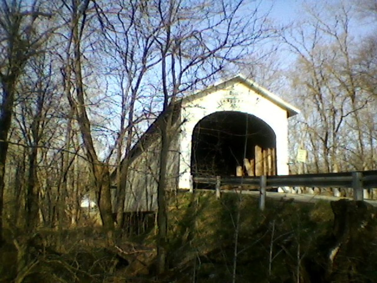
The bridge shown above is the Antelope Covered Bridge.
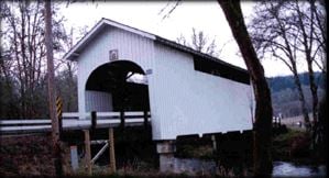
Harris Bridge - Mary's River - Benton County
World Guide Number: 37-02-04
The Harris Covered Bridge is beautiful! This span of 75 feet, crosses the Marys River on a gravel road near a town named after George Harris whose family settled the area in 1890.
The current bridge was built in 1936 to replace the original covered bridge on the site.
How to get there:
Go west out of Corvallis on Highway 20 to Wren. Take the Harris Road about 2 miles to the bridge.
Harris Bridge
Bridge photographs on this page are used with permission of the Covered Bridge Society of Oregon
Alsea River (Hayden) Covered Bridge - Benton County
World Guide Number: 37-02-05
Spanning the Alsea River, two miles west of Alsea, The Hayden Bridge is one of the oldest in the state.
The Original Bridge was built in 1918. The span was either partially or totally rebuilt in 1945. Its portals, once rounded in design, have been enlarged to a more modern design to facilitate larger loads.
Vertical board and batten siding flares out at the base. A daylighting window strip below the roofline on both sides of the bridge lights the bridge from the inside.
Where is it located?
From Corvallis take Highway 34 southwest approximately 24 miles to Alsea and continue west 2 miles to Hayden Road. Turn left on Hayden Road and continue for several hundred yards to the bridge.
Hayden Bridge
Irish Bend Bridge - Oak Creek - Benton County
World Guide Number: 37-02-09
This beautiful Irish Bend Bridge originally crossed a slough near the tight bend in the Willamette River which was named for the pioneers of mostly Irish descent who settled this area.
It was built in 1954 and was utilized there until 1970.
In 1989 the bridge was moved and re-assembled on the Oregon State University Campus in Corvallis.
To find it, take Hwy 20 West to 53rd St, then take a right, travel approximately 1 mile east and you will find it!
Sandy Creek Bridge (Remote) - Coos County -Sandy Creek
World Guide Number: 37-06-09
This 60 ft. Howe truss span is officially called Sandy Creek Bridge for the stream it traverses, but many people refer to it as Remote Bridge naming it for the small townsite a half mile east.
Sandy Creek bridge remained in service from 1921 until 1949 on state route 42 which is the main route between Roseburg and the Coast. It carried heavy traffic including log trucks and was strengthened with a double Howe structure which is very unusual for such a short span. Another oddity of this bridge are the large framed windows running its length to provide interior light for safety. In 1981 the Myrtle Point Lyons Club adopted the bridge and it now rests in a wayside park.and through their effort transformed the site into a park.
To find it, take Highway 42 West from Roseburg to Remote. The bridge stands next to the concrete highway crossing.
Sandy Creek Bridge
Rock O' the Range Bridge - Swalley Canal - Deschutes County
World Guide Number: 37-09-A
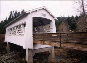
Rock O' the Range Bridge cross the Swalley Canal, east of the Cascade mountains in Oregon. This is a private covered span, dedicated for use by the public. It is not, according to the World Guide, a "true" covered bridge because it is not supported by a truss, but it sure looks covered...and it is a bridge!
Rock O' the Range Bridge

Cavitt Creek Bridge - Little River - Douglas County
World Guide Number: 37-10-06
Cavitt Creek Bridge spans the Little River, and is 70 feet in length. It was built in 1943. It is painted white. The shape was designed for logging trucks to cross, you can see the high portals to accomadate their loads of logs. The bridge has small windows on each side.
It was named after Robert Cavitt, a pioneer settler of the 1880's. It is a Howe Truss style and was built by Douglas County bridge builder, Floyd Frear.
DIRECTIONS: Take highway 138 from Roseburg to Glide. From there, take county road 17A south for one mile then stay to the left and follow 17 four miles to Peel. Continue on one mile to the bridge at the intersection or county roads 17 and 82.
Cavitt Creek Bridge
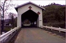
Horse Creek Bridge - Douglas County - Myrtle Creek
World Guide Number: 37-10-12
The Horse Creek Bridge was built in 1930, it is 105 ft. long and now spans Myrtle Creek at Millsite Park. Closed in 1968, it was then moved from it's original place and reassembled by the citizens of Myrtle Creek.
The legend at the bridge states the following:
"DEDICATION
This reconstruction project is dedicated to those individuals, civic organizations and corporations that have donated materials, time and equipment to make possible the renaissance of one of Oregon's truly historic structures. Also to the citizens of this community for displaying the support vital to any such project.
HISTORY
The Horse Creek Covered Bridge was constructed in 1930 featuring the Howe Truss Design. The bridge was located on Horse Creek Road in the vicinity of the McKenzie River Bridge. The Horse Creek Bridge was removed for salvage by Lane County in December of 1987 and given to the City of Cottage Grove. As Cottage Grove had no intentions of reconstructing the bridge and Myrtle Creek showed and interest in doing so, Cottage Grove gave the structure to Myrtle Creek."
To find it take I-5 to the Myrtle Creek Exit. The bridge is downtown in Millsite Park.
Horse Creek Bridge
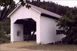
Milo Academy Bridge - Douglas County - South Umpqua River
World Guide Number: 37-10-A
The Milo Academy Bridge spans the South Umpqua River. It was built in 1962 and replaced an earlier wooden truss covered bridge at this site; it is actually a steel bridge with a wooden housing and metal roof.
The view is just gorgeous as you look at it from the side as it spants the 100 feet space over the river.
To get there, Take highway 227 from I-5 Canyonville/Days Creek exit and follow it to the bridge.
Neal Lane Bridge - Douglas County - Myrtle Creek
World Guide Number: 37-10-07
The Neal Lane Covered Bridge crosses Myrtle Creek, a stream used heavily for irrigation.. It is only 42 feet long, it is one of the shortest covered bridges in Oregon, and the only roofed span in Oregon using a kingpost truss design. It was built in 1929. Though one local resident says he did construction on the bridge in 1939.
The site at Myrtle Creek was originally settled in 1851. It was sold to John Hall in 1862, who established the town in 1865. The name Myrtle Creek was in recognition of the nearby groves of Oregon Myrtle, an evergreen tree distinguished by a strong camphor odor.
Location:
From the city center of Myrtle Creek travel south on Main Street to Riverside Drive. Head east on Riverside Drive to Day's Creek Cut Off Road. Travel South on Day's Creek Cut-off Road to Neal Lane.
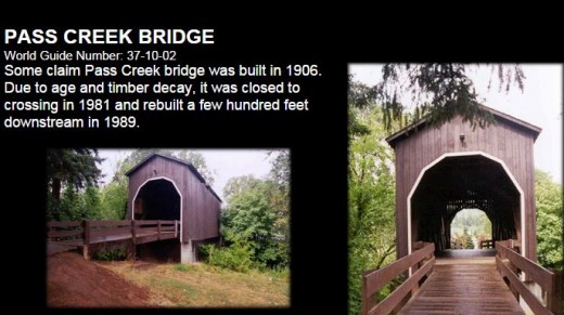
Pass Creek Bridge - Douglas County - Pass Creek
World Guide Number: 37-10-02
The Pass Creek Bridge was built in 1925, it possibly replaced another bridge there built in the late 1800's or even possibly in 1906, according to legend.
It is a Howe Truss type of bridge, with a span of 61 feet long.
The bridge was moved in 1989 to it's current location, to get there go from West B Street in Drain, turn south on 2nd and go one block to West A Street. The bridge is behind the Civic Center.
Pass Creek Bridge
Bridge photographs on this page are used with permission of the Covered Bridge Society of Oregon
Rochester Bridge - Douglas County - Calapooya River
World Guide Number: 37-10-04
This long bridge is 80 feet in length, and is called The Rochester Bridge. It crossed the Calapooya River in Douglas County. It was built in 1933.
The design of this bridge is unique among Oregon roofed structures, featuring windows that have graceful curved tops.
Rochester Bridge
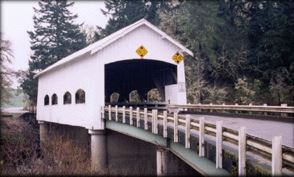
Built by veteran builder Floyd Frear, the bridge combines both beauty and strength offered by the wooden structure.
Bridge photographs on this page are used with permission of the Covered Bridge Society of Oregon.
Antelope Creek - Little Butte Creek - Jackson County
World Guide Number: 37-15-02
The Antelope Creek Bridge is a queenpost truss and was built in 1922 south of Eagle point.
Its 58 feet long and spans Antelope Creek.
In 1987, years after the structure had been closed to traffic, there was talk of tearing it down. The citizens of Eagle Point rescues the bridge.
In August of that same year, the structure was relocated to the middle of Eagle Point, Oregon to span Little Butte Creek as a pedestrian crossing.
Large windows were cut into the sides to provide light and visibility for the school children who would be using the span.
This alteration, however, caused the bridge to be removed from the National Register of Historic Places.
In spite of this, it is still a sight to see.
To find it head north of Medford on highway 62. You won't miss it!
Antelope Creek
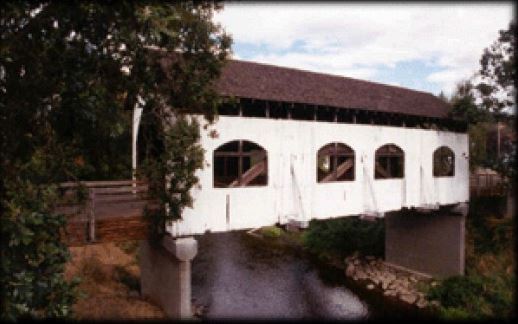
Lost Creek Bridge _Lost Creek - Jackson County, Oregon
World Guide Number: 37-15-03
The Lost Creek Bridge, at 39 feet, is the shortest of all Oregon covered bridges. Since 1979, the structure has been closed to traffic with a concrete span handling the few vehicles each day.
Many Jackson County residents, including Shirley Stone, daughter of pioneer John Walch, claim the Lost Creek Bridge to have been built as early as 1878-1881. If authenticated, this would make it Oregon's oldest standing covered bridge.
Johnny Miller, the builder of the Lost Creek Bridge, also roofed the nearby span at Lake Creek in the 1880s, thus lending credence to a sign nailed on the bridge: LOST CREEK BRIDGE, BUILT ABOUT 1881.
The span may have been partially or totally rebuilt in 1919, hence the official construction date in that year. Features of the bridge include the usual county Queenpost design, a shingle roof and flying buttress braces. The rough wooden flooring consists of diagonal planking, and hand hewn truss members provide structural stability.
From highway 62, turn east on highway 140 and follow it to the Lake Creek exit. From Lake Creek, go three and a half miles on South Fork Little Butte Road, then turn right on Lost Creek Road. The bridge is a half a mile farther.
McKee Bridge - Jackson County - Applegate River
World Guide Number: 37-15-06
The McKee Bridge is Oregon's southernmost span resting only eight miles from the California border.
Built in 1917 by John Hartman of Jacksonville and was utilized until 1956 when it was declared unsafe for vehicular traffic.
The land for the site was donated by rancher Adelbert "Deb" McKee, whose home had also served as a stage station and halfway point for the Blue Ledge copper mine which operated until 1919. Relief horses were kept there for the ore wagons. Lodging was also provided for travelers.
The 122 ft. span is 45 ft. above the Applegate River, named for Lindsey Applegate, the pioneer trail blazer who opened the southern route for Oregon settlers. It is supported by a Howe truss and is stiffened with flying buttresses. A scenic park, built by the Civilian Conservation Corps in the 1930s, is adjacent to the bridge. This is another "must see" covered bridge.
Take highway 238 to Ruch, Oregon. Head south on Applegate Road following the Applegate Dam signs to the town of MaKee Bridge. The span is located just south of town.
Grave Creek Covered Bridge - Josephine County - Grave Creek
World Guide Number: 37-17-01
Grave Creek Covered Bridge.
In 1846, after witnessing too much death and tragedy among the Oregon Trail pioneers, Jesse and Lindsay Applegate felt that there had to be a better way, a southern route into Oregon's Willamette Valley. That year they forged the trail and the first wagon train rolled into the territory from the south. On that journey, 14 year old Martha Leland Crowley succumbed to illness at this crossing. After this, the stream came to be known as Grave Creek. The 105 ft. covered bridge was built at this crossing in 1920 using a Howe truss for its support. Interstate 5 is now the main North/South artery in the valley and the bridge only serves local traffic, but Josephine county officials are contemplating replacing the bridge with a concrete span.
You can actually see this bridge from I-5. Go east under the freeway at the Sunny Valley exit, the head north for approximately one mile to the site.
Belknap Bridge - McKenzie River - Lane County
World Guide Number: 37-20-11
The Belknap Bridge occupies a site in which a covered bridge has been in continuous use since 1890. The neighboring community recognized the importance of a river crossing at that location and adopted the name "McKenzie Bridge."
In 1911 the first bridge was replaced by Lane County with another covered structure.
The third covered bridge at this site was erected in 1939 and was destroyed by the Christmas Flood of 1964. The current covered span was designed by Oregon Bridge Corporation of Springfield and the bridge was opened in 1966.
Several years later, louvered windows were added to the bridge to give interior illumination and to reduce the "box effect" of the windowless span. Extensive repairs in 1992 and 2002 strengthened the structure, and a new roof was installed.
Belknap Bridge
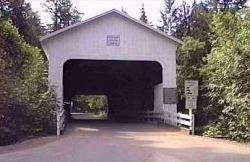
The Centennial Bridge was built in 1987 and is 84 feet long.
This bridge, located in Cottage Grove, is different than others. It is a footbridge constructed from the old timbers of two dismantled highway bridges, Meadows Bridge of Mapleton and Brumbaugh covered bridge which was near this same Community. The two bridges were put together to form this one in 1987 to commemorate the town of Cottage Grove's 100 year anniversary.
It is said the timbers from the two dismantled bridges were taken from the Lane County storage yard and milled to size at the John Wilson and Son Sawmill.
The vertical tension rods were cut and re-threaded to fit the shortened structure of 14 ft. The labor for the project was primarily volunteer, and its design reflects the dimension the nearby Chambers Bridge, a derelict remnant from the days of steam railroading. It is a wonderful piece of history.
The bridge is on Main Street just west of Downtown Cottage Grove.
The Centennial Bridge
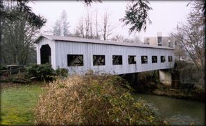
Chambers Railroad Bridge - Lane County -
World Guide Number: 37-20-40
Chambers Railroad Bridge is the only remaining covered railway bridge in Oregon. It is 78 ft. in length, and a Howe Truss span.
The bridge was named for the Frank Chambers Sawmill which it served from its construction in 1936 until the sawmill burned in 1943. It has stood abandoned crossing the Coast Fork of the Willamette River ever since.
The bridge's odd proportions reflect its usage. It had to be tall to accommodate steam locomotives, and it had to be sturdy to hold up to the weight of loaded log cars on their way to the mill. The timbers were all hand hewed. Sawing raises the grain of the wood and allows moisture to enter. Dimensioning the cords with adze and broadax produces a smooth, naturally water repellent surface.
To find the bridge, in Cottage Grove, go south on River Road.
Chambers Railroad Bridge
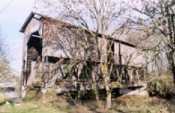
The Coyote Creek Bridge - Coyote Creek - Lane County
World Guide Number: 37-20-02
The Coyote Creek Bridge spans Coyote Creek in Lane County. It is 60 feet in length. This Howe truss style bridge was built in 1922, and has been known by several names, Swing Log and Battle Creek Bridge. Heavy snowfall severely damaged the bridge in 1969 as the weight of more than three feet of snow collapsed the entire roof. Chainsaws were used to saw off the rafters, and the bridge remained uncovered until early spring when county crews reroofed the structure. The road it is on is the first road in Lane County, constructed in 1851.
To get to it, take Crow Road, which is 6 miles west of Eugene off of S.R. 126, to its intersection with the Territorial Highway. Go south one mile on Battle Creek Road, then turn west to get to the bridge.
Latitude: 43°58'11.3"N Longitude: 123°19'07.8"W Truss Type: Howe
The Currin Bridge - Row River - Lane County
World Guide Number: 37-20-22
The Currin Bridge spans the Row River, it is a long bridge at 105 feet in length. It was built in 1925 and replaced another bridge that had been built in 1883. The bridge was closed to traffic in 1979, and restored again in 1995.
To get to the bridge, take Row River Road, 4 miles SE of Cottage Grove to Laying Road.
Note: There is another bridge close by, the Mosby Creek bridge, only one mile away on the same road. So you can see them both in the same trip.
Latitude: 43°47'34.9"N Longitude: 122°59'47.5"W Truss Type: Howe
The Deadwood Bridge - Deadwood Creek - Lane County
World Guide Number: 37-20-38
The Deadwood Bridge spans Deadwood Creek. It too is 105 feet long. The Deadwood Bridge was built in 1932. The floor of the bridge was purposely built on a slant so those crossing it could round the corner safely. Closed in the 1970s, it has been restored and is now open since 1986.
To get there, head north to Deadwood from Mapleton. Take Deadwood Creek Road 5 miles to Deadwood Loop Road. The bridge is on Deadwood Loop Road.
Latitude: 44°08'36.9"N Longitude: 123°43'13.9"W Truss Type: Howe
The Dorena Covered Bridge - Row River - Lane County
World Guide Number: 37-20-23
The Dorena Covered Bridgespans the Row River. This bridge is also 105 feet in length. It was constructed in 1949 after the Dorena Reservoir was opened. Restored in 1996, with a brand new roof, deckng and windows it is now a rest area.
To get there head east on Row River Road from Cottage Grow to Government Camp Road. It is 7 miles to the bridge.
Latitude: 43°44'14.6"N Longitude: 122°53'01.4"W Truss Type: Howe
The Earnest Bridge - Mohawk River - Lane County
World Guide Number: 37-20-35
The Earnest Bridge spans the Mohawk River. It is 75 feet long, and was built to replace the Adams Bridge (1903) in 1938.
This bridge has a neat history as it was altered and used in a 1964 movie, Shanandoah, but was restored to it's original condition with one addition, they added a side window.
To get to the bridge, from Springfield, Oregon head north on Marcola Road (14th Street) for 17 miles, then take a right on Pachelke Road to the bridge.
Latitude: 44°12'04.6"N Longitude: 122°50'10.5"W World Guide Number: 37-20-35 Truss Type: Howe
Map of Covered Bridge Locations, Truss types & References used
- Map of Covered Bridges in Oregon
Oregon Department of Transportation - Oregon Covered Bridges Directory - StateofOregon.com
Oregon Covered Bridges Directory - StateofOregon.com - Oregon's Covered Bridges
Oregon's Covered Bridges. Most people think of quaint New England villages when they think of covered bridges, but Oregon also has its share. Today, many are preserved next to new concrete spans and some have been converted into roadside parks, but - Oregon.com - Covered Bridges of Oregon
Online guide to covered bridges of Oregon with pictures, maps and history of each covered bridge. - StateofOregon.com Covered Bridges Directory
Watch this space for future events. Upcoming Meetings: April 19 May 17 October 18 November 15 All meetings begin at 7:30 p.m. at Keizer City Hall.Volunteers Needed to help with our Covered Bridge Festival. - Howe Truss
What is a Howe Truss? William Howe, from Spencer, Massachusetts, patented his new truss design in 1840, and extended the patent in 1850 with design improvements. The Howe Truss was originally designed to combine diagonal timber compression members a - The Theodore Burr Covered Bridge Society of Pa., Inc. Trusses Page
A covered bridge society for the preservation of covered bridges. This is a great page that shows pictures of different trusses used in building covered bridges. - Introduction to Oregon's Covered Bridges
This explains why they were give a World Guide Number - Driving directions to Bridges
This is a fantastic list to print off and take with you when traveling. They have put together driving directions as well as the latitude and longitude for each covered bridge in Oregon! - Covered Bridge Index
A guick index to lengths and years the bridges were built.
Goodpasture Bridge - Lane County - McKenzie River
World Guide Number: 37-20-10
The Goodpasture Bridge is among Oregon's longest covered spans at 165 feet, and is the longest highway span still in use. It too is a Howe Truss.
The bridge was named for a pioneer family.
It seems Goodpasture Bridge is the county's most photographed covered bridge.
It displays Gothic-louvered windows on each side and semi-elliptical portal openings.
The bridge when built cost $15,138 in the 80's it was decided it needed some repairs, then in 1987, after spending $750,000.00 fixing up the bridge, it was reopened to traffic.
Good pasture Bridge
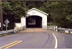
Lake Creek Bridge - Lane County - Lake Creek
World Guide Number: 37-20-06
Lake Creek Bridge
This bridge is also known as Nelson Creed Bridge, and sometimes called Nelson Mountain Bridge.
The original bridge was built in 1928 using a Howe Truss for support at a cost of $3,155. It is 105 feet in length.
They "upgraded" the bridge in 1984, to include center pier and concrete decking. The pier was a necessary addition since the precast concrete decking works independently of the Howe truss. Because the concrete flooring and center pier do not support the trusses, the intricate job of installing them required use of a crane to slide them into place. Wooden abutments and wooden trestle approaches were also replaced with reinforced concrete materials. It features narrow ribbon openings at the eaves, and squared portal openings.
Portal boards on both ends were replaced in the late 1970s after they had been broken by the high loads of log trucks. A new coat of white paint was added to the structure after the reconstruction project was completed. The top and bottom chords of the truss are each cut from single logs. The uppers are 12" x 12" x 79 feet. The lower chords are 12" x 12" by 111 feet!
To find it:
From Eugene take Highway 99 north to Highway 36. Travel west on Highway 36 approximately 38 miles to Nelson Mountain Road. Alternately, travel north from Mapleton on Highway 36. The Nelson Mountain Road turnoff is located near milepost 17. Turn south on Nelson Mountain Road to the bridge.
Latitude: 44°06'15.6"N
Longitude: 123°40'25.1"W
Lowell Bridge - Middle Fork Willamette River - Lane County
World Guide Number: 37-20-18
The Lowell Bridge
Amos Hyland named the townsite after his birthplace of Lowell, Maine when he settled, which is how the bridge became Lowell Bridge.
They used to cross by ferry. Nels Roney built the first bridge at Lowell in 1907. Roney was paid $6,295 for the 210-foot span.
A truck mishap in the old Lowell Bridge in the early 1940s knocked the truss out of alignment. The Roney-built bridge was replaced at a cost of $25,473 in 1945.
In 1953, the bridge was raised six feet and the roadway rebuilt in anticipation of the flooding produced by Dexter Dam. The engineers' estimates were correct, and water has never risen closer than 2 feet from the bottom of the bridge.
Until 1981, it was used heavily by Trucks. It was closed that year when a modern concrete span was built paralleling the old wooden one. Prior to the closure, a dump truck passing through the bridge with its bed raised extensively damaged the span.
Lane County replaced broken lateral roof braces and portal boards, only to close the structure several weeks later when it was bypassed.
Western Federal Lands Highway Division, Lane County, Oregon Department of Transportation and the United States Forest Service are entering into an agreement to create an interpretive center for the Lowell Covered Bridge. This project will include restoration and rehabilitation of the bridge, as well as creating a parking area with bathrooms, developing interpretive features and signing. The total cost of the project is expected to be $1.2 million.
This bridge replaced a 1907 covered span. At 24 feet, it is the widest of all covered bridges in the state and handled heavy logging truck crossing until it was closed to crossing in 1981. It is the only known instance of a covered bridge over a reservoir.
Lowell Bridge

Mosby Creek Bridge - Lane County - Mosby Creek
World Guide Number: 37-20-27
Named after David Mosby, Who was came on the Oregon Trail in 1853 and settled in this area east of Cottage Grove and owned 1,600 acres east of the present city of Cottage Grove.
Lane County's oldest covered bridge, the Mosby Creek Bridge was built in 1920 at a cost of $4,125 by Walter and Miller Sorenson. . The span is a 90 ft. long modified Howe Truss with spliced chords and steel rod cross braces on the upper chords. The span was capped with a corrugated metal roof. It has semi-circular portal arches, ribbon openings at the roofline, and board-and-batten siding.
In 1996, foul weather took its toll on the bridge causing extensive damage. Then during the summer of 2002, the roof was replaced with synthetic roofing material, and other repairs were made at the same time.
Location:
Travel one mile east of Cottage Grove on Row River Road. Follow the sign to Mosby Creek Road by turning right, and crossing the railroad track. Turn left on Mosby Creek Road and travel southeast two miles to the bridge.
Or from Currin Bridge continue southwest on Layng Road to Mile Point 0.2 to Mosby Creek Bridge.
One interesting fact, The Mosby Creek Bridge was one of the bridges which could be seen from the Oregon, Pacific and Eastern steam excursion train, The Goose, prior to the sale of the locomotive to Yreka, California in 1987.
Office (Westfir) Bridge - Lane Co -North Fork of Middle Fork Willamette River
World Guide Number: 37-20-39
Office (Westfir) Bridge spans the North Fork of the Middle Fork of the Willamette River at 180 feet. Believed to be the longest span in Oregon for Covered Bridges. It also has a attached covered walkway next to the road deck, which makes it a very unique bridge and one for the covered bridge lover that is a "must see"!
It has a Howe Truss, and was built in 1944 by the Hines Lumber Company. The truss members are gigantic with multiple tension rods and compound chord members. The house has horizontal shiplap siding. It is used for hauling logs to the mill across the river.
The bridge was extensively restored from 1992-1994.
To find it, Take highway 58 east from Eugene. As you approach Oakridge, turn on Westridge Avenue (near mile post 31). Take the county road (C.R. 6128) to Westfir, about 2 and a half miles.
GPS Users: Latitude: 43°45'30.3"N
Longitude: 122°29'44.5"W
Parvin Covered Bridge - Lane Co - Lost Creek
World Guide Number: 37-20-19
The Parvin Covered Bridgetakes its name from James and Salina Parvin who homesteaded in this area in the 1850s.
The original bridge was built in the late 1800's. The bridge there now was built in 1921 by George W. Breeding.
It is a 75-foot Howe span. The cost of the structure was $3,617 and included a 62-foot east approach and a 17-foot west approach.
Bypassed in the mid 1970s, the bridge was re-opened with a ceremony November 17, 1986, being a special day for the several dozen people which gathered at the dedication of the renovated span. Present for the dedication ceremony were two granddaughters of James and Salina Parvin who homesteaded in the area during the 1850s.
To get to the bridge, Take highway 58 for 12 miles from Interstate 5, turn right and proceed south on Lost Creek Road. At the railroad bridge turn right on Parvin Road and follow this to the bridge.
GPS: Latitude: 43°53'58.0"N
Longitude: 122°49'22.8"W
Pengra Bridge - Lane County - Fall Creek
World Guide Number: 37-20-15
The Pengra Bridge spans Fall Creek at a length of 120 feet.
The bridge was constructed in 1938. It utilizes a Howe Truss.
One interesting feature of this bridge is the size of the Timbers, The Pengra Bridge has the longest timbers of any Oregon bridge, measuring 16" x 18" x 126'.
The Bridge was restored in 1994.
Pengra Bridge
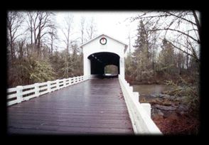
To get to the bridge take highway 58 to the Lowell Bridge, cross Dexter Resevoir, and head north about 2 miles to Unity Bridge. Turn left on Place road and head west for about three miles watching for the short lane to the bridge on the right.
Latitude: 43°57'57.7"N
Longitude: 122°50'43.5"W
Unity Bridge - Lane County - Fall Creek
World Guide Number: 37-20-17
Unity Bridge sports a Howe Truss and spans Fall Creek at a length of 90 feet. The bridge cost the County $4,400 to construct and was completed in 1936. It has a full length "picture window" on the upstream side which provides visibility for traffic to see if other cars are coming as they cross.
The Unity Bridge replaced an earlier structure that was located less than a mile downstream. Restored to a near "mint" condition in 1994.
The window has its own shingled awning to protect drivers crossing the bridge from being blinded by the sunlight, and it also helps keep the weather out.
Due to its proximity to Pengra, Lowell, and Parvin Covered Bridges, many bicycling tours include this on their rural routes.
To get to Unity Bridge just take highway 58 to the Lowell Bridge, cross Dexter Lake on the causeway and head north two miles on the Lowell-Unity Road.
Stewart Bridge - Lane County - Mosby Creek
World Guide Number: 37-20-28
Stewart Bridge is one that is no longer open to vehicle crossing, but you can walk or ride across this span. The Howe Truss structure is 60 ft. long spanning Mosby Creek near Cottage Grove.
Built originally in 1930 and carried a 20 ton load limit until its closure in the mid 1980s then in 1987 it was restored to allow pedestrian and bicycle crossing.
The bridge was by-passed in the 1980s by a concrete bridge. Steps lead down to Mosby Creek below the bridge for fishing and swimming.
A unique feature in Stewart Bridge is its deck. About two thirds of the way through is a hand hewn plank that raises the level of the deck by a deck board's thickness. Like a speed bump.
This bridge has been through a lot, both of its lower chords broke in the 1964 Christmas flood, and in 1968, the roof caved in under the weight of three feet of snow during a winter storm. Both times repairs were effected to return the bridge to full capacity.
DIRECTIONS: The bridge is near Mosby Creek bridge. Follow Row River Road from Cottage Grove for one mile to Mosby Creek Road. Turn Right, go over the railroad tracks and turn left. The bridge is at the intersection of Mosby Creek Road and Garoutte Road.
Wendling Bridge - Mill Creek - Lane County
World Guide Number: 37-20-36
Wendling Bridge cross Mill Creek at a length of 60 feet.
The Wendling Covered Bridge was built in 1938 under the supervision of A.C. Striker, the Bridge Superintendent, at a cost to Lane County of $2,241 for construction.
The bridge was named after George Wendling, director of the Booth-Kelley Lumber Company which provided the huge single piece timbers for the upper and lower chords in the Pengra Bridge truss.
Some unique features of this bridge are the semi-elliptical portal arches, ribbon openings near the eaves and a wooden floor.
To find the bridge from Springfield head north on Marcola Road (14th St.). At Marcola, turn right on Wendling Road and follow this to the bridge.
Photo of Wendling Bridge
Wildcat Creek Bridge - Lane County - Wildcat Creek
World Guide Number: 37-20-04
Wildcat Creek Bridge spans Wildcat Creek, at a length of 75 feet. It utilizes a Howe Truss span.
The bridge was built in 1925, and set in a beautiful scenic area, with the nearby Austa boat ramp providing access to the Siuslaw River for fishermen, as well as a great picnic area. In 1990, it was completely renovated and restored to its 20 ton load limit.
This is another of Lane County's bridges with Massive single timber chords. The bottom chords measure 16" x 16" x 113 feet on this Howe truss span. It also has a long narrow opening on the east side to provide a view of oncoming traffic. It also features decorative end brackets, ribbon openings under the eaves, wooden deck flooring.
To get there, just take highway 126 west from Eugene, check your odometer at Eugene's Beltline road and continue for 28 miles to the Whitaker Creek/Clay Creek Recreation Area turnoff. Make a left and then go back under the highway and railroad bridges about a half mile to the bridge.
The Bridges of Madison County Trailer
Thank you for taking the time to leave a note, I appreciate you!
Linda


