Creating Effective Google Maps For Your Hubs
Why Put Maps Into Articles
If you are writing an article about a pacific place then adding a map to show its location is a great visual tool that will help your readers.
Maps can be used to show the location of many different places in a Town or City or even a County or Country. They can also be used to give people directions from one place to another, to make places and attractions easier to find.
Placing Maps In Hubs
Placing a map into a hub is as easy as placing any other capsule. All you have to do is choose a location you want to place the map and insert a map capsule.
Example Map 1: Place Locations
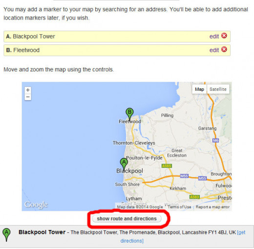
The above map is the kind I like to place at the top of a travel article as it shows the location of the place that the article is about.


Adding Useful Driving Directions
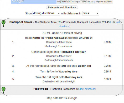
You can add directions to your map easily. All you have to do is click on the show directions button at the bottom of the maps editing window, once you have added at leased two locations. See images to the right. This will bring up the driving directions for you to see. The button is visible to your readers so they can choose to view them if they wish. This means that even if you don't check it while editing readers will still be able to view them.
This is a great tool to show your readers places to explore in and around their chosen location.
In the example above I have set up driving directions from Blackpool Tower to Fleetwood. This would be useful if the reader did not want to take the tram between these locations.
I found this to be a great tool in an article I'm compiling about Scotland as I have been able to create a set of maps that guide the reader from one location to the next easily.
- A visitors Guide to Scotland: Where to explore.
Where to explore in the beautiful Country of Scotland. With its great Cities, Quaint Villages, Mountains and Lochs there is lots to see and do in the land of Tartan Kilts and sporrans
US States
The map capsual is also a great tool to help in educational hubs where the aim is to show readers where each US state is in relation to each other. To do this just focus the map on part of the us and zoom out untill the desired effect is acheived.
World Map
To create the above just open up a map capsule and zoom out until all the continents are visible, then line it up. This map is usefull in lots of geography related articals, like where one country is in relation to another. The only problem is that to get both the artic and antartic to show you have to take the map to a point where it shows the continents twice. (See Below).

