How to Geocache With a Garmin StreetPilot c330 GPS

How to Geocache With a Garmin StreetPilot c330 GPS
Geocaching is a high-tech treasure hunting game played throughout the world by adventure seekers equipped with GPS receiver devices. Although hand-held GPS receivers are more commonly used, this automobile model is also suitable.
Things You’ll Need:
- Garmin StreetPilot c330 GPS
- Computer with MS Windows
- USB Cable
- Geocaching.com Premium Membership (optional)
How to Geocache With a Garmin StreetPilot c330 GPS

How to Geocache With a Garmin StreetPilot c330 GPS

E How to Geocache With a Garmin StreetPilot c330 GPS
Steps
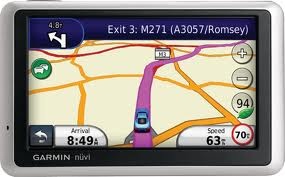
The c330 can be mounted in a car, but can easily be removed for use as a hand-held. This makes it convenient for driving to the Geocache location as well as finding the cache on foot.
- Download and install the Garmin POI Loader software from garmin.com. Click Support, Software Updates, Additional Software, StreetPilot c330, then POI Loader for Windows.
- Pick one or more Geocaches on Geocaching.com which you would like to find. Download the GPX file for each Geocache. Just click the GPX Exchange File link on the Geocache Details page. Or, use a Pocket Query to select up to 500 caches at once using various criteria. You can create Pocket Queries on Geocaching.com (requires a paid, premium membership). Just login, click My Account, then click Build Pocket Queries. The combined GPX file will be emailed to you--usually within a few minutes. Save the GPX file or files into one folder on your computer. Connect the GPS to the computer with a USB cable. Start the POI Loader program. It will open a wizard which detects the GPS and allows you to select the folder containing the GPX files. Finally, it downloads the caches to the GPS, replacing any existing custom points of interest. On the GPS, tap Menu, Where To, My Locations, then Custom POIs. The 50 Geocaches closest to your current location will be listed. To find other caches, tap Spell and enter the Geocache's Code (GCxxxxx). When you get close to the cache's location, it may be difficult to pinpoint because the GPS assumes you're driving and snaps the blue 'you are here' arrow to the nearest road. Just tap Where To, My Locations, Custom POIs, and select the Geocache. Then, instead of tapping Go, tap Show Map. Tap the + button to zoom all the way in. You can upload Geocaches directly to the GPS from the cache's details page on Geocaching.com. These will appear as Favorites in the GPS. However, the GPS will only store 50 favorites and they must be deleted one-at-a-time before adding more.
E How to Geocache With a Garmin StreetPilot c330 GPS
Tips
- Upgrading the GPS' firmware from garmin.com may allow for more than 50 favorites.
- The c330 has about 2GB of memory for holding maps and custom POIs. If you load the USA maps, there is still room for many thousands of POIs. Although maps may be stored in a removeable SD memory card, POIs can only be stored in main memory.
- Software like the Geocaching Swiss Army Knife from gsak.net can be used to organize your GPX files and keep track of which ones you've found.
- Make sure you know how to get back to your car after finding the cache. Just tap Menu, Where To, My Locations, then Save to save your current location before leaving your vehicle.
- Your exact location is shown, not by the tip of the blue 'you are here' arrow, but by the middle of the flat end of the arrow.
- Conserve battery power by lowering the brightness level or by turning off the GPS until it is needed. Tap Menu, then the sun icon in the lower right corner to set the brightness.
- You must keep moving for the blue 'you are here' arrow to update and show your direction. Standing still and swinging the GPS around has no effect.
- The c330 has a built-in rechargeable battery which lasts about 4 hours, but it can also be powered by a USB cable or its main power source, the cigarette lighter.
- Since this is primarily a car GPS, it is not waterproof and may not be suitable for hiking in bad weather or through water.