Aircraft Safety Management System

Request From Scandinavian Airlines
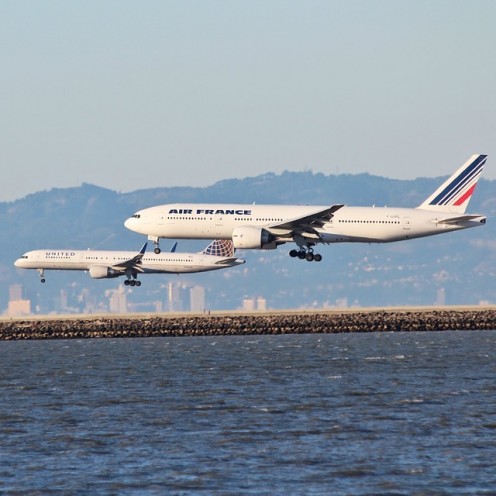
Safety of Aircraft
When two training aircraft collided in mid-air over Saskatoon, Canada it was witnessed by Don when he was still a youngster.
The sight of the crew members mutilated bodies instilled in him a passion for safety. After college, work was scarce and he was eventually offered a job in America in the aviation industry.
Don Bateman was in his office when a colleague handed him a request in 1966. One of Scandinavian Airlines SAS crashed while trying to land at Ankara in Turkey, killing all forty two on board.
The company wanted someone to invent something to warn pilots when they got too close to the ground.
The request of SAS’s gave Don an idea. He took data from two cockpit warning devices. One alerted pilots when the plane was in danger of a stall.
The other, an altimeter, bounced a radio beam off the ground to measure a plane’s precise height so it could be landed in fog.
Incorporating the data into a new device Don called it the ground proximity warning system(GPWS) or ground-prox.
The new device triggered a red light and a noise to alert the pilot when he was nearing the ground.
The SAS Began Fitting Their Aircraft With Ground-Prous
The SAS began fitting their aircraft with ground-pros in 1972. However other airlines showed little interest. America’s Federal Aviation Administration FAA, argued that such accidents were caused by pilot error.
Dan was convinced that all 3500 lives lost over five years could have been saved by his device. In September 1971 his company plane, fitted with ground-prox, was retracing the fatal route of the crashed Boeing.
The Boeing smashed into the Chilkat mountains near Alaska a few days before due to thick fog. One hundred and eleven passengers and crew were killed.
Seconds before reaching the mountain the ground-prox alert sounded, giving the pilot time to pull up smoothly and zoom over the ridge.
Ninety Two Passengers Died in TWA 727 Crash
On December 1, 1974, when a TWA 727 clipped a ridge some 32 kilometers from Washington D.C’s Dulles airport, ninety two passengers died.
Don‘s company plane retracted the route of the crashed plane and showed safety experts and the media how the accident could have been avoided with the ground prox.
After this disaster the FAA made ground-prox compulsory in all commercial jets within days. CFIT accidents in the US fell from an average of eight aircraft per year to only one aircraft every five years.
Warnings Started To Come In About The Safety Device
As timely warnings saved more and more lives, his system was now basic equipment the world over.
Don started getting more and more complaints from airlines that the radio beams bounced off other planes and caused false alarms.
This led pilots to ignore the warnings, with deadly consequences. When a Avianca 747 was descending into Madrid, the ground-prox sounded an alert.
The captain ignored the alert. Seconds later the plane piled into a ridge nearly nine kilometers short of the runway, killing 183. Dan worked hard to improve his invention.
Don then decided to use Global Positioning Satellite GPS navigation systems instead of radio beams in a new safety device.
The new device required a large amount of computer memory and fast processors. Finally Don and his engineers completed the new safety device.
With a small twin prop plane they headed for the Cascade Mountains. Don told the pilot to fly at a mountain peak.
On the laptop computer a picture appeared on the screen, a moving contour map of the surroundings. The new enhanced ground-prox GPWS was born.
Dan Showed His Manager A Video Cassette
Dan’s company was for sale and the management was cutting costs. The situation didn’t get better when the company became a division of Allied Signal later Honeywell.
Dan showed his manager a video cassette of the new ground-prox operating successfully in the cockpit of their plane. His manager told him to carry on.
His engineers ran into trouble when they required digitized maps of the whole world. The US and Canada produced the required maps but some countries wanted ridiculous compensations for the maps.
Africa did not have digitized maps. Eventually they were sold maps of the whole world compiled by the former Soviet Union.
Map Of World Stored On A Chip
With a map of the world stored on a chip and three circuit boards slotted into a box the size of a telephone directory. Amazingly Dan had the same problems having the airlines buy and install the new device as he had twenty years previously.
The FAA and the airlines thought it was unnecessary. Dan arranged a meeting with David Fleming, chief technical pilot of British Airways.
David and Jack, chief test pilot of the UK’s Civil Aviation Authority then installed the device in a 747 and flew to test it. He was very impressed with the device.
American Airlines 757 Crashes On Way To Columbia
Just before Christmas 1995 an American Airlines 757 crashed in low clouds on approach to Cali, Colombia, killing 159 people.
Dan learnt that the old-style ground-prox had sounded 12 seconds before impact, the warning had come too late and the aircraft flew straight into a mountain. The new ground-prox would have saved them.
Three days later Dan was in AA’s Dallas headquarters, addressing a room packed with senior pilots and safety managers.
Hooking up a laptop and projecting the image on a wall screen, he simulated the doomed jet’s flight path. The outline of the mountain appeared in bright red.
Soon orders poured in for the new device. All passenger planes in the US had to have the enhanced ground prox installed by 2005. South Africa has not yet made the new device compulsory, although all passenger planes use the original version.
How Ground-Prox Operates
On an Air France 777 flight from Sao Paulo to Rio, 15 seconds from landing the ground-prox warned, ‘Pull up.’ The pilots obeyed.
Faulty guidance equipment on the ground, was directing them to land nearly six kilometers short of the runway.
Transmission lines and radio towers are being programmed into digital maps, so helicopters can use ground-prox. Dan and his engineers continue to improve their device.
How Ground-Prox Operates.
- The solid red area represents ground which the plane risks hitting within about 30 seconds or less.
- The solid yellow area indicates dangerous terrain within about 30-60 seconds flying time.
- Green dots represent land that is below the aircraft.
- Yellow dots mark a area that is at approximately the same altitude as the plane.
- Red dots show ground that is well above the aircraft.
- The open white triangle at the bottom of the photograph shows the position of the plane.
This content is accurate and true to the best of the author’s knowledge and is not meant to substitute for formal and individualized advice from a qualified professional.
© 2017 Anita Hasch