North Carolina Cycling - The Mountains to the Sea Route 2

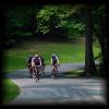
When the first hint of fall weather reaches North Carolina, thousands take to their bikes along the state's many cycle paths, trails, and roadways. North Carolina is considered to be a very cycle-friendly state. Below is a profile of the western segments of the Mountains to the Sea Route 2:
North Carolina has developed a route that travels from the western mountain town of Murphy to Manteo on the coast. This 700-mile route stretches from the peaks of the mountains to the beaches. Here are some segments of this route, beginning in Murphy. The first three segments are not only mountainous, but also strenuous. They should only be attempted by experienced and well-prepared riders who are in good health.
Trail of Tears
Beginning in Murphy, the Trail of Tears crosses the Nantahala National Forest. After traveling through Marble and Andrews, there is a remote and heavily wooded section that peaks at Wayah Crest. Through this remote area, one is passing by Junaluska Creek, named for the Cherokee chief who served valiantly during the War of 1812. This segment of the Mountains to Sea route is named in remembrance of the Cherokee Indians displaced to Oklahoma along what we now know as the Trail of Tears.
Nikwasi
The Nikwasi segment of the route enters the Cowee Valley where Franklin is located. Franklin is situated above the old and sacred Cherokee settlement of Nikwasi, from which this section gets its name. From Franklin, riders continue to descend, passing near Judaculla Rock and eventually into the Tuckaseigee River Valley and Cullowhee. There is a climb from Cullowhee through Sylva and onto the Blue Ridge Parkway. This segment ends near Balsam.
Sliding Rock
The Sliding Rock segment follows the Blue Ridge Parkway out of Nantahala National Forest and into Pisgah National Forest. Cyclers climb to the highest peak along the parkway, Richland Balsam. After that, they pass the Devil's Courthouse area which offers panoramic views of four states. Deeper into Pisgah National Forest, visitors pass several recreation areas with hiking trails and great views.
Craggy Pinnacle
Also following the Blue Ridge Parkway, Craggy Pinnacle segment starts near Asheville and climbs to the crests of the Black Mountains, which host some of the highest peaks in the regionis home to many noteworthy sites including the Biltmore House and Gardens. Outside of Asheville is the Craggy Gardens Scenic Area and Mt. Mitchell State Park. Mt. Mitchell is the highest peak east of the Mississippi River. Near the end of this segment is Crabtree Meadows, named for the crabapple trees which used to fill the meadowlands in this region. This area also includes hiking trails and waterfalls.
Brown Mountain Lights
Named for the famous Brown Mountain Lights, this segment begins its route along the Blue Ridge Parkway and winds down into the Linville Falls area. The route passes the Linville Caverns, Falls and the Linville Gorge Wilderness Area. Along the way, Brown Mountain can be seen with its mysterious lights, which defy explanation.
Cities and towns along the route (from west to east) include:
- Murphy, North Carolina
- Franklin, North Carolina
- Burnsville, North Carolina
- Marion, North Carolina
- Morganton, North Carolina
- Hiddenite, North Carolina
- Union Grove, North Carolina
- High Point, North Carolina
- Greensboro, North Carolina
- Graham, North Carolina
- Apex, North Carolina
- Raleigh, North Carolina
- Wilson, North Carolina
- Chocowinity, North Carolina
- Swan Quarter, North Carolina
- Nags Head, North Carolina
- Roanoke Island


 in Western North Carolina")


