Astypalaia - Live your myth in Greek island


Astypalaia
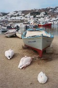
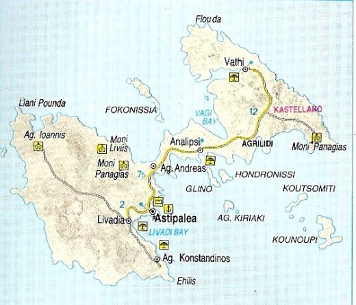
GEOGRAPHY. Rather isolated from the rest of the Dodecanese and nearer the Cyclades, Astypalaia lies between Amorgos, Anaphi and Kalymnos. It is also known as Astropalia and Stampalia, reminders of its Venetian occupation. 97 sq. km. in area, with 110 km. of coastline and 1,030 inhabitants it is 180 nautical miles from Piraeus. There is a ferry boat service four times a week during the summer and three times a week in winter. There are also boat connections with the Cyclades, the Dodecanese and, via the route to the outlying islands, with Crete. The island's terrain is mountainous (highest peak Vardia, 482 m. a.s.l) and in effect consists of two peninsula (south and north) linked by a narrow isthmus 105 m. wide. The morphology of the land has affected that of the coastline which is indented with many small coves and larger bays. The island's capital Astypalaia is the focus of all routes to the rest of the island with its few villages and scattered farmsteads. Its harbor is called Pera Yalos. With its tardy way of life, lovely beaches and small bays, Astypalaia is a perfect place for quiet holidays away from tourists.
HISTORY. Excavations have shown that Astypalaia was inhabited in prehistoric times, first by Karians and Phoenicians and later by Cretans, Mycenaean’s and Megarites. In antiquity the island was known by several names (Pyrra, Pylaia, Theon Trapeza, Ichthyoessa) and evidently experienced something of an acme, as the many inscriptions found there suggest.
The island was a trading station and anchorage from which anti-piratical raids were launched. In Byzantine times it belonged to the Thema of the Aegean and it was during this period (9th century) that the castle of Aghios loannis was built on the southwest side. From 1207 onwards it was ruled by the Venetians and in 1537 was sacked by Barbarossa. It took part in the Struggle for Independence in 1821 but remained under Turkish rule until 1912 when it was taken by the Italians who held it until 1948 when, along with the other isles of the Dodecanese, it was incorporated in the Greek state.
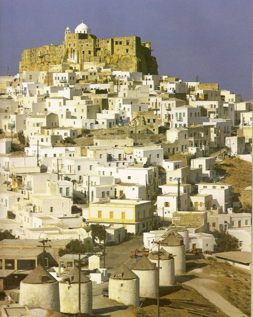
SIGHTS - MONUMENTS. The island's capital, Astypalaia, is built amphitheatrically on a hill on its south side presenting a delightful vista with its white house’s clambering up from the harbor to the hill top, dominated by its magnificent castle. The picture is completed by the windmills strung out along the crest of the hill on the outskirts of the village. The wall of the castle comprises numerous houses, the so-called Xokastra, the oldest part of the settlement. The castle entrance is on its southwest face and within its confines are two important churches, St. George and the Annunciation. The church of the Virgin Portaitissa, just below the castle, is one of the most beautiful in the Dodecanese. Only another three villages on the island have a permanent population: Analipsi (Maltezana), Livadi (2 km. south of Choral and Vathy (19 km. northwest of Choral. Sights of interest include the monastery of the Virgin Poulariani (17 km. northeast of Choral and that of St. John the Baptist (12 km. west of Choral.
Both facilities for tourists and the road nettwork are underdeveloped. However, there are many lovely beaches which can be reached by bus from Chora, Livadi, Pera Yalos, Maltezaana, or caique Aghios Konstantinos, Vathy. Acccommodation is available in rented rooms. Yachts can replenish their water supply in the harbour.