- HubPages»
- Travel and Places»
- Visiting North America»
- United States
Local Attractions In Central Oregon: See A Volcano - Visit Newberry National Volcanic Monument
See a Volcano: Visit Newberry National Volcanic Monument
If you want to see a live volcano, come visit the Newberry National Volcanic Monument located in the Deschutes National Forest in the heart of Central Oregon. While the volcano is currently dormant, it is very much alive and is one of the most dangerous volcanoes in the United States.
These 55,500 acres of incredible topography are located in the Deschutes National Forest and are some of the most remarkable in the state of Oregon if not the entire country. There are also another 10,300 acres which are under special management and are not accessible.
Visitors come from all over the world in the form of students, teachers, geologists, and even astronauts to get a glimpse of this volcanic paradise. The areas are easily accessible and there is so much to see that you might want to take at least several days to see it all.
For more information:
Lava Lands Visitor Center (541) 593-2421
(Open late April through early October)
Newberry Crater Information Station
(Open Memorial Day Weekend to Labor Day Weekend)
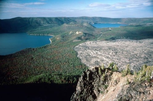
Newberry National Volcanic Monument
The varied landscapes were created by volcanic eruptions spanning at least the last half million years. Within the Newberry National Volcanic Monument, you will find some of the most unique occurrences anywhere on the globe - like cinder cones, lava flows, obsidian flows, lava cast forest, lava caves, and magnificent lakes, streams and waterfalls.
Let's take a look at this spectacular monument, which can most easily be summed up into these 10 most specific areas of interest (in alphabetical order):
- Benham Falls
- Big Obsidian Flow
- East Lake
- Lava Butte
- Lava River Cave
- Newberry Caldera
- Newberry Volcano
- Northwest Rift Zone
- Paulina Lake
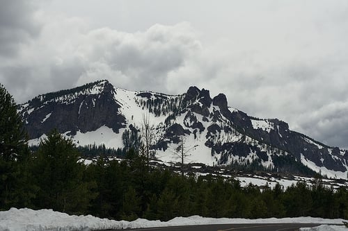
- Paulina Peak
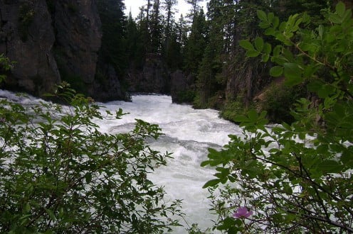
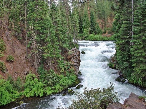
Benham Falls
Benham Falls are rapids on the Deschutes River which runs between Sunriver and Bend. It's located south of Bend and 4 miles from Lava Lands.
These falls are rated as a Class 6, which are unpassable for watercraft.
An eruption of Lava Butte estimated about 6000 years ago created the falls when the lava flow effectively dammed the Deschutes River with over 100 feet of lava, forming a lake which was called Lake Benham. This lake eventually drained, flowing over the dam, thus creating Benham Falls.
The falls were discovered in 1885 when J.R. Benham tried to file a claim for land near the falls but failed. However, the falls were later named for him.
Benham Falls are the largest falls on the Deschutes River.
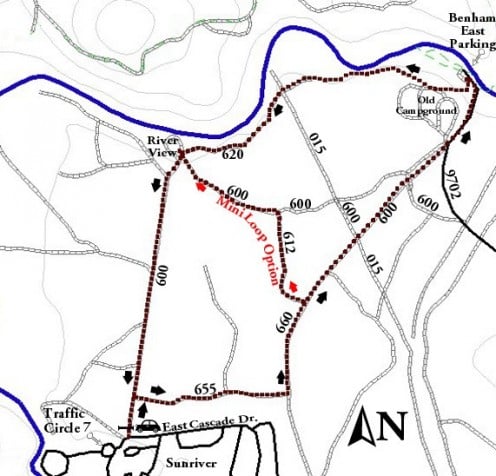
You can reach Benham Falls by a series of paths from Sunriver Resort and you can also get there from Lava Butte and the Lava River Cave by taking forest roads.
This is a favorite path for hikers and bicyclers as there are many great lookouts over the gorge. The area is also full of wildlife and flowers. There is a lovely old footbridge connecting one of the forest roads to the trail near the river and waterfall.
You can continue on the trail towards Bend and will also pass Dillon Falls and Lava Island Falls. Benham Falls though is easier in many ways to see and photograph because it is surrounded by forest and not lava flow.
Benham Falls has been considered for a dam site for power generation or irrigation. Proposals date back to 1905 and continued into the 1980s.
In 1939, the Wickiup Basin was cleared for the Wickiup Reservoir project and timber in the amount of 26,000,000 board feet was floated down the Deschutes to Benham Falls. it was then loaded on railroad cars and sent to the mills in Bend.
For recreational sites, check out Benham Falls Recreation Site and Benham Falls West Recreation Site.
Big Obsidian Flow
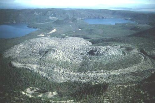
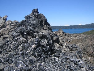
The Big Obsidian Flow of Newberry National Volcanic Monument is the youngest volcanic activity known within the caldera.
The Big Obsidian Flow was created from a vent in the caldera that experienced continual eruptions producing pumice that began to cover the southern part of the caldera and the eastern flank of the volcano.
These pumice eruptions were followed by ash eruptions followed by a final event where there was a slight collapse of the caldera in about a half mile area. This vent then allowed the flow of all these volcanic materials (lava) known as the Big Obsidian Flow. It is thought to have occurred 1300 years ago. This makes the Big Obsidian Flow the youngest dated volcanic feature in Central Oregon.
This particular lava flow moved slowly and is in total about 6000 feet long and thicker in places than 65 feet. It is estimated that the flow was 45% pumice (which went into the air) and 55% became the lava flow.
The estimate is that the amount of pumice that was vented was at least 416,000,000 cubic yards.
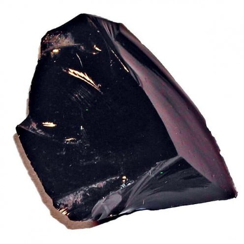
Surgical blades can be made of obsidian that are sharper than those of steel. There are also arrowheads that have been found made of obsidian. Indians used the obsidian to make many sharp instruments and traded them as far away as California.
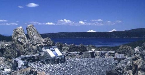
Walking the trail at the Big Obsidian Flow, you need to be careful not to fall on the rocks or lean against them because at certain points, they are razor sharp.
Astronaut R. Walter Cunningham tested moon suit mobility on the Big Obsidian Flow on August 27, 1964.
NASA tested the chemistry of rock found at the Big Obsidian Flow from not 1 but 70 sites and the chemistry at all 70 sites was identical.
There is a wonderful trail at the Big Obsidian Flow with entry from a well-paved road. Hiking to the top, you can see out over the Big Obsidian Flow and can see the magnitude of this eruption.
East Lake
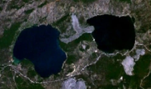
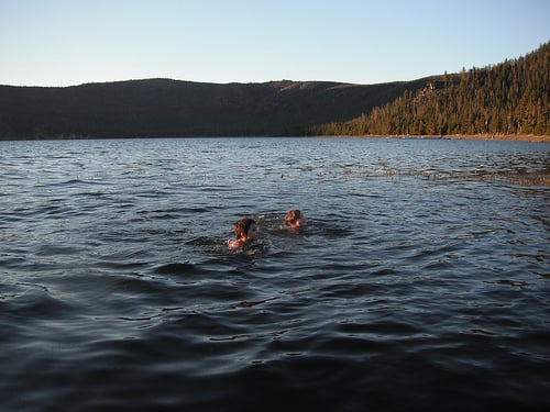
East Lake is one of two lakes that were formed within the Newberry Crater.
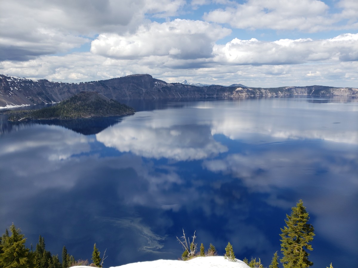
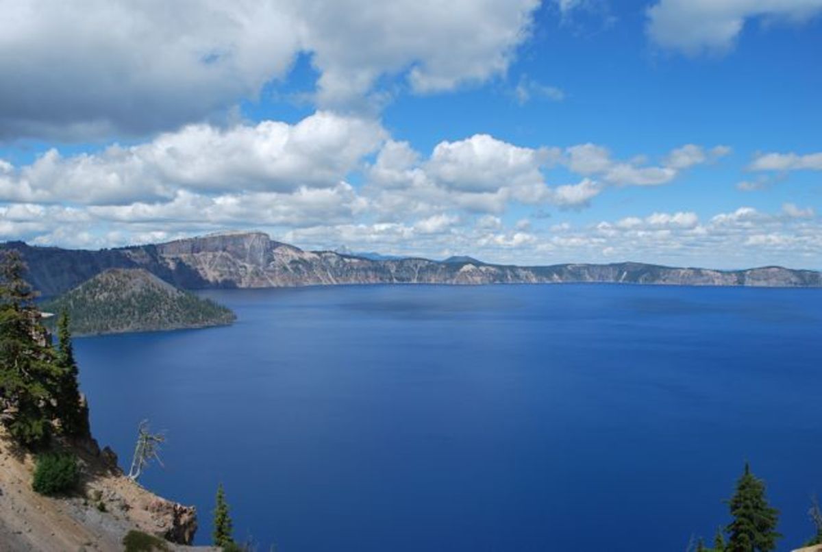
These two lakes were formed in a similar fashion to Crater Lake when Mount Mazama erupted and the top collapsed, forming a caldera. In the same manner, Newberry Volcano collapsed thus forming the Newberry Caldera and forming the twin lakes - East Lake and Paulina Lake.
East Lake is likewise located in the Deschutes National Forest and is part of the Newberry National Volcanic Monument. The caldera was formed some 500,000 years ago as a result of the volcano's eruptions.
Water for East Lake comes from snow melt, rainfall, and hot springs. There is no surface outlet to East Lake and likewise, no inlet such as streams or rivers. Thus you can measure rainfall and get a feel for the climate. The East Lake water levels have fluctuated over a range of some 16 feet - from 6366 feet elevation to 6382.5 feet elevation.
East Lake has 2 main campgrounds along the lake shore and also has the East Lake Resort.
At the resort, you can rent cabins and boats and there is also a general store.
East Lake is famous for its record-sized brown trout and rainbow trout. The lake is also stocked with sockeye salmon (Kokanee) and Atlantic salmon. The Oregon Department of Fish and Wildlife first stocked Atlantic salmon in East Lake in 1990.
A small bath house was built at East Lake Hot Springs in 1915. The first overnight resort was built in 1918, later burned down, then was rebuilt in 1924. It again burnt down in 1941. East Lake was a flourishing business because of its hot springs and people came from all over the country to take in the springs (120 degrees).
The East Lake Hot Springs are now drowned hot springs and are found in the cold water of East Lake. The highest temperature has been 175 degrees and there are gas bubbles much like at Yellowstone that smell like rotten eggs.
There is a bald eagle pair with a nesting site at East Lake making this the highest elevation bald eagle nest site in Oregon.
Lava Butte
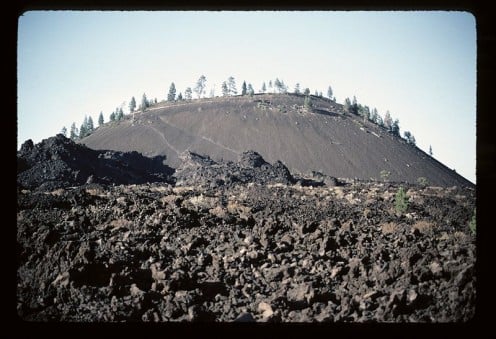
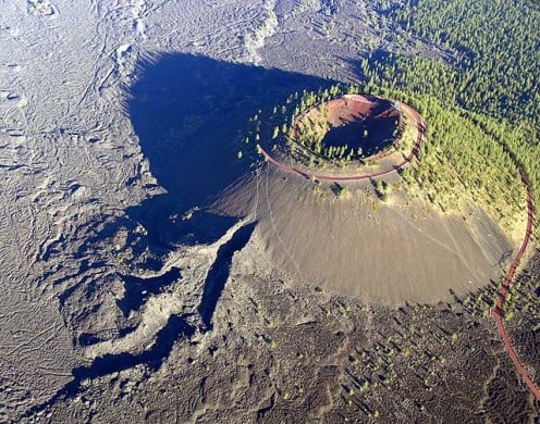
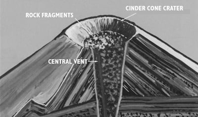
Lava Butte is a cinder cone located just west of Highway 97 between Bend and Sunriver. It is 500 feet high and the crater is 180 feet deep measured from the highest point on the rim.
This cinder cone is part of a series on the northwest flank of Newberry Volcano, which is a huge shield volcano. The cinder cone is capped by a crater extending about 60 feet deep under its south rim and 160 feet deep from the summit on its north side. Lava Butte is part of the Newberry National Volcanic Monument.
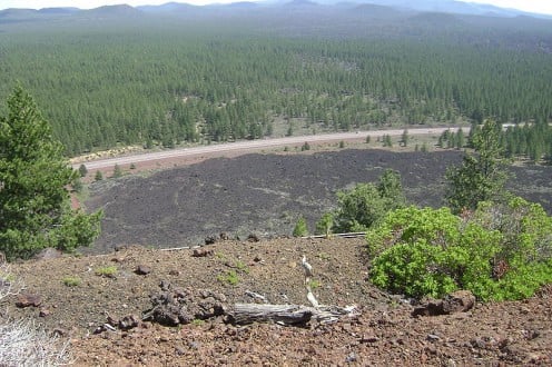
It is believed that Lava Butte only experienced a single eruption perhaps 7000 years ago. A river of basalt lava flowed from the base of the small volcano to the west. If you visit the Visitors Center, you can look down and see is completely devoid of vegetation.
The lava flow reached the Deschutes River about 2-1/2 miles west dumping over 100 feet of lava and damming the river creating Lake Benham. This river eventually overflowed creating Benham Falls.
In September 1914, Lava Butte had a simulated eruption put on by the Chamber of Commerce and later, geologists such as Harold Stearns studied the Newberry area and discovered the fissure system which extends from Lava Butte to East Lake within the Newberry Caldera.
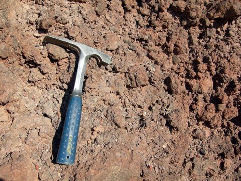
Some of the cinder cone has been used for commercial purposes - such as using it to pave highways or shipped to other cities for construction materials.
There is a fire lookout tower on Lava Butte that was built in 1931 and reconstructed. There is a road that winds up to the top of Lava Butte and a visitor center and museum.
In 1966, twenty-two astronauts trained at sites such as Lava Butte, Lava River Cave and Newberry Crater for upcoming moon landings.
The volume of rock in the Lava Butte Lava Flow is estimated to be 380,000,000 cubic yards. It is estimated that there is enough rock to pave 160,000 miles of road - which is equivalent to circling the world 6-1/2 times.
The lava flow from Lava Butte is 30-100 feet thick and it covers an area of over 9 square miles.
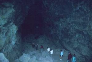
Lava River Cave
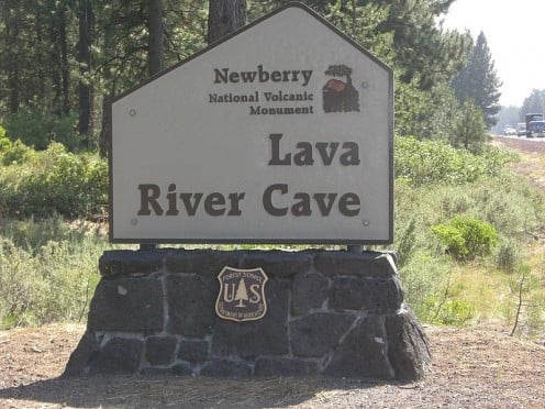
The Lava River Cave is located 12 miles south of Bend on Highway 97. It is located on the east side of the highway and is part of the Newberry National Volcanic Monument.
There is a forest surrounding the cave entrance consisting of many indiginous trees and bushes to Central Oregon. You can find your fill of sagebrush and ponderosa pine trees as well as manzanita.
However, once you enter the cave, it is a different world. There are all kinds of species of spiders, worms, etc. that inhabit the caves. There are also mice and bats that dwell in the cave year round. Bats usually remain in hibernation until July so they are rarely spotted.
The discovery of the Lava River Cave is credited to a local settler by the name of Leander Dillman who stumbled upon it during a hunting trip in 1889. It is thought, however, that Native Americans knew about the Lava River Cave long before as there have been obsidian particles found near the cave.
The cave was later mapped on a geology study by Ira A. Williams in 1923.
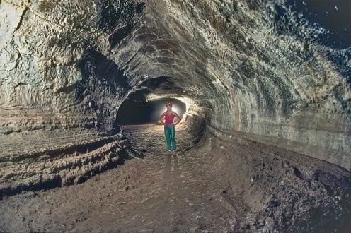
This unique lava tube/cave runs in two directions from the entrance. The main portion runs gradually downhill towards the northwest and passes under highway 97.This part of the cave is the longest known uncollapsed lava tube in Oregon.
The other part of the cave extends southeast from the entrance. It runs towards the source of the flow and has a slight uphill grade. This part of the cave is not open to the public due to loose rocks in the ceiling.
The mouth of the cave is at 4500 feet elevation and at its deepest point, the cave is at 4350 feet.
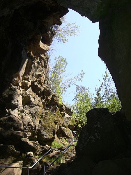
In order to enter the cave, you descend 126 steps with guardrails for assistance because you are descending through the Collapsed Corridor - a part of the cave where water has frozen on rocks creating a freeze-thaw-freeze cycle which in turn has caused them to loosen and fall. The freezing temperatures only occur at the mouth of the cave, however.
After you enter the cave and go for a short ways, the ceiling reaches a height of 58 feet. The width of the cave at this point is about 50 feet. This portion of the river cave is called Echo Hall. You can observe the ancient lava flow which molded the tunnel walls. You then go through another area where it narrows to the Low Bridge Lane where the ceiling drops to less than 6 feet. It then narrows further down to the end of the lava tube.
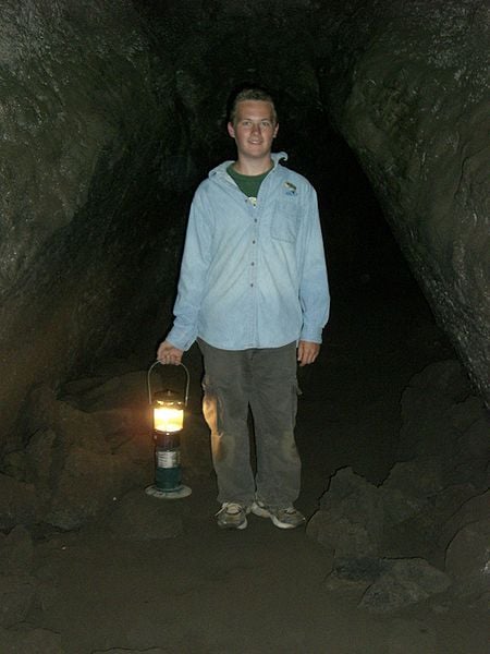
You are provided with a lantern to walk through the Lava River Cave and it is a very unique experience. To imagine a lava tube creating this huge cave is extraordinary. It also gets quite chilly underground so always bring a light jacket since there are 3 different climates within the cave and environs - warm dry climate at the entrance, warm moist microclimate at the entrance, and the moist, dark environment in the cave itself.
Newberry Caldera
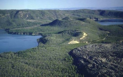
The Newberry Caldera or Newberry Crater as some have called it is what now exists after the eruption of Newberry Volcano. In actuality, there have been several eruptions and probably several calderas.
The last major eruption occurred somewhere around 200,000 years ago. As a result, the caldera is filled with ash, pumice and lava from eruptions on the floor of the caldera.
It is believed from geological and geophysical information that molten rock is probably 2-3 miles below the floor of the Newberry Caldera. There are studies underway currently regarding harnessing the geothermal power of this caldera to generate power as the potential could be enormous.
Newberry Crater was named for John Strong Newberry who was a physician and a naturalist who was present in the area in 1855 working with the Topographic Corps Expedition as they mapped railroad routes. It was suggested to name the caldera Mount Newberry but instead it became the Newberry Crater or Caldera.
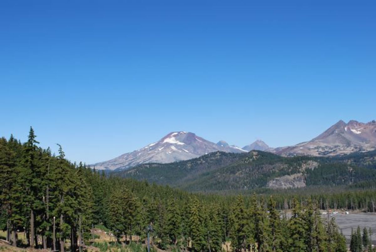
It is hypothesized that the next major volcanic eruption in this area will come from Newberry Crater or the nearby South Sister.
In the past, the caldera is thought to have contained a single lake instead of 2 lakes and that this single lake was as much as 1600 feet and as deep as Crater Lake. There are instead 2 lakes, Paulina and East Lake.
Native American traces are found in the Newberry Caldera as far back as 10,000 years.
In the early 1900s, there were no fish in the lakes but crayfish were able to crawl up nearly vertical rocks to reach the lakes.
A road was constructed in 1913 from La Pine to East Lake and in 1933, a new road to Paulina Lake was built from the west. It was rebuilt in 1952 and again improved and rebuilt in the early 1990s.
The US Geological Surveyors drilled an exploratory well to the east of the Big Obsidian Flow in 1981. This well reached a depth of 3058 feet and had a temperature of 509 degrees at the bottom. The thought is that the Newberry Caldera would be an excellent source for geothermal energy and studies are ongoing.
Some 60,000 fisherman visit Newberry Caldera per year even though these lakes do not open until spring because of heavy snows. The fishing is said to be some of the best in the west because of the enormous fish that come out of the lakes of the caldera.
Most Dangerous Volcanoes in the United States
Akutan Volcano: A stratovolcano in Alaska - Last eruption in 1992.
Augustine Volcano: A lava dome in Alaska - Current activity/unrest.
Makushin Volcano: A stratovolcano in Alaska - Last eruption in 1995.
Redoubt Volcano: A stratovolcano in Alaska - Last eruption in 1990.
Spurr Volcano: A stratovolcano in Alaska - Last eruption in 1992.
Lassen Peak: A stratovolcano in California - Last eruption in 1917.
Long Valley: A caldera in California - Last eruption during the Pleistocene.
Mount Shasta: A stratovolcano in California - Last eruption in 1786.
Kilauea Volcano: A shield volcano in Hawaii - Current activity/unrest.
Mauna Loa Volcano: A shield volcano in Hawaii - Last eruption in 1984.
Crater Lake: A caldera in Oregon - Last eruption about 2290 BC +/- 300 years.
Mount Hood: A stratovolcano in Oregon - Last eruption in 1866.
Newberry Volcano: A shield volcano in Oregon - Last eruption about 620 AD.
South Sister: A stratovolcano in Oregon - Last eruption about 50 BC (?).
Mount Baker Volcano: A stratovolcano in Washington - Last eruption in 1880.
Glacier Peak: A stratovolcano in Washington - Last eruption about 1700.
Mount Rainier: A stratovolcano in Washington - Last eruption in 1825.
Mount St. Helens: A stratovolcano in Washington - Current activity/unrest.
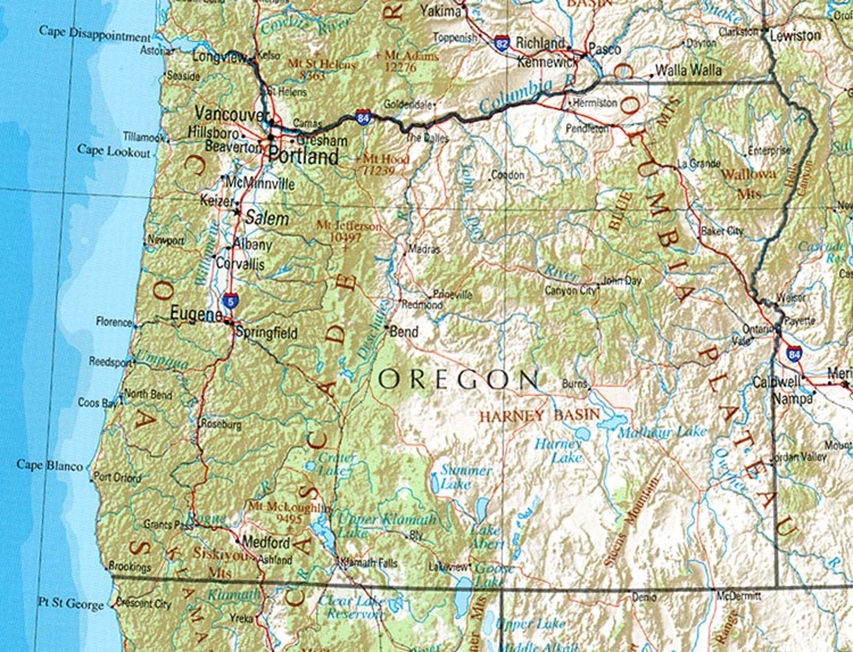
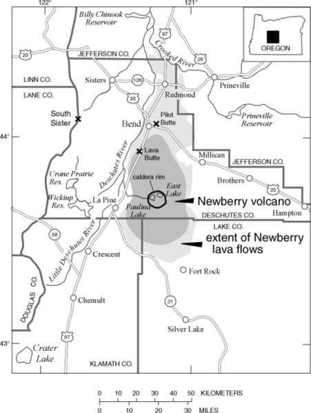
See map below for locations
Newberry Volcano
The Newberry Volcano is a large and potentially active shield volcano that is located 40 miles east of the Cascades and 20 miles southeast of Bend. It is atypical as a shield volcano because in addition to basalt lava flows, it also has erupted andesitic and rhyolitic lava flows.
Newberry Volcano is one of the quaternary volcanoes which designates a particular geological type of volcano. It is one of the largest in the continental United States and covers an area in excess of 500 square miles. It is 25 miles in diameter at least. The lava flows extend northward many miles.
At the summit of Newberry Volcano lies the Newberry Caldera, which was created after the multiple eruptions of the volcano.
It is believed that the eruptions from Newberry Volcano can be both explosive (ash and pumice) and passive (lava flow).
The age of the volcanic deposits is estimated to be 700,000 to 1300 years old - the latest and youngest at 1300 years being the Big Obsidian Flow.
Average elevation at the base of Newberry Volcano is 4400. The highest point (Paulina Peak) is 7984 feet.
The slopes of Newberry are covered with about 400 cinder cones. Mokst Butte and Lava Butte are examples of this phenomenon.
Many geological conferences have been held at Newberry National Volcanic Monument since 1965 as scientists attempt to study this rare and yet active volcano.
Climbing the Newberry Volcano
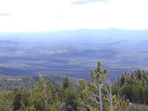
From the top of Paulina Peak, it's possible to see the entirety of Newberry Crater, south and west flanks of Newberry Volcano, the Cascades and most of Central Oregon.
From the junction with road 21 within the Newberry Crater, Paulina Peak Road is a little over 4 miles long. It is a steep and dusty road but cars and vans can be driven up it – though be aware that it is narrow, rough and precipitously steep in some places.
Elevation of Paulina Peak is 7984 – about 4000 feet higher than the surrounding terrain.
Located 20 miles southeast of Bend – covering an area in excess of 500 square miles.
You can even see parts of Washington and California and can view almost the entire high Cascade range in Oregon.
Things you can see:
- Three sisters and Cascade Range
- South and west flanks of Newberry Volcano
- Many cinder cones (bumps) on flank of Newberry Volcano
- Oregon's High Desert to the southeast
- Rim of Newberry Crater
- Main road (road 21) through Newberry Crater
- Paulina Lake
- East Lake
- Big Obsidian Flow
- Central Pumice Cone
Northwest Rift Zone
The Northwest Rift Zone is a set of plates that shifted and opened it is estimated about 7000 years ago, thus causing molten lava to rise to the surface which in turn created lava flows and cinder cones such as the Lava Butte, Mokst Butte and the Lava Cast Forest Flow.
This Rift Zone is a deep gash that occurred in the northern caldera wall and is often called just "The Fissure". It is the end of a 29-mile long series of fractures.
Volume of rock in these lava flows of the Northwest Rift Zone is roughly about 850,000,000 cubic yards. If you made this rock into a paved road, that would make enough rock to circle the world 14-1/2 times.
The Northwest Rift Zone is an area much like the fault plates that can shift and cause eruptions in the future. These shiftings are linked to the so-called fissure eruptions, a theory that was introduced in the late 1930s.

Paulina Lake
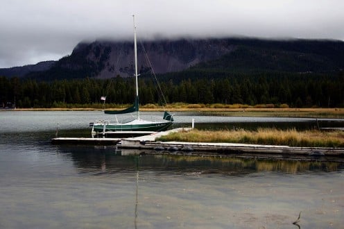
Paulina is the other of the twin lakes inside the Newberry Caldera (the other being East Lake). It is located 6350 feet above sea level and is part of the Newberry National Volcanic Monument within the Deschutes National Forest.
Mainly the lake receives its water supply from snow melt, hot springs and seepage from East Lake. It outflows to the Paulina Creek.
Average depth of Paulina Lake is about 163 feet while at its deepest, it can reach 250 feet. This lake is larger than East Lake and covers some 1531 acres.
Paulina Lake is about 50 feet lower than East Lake and to the west of the twin lake.
Paulina is known for its great number of Kokanee salmon and brown trout.
The Paulina Lake Resort was built in the late 1920s when people flocked to the park to partake of the hot springs.
The Paulina Lake Guard Station is on the National Register of Historic Places - built in the 1930s, it is now the home of the Paulina Visitor Center.
There is also a phenomenon unique to only a few lakes in North America called 'turning over' which Paulina Lake does. The water from the bottom of the lake comes up to the surface, and this creates changes in oxygenation and fish feeding patterns.
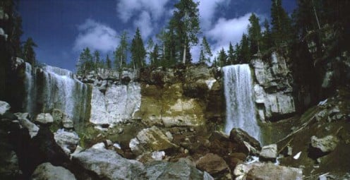
The Paulina Creek also gives way to the Paulina Creek Falls which have changed over the years due to falling rock. It is thought that thousands of years in the future, the falls will be at the level of Paulina Lake which would mean a drop of about 20 or so feet.
Paulina Peak
Paulina Peak was named after an Indian chief, Chief Paulina who was of the Paiute tribe. He was famous for killing off many miners, trappers and settlers between the 1850s and 1860s. Finally he was pursued by ranchers in the John Day country and shot by Howard Maupin (who the town of Maupin is named after).
The highest point of the Newberry Volcano is Paulina Peak which is 7897 feet. It is about 4000 feet higher than the rest of the terrain surrounding the volcano. At the summit of the Newberry Volcano is the Newberry Caldera which is a 4-5 mile wide caldera containing Paulina Lake and East Lake.
You can hike to Paulina Peak and the rumor is that the toilet on Paulina Peak is the highest public toilet in Oregon.
Climbing Paulina Peak, you can see the Cascade Mountains from Mt. Adams in Washington to Mt. Shasta in California and you can see parts of 3 different states.
In 1915, a fire lookout was built on Paulina Peak which was later rebuilt in 1931 and 1964. The last one was destroyed in 1968.
See a Volcano: Visit Newberry National Volcanic Monument
If you're looking for a great place to visit, Newberry National Volcanic Monument has much to offer and it's guaranteed you won't be bored.
Along with all the geological wonders and history that you can absorb in this beautiful part of the Deschutes National Forest, there are recreational opportunities year round that are incredible.
The Newberry National Volcanic Monument and the Deschutes National Forest are both recreation havens for thousands of visitors every year. From fishing for trophy-size brown and rainbow trout to hiking, boating and horseback riding to white water rafting - to hunting to wildlife viewing to Christmas tree cutting to cross-country skiing and snowmobiling - this is a vacation paradise.
There are many resources of information on-line and at the Lava Lands Visitor Center as well as the Newberry Crater Information Station.
There are many campgrounds in and around La Pine as well as within the park itself. There is also the Paulina Lake Lodge for lodging or meals - it is a delightful place for breakfast, lunch or dinner!
The community of Sunriver is just a few minutes north of the Newberry National Volcanic Monument and offers every amenity.
From RV camping to tent camping to staying at an inn or renting a private home - this part of Central Oregon is a vacation mecca from which to see the splendor that volcanic Oregon has to offer. Just about anything you can imagine doing on vacation is right here at the Newberry National Volcanic Monument.
Wishing you a happy journey seeing all that it has to offer!
More Hubs on Central Oregon
- Best Places To Get Pet Services in Central Oregon
Pet services come in many different varieties and encompass a wide range of things associated with pets. Pet services can be finding a groomer who knows what they're doing with your particular breed of dog,... - Top Spa Services in Central Oregon
Some of the top spa services in the country are located in Central Oregon. This is in part due to the fact that there are so many destination resorts here. For such a small part of the Pacific Northwest,... - Central Oregon Vacation: Learn Dog Sledding or Urban...
A Central Oregon vacation can offer many things but one activity you might want to try is dog sledding or urban mushing. Urban mushing is actually the same as dog sledding only without the dog sled and a... - 10 Best Places To Eat in Central Oregon (Most Pet Fr...
Central Oregon is absolutely loaded with great places to eat and having said that, picking the 10 best places to eat in Central Oregon could be done several times over. I chose these 10 places as the... - Best Golf Courses: Central Oregon (SunRiver)
If you're a golf enthusiast and want to experience golfing from one spectrum to the other without ever leaving the resort, SunRiver, Oregon is the place for you! Some of the best golf courses in the United... - Best Natural And Organic Grocery Stores in Central O...
The best natural and organic grocery stores in Central Oregon are all located in Bend, which is the heart of Central Oregon. This being said, it is not that far for most of us to make the trek a half hour to... - Central Oregon Travel: Bend Oregon Paulina Plunge Mo...
If you are looking for a great vacation spot, Central Oregon and specifically Bend Oregon and Sunriver Oregon will give you memories you will never forget. Central Oregon and in particular Bend Oregon... - Lava Cast Forest in Central Oregon
If you come to visit the Central Oregon area during spring through fall, you must take time to visit the Lava Cast Forest, just east of Sunriver. Take the exit off Highway 97, as if you are going to Sunriver,... - Best Aquatic Fitness Centers in Central Oregon
The best aquatic fitness centers in Central Oregon have become my new exercise salvation! I wish I had thought of this form of exercise sooner as I would have saved myself a lot of aches and pains. ... - Central Oregon Travel: Smith Rock State Park
Smith Rock State Park in Central Oregon is a place that will take your breath away literally! Whether you are traveling to rock climb at Smith Rock or just to enjoy the 10 miles of hiking trails, it will...
More Hubs on Volcanoes
- 10 Interesting Things to Know About Volcanoes
What do you know about volcanoes? Unless you live in an area like Hawaii that happens to be known for its volcanoes, you might not know a lot about them. However, people who have never had to think about... - How I Survived the Krakatoa Volcano - A True America...
The Krakatoa Volcano Eruption of 1883 was bad, real bad. Here is how I survived the volcano and tsunami. What did I have in my volcano survivor kit? - Mayon Volcano
Mayon Volcano, also known as Mount Mayon, is an active stratovolcano in the province of Albay, in the Bicol Region, on the island of Luzon, in the Philippines. Renowned as the - Famous Volcanoes
Nature is full of diversity, and volcanoes are a part of these diverse features of nature. Volcanoes are known for their fury when they erupt, but not all volcanoes are lava spitting volcanoes or eruptive. ... - Types Of Volcanoes
We all know what a volcano is. We have all seen it countless times on the television in documentaries; a huge eruption of earths surface followed by the release of molten red hot liquid called lava, ash... - How to Visit A Volcano. Nea kameni. Santorini. Photo...
If you go on holiday to the Greek Island of Santorini you can visit Nea Kameni the volcano. There are boat trips in the holiday months May to October. You can swim in the mineral waters. Here are photos of the volcano and the volcanic... - Super Volcanoes
Each year over 330,000 visitors flock to Yellowstone National Park to see it's main attraction, Old Faithful. About every ninety minutes Old Faithful erupts shooting thousands of gallons of water into the... - Volcanoes in Hawaii
All the volcanoes in Hawaii are shield volcanoes. This means they are relatively large and have shallow-sloping sides - much like a warrior's shield. They are formed by low-viscosity (very runny) lava... - The Island of Hawaii and Its Six Volcanoes
Volcanoes, like their close cousins earthquakes, are responsible for both massive destruction as well as for the creation of many of the beautiful landscapes on our earth. The Earth as we know it today was... - Is Yellowstone's Super Volcano Coming Alive?
For those that follow and study earthquakes and volcanoes - this has surely got to be the question of the day: Is the super volcano at Yellowstone Park becoming active? Is the old man about to get out of his...


